Braeroddach Loch
Lake, Pool, Pond, Freshwater Marsh in Aberdeenshire
Scotland
Braeroddach Loch
Braeroddach Loch is a small, picturesque freshwater loch located in Aberdeenshire, Scotland. Nestled amidst rolling hills and surrounded by lush greenery, it offers a serene and tranquil setting for visitors to enjoy.
Covering an area of approximately 10 acres, Braeroddach Loch is known for its crystal-clear waters and diverse wildlife. The loch is fed by natural springs and small streams, which contribute to its high water quality and provide a habitat for a variety of aquatic plants and animals.
The loch is home to several species of fish, including brown trout and perch, making it a popular spot for fishing enthusiasts. Fishing permits can be obtained locally, allowing visitors to try their hand at catching these elusive creatures.
Surrounding the loch, there are patches of marshland and reed beds, creating a diverse ecosystem that supports a wide range of bird species. Common sightings include ducks, swans, and various wading birds, making it a haven for birdwatchers.
The area around Braeroddach Loch is also frequented by walkers and nature enthusiasts. A walking path encircles the loch, offering stunning views of the surrounding landscape and ample opportunities to spot wildlife.
With its natural beauty and peaceful atmosphere, Braeroddach Loch is a hidden gem in Aberdeenshire, providing a delightful escape from the hustle and bustle of everyday life. Whether one is looking to fish, observe wildlife, or simply take in the scenic surroundings, this freshwater loch offers something for everyone to enjoy.
If you have any feedback on the listing, please let us know in the comments section below.
Braeroddach Loch Images
Images are sourced within 2km of 57.0908/-2.8572825 or Grid Reference NJ4800. Thanks to Geograph Open Source API. All images are credited.


Braeroddach Loch is located at Grid Ref: NJ4800 (Lat: 57.0908, Lng: -2.8572825)
Unitary Authority: Aberdeenshire
Police Authority: North East
What 3 Words
///method.confusion.polishing. Near Aboyne, Aberdeenshire
Nearby Locations
Related Wikis

Dinnet railway station
Dinnet railway station was opened on 17 October 1866 by the Aboyne and Braemar Railway and served Dinnet village from 1899 to 1966 as an intermediate station...
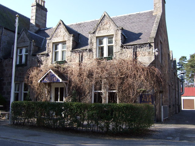
Dinnet
Dinnet (Scottish Gaelic, Dùnaidh) is a village in the Marr area of Aberdeenshire, Scotland. Approximately equidistant from Deeside towns Aboyne and Ballater...
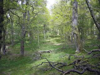
Dinnet Oakwood
Dinnet Oakwood is a Designated Special Area of Conservation located in Aberdeenshire, Scotland. It is located approximately 9 miles from Aboyne and six...

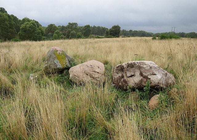
Tomnaverie stone circle
Tomnaverie stone circle is a recumbent stone circle set on the top of a small hill in lowland northeast Scotland. Construction started from about 2500...
Nearby Amenities
Located within 500m of 57.0908,-2.8572825Have you been to Braeroddach Loch?
Leave your review of Braeroddach Loch below (or comments, questions and feedback).