Bachau

Settlement in Anglesey

Wales

Bachau

Benchmark on St Mary's lychgate, Llanerchymedd Ordnance Survey benchmark on the west side of St Mary's lychgate. The mark is recorded on old maps levelled at 222.8 feet above Liverpool Datum. For a wider view see <a href="https://www.geograph.org.uk/photo/7582270">SH4184 : St Mary's lychgate from Market Square, Llanerchymedd</a>
Benchmark Database: <span class="nowrap"><a title="https://www.bench-marks.org.uk/bm35364" rel="nofollow ugc noopener" href="https://www.bench-marks.org.uk/bm35364">Link</a><img style="margin-left:2px;" alt="External link" title="External link - shift click to open in new window" src="https://s1.geograph.org.uk/img/external.png" width="10" height="10"/></span>
Benchmark on St Mary's lychgate, Llanerchymedd Credit: John S Turner

Bachau is a small village located on the island of Anglesey in North Wales. Situated about 2 miles east of the town of Amlwch, Bachau is nestled in a rural setting surrounded by picturesque countryside and farmland.

The village itself is characterized by its quaint and traditional charm, with a collection of stone-built houses and cottages lining the narrow streets. The community in Bachau is tight-knit, with a population of around 300 residents who enjoy a peaceful and close community spirit.

One of the notable features of Bachau is its proximity to the beautiful coastline of Anglesey. Within a short drive, residents and visitors can access stunning beaches, such as Porth Eilian and Bull Bay, which are popular for swimming, sunbathing, and coastal walks.

Although small in size, Bachau offers a range of amenities to its residents. These include a local convenience store, a village hall that hosts community events and gatherings, and a primary school, providing education to the younger population.

For those seeking outdoor activities, Bachau is surrounded by an abundance of natural beauty. The nearby Anglesey Coastal Path offers stunning walks along the coast, while the surrounding countryside is ideal for hiking, cycling, and exploring the outdoors.

In summary, Bachau is a charming village in Anglesey, known for its peaceful rural setting, close-knit community, and its proximity to the stunning coastline and natural beauty of North Wales.

If you have any feedback on the listing, please let us know in the comments section below.
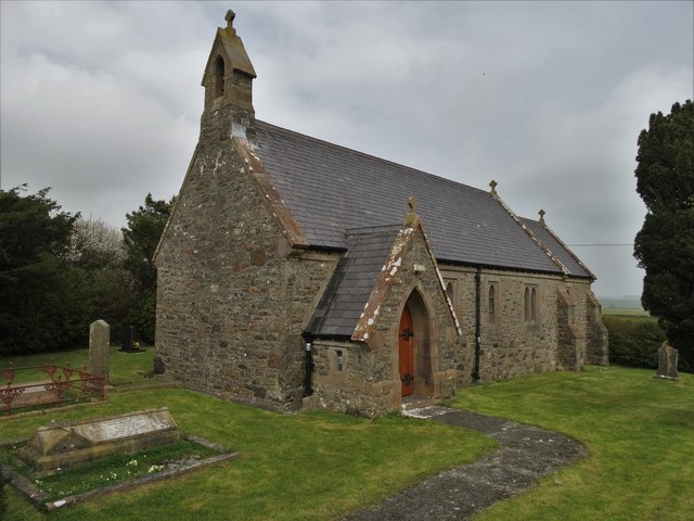
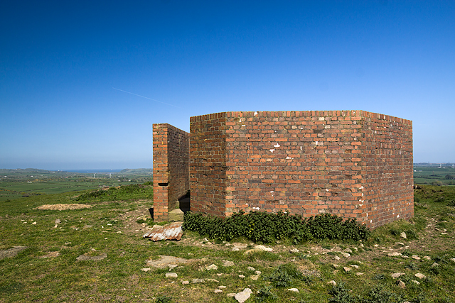
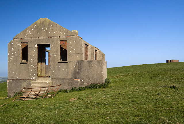
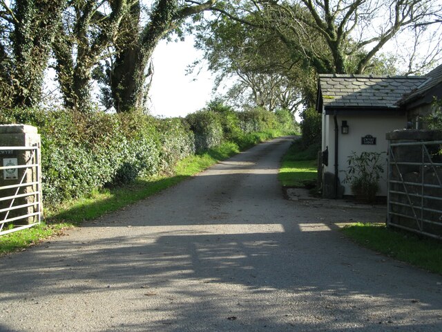
Bachau Images

Images are sourced within 2km of 53.327252/-4.357128 or Grid Reference SH4383. Thanks to Geograph Open Source API. All images are credited.

Benchmark on St Mary's lychgate, Llanerchymedd Ordnance Survey benchmark on the west side of St Mary's lychgate. The mark is recorded on old maps levelled at 222.8 feet above Liverpool Datum. For a wider view see <a href="https://www.geograph.org.uk/photo/7582270">SH4184 : St Mary's lychgate from Market Square, Llanerchymedd</a>
Benchmark Database: <span class="nowrap"><a title="https://www.bench-marks.org.uk/bm35364" rel="nofollow ugc noopener" href="https://www.bench-marks.org.uk/bm35364">Link</a><img style="margin-left:2px;" alt="External link" title="External link - shift click to open in new window" src="https://s1.geograph.org.uk/img/external.png" width="10" height="10"/></span>
Benchmark on St Mary's lychgate, Llanerchymedd
Ordnance Survey benchmark on the west side of St Mary's lychgate. The mark is recorded on old maps levelled at 222.8 feet above Liverpool Datum. For a wider view see SH4184 : St Mary's lychgate from Market Square, Llanerchymedd Benchmark Database: LinkExternal link
St Mary's lychgate from Market Square, Llanerchymedd There is an Ordnance Survey benchmark to the right of the gate on St Mary's lychgate <a href="https://www.geograph.org.uk/photo/7582248">SH4184 : Benchmark on St Mary's lychgate, Llanerchymedd</a>
St Mary's lychgate from Market Square, Llanerchymedd
There is an Ordnance Survey benchmark to the right of the gate on St Mary's lychgate SH4184 : Benchmark on St Mary's lychgate, Llanerchymedd
Benchmark on railway bridge, Llanerchymedd Ordnance Survey benchmark on Bridge Street railway bridge, Llanerchymedd. For a wider view see: <a href="https://www.geograph.org.uk/photo/7583350">SH4184 : Bridge Street railway bridge, Llanerchymedd</a> Levelled at 71.469m above Newlyn Datum, verified 1975. 
Benchmark database: <span class="nowrap"><a title="https://www.bench-marks.org.uk/bm35363" rel="nofollow ugc noopener" href="https://www.bench-marks.org.uk/bm35363">Link</a><img style="margin-left:2px;" alt="External link" title="External link - shift click to open in new window" src="https://s1.geograph.org.uk/img/external.png" width="10" height="10"/></span>
Benchmark on railway bridge, Llanerchymedd
Ordnance Survey benchmark on Bridge Street railway bridge, Llanerchymedd. For a wider view see: SH4184 : Bridge Street railway bridge, Llanerchymedd Levelled at 71.469m above Newlyn Datum, verified 1975. Benchmark database: LinkExternal link
Bridge Street railway bridge, Llanerchymedd Bridge Street railway bridge has an Ordnance Survey benchmark on the stone wall, indicated by the white-painted arrow <a href="https://www.geograph.org.uk/photo/7583348">SH4184 : Benchmark on railway bridge, Llanerchymedd</a>
Bridge Street railway bridge, Llanerchymedd
Bridge Street railway bridge has an Ordnance Survey benchmark on the stone wall, indicated by the white-painted arrow SH4184 : Benchmark on railway bridge, Llanerchymedd
Melin Gallt y Benddu, Llanerchymedd This is the oldest known of the 'tower' windmills on Anglesey.  Construction started in 1737 and it operated till the end of the 19th century, when a storm destroyed its cap and sails.  Renovated as a dwelling in the nineteen sixties, now a holiday let.
Melin Gallt y Benddu, Llanerchymedd
This is the oldest known of the 'tower' windmills on Anglesey. Construction started in 1737 and it operated till the end of the 19th century, when a storm destroyed its cap and sails. Renovated as a dwelling in the nineteen sixties, now a holiday let.
Houses on Holyhead Road, Llanerchymedd
St Anne's Church, Coedana
Old water pump at Llwydiarth Esgob Farm, Llanerchymedd This old water pump stands alongside the public footpath that runs through the historic Llwydiarth Esgob Farm, near Llanerchymedd, Anglesey.  The stone trough is dated 1825, but there are no obvious markings on the pump itself.  See also <a href="https://www.geograph.org.uk/photo/5368771">SH4384 : Old water pump and trough at Llwydiarth Esgob Farm, Llanerchymedd</a>
Old water pump at Llwydiarth Esgob Farm, Llanerchymedd
This old water pump stands alongside the public footpath that runs through the historic Llwydiarth Esgob Farm, near Llanerchymedd, Anglesey. The stone trough is dated 1825, but there are no obvious markings on the pump itself. See also SH4384 : Old water pump and trough at Llwydiarth Esgob Farm, Llanerchymedd
Old water pump and trough at Llwydiarth Esgob Farm, Llanerchymedd This old water pump stands alongside the public footpath that runs through the historic Llwydiarth Esgob Farm, near Llanerchymedd, Anglesey.  The stone trough is dated 1825, but there are no obvious markings on the pump itself.  See also <a href="https://www.geograph.org.uk/photo/5368769">SH4384 : Old water pump at Llwydiarth Esgob Farm, Llanerchymedd</a>
Old water pump and trough at Llwydiarth Esgob Farm, Llanerchymedd
This old water pump stands alongside the public footpath that runs through the historic Llwydiarth Esgob Farm, near Llanerchymedd, Anglesey. The stone trough is dated 1825, but there are no obvious markings on the pump itself. See also SH4384 : Old water pump at Llwydiarth Esgob Farm, Llanerchymedd
North Wales WWII defences: Llanerchymedd, Anglesey - RDF Tower (1) -
RDF Tower: EDoB ID: e41692

On the top of Pen-y-Foel at Llanerchymedd is the octagonal blast wall that once surrounded the 30 ft wooden tower of a wartime direction finding station. It was probably associated with RAF Valley, and was in use as a navigational aid for aircraft that operated in conjunction with other D/F stations around the country. Also known as HF/DF, the acronym 'RDF' stands for Radio Direction Finding, not to be confused with the British wartime Chain Home radar system that in its early days was also referred to as RDF before the adoption of the name Radar (Radar is itself an acronym for  RAdio Detection And Ranging). The buildings at Pen-y-Foel are the only known surviving remains of a wartime RDF station in North Wales.

<a href="https://www.geograph.org.uk/photo/5409007">SH4284 : North Wales WWII defences: Llanerchymedd, Anglesey - RDF Tower (2)</a>
North Wales WWII defences: Llanerchymedd, Anglesey - RDF Tower (1)
- RDF Tower: EDoB ID: e41692 On the top of Pen-y-Foel at Llanerchymedd is the octagonal blast wall that once surrounded the 30 ft wooden tower of a wartime direction finding station. It was probably associated with RAF Valley, and was in use as a navigational aid for aircraft that operated in conjunction with other D/F stations around the country. Also known as HF/DF, the acronym 'RDF' stands for Radio Direction Finding, not to be confused with the British wartime Chain Home radar system that in its early days was also referred to as RDF before the adoption of the name Radar (Radar is itself an acronym for RAdio Detection And Ranging). The buildings at Pen-y-Foel are the only known surviving remains of a wartime RDF station in North Wales. SH4284 : North Wales WWII defences: Llanerchymedd, Anglesey - RDF Tower (2)
North Wales WWII defences: Llanerchymedd, Anglesey - RDF Tower (2) -
RDF Tower: EDoB ID: e41692

The blast wall protected entrance to the tower.

<a href="https://www.geograph.org.uk/photo/5409015">SH4284 : North Wales WWII defences: Llanerchymedd, Anglesey - RDF Tower (3)</a>
North Wales WWII defences: Llanerchymedd, Anglesey - RDF Tower (2)
- RDF Tower: EDoB ID: e41692 The blast wall protected entrance to the tower. SH4284 : North Wales WWII defences: Llanerchymedd, Anglesey - RDF Tower (3)
North Wales WWII defences: Llanerchymedd, Anglesey - RDF Tower (3) -
RDF Tower: EDoB ID: e41692

The octagonal concrete plinth on which the wooden tower would have been bolted onto. Some of the original fixing bolts remain in-situ.

<a href="https://www.geograph.org.uk/photo/5409051">SH4284 : North Wales WWII defences: Llanerchymedd, Anglesey - RDF Tower (4)</a>
North Wales WWII defences: Llanerchymedd, Anglesey - RDF Tower (3)
- RDF Tower: EDoB ID: e41692 The octagonal concrete plinth on which the wooden tower would have been bolted onto. Some of the original fixing bolts remain in-situ. SH4284 : North Wales WWII defences: Llanerchymedd, Anglesey - RDF Tower (4)
North Wales WWII defences: Llanerchymedd, Anglesey - RDF Tower (4) -
RDF Tower: EDoB ID: e41692


A pair of the original foundation bolts to the tower.

<a href="https://www.geograph.org.uk/photo/5409055">SH4284 : North Wales WWII defences: Llanerchymedd, Anglesey - RDF Tower (5)</a>
North Wales WWII defences: Llanerchymedd, Anglesey - RDF Tower (4)
- RDF Tower: EDoB ID: e41692 A pair of the original foundation bolts to the tower. SH4284 : North Wales WWII defences: Llanerchymedd, Anglesey - RDF Tower (5)
North Wales WWII defences: Llanerchymedd, Anglesey - RDF Tower (5) -
RDF Tower: EDoB ID: e41692

<a href="https://www.geograph.org.uk/photo/5409068">SH4284 : North Wales WWII defences: Llanerchymedd, Anglesey - RDF Tower (6)</a>
North Wales WWII defences: Llanerchymedd, Anglesey - RDF Tower (5)
North Wales WWII defences: Llanerchymedd, Anglesey - RDF Tower (6) -
RDF Tower: EDoB ID: e41692

A short distance from the tower stands the derelict crew accommodation hut.

<a href="https://www.geograph.org.uk/photo/5409077">SH4284 : North Wales WWII defences: Llanerchymedd, Anglesey - RDF Tower (7)</a>
North Wales WWII defences: Llanerchymedd, Anglesey - RDF Tower (6)
- RDF Tower: EDoB ID: e41692 A short distance from the tower stands the derelict crew accommodation hut. SH4284 : North Wales WWII defences: Llanerchymedd, Anglesey - RDF Tower (7)
North Wales WWII defences: Llanerchymedd, Anglesey - RDF Tower (7) -
RDF Tower: EDoB ID: e41692

Fine views from the top of Pen-y-Foel, one of the highest spots in central Anglesey.

START:- <a href="https://www.geograph.org.uk/photo/5408984">SH4284 : North Wales WWII defences: Llanerchymedd, Anglesey - RDF Tower (1)</a>
North Wales WWII defences: Llanerchymedd, Anglesey - RDF Tower (7)
- RDF Tower: EDoB ID: e41692 Fine views from the top of Pen-y-Foel, one of the highest spots in central Anglesey. START:- SH4284 : North Wales WWII defences: Llanerchymedd, Anglesey - RDF Tower (1)
Private farm road to Cwyrt This could be confusing as the map shows the house on the right as Cwyrt Bach, whilst the house name says Cwyrt Lodge. Just 100m or so along the road is another house marked as 'Lodge'.
Private farm road to Cwyrt
This could be confusing as the map shows the house on the right as Cwyrt Bach, whilst the house name says Cwyrt Lodge. Just 100m or so along the road is another house marked as 'Lodge'.
Farm road and footpath A short way east of the village of Llanerchymedd, with a farm access road and public footpath leading towards Tyddyn, which is in the adjacent square.
Farm road and footpath
A short way east of the village of Llanerchymedd, with a farm access road and public footpath leading towards Tyddyn, which is in the adjacent square.
Show me another place!

Bachau is located at Grid Ref: SH4383 (Lat: 53.327252, Lng: -4.357128)

Unitary Authority: Isle of Anglesey

Police Authority: North Wales

What 3 Words

///untruth.campsites.crinkled. Near Llanerchymedd, Isle of Anglesey

Nearby Locations

Bachau

Related Wikis

Llwydiarth-Esgob

Llwydiarth-Esgob is an area in the community of Rhosybol, Anglesey, Wales, which is 137.3 miles (220.9 km) from Cardiff and 218.1 miles (350.9 km) from...

Bachau

Bachau () is a small rural hamlet of about a dozen dwellings in Anglesey, north Wales, which is 137 miles (220.5 km) from Cardiff and 218.1 miles (351...

Twrcelyn Rural District

Twrcelyn was a rural district in the administrative county of Anglesey, Wales, from 1894 to 1974. The district took its name from Twrcelyn, one of the...

Llannerch-y-medd

Llannerch-y-medd, is a small village, community and post town on the Isle of Anglesey in Wales. The Royal Mail postcode is LL71, and it has a population...

St Mary's Church, Llannerch-y-medd

St Mary's Church is a medieval church in the town of Llannerch-y-medd, Anglesey, Wales. St Mary's Church is dedicated to Saint Mary. The east doorway in...

Bryn Hafod

Bryn Hafod is an area in the community of Llannerch-y-medd, Anglesey, Wales, which is 137.8 miles (221.8 km) from Cardiff and 219 miles (352.4 km) from...

Llanerchymedd railway station

Llanerchymedd railway station was situated on the Anglesey Central Railway line from Gaerwen to Amlwch. There was a single platform with a small station...

Coedana

Coedana is a hamlet in Anglesey, in north-west Wales., in the community of Llanerchymedd. == References ==
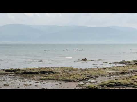
Related Videos

Llannerch-Y-Medd

Beach view North Wales.
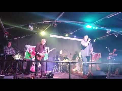
Have you been to Bachau?

Leave your review of Bachau below (or comments, questions and feedback).