Bache Pool

Lake, Pool, Pond, Freshwater Marsh in Shropshire

England

Bache Pool

Greenway Cross
Greenway Cross Credit: Richard Webb

Bache Pool is a freshwater marsh located in the county of Shropshire, England. It is situated in the small village of Bache, near the town of Ellesmere. The pool covers an area of approximately 1.5 hectares and is surrounded by lush greenery and a diverse range of wildlife.

The pool itself is relatively shallow, with an average depth of around 1 meter. It is fed by a number of small streams and springs, ensuring a constant flow of freshwater. The water is clear and relatively calm, making it an ideal habitat for various aquatic plants and animals.

The surrounding area of Bache Pool is a mix of wetland and woodland, providing a perfect habitat for a wide range of bird species. It is known to be a popular spot for birdwatchers, who can observe a variety of waterfowl, including ducks, geese, and swans. In addition, the pool is home to several species of fish, such as roach and perch.

The pool is accessible to the public and has been designated as a Site of Special Scientific Interest (SSSI) due to its ecological importance. It offers a peaceful and serene environment for visitors to enjoy nature and observe the local wildlife. There are walking trails in the vicinity, allowing visitors to explore the surrounding wetlands and woodland.

Overall, Bache Pool in Shropshire is a picturesque freshwater marsh that provides a haven for various bird species and other wildlife. Its natural beauty and ecological significance make it a popular destination for nature enthusiasts and those seeking a tranquil outdoor experience.

If you have any feedback on the listing, please let us know in the comments section below.

Bache Pool Images

Images are sourced within 2km of 52.431545/-2.7817925 or Grid Reference SO4681. Thanks to Geograph Open Source API. All images are credited.

Greenway Cross
Greenway Cross
Under Norton Camp Whettleton Woods and arable farmland.
Under Norton Camp
Whettleton Woods and arable farmland.
Almost Irish Signpost at Greenway Cross.  The National Cycle Network route is still shown after the network was severely degraded earlier in the year.
Almost Irish
Signpost at Greenway Cross. The National Cycle Network route is still shown after the network was severely degraded earlier in the year.
B4368, near Greenway Cross Craven Arms to Corve Dale road.
B4368, near Greenway Cross
Craven Arms to Corve Dale road.
Winter cereals, Whettleton Above Greenway Cross.
Winter cereals, Whettleton
Above Greenway Cross.
Road through Norton Norton is a common placename, but few of them have grown to any size.
Road through Norton
Norton is a common placename, but few of them have grown to any size.
Passing New House Farm, Onibury View to the Bringewood scarp, a continuation of Wenlock Edge.
Passing New House Farm, Onibury
View to the Bringewood scarp, a continuation of Wenlock Edge.
Field of young rape seed north of Bache Believe it or not a public footpath lies through this field, unmarked by the farmer. In a month this will be inpassable unless the farmer intervenes.
Field of young rape seed north of Bache
Believe it or not a public footpath lies through this field, unmarked by the farmer. In a month this will be inpassable unless the farmer intervenes.
Bache Pool A quiet pool by Bache Farm, sounds of wildlife enjoying the peacefulness
Bache Pool
A quiet pool by Bache Farm, sounds of wildlife enjoying the peacefulness
Footpath leading around Bache Farm Doubling up as a very durable track to the farm
Footpath leading around Bache Farm
Doubling up as a very durable track to the farm
Bache Farm Magnificent farm house and attached buildings in this idyllic setting
Bache Farm
Magnificent farm house and attached buildings in this idyllic setting
Farm buildings at Norton Restored old long barn by the looks of it.
Farm buildings at Norton
Restored old long barn by the looks of it.
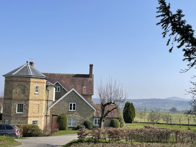
Grand old building in Norton Interesting extended buildings, very well manicured and now being used as apartments of some kind. Beautiful setting
Grand old building in Norton
Interesting extended buildings, very well manicured and now being used as apartments of some kind. Beautiful setting
Field of young wheat near Norton Another footpath crossing a planted field. Hopefully the farmer will delineate the footpath before the crop is fully grown.
Field of young wheat near Norton
Another footpath crossing a planted field. Hopefully the farmer will delineate the footpath before the crop is fully grown.
Into Whettleton Wood The footpath leads you in and then disappears completely! An adventure ensued.
Into Whettleton Wood
The footpath leads you in and then disappears completely! An adventure ensued.
Nortoncamp building Looking back up to Norton Camp from Campbarn. Campbarn is identified as such on the OS map, but now is a pile of soil and rubble - wonder what it looked like?
Nortoncamp building
Looking back up to Norton Camp from Campbarn. Campbarn is identified as such on the OS map, but now is a pile of soil and rubble - wonder what it looked like?
Farm track and hedge The cloud-covered Clee Hills are on the horizon.
Farm track and hedge
The cloud-covered Clee Hills are on the horizon.
Entering Culmington at The Green B4365 northbound
Entering Culmington at The Green
B4365 northbound
Show me another place!

Bache Pool is located at Grid Ref: SO4681 (Lat: 52.431545, Lng: -2.7817925)

Unitary Authority: Shropshire

Police Authority: West Mercia

What 3 Words

///charts.arena.violinist. Near Craven Arms, Shropshire

Nearby Locations

Bache Norton Bache Pool

Related Wikis

Bache, Shropshire

Bache is a hamlet in Shropshire, England. == References == == External links == Media related to Bache, Shropshire at Wikimedia Commons

Culmington

Culmington is a village and civil parish in south Shropshire, England, about 3+1⁄2 miles (5.6 km) east of Craven Arms and 4+1⁄2 miles (7 km) north of Ludlow...

River Corve

The River Corve is a minor river in Shropshire, England. It is a tributary of the River Teme which it joins in the town of Ludlow, and which joins the...

Onibury

Onibury is a village and civil parish on the River Onny in southern Shropshire, about 4 miles (6.4 km) northwest of the market town of Ludlow. The parish...

Nearby Amenities

Located within 500m of 52.431545,-2.7817925
Building: yes
Lat/Long: 52.4271722/-2.7824656
Power: pole
Lat/Long: 52.4316067/-2.7888966
Power: pole
Lat/Long: 52.4304178/-2.7859971
Power: pole
Lat/Long: 52.4298977/-2.7847391
Power: pole
Lat/Long: 52.4293924/-2.7834463
Power: pole
Lat/Long: 52.4287251/-2.7818397
Power: pole
Lat/Long: 52.4282639/-2.7807051
Power: pole
Lat/Long: 52.427806/-2.7795705
Generator Method: photovoltaic
Generator Output Electricity: yes
Generator Source: solar
Generator Type: solar_photovoltaic_panel
Location: roof
Power: generator
Lat/Long: 52.4320695/-2.7821267
The data included in this document is from www.openstreetmap.org. The data is made available under ODbL.

Have you been to Bache Pool?

Leave your review of Bache Pool below (or comments, questions and feedback).