Alne, Great

Settlement in Warwickshire Stratford-on-Avon

England

Alne, Great

Bearley Road, Aston Cantlow Looking north-eastward.
Bearley Road, Aston Cantlow Credit: Peter Wood

Alne is a small village located in the district of Stratford-on-Avon, in the county of Warwickshire, England. Situated approximately 5 miles southeast of the town of Alcester, Alne is surrounded by picturesque countryside and offers a peaceful and rural setting.

The village itself is home to a close-knit community, with a population of around 400 residents. Alne is known for its charming and well-preserved historic buildings, including St. Peter's Church, a beautiful 13th-century parish church that stands as a prominent landmark in the village.

Alne boasts a range of amenities to cater to the needs of its residents. These include a primary school, a village hall, and a local pub that serves as a social hub for the community. Additionally, the village is well-connected to nearby towns and cities, with good transport links and access to major road networks.

For nature enthusiasts, Alne offers an abundance of natural beauty, with idyllic walks and cycling routes in the surrounding countryside. The village is also located close to the renowned Cotswolds Area of Outstanding Natural Beauty, providing further opportunities for outdoor activities and exploration.

Overall, Alne is a charming and tranquil village that offers a blend of rural living and easy access to nearby amenities. With its rich history, natural beauty, and strong sense of community, Alne is a desirable place to reside for those seeking a peaceful and picturesque setting in Warwickshire.

If you have any feedback on the listing, please let us know in the comments section below.

Alne, Great Images

Images are sourced within 2km of 52.232539/-1.823073 or Grid Reference SP1259. Thanks to Geograph Open Source API. All images are credited.

Bearley Road, Aston Cantlow Looking north-eastward.
Bearley Road, Aston Cantlow
Looking north-eastward.
The Huff Cap, Great Alne Sometimes called the Mother Huff Cap, this oddly-named inn, with its rambling extensions which seem to have engulfed a private house, now stands on a bend on the secondary road between Wootton Wawen and Alcester but was once an important staging post on the coach road from London to Shrewsbury.  The Victoria County History tells us that "the first record of this curious name occurs in the accounts of 1746 ... where it is given simply as 'Huff Cap' (a term for strong ale)."  The pub closed for a time in 2010; a proposal to rename it as "The Greedy Pig" was abandoned to the relief of many villagers and since then it has reopened with the signage mostly reverting to the original 18th-century version. 

See also <a href="https://www.geograph.org.uk/photo/4658219">SP1159 : Sign for the Huff Cap</a>.
The Huff Cap, Great Alne
Sometimes called the Mother Huff Cap, this oddly-named inn, with its rambling extensions which seem to have engulfed a private house, now stands on a bend on the secondary road between Wootton Wawen and Alcester but was once an important staging post on the coach road from London to Shrewsbury. The Victoria County History tells us that "the first record of this curious name occurs in the accounts of 1746 ... where it is given simply as 'Huff Cap' (a term for strong ale)." The pub closed for a time in 2010; a proposal to rename it as "The Greedy Pig" was abandoned to the relief of many villagers and since then it has reopened with the signage mostly reverting to the original 18th-century version. See also SP1159 : Sign for the Huff Cap.
Sign for the Huff Cap For the uniquely-named pub <a href="https://www.geograph.org.uk/photo/4657181">SP1159 : The Huff Cap, Great Alne</a>.
Sign for the Huff Cap
For the uniquely-named pub SP1159 : The Huff Cap, Great Alne.
B4089 Near Turn for Coughton via Ford
B4089 Great Alne Village Sign
Corrugated Iron Farm Buildings in Need of Some Attention
Approaching Great Alne
Alne End
Alne End
Great Alne
Great Alne
Henley Road Great Alne
Great Alne Road to Little Alne
B4089 Road to Little Alne
Field entrance off the B4089
B4089 towards Wooten Wawen Looking north east.
B4089 towards Wooten Wawen
Looking north east.
Entering Alne End Looking north east on National Cycle Route 5 (B4089).
Entering Alne End
Looking north east on National Cycle Route 5 (B4089).
Crop field, Alne End North of the B4089.
Crop field, Alne End
North of the B4089.
National Cycle Route 5 B4089, Alne End - looking north east.
National Cycle Route 5
B4089, Alne End - looking north east.
Children's playground, Alne End
Show me another place!

Alne, Great is located at Grid Ref: SP1259 (Lat: 52.232539, Lng: -1.823073)

Administrative County: Warwickshire

District: Stratford-on-Avon

Police Authority: Warwickshire

What 3 Words

///decisions.tungsten.buzzards. Near Alcester, Warwickshire

Related Wikis

Great Alne

Great Alne is a small village in Warwickshire, England, 7 miles (11 km) north-west of Stratford-upon-Avon, 3 miles (4.8 km) north-east of Alcester and...

Kinwarton

Kinwarton is a village in the valley of the River Alne, Warwickshire, to the north-east of the market town of Alcester. The population of the civil parish...

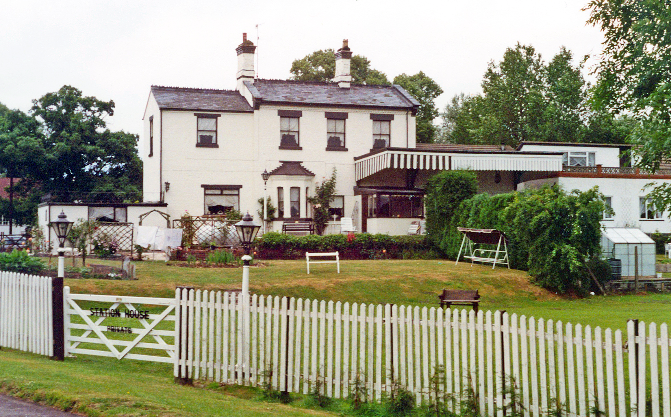
Great Alne railway station

Great Alne Railway Station was a station in the village of Great Alne in Warwickshire on the Great Western Railway line from Alcester, Warwickshire to...

Haselor

Haselor is a village in Warwickshire. It is by the River Alne, about one mile east of Alcester just off the A46 main road to Stratford-upon-Avon. The...

Walcote, Warwickshire

Walcote is a small village in Warwickshire, England, one mile south of the Ancient Roman market town of Alcester. It consists of just seventeen dwellings...

Aston Cantlow

Aston Cantlow is a village in Warwickshire, England, on the River Alne 5 miles (8.0 km) north-west of Stratford-upon-Avon and 2 miles (3.2 km) north-west...

Alne End

Alne End is a village in Warwickshire, England. Population details can be found under Great Alne.

Upton, Warwickshire

Upton is a village in south-west Warwickshire, England. It is just off the A46, between Alcester and Stratford-upon-Avon, about a mile east of Alcester...

Nearby Amenities

Located within 500m of 52.232539,-1.823073
Barrier: kissing_gate
Lat/Long: 52.2331768/-1.8180802
Barrier: kissing_gate
Lat/Long: 52.2342671/-1.8254016
Fixme: continues
Lat/Long: 52.2355815/-1.8249727
Barrier: kissing_gate
Lat/Long: 52.2337629/-1.8295573
Barrier: kissing_gate
Source: survey
Lat/Long: 52.2340163/-1.8290999
Material: wood
Power: pole
Lat/Long: 52.2360609/-1.8267131
Material: wood
Power: pole
Lat/Long: 52.2342901/-1.8183848
Post Box
Collection Times: Mo-Fr 09:00; Sa 07:00
Operator: Royal Mail
Post Box Type: lamp
Ref: B49 121D
Royal Cypher: EIIR
Royal Cypher Wikidata: Q33102113
Source: survey
Lat/Long: 52.2329277/-1.8244684
Power: pole
Ref: 773454
Source: wpd_opendata
Transformer: distribution
Lat/Long: 52.2330006/-1.8227515
Power: pole
Source: bing
Lat/Long: 52.2332585/-1.82192
Power: pole
Source: bing
Lat/Long: 52.2338893/-1.8209195
Power: pole
Source: bing
Lat/Long: 52.2334491/-1.81986
Power: pole
Ref: 774104
Source: bing
Transformer: distribution
Lat/Long: 52.2329513/-1.8192056
Power: pole
Source: bing
Lat/Long: 52.2324568/-1.8186691
Power: pole
Source: bing
Lat/Long: 52.2316207/-1.8177223
Power: pole
Source: bing
Lat/Long: 52.2310128/-1.8169954
Generator Method: photovoltaic
Generator Output Electricity: yes
Generator Source: solar
Generator Type: solar_photovoltaic_panel
Location: roof
Power: generator
Lat/Long: 52.231918/-1.8295294
The data included in this document is from www.openstreetmap.org. The data is made available under ODbL.

Have you been to Alne, Great?

Leave your review of Alne, Great below (or comments, questions and feedback).