Headshaw Loch

Lake, Pool, Pond, Freshwater Marsh in Roxburghshire

Scotland

Headshaw Loch

Felled block, Hartwoodmyres
Felled block, Hartwoodmyres Credit: Richard Webb

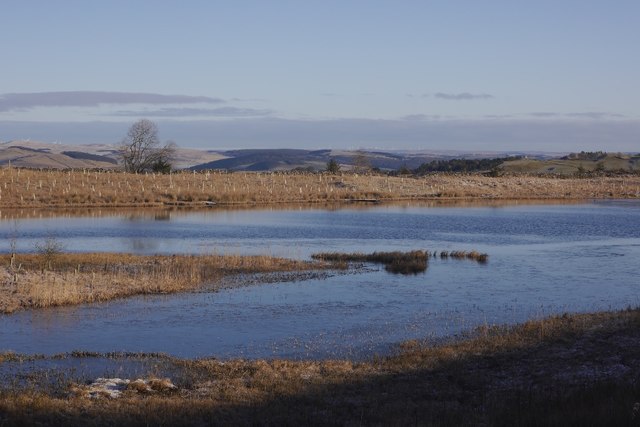
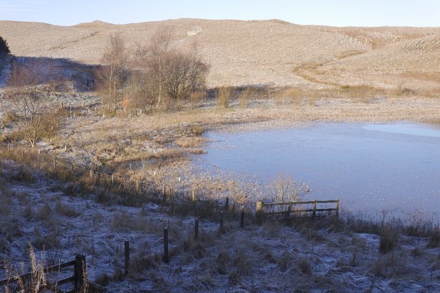
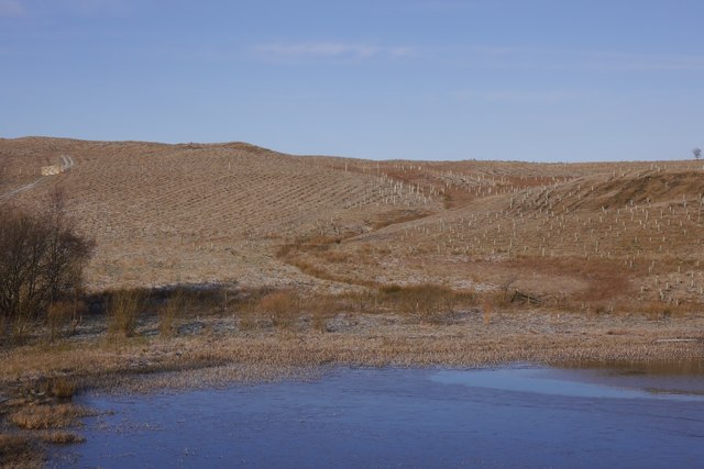
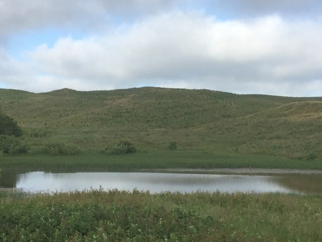
Headshaw Loch is a picturesque freshwater loch located in the county of Roxburghshire, Scotland. Situated amidst rolling hills and verdant countryside, it covers an area of approximately 10 acres, making it a relatively small body of water. The loch is nestled within the expansive Headshaw Estate, surrounded by a mix of woodlands and open fields.

The tranquil beauty of Headshaw Loch is enhanced by its diverse ecosystem. The water is crystal clear and teems with various species of freshwater fish, including brown trout and perch, making it a popular spot for anglers. The loch also attracts a variety of birdlife, with frequent sightings of ducks, swans, and herons. In fact, the area is designated as a Site of Special Scientific Interest due to its importance for breeding waterfowl.

The loch is surrounded by a narrow strip of reed beds and marshy vegetation, creating a freshwater marsh ecosystem at its edges. This habitat provides a haven for a wide range of flora and fauna, including rare wetland plants and amphibians such as frogs and newts.

Headshaw Loch is a popular destination for nature enthusiasts and those seeking tranquility. Visitors can enjoy leisurely walks along the loch's shoreline, taking in the stunning views and observing the abundant wildlife. The area is also well-equipped with picnic spots and benches, allowing visitors to immerse themselves in the natural beauty while enjoying a peaceful meal or simply basking in the serenity of the surroundings.

Overall, Headshaw Loch is a hidden gem in Roxburghshire, offering a harmonious blend of scenic beauty, biodiversity, and recreational opportunities.

If you have any feedback on the listing, please let us know in the comments section below.

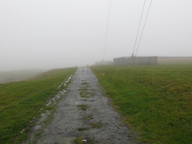
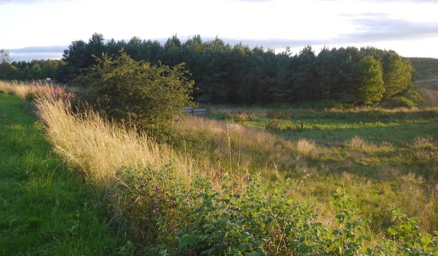
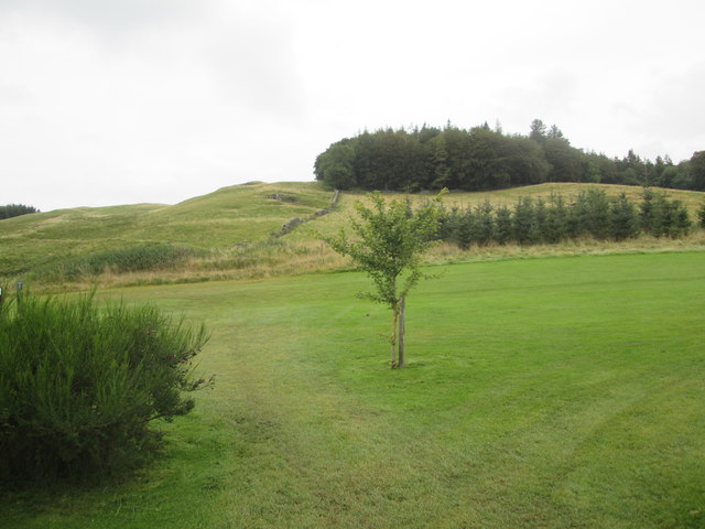
Headshaw Loch Images

Images are sourced within 2km of 55.503326/-2.8569167 or Grid Reference NT4523. Thanks to Geograph Open Source API. All images are credited.

Felled block, Hartwoodmyres
Tuley tubes, Hartwoodmyres
A symbolic gravestone in Ashkirk Parish Churchyard This 18th century stone, which is leaning forwards, displays the classic symbols of mortality with crossed femur bones, a horizontal hourglass and a death’s head skull. A winged soul at the top of the stone is a symbol of immortality representing the human spirit.
A symbolic gravestone in Ashkirk Parish Churchyard
This 18th century stone, which is leaning forwards, displays the classic symbols of mortality with crossed femur bones, a horizontal hourglass and a death’s head skull. A winged soul at the top of the stone is a symbol of immortality representing the human spirit.
He was only 363 when he died The inscription on this Crawford gravestone in Ashkirk Parish Churchyard is interesting and amusing because the 18th century mason has carved the age of Robert Crawford as 363 when he died. The inscription reads:

HERE LYES
JOHN CRAWFORD
LATE TENNENT IN
DRAYDIAN WHO
DIED MAY 26 1744
AGID 78

Also Robert Crawford Son
late tenant in Branksholme
Town who died Sept 7 1767
Aged 363 years

For a view of the other side of the stone, see <a href="https://www.geograph.org.uk/photo/4739479">NT4622 : A symbolic gravestone in Ashkirk Parish Churchyard</a>.
He was only 363 when he died
The inscription on this Crawford gravestone in Ashkirk Parish Churchyard is interesting and amusing because the 18th century mason has carved the age of Robert Crawford as 363 when he died. The inscription reads: HERE LYES JOHN CRAWFORD LATE TENNENT IN DRAYDIAN WHO DIED MAY 26 1744 AGID 78 Also Robert Crawford Son late tenant in Branksholme Town who died Sept 7 1767 Aged 363 years For a view of the other side of the stone, see NT4622 : A symbolic gravestone in Ashkirk Parish Churchyard.
Moorland road at Bishop's Stone Looking north-westward.
Moorland road at Bishop's Stone
Looking north-westward.
Ordnance Survey Cut Mark with Rivet This can be found in the driveway to Dryden Stables.
For more information see : <span class="nowrap"><a title="http://www.bench-marks.org.uk/bm72387" rel="nofollow ugc noopener" href="http://www.bench-marks.org.uk/bm72387">Link</a><img style="margin-left:2px;" alt="External link" title="External link - shift click to open in new window" src="https://s1.geograph.org.uk/img/external.png" width="10" height="10"/></span>
Ordnance Survey Cut Mark with Rivet
This can be found in the driveway to Dryden Stables. For more information see : LinkExternal link
Milestone Edinburgh 43 miles (re-positioned) This milestone once stood beside the A7 at NT 475 230  but during re-alignment of the road was discarded. The owner of Dryden Stables found it in a ditch and re-positioned it on his driveway. A bit of history preserved.
Milestone Edinburgh 43 miles (re-positioned)
This milestone once stood beside the A7 at NT 475 230 but during re-alignment of the road was discarded. The owner of Dryden Stables found it in a ditch and re-positioned it on his driveway. A bit of history preserved.
Dunhog Moss Land around the loch has now been planted with trees.
Dunhog Moss
Land around the loch has now been planted with trees.
Dunhog Moss The southwestern end of the loch, now with woodland in the background.
Dunhog Moss
The southwestern end of the loch, now with woodland in the background.
Brown Moor Heights Newly planted woodland above Dunhog Moss.
Brown Moor Heights
Newly planted woodland above Dunhog Moss.
The edge of Ashkirk The village of Ashkirk is very spread out but does have a small concentrated group of houses near the junction with the A7. This picture was taken just on the edge of the village close to the Ale Water which is the stream / burn that runs through the village.
The edge of Ashkirk
The village of Ashkirk is very spread out but does have a small concentrated group of houses near the junction with the A7. This picture was taken just on the edge of the village close to the Ale Water which is the stream / burn that runs through the village.
Access road to Hare Moss reserve This is the old course of the nearby A7. Now it is moss-covered.
Access road to Hare Moss reserve
This is the old course of the nearby A7. Now it is moss-covered.
Dunbog Moss The new trees on the far bank are getting established..
Dunbog Moss
The new trees on the far bank are getting established..
Track near the mast at Hare & Dunhog Moss Looking south-eastward.
Track near the mast at Hare & Dunhog Moss
Looking south-eastward.
Track at Hare & Dunhog Moss leading away from the mast to the A7 road Looking south-westward.
Track at Hare & Dunhog Moss leading away from the mast to the A7 road
Looking south-westward.
Forest track at Hartwoodmyres Looking north-eastward.
Forest track at Hartwoodmyres
Looking north-eastward.
Beside the A7, Hare Moss The woodland here is now part of a much bigger plantation with the surrounding hillside recently planted.
Beside the A7, Hare Moss
The woodland here is now part of a much bigger plantation with the surrounding hillside recently planted.
Woll  Plantation  above  Woll  Golf  Course The B A Way goes through the golf course to the Thief Road (tk)
Woll Plantation above Woll Golf Course
The B A Way goes through the golf course to the Thief Road (tk)
Show me another place!

Headshaw Loch is located at Grid Ref: NT4523 (Lat: 55.503326, Lng: -2.8569167)

Unitary Authority: The Scottish Borders

Police Authority: The Lothians and Scottish Borders

What 3 Words

///various.looms.gets. Near Selkirk, Scottish Borders

Related Wikis

Woll

Woll is a village on the Ale Water, off the A7, in the Ettrick Forest, north of Hawick, and south of Selkirk in the Scottish Borders area of Scotland....

Salenside

Salenside is a village off the A7, on the Ale Water, near Ashkirk, in the Scottish Borders area of Scotland, in the former Selkirkshire. There was a Salenside...

Ashkirk

Ashkirk is a small village on the Ale Water, in the Scottish Borders area of Scotland. It is located just off the A7 road, approximately 6 miles (10 kilometres...

Oakwood Roman Fort and Camp

Oakwood Roman Fort and Camp is a British archaeological site, a Roman fort and nearby Roman camp, about 3.5 miles (5.6 km) south-west of Selkirk in the...

Nearby Amenities

Located within 500m of 55.503326,-2.8569167
Stobshaw Hill
Natural: peak
Lat/Long: 55.4995982/-2.8568171
The data included in this document is from www.openstreetmap.org. The data is made available under ODbL.

Have you been to Headshaw Loch?

Leave your review of Headshaw Loch below (or comments, questions and feedback).