Greasley

Settlement in Nottinghamshire Broxtowe

England

Greasley

On the Robin Hood Way northwest of Kimberley
On the Robin Hood Way northwest of Kimberley Credit: Colin Park

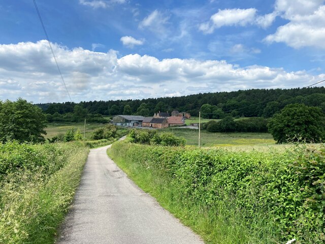
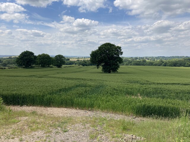
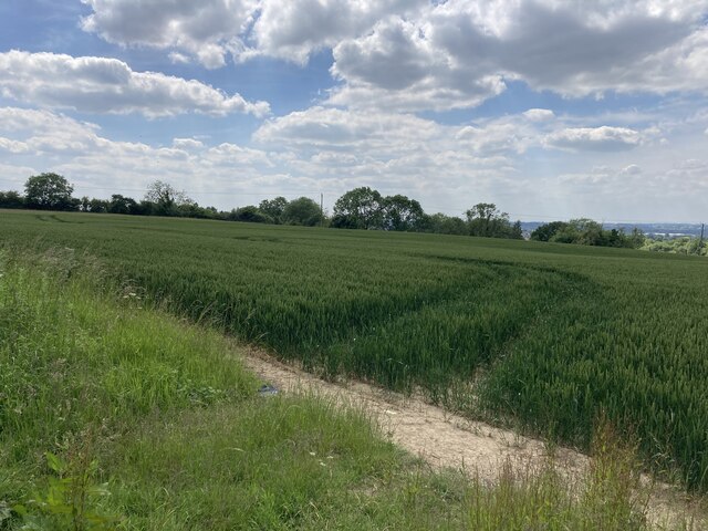
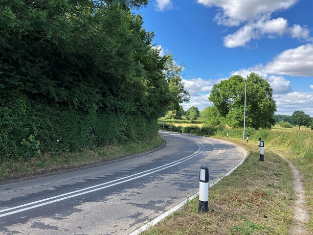
Greasley is a small village located in the county of Nottinghamshire, in the East Midlands region of England. Situated about 11 miles northwest of the city of Nottingham, Greasley is nestled in a rural landscape surrounded by rolling hills and picturesque countryside.

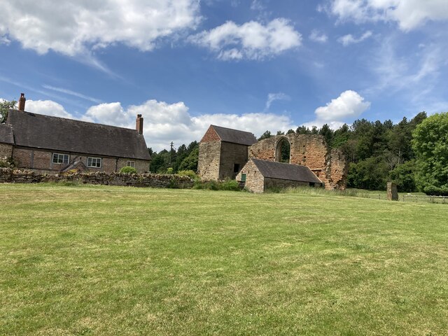
The village has a rich history dating back to the medieval period, with evidence of settlements in the area since Roman times. One of the most notable landmarks in Greasley is the St. Mary's Church, a beautiful 13th-century building that stands as a testament to the village's heritage.

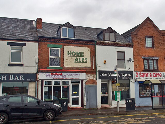
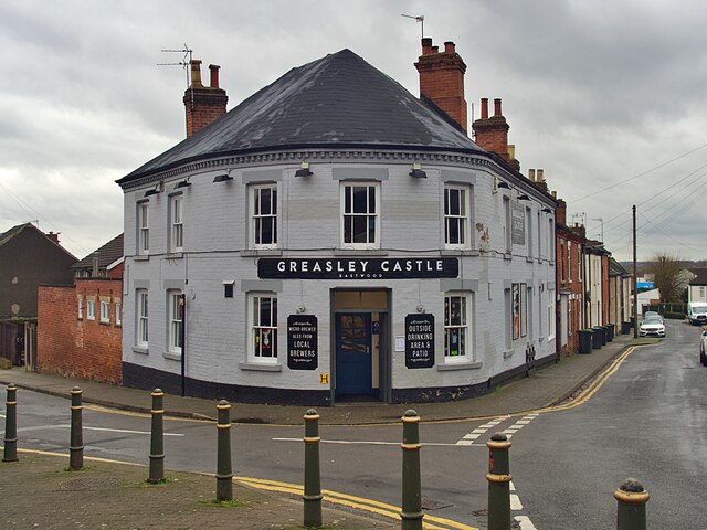
Greasley is a close-knit community with a population of around 2,500 residents. The village offers a peaceful and tranquil atmosphere, making it an ideal place for those seeking a quieter lifestyle away from the hustle and bustle of city life. The local amenities include a primary school, a village hall, and a few shops and pubs.

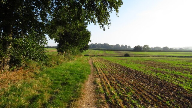
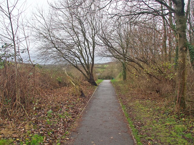
For nature enthusiasts, the surrounding countryside provides plenty of opportunities for outdoor activities such as hiking, cycling, and birdwatching. The nearby Colliers Wood Nature Reserve offers a peaceful retreat with its lush greenery, tranquil ponds, and diverse wildlife.

Greasley is well-connected to the wider region, with good road links to Nottingham and other nearby towns. The village is also served by regular bus services, providing easy access to surrounding areas.

Overall, Greasley offers a charming and idyllic rural setting, making it a desirable place to live for those seeking a peaceful and picturesque village lifestyle.

If you have any feedback on the listing, please let us know in the comments section below.
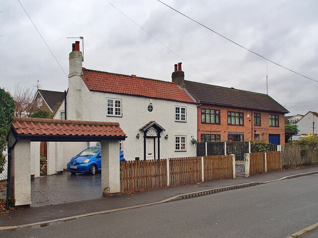
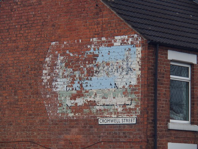
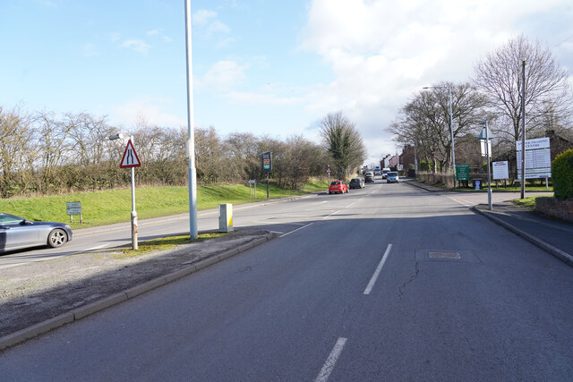
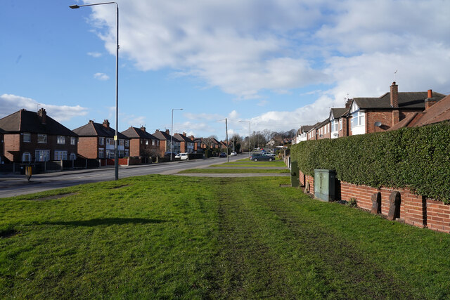
Greasley Images

Images are sourced within 2km of 53.019928/-1.270192 or Grid Reference SK4947. Thanks to Geograph Open Source API. All images are credited.

On the Robin Hood Way northwest of Kimberley
Robin Hood Way leading northeast towards Greasley
St Mary's Church, Greasley
Public footpath in Eastwood Running between Garden Road and Walker Street
Public footpath in Eastwood
Running between Garden Road and Walker Street
Ghost sign on Nottingham Road For Home Ales, a brand which disappeared in the 1990s but I believe used to supply the Greasley Castle opposite <a href="https://www.geograph.org.uk/photo/7045094">SK4746 : The Greasley Castle</a>
Ghost sign on Nottingham Road
For Home Ales, a brand which disappeared in the 1990s but I believe used to supply the Greasley Castle opposite SK4746 : The Greasley Castle
The Greasley Castle Public House at the Castle Street/Raglan Street junction.  I believe the pub used to sell Home Ales, for which beer there remains a ghost sign opposite on Nottingham Road <a href="https://www.geograph.org.uk/photo/7045090">SK4746 : Ghost sign on Nottingham Road</a>
The Greasley Castle
Public House at the Castle Street/Raglan Street junction. I believe the pub used to sell Home Ales, for which beer there remains a ghost sign opposite on Nottingham Road SK4746 : Ghost sign on Nottingham Road
Houses on Pinfold Road, Giltbrook
Ghost sign  Pointing the way to 'Gilbrook Dyers and Cleaners' whose premises were to the left of the sign but have now moved to Ilkeston.
Ghost sign
Pointing the way to 'Gilbrook Dyers and Cleaners' whose premises were to the left of the sign but have now moved to Ilkeston.
Giltbrook Dyers and Cleaners Ghost sign on a gable end on Cromwell Street. The sign was pointing the way to their premises but the company has moved and is now located in Ilkeston. Local knowledge from a walking colleague assisted in deciphering the wording.
For context see <a href="https://www.geograph.org.uk/photo/7045107">SK4845 : Ghost sign </a>.
Giltbrook Dyers and Cleaners
Ghost sign on a gable end on Cromwell Street. The sign was pointing the way to their premises but the company has moved and is now located in Ilkeston. Local knowledge from a walking colleague assisted in deciphering the wording. For context see SK4845 : Ghost sign .
Nottingham Road The Nottingham Road or The B6010 looking towards Newthorpe and Eastwood.
Nottingham Road
The Nottingham Road or The B6010 looking towards Newthorpe and Eastwood.
Nottingham Road Looking along the Nottingham Road from the corner of Pinfold Road. The grass verbe is very wide at this point.
Nottingham Road
Looking along the Nottingham Road from the corner of Pinfold Road. The grass verbe is very wide at this point.
Carved Tree In a tiny nature reserve.
Carved Tree
In a tiny nature reserve.
Beauvale Priory and Abbey Farm Pictured from the access road to the south of the location. The priory can be seen by visitors when the tea room nearby is open. It wasn't on this day and I was shunted off.
Beauvale Priory and Abbey Farm
Pictured from the access road to the south of the location. The priory can be seen by visitors when the tea room nearby is open. It wasn't on this day and I was shunted off.
Remains of Beauvale Priory This priory was built for Carthusian monks in 1343 - one of only a handful to be built in England for this order. They resisted Henry VIII's Oath of Supremacy and two members of the charterhouse later achieved martyrdom. A small portion of the remains are located outside this grid square in SK4950.
Remains of Beauvale Priory
This priory was built for Carthusian monks in 1343 - one of only a handful to be built in England for this order. They resisted Henry VIII's Oath of Supremacy and two members of the charterhouse later achieved martyrdom. A small portion of the remains are located outside this grid square in SK4950.
Farmland near Colliers Wood Pictured from a field entrance off New Road. Moorgreen Reservoir is located in the middle distance but out of sight here.
Farmland near Colliers Wood
Pictured from a field entrance off New Road. Moorgreen Reservoir is located in the middle distance but out of sight here.
Field of Wheat near Moorgreen Pictured from an un-gated entrance on New Road.
Field of Wheat near Moorgreen
Pictured from an un-gated entrance on New Road.
Sharp Bend on the B600 Road Pictured close to Moorgreen Reservoir which is just out of picture to the right.
Sharp Bend on the B600 Road
Pictured close to Moorgreen Reservoir which is just out of picture to the right.
Caught & Bowled Micropub, Giltbrook There is an astonishing number of micropubs along the road from Nuthall to Langley Mill including this cricket-themed establishment in Giltbrook occupying a former newsagent's shop. Perhaps it was the loss of the Hardys and Hanson brewery in Kimberley, whose products were ubiquitous in this area, that spurred the trend.
Caught & Bowled Micropub, Giltbrook
There is an astonishing number of micropubs along the road from Nuthall to Langley Mill including this cricket-themed establishment in Giltbrook occupying a former newsagent's shop. Perhaps it was the loss of the Hardys and Hanson brewery in Kimberley, whose products were ubiquitous in this area, that spurred the trend.
Show me another place!

Greasley is located at Grid Ref: SK4947 (Lat: 53.019928, Lng: -1.270192)

Administrative County: Nottinghamshire

District: Broxtowe

Police Authority: Nottinghamshire

What 3 Words

///unfolds.solicitor.openly. Near Eastwood, Nottinghamshire

Nearby Locations

Sledder Wood Greasley

Related Wikis

Greasley

Greasley is a civil parish north west of Nottingham in Nottinghamshire, England. Although it is thought there was once a village called Greasley, there...

St Mary's Church, Greasley

St Mary's Church, Greasley is a parish church in the Church of England in Greasley, Nottinghamshire. The church is Grade II listed by the Department for...

Newthorpe, Nottinghamshire

Newthorpe is a village in the English county of Nottinghamshire. It is in the Broxtowe Borough Council ward of Greasley (Giltbrook and Newthorpe). It forms...

Giltbrook

Giltbrook is a village in England situated approximately 6 miles (9.7 km) northwest of Nottingham and within close reach of junction 26 of the M1 motorway...

Beauvale Priory

Beauvale Priory (also known as Beauvale Charterhouse) was a Carthusian monastery in Beauvale, Nottinghamshire. It is a scheduled ancient monument. ��2...

Beauvale

Beauvale, or Beauvale Newthorpe, is a village in Nottinghamshire, England. It is located 1 mile to the east of Eastwood. It is in Greasley parish. Beauvale...

Watnall

Watnall is an area in the Borough of Broxtowe in Nottinghamshire, England. It is part of Greasley civil parish, and is located one mile north of Kimberley...

Eastwood Town F.C.

Eastwood Town Football Club was an English football club based in Eastwood, Nottinghamshire. The club last participated in the Northern Premier League...

Nearby Amenities

Located within 500m of 53.019928,-1.270192
Greasley
Is In: Nottinghamshire, United Kingdom
Place: village
Wikidata: Q1992557
Lat/Long: 53.0206209/-1.2700699
Bus Stop
Church
Bus: yes
Naptan AtcoCode: 3300BR0185
Naptan Bearing: NW
Naptan CommonName: Church
Naptan Indicator: o/s
Naptan Landmark: Church
Naptan NaptanCode: ntsdpwad
Naptan Notes: none
Naptan Street: Church Road
Naptan Verified: yes
Public Transport: platform
Shelter: no
Source: naptan_import
Lat/Long: 53.0205223/-1.2720203
Bus Stop
Church Road
Bus: yes
Naptan AtcoCode: 3300BR0196
Naptan Bearing: SE
Naptan CommonName: Church Road
Naptan Crossing: Church Road
Naptan Indicator: adj
Naptan NaptanCode: ntsdapwg
Naptan Notes: BW
Naptan Street: Main Road
Naptan Verified: no
Public Transport: platform
Shelter: no
Source: naptan_import
Lat/Long: 53.0176365/-1.2661436
Bus Stop
Church
Bus: yes
Naptan AtcoCode: 3300BR0265
Naptan Bearing: SE
Naptan CommonName: Church
Naptan Indicator: opp
Naptan Landmark: Church
Naptan NaptanCode: ntsdaptm
Naptan Notes: none
Naptan Street: Church Road
Naptan Verified: no
Public Transport: platform
Shelter: no
Source: naptan_import
Lat/Long: 53.0205292/-1.271685
Church Road
Naptan AtcoCode: 3300BR0507
Naptan Bearing: NW
Naptan BusStopType: CUS
Naptan CommonName: Church Road
Naptan Crossing: Church Road
Naptan Indicator: opp
Naptan NaptanCode: ntsgmtam
Naptan Notes: 3300BR0196
Naptan Street: Main Road
Naptan Verified: no
Source: naptan_import
Lat/Long: 53.0175384/-1.2662794
Barrier: kissing_gate
Lat/Long: 53.0199035/-1.2733994
D.H. Lawrence Heritage - The Country of My Heart
Information: board
Source: survey
Tourism: information
Lat/Long: 53.0197377/-1.27233
Pipeline: marker
Substance: gas
Lat/Long: 53.017791/-1.2650129
Waste Basket
Lat/Long: 53.017887/-1.2653629
Bench
Lat/Long: 53.0178934/-1.2653871
Waste Basket
Lat/Long: 53.0206041/-1.272212
Man Made: mast
Source: survey; Bing
Lat/Long: 53.0241752/-1.2721771
Entrance: main
Lat/Long: 53.0196618/-1.2716956
Bench
Lat/Long: 53.0196554/-1.2718157
Bench
Lat/Long: 53.0196546/-1.2718968
Bench
Lat/Long: 53.0196537/-1.2719639
Entrance: service
Lat/Long: 53.0197171/-1.2720905
Bench
Lat/Long: 53.0197941/-1.2727511
Bench
Lat/Long: 53.0204742/-1.2731574
Bench
Lat/Long: 53.0205081/-1.273203
Bench
Lat/Long: 53.0204887/-1.2732124
Bench
Lat/Long: 53.0203302/-1.2720738
Bench
Lat/Long: 53.0202826/-1.2721107
Bench
Lat/Long: 53.0202378/-1.2721449
Bench
Lat/Long: 53.0201854/-1.2721798
Bench
Lat/Long: 53.0201394/-1.2722053
St Mary's Church, Greasley
Advertising: board
Description: Service times
Source: survey
Lat/Long: 53.0200745/-1.2711331
D.H. Lawrence Heritage - The Country of My Heart
Information: board
Source: survey
Tourism: information
Lat/Long: 53.0200829/-1.2711253
Grit Bin
Lat/Long: 53.0204161/-1.2717573
Bench
Lat/Long: 53.0203491/-1.2715347
Waste Basket
Lat/Long: 53.0203387/-1.2715106
D.H. Lawrence Heritage - The Country of My Heart
Information: board
Source: survey
Tourism: information
Lat/Long: 53.0201204/-1.271017
Information: map
Operator: Greasley Parish Council
Source: survey
Tourism: information
Lat/Long: 53.0201124/-1.2709922
"The Lost Village of Greasley"
Information: board
Operator: Greasley Parish Council
Source: survey
Tourism: information
Lat/Long: 53.0201039/-1.2709708
Barrier: kissing_gate
Lat/Long: 53.0197209/-1.26919
Bicycle Parking
Bicycle Parking: stands
Capacity: 8
Covered: no
Lat/Long: 53.0201604/-1.2721476
Greasley Castle Farm Cafe
Addr City: Greasley
Addr Housename: Greasley Castle Farm
Addr Housenumber: 120
Addr Postcode: NG16 2AB
Addr Street: Church Road
Contact Facebook: https://www.facebook.com/greasleycastlefarm
Cuisine: coffee_shop;sandwich
Fhrs Id: 1515146
Internet Access: no
Min Age: 0
Opening Hours: Fr-Su 10:00-18:00
Outdoor Seating: yes
Phone: +44 7960448722
Website: https://greasley-castle-farm-project.ueniweb.com
Lat/Long: 53.0191818/-1.2702286
Cafe
The Parish Oven
Dog: yes
Opening Hours: Tu-Th 10:00-15:00
Lat/Long: 53.0200978/-1.2718475
The data included in this document is from www.openstreetmap.org. The data is made available under ODbL.

Have you been to Greasley?

Leave your review of Greasley below (or comments, questions and feedback).