Rough Haugh Pool
Lake, Pool, Pond, Freshwater Marsh in Selkirkshire
Scotland
Rough Haugh Pool

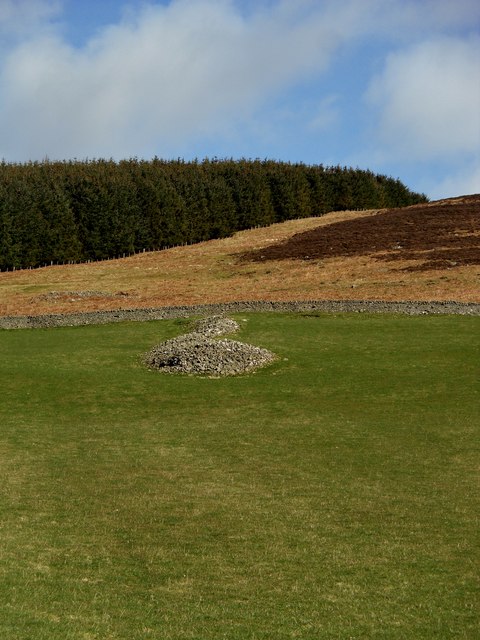
Rough Haugh Pool, located in Selkirkshire, is a picturesque freshwater marsh situated in the southern region of Scotland. This natural water body, often referred to as a pool or pond, serves as an important habitat for a variety of flora and fauna, making it a popular destination for both nature enthusiasts and wildlife observers.
Covering an area of approximately 2 hectares, Rough Haugh Pool is surrounded by lush vegetation, including reeds, grasses, and water lilies. The pool itself is relatively shallow, with a maximum depth of around 2 meters, and is fed by both surface runoff and groundwater sources, ensuring a constant supply of fresh water.
The diverse range of plant life found within the pool provides an ideal habitat for numerous species of wildlife. Waterfowl such as ducks, geese, and swans are commonly spotted, both nesting and foraging in the pool's calm waters. The surrounding marshland attracts a variety of wading birds, including herons and egrets, while the dense vegetation provides shelter for small mammals like voles and frogs.
Rough Haugh Pool is not only a haven for wildlife but also serves as a recreational spot for local residents and visitors alike. The tranquil surroundings and scenic beauty of the area make it an ideal location for picnicking, photography, and leisurely walks along the water's edge. Furthermore, the pool's calm waters offer opportunities for fishing, creating a popular pastime for angling enthusiasts.
Overall, Rough Haugh Pool is a captivating freshwater marsh that supports a rich biodiversity and provides a serene escape for those seeking a connection with nature in Selkirkshire.
If you have any feedback on the listing, please let us know in the comments section below.
Rough Haugh Pool Images
Images are sourced within 2km of 55.615839/-2.9458043 or Grid Reference NT4036. Thanks to Geograph Open Source API. All images are credited.


Rough Haugh Pool is located at Grid Ref: NT4036 (Lat: 55.615839, Lng: -2.9458043)
Unitary Authority: The Scottish Borders
Police Authority: The Lothians and Scottish Borders
What 3 Words
///eggplants.joke.outsiders. Near Innerleithen, Scottish Borders
Nearby Locations
Related Wikis

Thornielee railway station
Thornielee railway station served the smallholding of Thornielee, Scottish Borders, Scotland from 1866 to 1950 on the Peebles Railway. == History == The...

Ashiestiel
Ashiestiel is a village in the Scottish Borders area of Scotland, in the Parish of Caddonfoot, on the south side of the River Tweed, 4m (6.5 km) east of...
Angling Club Cottage Platform railway station
Angling Club Cottage Platform served the Edinburgh Angling Club in Selkirk, Scottish Borders, Scotland from 1898 to the late 1940s. == History == The station...

Peel Hospital
Peel Hospital was a health facility at Caddonfoot in the Scottish Borders, Scotland. It is a Category A Listed Building. == History == Peel House was designed...
Caddonlee
Caddonlee is a farm in the village of Clovenfords in the Scottish Borders area of Scotland, by the Caddon Water, near Caddonfoot where Caddon Water meets...
Caddon Water
The Caddon Water (Scottish Gaelic: Cadan) is a small river by the village of Caddonfoot, in the Scottish Borders area of Scotland. It rises on Windlestraw...
Clovenfords
Clovenfords is a village in the Scottish Borders area of Scotland, 1 mile (2 kilometres) north of the hamlet of Caddonfoot and 4 miles (6 kilometres) west...

Walkerburn railway station
Walkerburn railway station served the village of Walkerburn, Scottish Borders, Scotland from 1867 to 1962 on the Peebles Railway. == History == The station...
Nearby Amenities
Located within 500m of 55.615839,-2.9458043Have you been to Rough Haugh Pool?
Leave your review of Rough Haugh Pool below (or comments, questions and feedback).