Loch of Moan

Lake, Pool, Pond, Freshwater Marsh in Orkney

Scotland

Loch of Moan

Rousay: Nousty Sand A small sandy beach, one of relatively few on Rousay compared with other Orkney islands.
Rousay: Nousty Sand Credit: Chris Downer

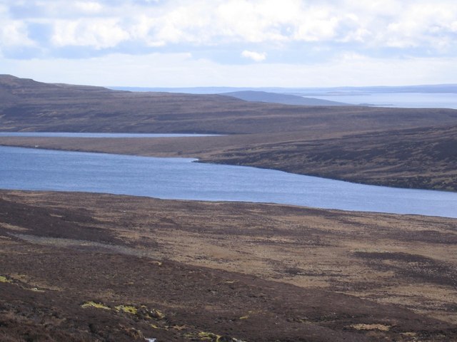
Loch of Moan is a picturesque freshwater loch located in Orkney, an archipelago in Scotland. It is situated in the parish of Birsay, approximately 15 kilometers northwest of Kirkwall, the capital of Orkney. The loch covers an area of about 90 hectares, making it one of the largest natural bodies of water in the region.

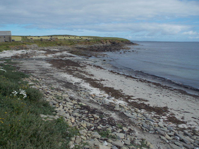
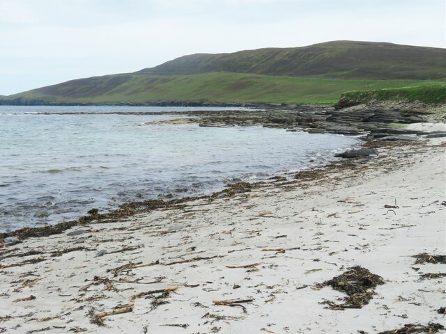
Surrounded by undulating hills and a diverse array of flora, Loch of Moan is a haven for nature enthusiasts. The loch itself is relatively shallow, with an average depth of around 2 meters, and its waters are crystal clear. The lake is fed by several small streams and springs, ensuring a constant flow of freshwater.

The surrounding area of Loch of Moan is home to a variety of wildlife, including numerous bird species. The loch serves as a vital habitat for migratory birds, such as greylag geese, wigeons, and teal, which flock to its shores during the winter months. Other bird species, including great crested grebes and tufted ducks, can also be spotted throughout the year.

In addition to its ecological significance, Loch of Moan offers recreational opportunities for visitors. Fishing is a popular activity, with the loch being well-stocked with brown trout. Anglers can enjoy a peaceful day on the water, surrounded by the serene beauty of the Orkney landscape.

Overall, Loch of Moan is a captivating freshwater loch that provides a sanctuary for wildlife, as well as a tranquil retreat for nature enthusiasts and anglers alike.

If you have any feedback on the listing, please let us know in the comments section below.

Loch of Moan Images

Images are sourced within 2km of 59.180719/-3.0829694 or Grid Reference HY3833. Thanks to Geograph Open Source API. All images are credited.

Rousay: Nousty Sand A small sandy beach, one of relatively few on Rousay compared with other Orkney islands.
Rousay: Nousty Sand
A small sandy beach, one of relatively few on Rousay compared with other Orkney islands.
Nousty Sand One of a handful of sandy beaches on Rousay, but even here there's not a lot of space for sunseeker's towels or beachside bars.
Nousty Sand
One of a handful of sandy beaches on Rousay, but even here there's not a lot of space for sunseeker's towels or beachside bars.
Old farm buildings at Saviskaill Old stone barns in various stages of decay.
Old farm buildings at Saviskaill
Old stone barns in various stages of decay.
A roofless barn at Saviskaill
A rough track down to Saviskaill Usually very muddy, I think.
A rough track down to Saviskaill
Usually very muddy, I think.
Nousty Sand at Saviskaill
Rousay: the post office The post office is within Tou Cottage*, Wasbister, about as far as you can get from the main village, Brinian, which is based around the ferry pier. This is because the current postmistress took over the role in 1991 and she lives here: the branch moved to the house of whoever wanted to take on the office.

Incidentally, there used to be two post offices on Rousay; one of them called simply 'Rousay' down at Brinain, and another named 'Wasbister' hereabouts. The Wasbister office closed on 25 June 1969, though.

* Tou Cottage is the address according to Royal Mail, although the map marks the name Too.
Rousay: the post office
The post office is within Tou Cottage*, Wasbister, about as far as you can get from the main village, Brinian, which is based around the ferry pier. This is because the current postmistress took over the role in 1991 and she lives here: the branch moved to the house of whoever wanted to take on the office. Incidentally, there used to be two post offices on Rousay; one of them called simply 'Rousay' down at Brinain, and another named 'Wasbister' hereabouts. The Wasbister office closed on 25 June 1969, though. * Tou Cottage is the address according to Royal Mail, although the map marks the name Too.
Rousay: postbox № KW17 53 and noticeboard, Wasbister This postbox serves the northern part of the island and faces the short track leading up to <a href="https://www.geograph.org.uk/photo/4715246">HY3833 : Rousay: the post office</a>.

The box is of a modern design, constructed of pressed steel and designed to be more robust, rustproof and theft-proof than the traditional cast iron box that it will have replaced in the last couple of years.

This particular style of box is becoming quite commonplace in these remote, exposed parts.
Rousay: postbox № KW17 53 and noticeboard, Wasbister
This postbox serves the northern part of the island and faces the short track leading up to HY3833 : Rousay: the post office. The box is of a modern design, constructed of pressed steel and designed to be more robust, rustproof and theft-proof than the traditional cast iron box that it will have replaced in the last couple of years. This particular style of box is becoming quite commonplace in these remote, exposed parts.
Track into an ancient landscape This doesn't appear to be anything more exciting than some rough grassland dropping down towards the sea on the west side of Rousay, but there is a sort of fossilised landscape here as this area was once inhabited and farmed before a brutal clearance by the laird. There are ruins of old cottages, stone dykes and runrig cultivation. If there had been more time between ferries, this would have been an interesting area to explore. Maybe next time.
Track into an ancient landscape
This doesn't appear to be anything more exciting than some rough grassland dropping down towards the sea on the west side of Rousay, but there is a sort of fossilised landscape here as this area was once inhabited and farmed before a brutal clearance by the laird. There are ruins of old cottages, stone dykes and runrig cultivation. If there had been more time between ferries, this would have been an interesting area to explore. Maybe next time.
Land above Quendal An area once farmed and now neglected. The green raised strip running across the picture is probably the base of an old dyke or field boundary. One of those grey days when sky and sea seem to merge. Northern coast of Mainland Orkney in the distance.
Land above Quendal
An area once farmed and now neglected. The green raised strip running across the picture is probably the base of an old dyke or field boundary. One of those grey days when sky and sea seem to merge. Northern coast of Mainland Orkney in the distance.
Old settlement site at Quendal The outlines of old field dykes can be seen here, whilst the occasional pile of stones might indicate a former cottage. This area was cleared by the landowner George William Traill, and the inhabitants evicted over two stages in 1845 and 1855-59, sheep being more profitable than crofters. This would make an interesting area to explore if time allowed between ferries. Several 'bonxies' noticed my arrival at the roadside anticipating some harassment if I stepped into their territory, but it was back to the car.
Old settlement site at Quendal
The outlines of old field dykes can be seen here, whilst the occasional pile of stones might indicate a former cottage. This area was cleared by the landowner George William Traill, and the inhabitants evicted over two stages in 1845 and 1855-59, sheep being more profitable than crofters. This would make an interesting area to explore if time allowed between ferries. Several 'bonxies' noticed my arrival at the roadside anticipating some harassment if I stepped into their territory, but it was back to the car.
A very straight wall Not just a boundary between different fields or areas of moorland, but also a local parish boundary.
A very straight wall
Not just a boundary between different fields or areas of moorland, but also a local parish boundary.
Farm buildings at Too Old stone buildings on the NW side of Rousay.
Farm buildings at Too
Old stone buildings on the NW side of Rousay.
Rousay post office A fair way from where most of the island population lives and also a bit of a trek from the ferry for the Royal Mail van.
Rousay post office
A fair way from where most of the island population lives and also a bit of a trek from the ferry for the Royal Mail van.
Feolquoy at Wasbister Looking along a drainage ditch and green track towards the farm at Feolquoy.
Feolquoy at Wasbister
Looking along a drainage ditch and green track towards the farm at Feolquoy.
Everybist looking over to Westray (North West Orkney) Everybist, on the Orkney island of Rousay, at the top of "Pig street" with a view down to Wasbister Loch (pronounced Wester) and over to Noup Head on Westray.
Everybist looking over to Westray (North West Orkney)
Everybist, on the Orkney island of Rousay, at the top of "Pig street" with a view down to Wasbister Loch (pronounced Wester) and over to Noup Head on Westray.
Wasbister Loch on Rousay Wasbister Loch on the north of Rousay (Orkney) looking over to Westray. At the left hand side of the loch can be seen The Burrian - believed to be a 'crannog' or artificial island.
Wasbister Loch on Rousay
Wasbister Loch on the north of Rousay (Orkney) looking over to Westray. At the left hand side of the loch can be seen The Burrian - believed to be a 'crannog' or artificial island.
Loch of Moan on Rousay in the  Wasbister region looking towards Faraclett Head An ideal location to watch the Rousay weather change then change again.
Loch of Moan on Rousay in the Wasbister region looking towards Faraclett Head
An ideal location to watch the Rousay weather change then change again.
Show me another place!

Loch of Moan is located at Grid Ref: HY3833 (Lat: 59.180719, Lng: -3.0829694)

Unitary Authority: Orkney Islands

Police Authority: Highlands and Islands

What 3 Words

///truckload.thickened.track. Near Brinian, Orkney Islands

Nearby Locations

Loch of Moan

Related Wikis

Midhowe Broch

Midhowe Broch () is an Iron Age broch located on the west coast of the island of Rousay in the Orkney Islands, in Scotland. == Description == Midhowe...

Midhowe Chambered Cairn

Midhowe Chambered Cairn is a large Neolithic chambered cairn located on the south shore of the island of Rousay, Orkney, Scotland. The name "Midhowe" comes...

Rousay

Rousay (, Scots: Rousee; Old Norse: Hrólfsey meaning Rolf's Island) is a small, hilly island about 3 km (1.9 mi) north of Mainland, the largest island...

Muckle Water

Muckle Water is a long, narrow fresh water loch on Ward Hill on Rousay, Orkney, Scotland. It is the biggest loch on the island and is popular for fishing...

Nearby Amenities

Located within 500m of 59.180719,-3.0829694
Generator Method: wind_turbine
Generator Source: wind
Power: generator
Lat/Long: 59.1797501/-3.0781906
Power: pole
Lat/Long: 59.1797993/-3.0747447
Power: pole
Lat/Long: 59.1799003/-3.0754508
Power: pole
Lat/Long: 59.1799686/-3.0758745
The data included in this document is from www.openstreetmap.org. The data is made available under ODbL.

Have you been to Loch of Moan?

Leave your review of Loch of Moan below (or comments, questions and feedback).