Charlie's Pool

Lake, Pool, Pond, Freshwater Marsh in Dumfriesshire

Scotland

Charlie's Pool

A7 north of Langholm - evening light
A7 north of Langholm - evening light Credit: Peter Moore

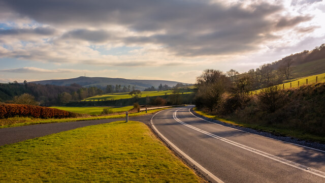
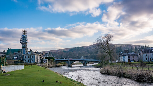
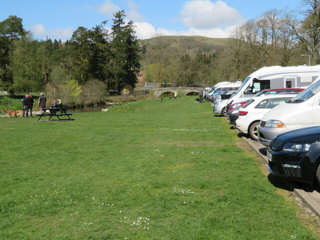
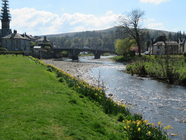
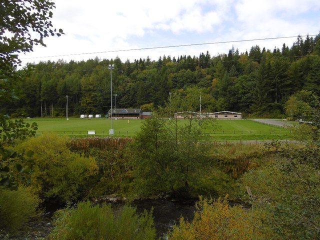
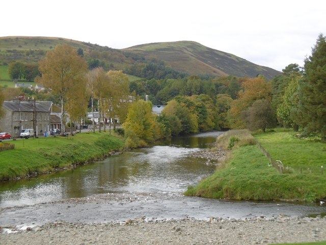
Charlie's Pool is a serene freshwater marsh located in Dumfriesshire, Scotland. Situated amidst breathtaking natural surroundings, this enchanting pool offers a tranquil retreat for both locals and visitors alike. It is nestled within a picturesque landscape, surrounded by rolling hills and lush vegetation, making it a haven for nature enthusiasts.

The pool itself is a small body of water, measuring approximately 150 meters in length and 50 meters in width. It is fed by a gentle stream that meanders through the marsh, providing a constant supply of fresh water. The pool's depth varies, with some areas reaching up to 2 meters deep, creating a diverse habitat for various aquatic species.

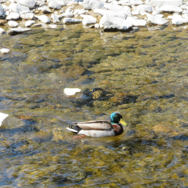
The biodiversity of Charlie's Pool is truly remarkable. The pool supports a wide range of plant life, including water lilies, reeds, and rushes, which thrive in the marshy conditions. These plants provide essential shelter and food for an array of wildlife. Visitors can spot numerous species of birds, such as herons, swans, and ducks, elegantly gliding across the water's surface or nesting in the nearby trees.

The pool's peaceful ambiance is further enhanced by the gentle chirping of birds and the occasional croak of frogs. It is a perfect spot for birdwatching, photography, or simply enjoying a peaceful stroll along the water's edge.

Charlie's Pool is a hidden gem of Dumfriesshire, offering a respite from the hustle and bustle of everyday life. Its unspoiled beauty and diverse ecosystem make it a must-visit destination for nature lovers seeking solace in the heart of Scotland.

If you have any feedback on the listing, please let us know in the comments section below.

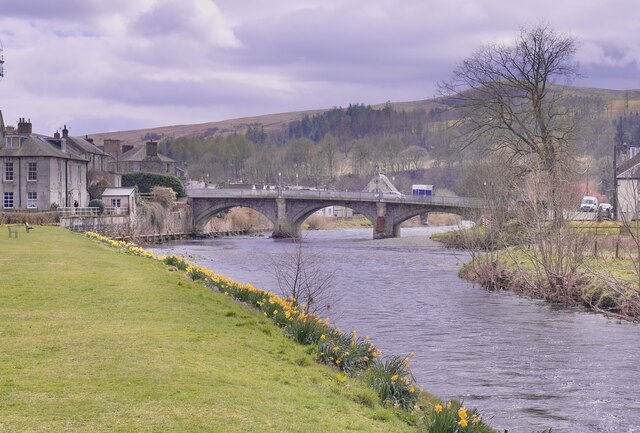
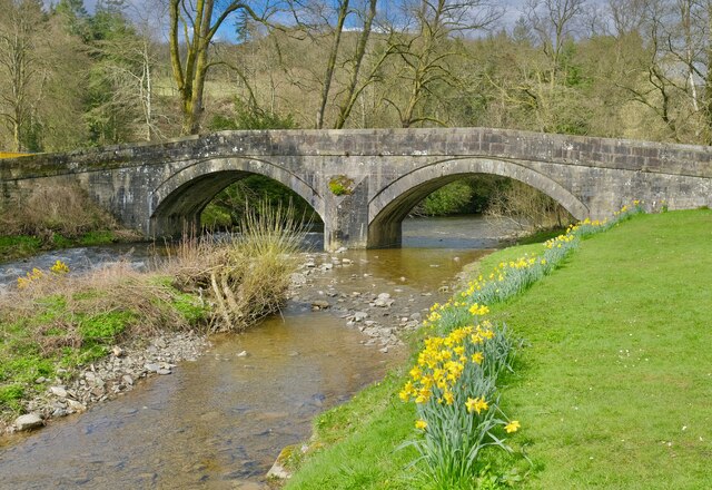
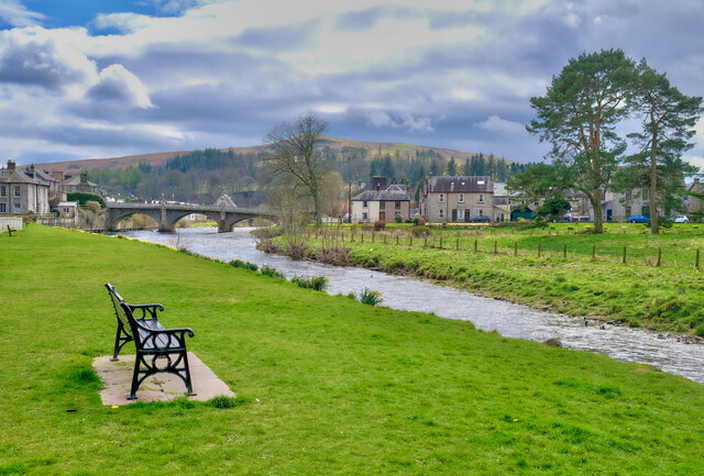
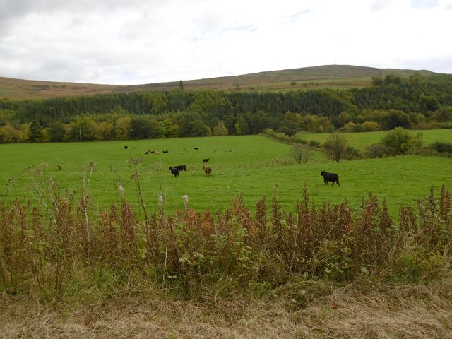
Charlie's Pool Images

Images are sourced within 2km of 55.153679/-3.0031159 or Grid Reference NY3684. Thanks to Geograph Open Source API. All images are credited.

A7 north of Langholm - evening light
Spire, bridge and tree in Langholm
Car park and picnic place at Langholm A handy stop on the A7 by the Ewes Water, just before it joins the River Esk.
Car park and picnic place at Langholm
A handy stop on the A7 by the Ewes Water, just before it joins the River Esk.
Drake Mallard at Langholm A male Anas platyrhynchos on the Ewes Water.
Drake Mallard at Langholm
A male Anas platyrhynchos on the Ewes Water.
The confluence of the River Esk and Ewes Water The River Esk comes in from the right, by the gravel spit, and the Ewes Water, in the foreground, loses its identity as it flows under the Townhead Bridge as part of the Esk.
The confluence of the River Esk and Ewes Water
The River Esk comes in from the right, by the gravel spit, and the Ewes Water, in the foreground, loses its identity as it flows under the Townhead Bridge as part of the Esk.
Car park at Langholm Conveniently situated on the A7 between the Ewes Water and Bar Wood.
Car park at Langholm
Conveniently situated on the A7 between the Ewes Water and Bar Wood.
Kirk Wynd View Taken from the top of Kirk Wynd looking over the town of Langholm.
Kirk Wynd View
Taken from the top of Kirk Wynd looking over the town of Langholm.
Whitshiels Cafe, Langholm
At Langholm Bridge over the river Esk
At Langholm
Bridge over the river Esk
Ewes Bridge Langholm
Ewes Bridge
Langholm
The River Esk Langholm
The River Esk
Langholm
Cattle, Ewesdale The Malcolm Monument on the skyline: Langholm is approaching.
Cattle, Ewesdale
The Malcolm Monument on the skyline: Langholm is approaching.
Milntown Home of Langholm RFC.
Milntown
Home of Langholm RFC.
Langholm approaching The latest edition of Langholm's relativistic road sign.  Please allow the scenery to pass at 13.4ms^-1 or less. Thank you.
Langholm approaching
The latest edition of Langholm's relativistic road sign. Please allow the scenery to pass at 13.4ms^-1 or less. Thank you.
Eskdale Hotel, Langholm
Pelosis Corner Cafe My spell checker keeps throwing in an apostrophe which is probably correct. Centre of Langholm.
Pelosis Corner Cafe
My spell checker keeps throwing in an apostrophe which is probably correct. Centre of Langholm.
Esk - Ewes confluence Ewes Water (right) joins the Esk in Langholm.
Esk - Ewes confluence
Ewes Water (right) joins the Esk in Langholm.
Langholm to Newcastleton road The climb up to Langholm Moor.
Langholm to Newcastleton road
The climb up to Langholm Moor.
Show me another place!

Charlie's Pool is located at Grid Ref: NY3684 (Lat: 55.153679, Lng: -3.0031159)

Unitary Authority: Dumfries and Galloway

Police Authority: Dumfries and Galloway

What 3 Words

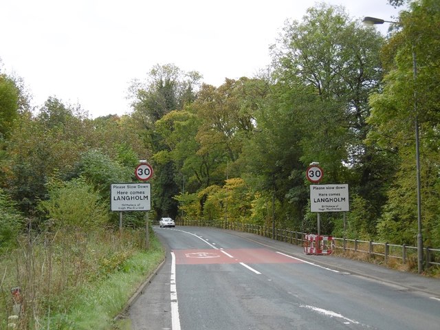
///shorts.snooping.cement. Near Langholm, Dumfries & Galloway

Related Wikis

Langholm Academy

Langholm Academy is a non-denominational, co-educational six-year comprehensive secondary school in Langholm, Scotland. Currently, the school has 240 pupils...
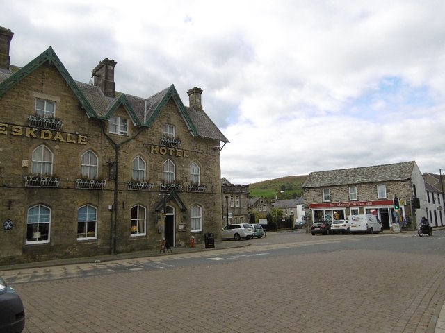
Langholm

Langholm , also known colloquially as the "Muckle Toon", is a burgh in Dumfries and Galloway, southern Scotland. Langholm lies between four hills in the...

Thomas Hope Hospital

Thomas Hope Hospital is a health facility in Strand Street, Langholm, Dumfries and Galloway, Scotland. It is managed by NHS Dumfries and Galloway. ��2...

Battle of Arkinholm

The Battle of Arkinholm was fought on 1 May 1455, at Arkinholm near Langholm in Scotland, during the reign of King James II of Scotland. Although a small...

Langholm Town Hall

Langholm Town Hall is a municipal building in the High Street in Langholm, Dumfries and Galloway, Scotland. The structure, which is used as a community...

Langholm railway station

Langholm railway station served the burgh of Langholm, Dumfries and Galloway, Scotland from 1864 to 1967 on the Border Union Railway. == History == The...

Duchess Bridge

The Duchess Bridge is a cast iron footbridge over the River Esk in Dumfries and Galloway, Scotland. It was built for Charles Montagu-Scott, 4th Duke of...

Wauchope Castle

Wauchope Castle was a castle located at Wauchope, in Dumfries and Galloway, Scotland. The castle was a stronghold of the Lindsay family. It was the caput...

Nearby Amenities

Located within 500m of 55.153679,-3.0031159
Langholm
Name En: Langholm
Name Gd: Langaim
Name Sco: The Muckle Toun
Place: town
Population: 2227
Wikidata: Q1014104
Wikipedia: en:Langholm
Lat/Long: 55.1505895/-2.9983313
Bus Stop
High Street
Naptan AtcoCode: 680000217111
Naptan Bearing: NW
Naptan CommonName: High Street
Naptan Indicator: Smiths
Naptan Landmark: Town Hall
Naptan NaptanCode: 34237565
Naptan Notes: none
Naptan Street: High Street
Naptan Verified: no
Shelter: yes
Source: naptan_import
Lat/Long: 55.1513617/-2.9995691
Bus Stop
Post Office
Bus: yes
Naptan AtcoCode: 680000217222
Naptan Bearing: SE
Naptan CommonName: Post Office
Naptan Indicator: o/s PO
Naptan NaptanCode: 34237564
Naptan Street: High Street
Public Transport: platform
Ref: 680000217222
Source: NaPTAN
Lat/Long: 55.1509549/-2.9987743
Bus Stop
Langholm Park
Bus: yes
Naptan AtcoCode: 680000217501
Naptan Bearing: S
Naptan CommonName: Park
Naptan Indicator: opp Entrance
Naptan NaptanCode: 34237567
Naptan Street: High Street
Public Transport: platform
Ref: 680000217501
Source: NaPTAN
Lat/Long: 55.1527286/-3.0002277
Bus Stop
Park
Naptan AtcoCode: 680000217502
Naptan Bearing: N
Naptan CommonName: Park
Naptan Indicator: At Entrance
Naptan Landmark: Thomas Telford Road
Naptan NaptanCode: 34238958
Naptan Street: High Street
Naptan Verified: no
Shelter: no
Source: naptan_import
Lat/Long: 55.1534682/-3.0002338
Bus Stop
Academy
Naptan AtcoCode: 680000378111
Naptan Bearing: NW
Naptan CommonName: Academy
Naptan Indicator: opp Academy
Naptan Landmark: Academy
Naptan NaptanCode: 34234368
Naptan Notes: none
Naptan Street: Thomas Telford Road
Naptan Verified: no
Source: naptan_import
Lat/Long: 55.1536642/-3.0069869
Bus Stop
Academy
Naptan AtcoCode: 680000378222
Naptan Bearing: SE
Naptan CommonName: Academy
Naptan Indicator: o/s Academy
Naptan Landmark: Academy
Naptan NaptanCode: 34234369
Naptan Notes: none
Naptan Street: Thomas Telford Road
Naptan Verified: no
Source: naptan_import
Lat/Long: 55.1537367/-3.0069103
Bus Stop
Caroline Street
Naptan AtcoCode: 680000379333
Naptan Bearing: SW
Naptan CommonName: Caroline Street
Naptan Indicator: no 53
Naptan Landmark: Eskdaill Street
Naptan NaptanCode: 34234367
Naptan Notes: none
Naptan Street: Caroline Street
Naptan Verified: no
Source: naptan_import
Lat/Long: 55.1501234/-3.0071094
Bus Stop
Caroline Street
Naptan AtcoCode: 680000379444
Naptan Bearing: NE
Naptan CommonName: Caroline Street
Naptan Indicator: opp 53
Naptan Landmark: Eskdaill Street
Naptan NaptanCode: 34234365
Naptan Notes: none
Naptan Street: Caroline Street
Naptan Verified: no
Source: naptan_import
Lat/Long: 55.1501846/-3.0071974
Police
Langholm Police Station
Addr City: Langholm
Addr Housename: Town Hall
Addr Postcode: DG13 0JQ
Addr Street: Market Place
Operator: Police Scotland
Operator Wikidata: Q7209499
Website: https://www.scotland.police.uk/police-stations/dumfries-and-galloway-police-stations/langholm-town-hall/
Lat/Long: 55.1505382/-2.9982855
Fire Station
Langholm Fire Station
Addr City: Langholm
Addr Postcode: DG13 0AT
Addr Street: Albert Place
Operator: Scottish Fire and Rescue Service
Operator Wikidata: Q7437729
Lat/Long: 55.1525517/-3.0055881
Crossing
Crossing: traffic_signals
Source: survey
Lat/Long: 55.1510011/-2.9989185
Pub
Crown Hotel
Source: survey
Lat/Long: 55.1515335/-2.9994424
Bank
Bank of Scotland
Addr Country: GB
Brand: Bank of Scotland
Brand Wikidata: Q627381
Brand Wikipedia: en:Bank of Scotland
Contact Website: https://branches.bankofscotland.co.uk/langholm/high-street
Operator: Bank of Scotland
Source: survey
Lat/Long: 55.1516085/-3.0000086
Toilets
Source: Bing
Toilets Disposal: flush
Unisex: yes
Lat/Long: 55.1537375/-3.0002666
Barrier: bollard
Motor Vehicle: no
Lat/Long: 55.1494817/-3.0021694
Post Box
Ref: DG13 58
Lat/Long: 55.1517877/-3.0050174
Post Box
Brand: Royal Mail
Brand Wikidata: Q638098
Mapillary: 446565747470432
Operator: Royal Mail
Operator Wikidata: Q638098
Post Box Mounting: building
Post Box Type: wall
Ref: DG13 3
Survey Date: 2022-06-04
Lat/Long: 55.1509919/-2.9987807
Post Office
Langholm Post Office
Addr City: Langholm
Addr Country: GB
Addr Housename: Town Hall
Addr Postcode: DG13 0JH
Brand: Post Office
Brand Wikidata: Q1783168
Check Date: 2022-05-27
Check Date Opening Hours: 2022‑05‑27
Contact Website: https://www.postoffice.co.uk/branch-finder/0124710/langholm
Opening Hours: We 10:00-15:30; Fr 09:00-14:00
Ref Pol Id: 167939
Lat/Long: 55.1510042/-2.9986385
Post Box
Ref: DG13 85
Lat/Long: 55.1537016/-3.0103004
Langholm
Whitewater: put_in
Lat/Long: 55.1542863/-3.000983
Langholm Weir
Rapids: 2
Waterway: rapids
Lat/Long: 55.1510727/-3.0019098
Barrier: cycle_barrier
Bicycle: yes
Foot: yes
Lat/Long: 55.1529587/-3.0069632
Pharmacy
Lat/Long: 55.1508341/-3.0001329
Entrance: yes
Lat/Long: 55.1540835/-3.0064914
Material: wood
Power: pole
Lat/Long: 55.1521302/-2.9958142
Addr Housenumber: 9
Addr Street: High Street
Lat/Long: 55.1523287/-3.0002077
Addr Housenumber: 11
Addr Street: High Street
Entrance: main
Lat/Long: 55.1522095/-3.0003299
Addr Housenumber: 10
Addr Street: High Street
Entrance: main
Lat/Long: 55.1521025/-3.0005112
Mercat Cross
Historic: memorial
Memorial: mercat_cross
Lat/Long: 55.1504229/-2.9980786
Langholm Castle
Historic: fort
Lat/Long: 55.1547241/-3.0031765
Doctors
Langholm Health Centre
Healthcare: doctor
Lat/Long: 55.1507736/-2.9998848
Bench
Lat/Long: 55.1500806/-3.0038367
Toilets
Access: yes
Toilets Disposal: flush
Unisex: yes
Lat/Long: 55.1505523/-2.9981329
Cafe
Polla-Anna's
Lat/Long: 55.1502554/-2.998169
The Douglas
Tourism: hotel
Lat/Long: 55.1503162/-2.998282
Bench
Backrest: yes
Lat/Long: 55.1503985/-2.9981191
Browns
Shop: butcher
Lat/Long: 55.1503994/-2.9984046
Cafe
Pelosis Corner Cafe
Lat/Long: 55.150743/-2.9983017
Chlow At La Belle
Shop: beauty
Lat/Long: 55.1508704/-2.9984235
Eskdale hotel
Tourism: hotel
Lat/Long: 55.1507572/-2.9988879
Davidsons
Shop: chemist
Lat/Long: 55.1508898/-2.9985716
Welcome To Langholm
Information: office
Tourism: information
Lat/Long: 55.1509674/-2.9990539
Londis
Brand: Londis
Brand Wikidata: Q21008564
Brand Wikipedia: en:Londis (United Kingdom)
Shop: convenience
Lat/Long: 55.1513579/-2.9992595
Buck Hotel
Tourism: hotel
Lat/Long: 55.1519955/-3.0001224
Townhead Bakery
Shop: bakery
Lat/Long: 55.1518037/-3.0002222
Bench
Lat/Long: 55.1494006/-3.0042477
Bench
Lat/Long: 55.1494588/-3.0045883
Leisure: picnic_table
Lat/Long: 55.1493301/-3.0042959
Information: guidepost
Tourism: information
Lat/Long: 55.1554157/-3.0007166
Defibrillator
Emergency: defibrillator
Indoor: no
Lat/Long: 55.15312/-3.0036907
Defibrillator
Defibrillator Location: Langholm Town Hall: external wall to left hand side of entrance (round the corner)
Emergency: defibrillator
Indoor: no
Lat/Long: 55.1507269/-2.9984016
Power: pole
Lat/Long: 55.1564792/-2.9993653
Power: pole
Lat/Long: 55.1557671/-2.9975062
The data included in this document is from www.openstreetmap.org. The data is made available under ODbL.

Have you been to Charlie's Pool?

Leave your review of Charlie's Pool below (or comments, questions and feedback).