Rydal Water

Lake, Pool, Pond, Freshwater Marsh in Westmorland South Lakeland

England

Rydal Water

Descent from Loughrigg Looking down one of the paths from Loughrigg, this leads towards the Oaks.
Descent from Loughrigg Credit: DS Pugh

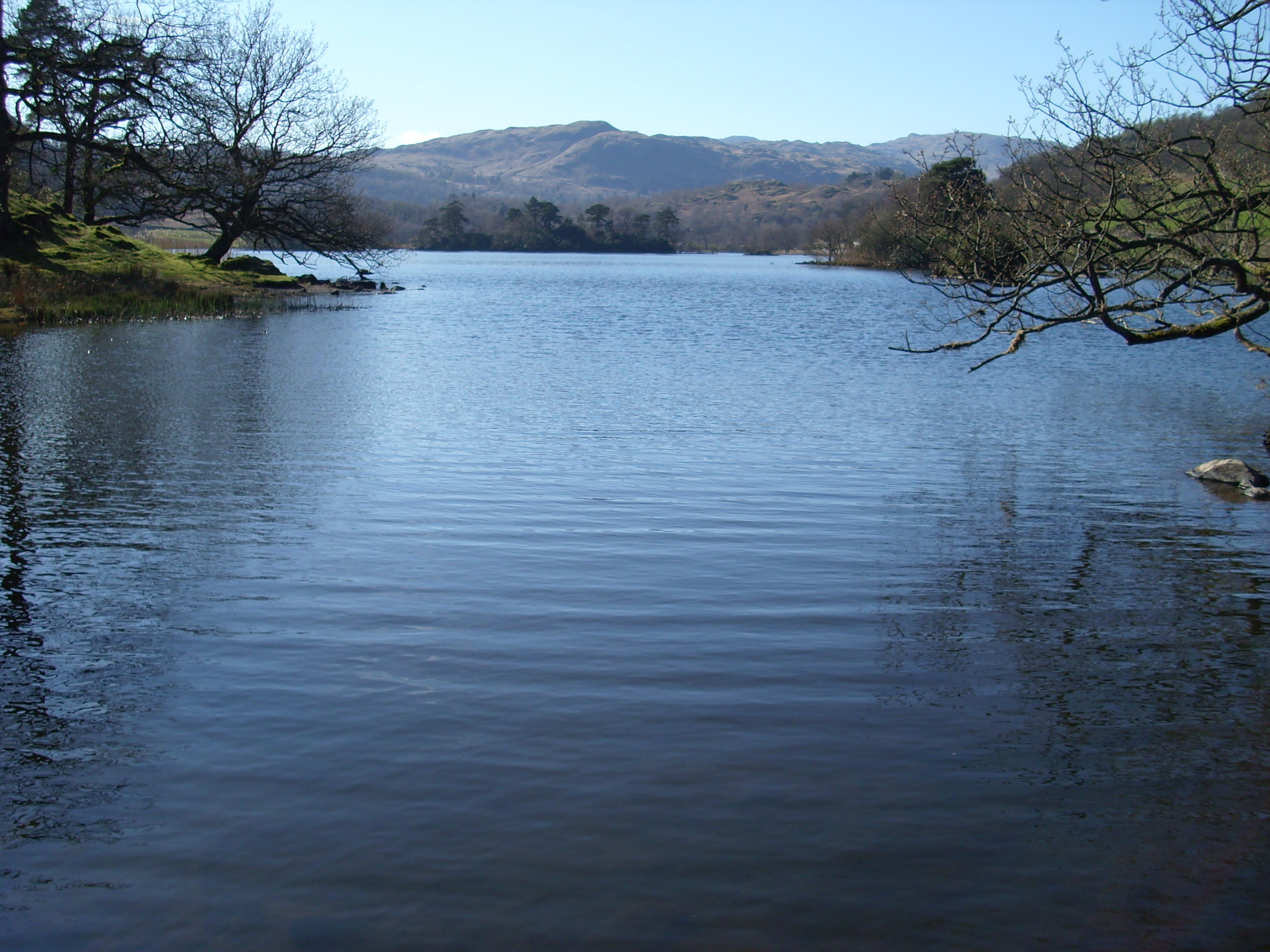
Rydal Water, located in the historic county of Westmorland in the northwestern region of England, is a picturesque lake nestled within the Lake District National Park. Covering an area of approximately 0.3 square kilometers, it is one of the smallest lakes in the region, yet it captivates visitors with its stunning natural beauty.

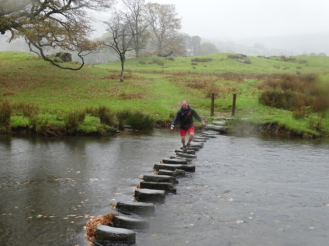
Surrounded by rolling hills and dense woodlands, Rydal Water offers a serene and tranquil atmosphere. The lake itself is a freshwater body, fed by various streams and springs that emerge from the surrounding fells. Its crystal-clear waters reflect the surrounding landscape, creating a mirror-like effect that adds to the enchantment of the area.

Rydal Water is renowned for its abundant wildlife and diverse flora. The shores of the lake are lined with reeds and rushes, providing a habitat for various waterfowl species, including ducks, geese, and swans. The surrounding woodlands are home to an array of bird species, such as woodpeckers, warblers, and owls. Additionally, visitors may spot red squirrels, deer, and even the occasional otter.

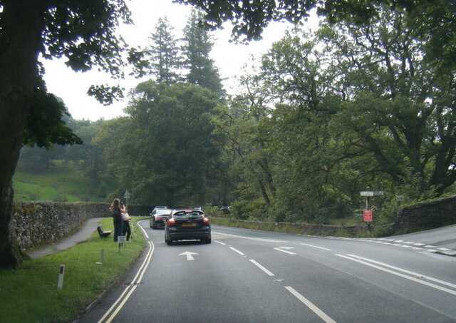
The area around Rydal Water is also steeped in history and literary connections. The renowned poet William Wordsworth resided in the nearby village of Rydal, and he drew inspiration from the lake and its surroundings. The popular walking trail known as the "Coffin Route" passes by Rydal Water, offering visitors an opportunity to immerse themselves in the romantic landscapes that inspired Wordsworth's poetry.

Overall, Rydal Water is a haven of natural beauty that showcases the unique charm of the Lake District. With its tranquil waters, abundant wildlife, and literary connections, it is a destination that continues to captivate and inspire visitors from around the world.

If you have any feedback on the listing, please let us know in the comments section below.

Rydal Water Images

Images are sourced within 2km of 54.447282/-2.9898698 or Grid Reference NY3506. Thanks to Geograph Open Source API. All images are credited.

Descent from Loughrigg Looking down one of the paths from Loughrigg, this leads towards the Oaks.
Descent from Loughrigg
Looking down one of the paths from Loughrigg, this leads towards the Oaks.
Summit of Loughrigg The trig point on Loughrigg is not very visible from the many false summits.
Summit of Loughrigg
The trig point on Loughrigg is not very visible from the many false summits.
Towards Windermere on Loughrigg Loughrigg Fell gives views in all directions down to several of the lakes.
Towards Windermere on Loughrigg
Loughrigg Fell gives views in all directions down to several of the lakes.
Path north from Loughrigg Fell Looking down towards Grasmere.
Path north from Loughrigg Fell
Looking down towards Grasmere.
Trig point on Loughrigg With wild campers setting up on the other side.
Trig point on Loughrigg
With wild campers setting up on the other side.
Towards Grasmere from Loughrigg Looking down over Loughrigg Terrace towards the lake below.
Towards Grasmere from Loughrigg
Looking down over Loughrigg Terrace towards the lake below.
Loughrigg Terrace and Rydal Looking around the terrace with a glimpse towards Rydal Water.
Loughrigg Terrace and Rydal
Looking around the terrace with a glimpse towards Rydal Water.
Dove Cottage, Grasmere Dove Cottage is best known as the home of the poet William Wordsworth and his sister Dorothy Wordsworth from December 1799 to May 1808, where they spent over eight years of "plain living, but high thinking". During this period, William wrote much of the poetry for which he is remembered today, including his "Ode: Intimations of Immortality", "Ode to Duty", "My Heart Leaps Up" and "I Wandered Lonely as a Cloud", together with parts of his autobiographical epic, The Prelude. The Wordsworth Trust bought the cottage for £650 in 1890.
Dove Cottage, Grasmere
Dove Cottage is best known as the home of the poet William Wordsworth and his sister Dorothy Wordsworth from December 1799 to May 1808, where they spent over eight years of "plain living, but high thinking". During this period, William wrote much of the poetry for which he is remembered today, including his "Ode: Intimations of Immortality", "Ode to Duty", "My Heart Leaps Up" and "I Wandered Lonely as a Cloud", together with parts of his autobiographical epic, The Prelude. The Wordsworth Trust bought the cottage for £650 in 1890.
A591 below Nab Scar
A591 below Nab Scar
A591 at Pelter Bridge
A591 Rydal Road at Ambleside village boundary
Cave interior - south of Rydal Water I've walked this way many times but never explored this cave before. It appears to be connected with a disused quarry hereabouts. There was water in the bottom, so you either had to edge around the side or use the stepping stones across the middle. It being half-term, there were numerous children making spooky sounds that reverberated around the interior!
Cave interior - south of Rydal Water
I've walked this way many times but never explored this cave before. It appears to be connected with a disused quarry hereabouts. There was water in the bottom, so you either had to edge around the side or use the stepping stones across the middle. It being half-term, there were numerous children making spooky sounds that reverberated around the interior!
View towards Rydal
View towards Rydal
Waterfall in Rydal
Waterfall in Rydal
Rydal Water
Rydal Water
Derelict drystone building
Footpath in the rain
Walker on stepping stones
Show me another place!

Rydal Water is located at Grid Ref: NY3506 (Lat: 54.447282, Lng: -2.9898698)

Administrative County: Cumbria

District: South Lakeland

Police Authority: Cumbria

What 3 Words

///fancied.nuptials.moats. Near Ambleside, Cumbria

Related Wikis

Rydal Water

Rydal Water is a small body of water in the central part of the English Lake District, in the county of Cumbria. It is located near the hamlet of Rydal...
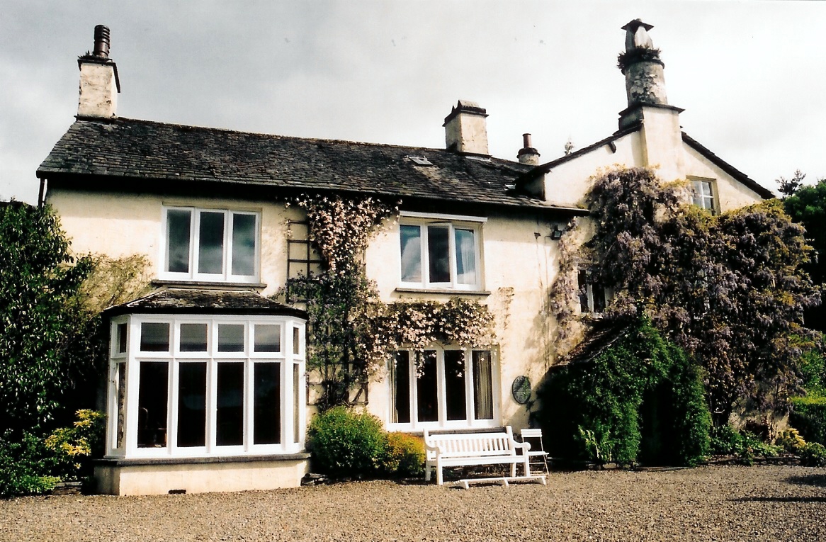
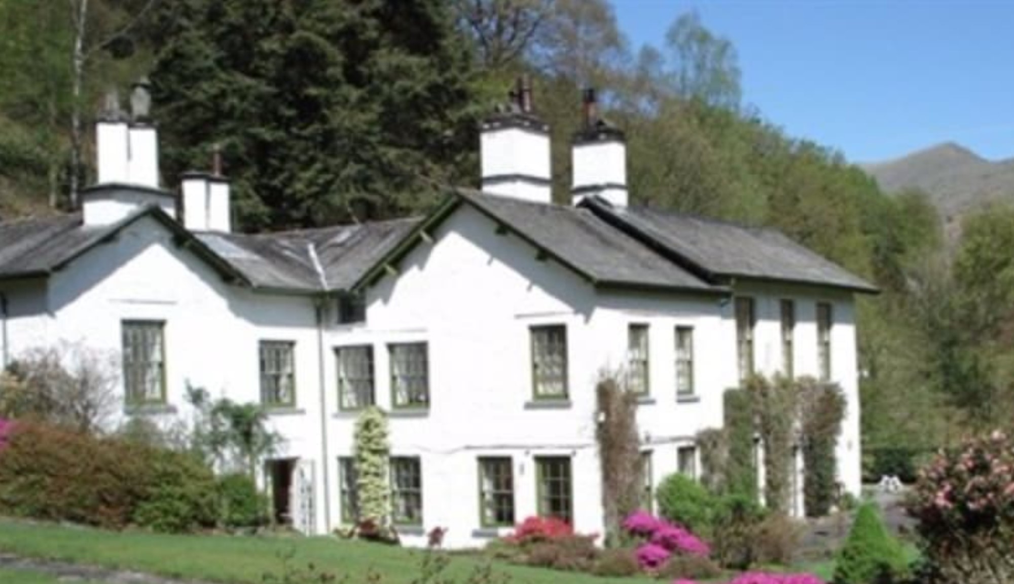
Rydal Mount

Rydal Mount is a house in the small village of Rydal, near Ambleside in the English Lake District. It is best known as the home of the poet William Wordsworth...

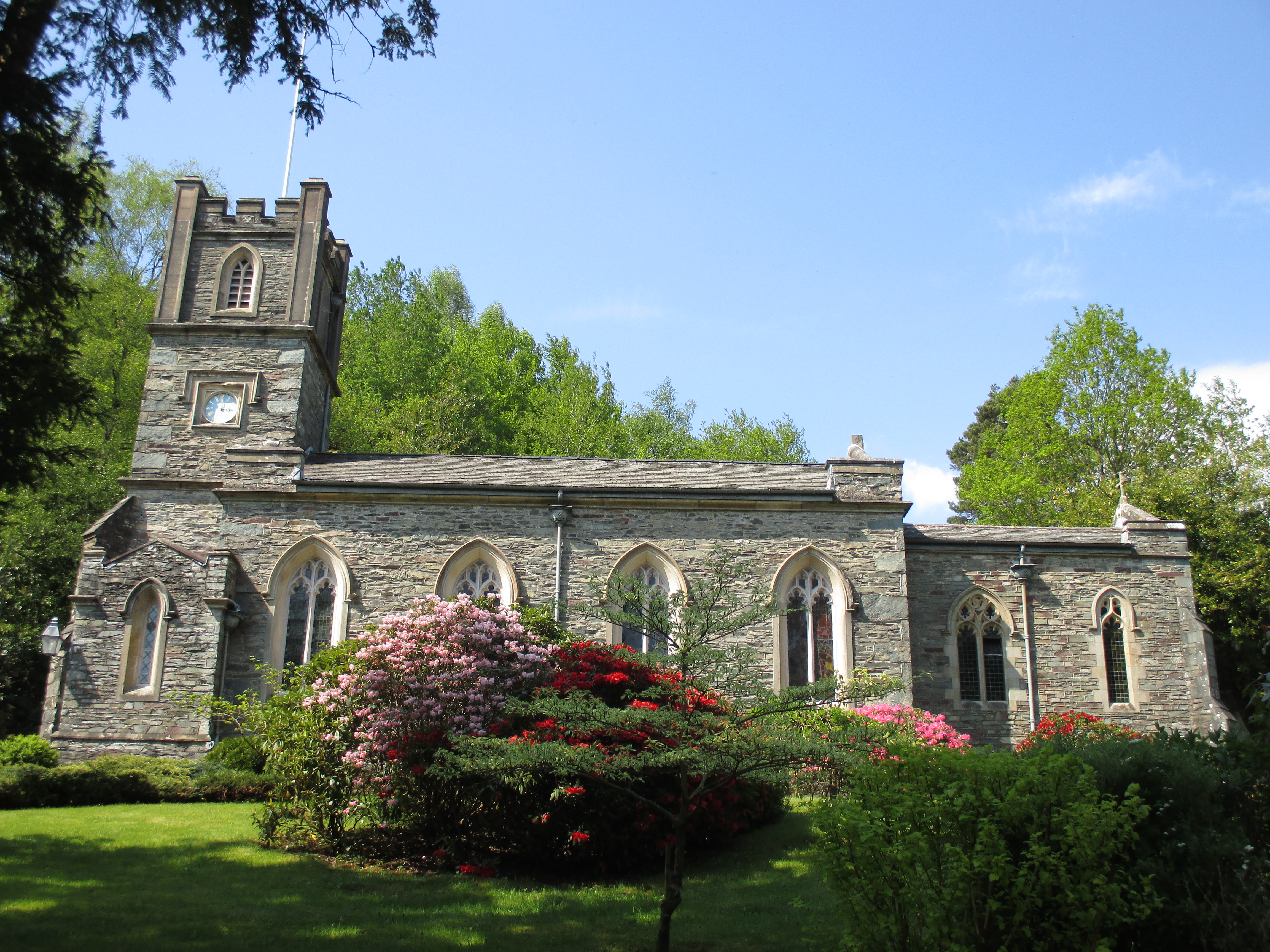
St Mary's Church, Rydal

St Mary's Church is in the village of Rydal in the Lake District, Cumbria, England. It is an active Anglican parish church in the deanery of Windermere...
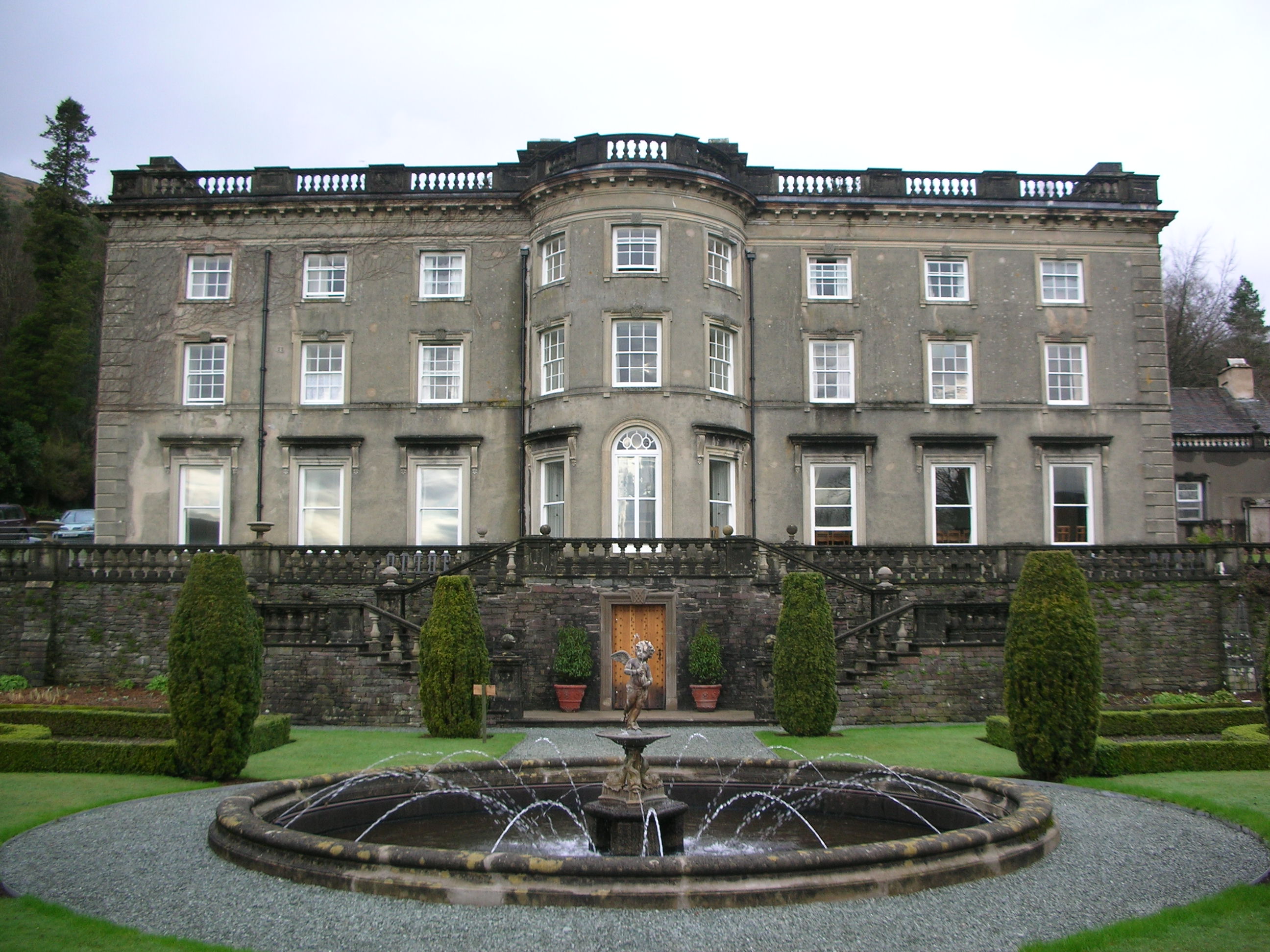
Rydal Hall

Rydal Hall is a large detached house on the outskirts of the village of Rydal, Cumbria, in the English Lake District. It has an early nineteenth-century...

Nab Scar

Nab Scar is a fell in the English Lake District, an outlier of the Fairfield group in the Eastern Fells. It stands above Rydal Water. == Topography... ==

Fox Ghyll

Fox Ghyll or Foxghyll, earlier Fox Gill, is a historic house near Ambleside in Cumbria, England, and is a Grade II listed building. It is a Regency building...

Dockey Tarn

Dockey Tarn is a small lake in South Lakeland district, Cumbria, England. It is located at a height of 379.3 m (1,244 ft), on the west slope below the...

Todd Crag

Todd Crag is a hill and a satellite peak of Loughrigg Fell at 224 m (735 ft) it is not classed as a fell but is a vantage point near Ambleside == Topography... ==

Nearby Amenities

Located within 500m of 54.447282,-2.9898698
Barrier: kissing_gate
Lat/Long: 54.4456931/-2.9892853
Bicycle: yes
Foot: yes
Ford: yes
Horse: yes
Lat/Long: 54.4453555/-2.9923835
Bench
Lat/Long: 54.4454389/-2.9895689
Barrier: kissing_gate
Lat/Long: 54.4463248/-2.9860252
Bench
Material: stone
Seats: 4
Lat/Long: 54.4505975/-2.9934873
Bench
Lat/Long: 54.4453555/-2.9892195
Bicycle: yes
Foot: yes
Ford: yes
Horse: yes
Lat/Long: 54.4453354/-2.9955524
Bench
Lat/Long: 54.4453909/-2.9902047
Bench
Material: stone
Seats: 5
Lat/Long: 54.4506333/-2.9939782
Jobson Close
Place: locality
Lat/Long: 54.4444799/-2.9951736
Pub
Badger Bar & Restaurant
Food: yes
Real Ale: yes
Toilets Access: customers
Lat/Long: 54.4469281/-2.9831394
Steps End
Place: locality
Lat/Long: 54.445714/-2.9884519
Cote How
Place: locality
Lat/Long: 54.4456988/-2.9841413
Bench
Lat/Long: 54.4475129/-2.9825125
Bench
Lat/Long: 54.4475332/-2.9831884
Bench
Lat/Long: 54.4455467/-2.9930473
Nab Scar Plantation
Natural: wood
Lat/Long: 54.4513216/-2.9909866
The data included in this document is from www.openstreetmap.org. The data is made available under ODbL.

Have you been to Rydal Water?

Leave your review of Rydal Water below (or comments, questions and feedback).