Carriston Reservoir

Lake, Pool, Pond, Freshwater Marsh in Fife

Scotland

Carriston Reservoir

Langside Hill Quarried hill above Kennoway. View northward.
Langside Hill Credit: Richard Webb

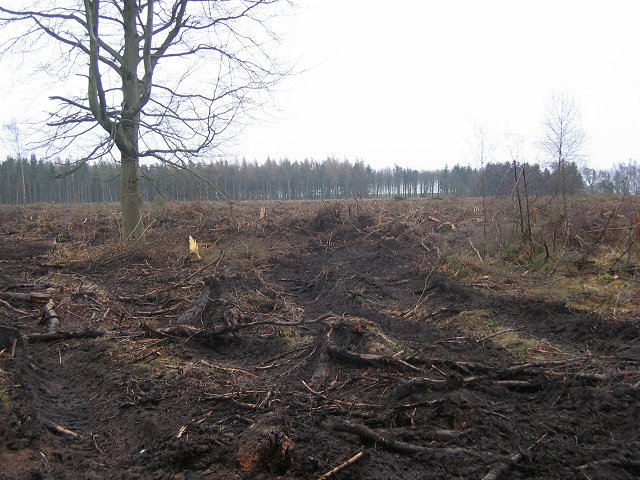
Carriston Reservoir is a freshwater lake located in Fife, Scotland. Situated in a rural area, it is surrounded by beautiful rolling hills and offers a peaceful retreat for visitors. The reservoir covers an area of approximately 25 acres and has a maximum depth of 10 meters.

The lake is a popular spot for fishing enthusiasts, as it is home to a variety of fish species including brown trout, pike, and perch. Anglers can enjoy a day out on the water, trying their luck and enjoying the tranquility of the surroundings.

Carriston Reservoir also serves as an important habitat for a diverse range of wildlife. The surrounding wetlands and marshes provide a haven for migratory birds, making it a prime location for birdwatching. Species such as herons, swans, and ducks can often be spotted in and around the lake.

The reservoir is easily accessible via a well-maintained footpath that circles the entire lake. This allows visitors to take leisurely walks or bike rides while enjoying the scenic views. There are also picnic areas available for those who prefer to relax and soak in the beauty of the surroundings.

Overall, Carriston Reservoir offers a peaceful and picturesque setting, making it a popular destination for nature lovers, anglers, and those seeking a tranquil escape from the hustle and bustle of everyday life.

If you have any feedback on the listing, please let us know in the comments section below.

Carriston Reservoir Images

Images are sourced within 2km of 56.221279/-3.089341 or Grid Reference NO3203. Thanks to Geograph Open Source API. All images are credited.

Langside Hill Quarried hill above Kennoway. View northward.
Langside Hill
Quarried hill above Kennoway. View northward.
Lalathan Farm drive. The whin slopes on the left were wooded on the 1940s map. View E.
Lalathan
Farm drive. The whin slopes on the left were wooded on the 1940s map. View E.
Devon Common Horsey looking place. I just squeezed into the square to get this photo. View W.
Devon Common
Horsey looking place. I just squeezed into the square to get this photo. View W.
Outside Devon quarry. Instructions to traffic outside the quarry/landfill
Outside Devon quarry.
Instructions to traffic outside the quarry/landfill
Devon Quarry The entrance to the quarry/landfill site.
Devon Quarry
The entrance to the quarry/landfill site.
Bird scarer, Ballinkirk A simple scarecrow amongst newly sown fields.
Bird scarer, Ballinkirk
A simple scarecrow amongst newly sown fields.
Drummy Wood Ride in this conifer wood which is currently undergoing a lot of clear felling. Looking south.
Drummy Wood
Ride in this conifer wood which is currently undergoing a lot of clear felling. Looking south.
Road in Drummy Wood. Looking north along a country land in Drummy  and Milldeans Wood.
Road in Drummy Wood.
Looking north along a country land in Drummy and Milldeans Wood.
Clearfell , Dykehead Wood. Part of the Drummy Wood forest block, now almost completely felled.
A view from 2009 can be seen here: <a href="https://www.geograph.org.uk/photo/1439915">NO3105 : Dykehead Wood</a>
Clearfell , Dykehead Wood.
Part of the Drummy Wood forest block, now almost completely felled. A view from 2009 can be seen here: NO3105 : Dykehead Wood
Star of Markinch, Fife A small village with a crooked layout as it evolved from a series of old farm steadings into a settlement.
Star of Markinch, Fife
A small village with a crooked layout as it evolved from a series of old farm steadings into a settlement.
Bogside by Star Spring is in the air at last. Farm fields by Bogside near Star
Bogside by Star
Spring is in the air at last. Farm fields by Bogside near Star
Newton Hall farmland Field being worked for planting by Newton Hall near Star.
Newton Hall farmland
Field being worked for planting by Newton Hall near Star.
Star Fields by Star with new housing being built at the western edge of the village.
Star
Fields by Star with new housing being built at the western edge of the village.
By Carriston Farmland by Carriston and Pyeston
By Carriston
Farmland by Carriston and Pyeston
Path to Star looking down from the highground and along the line of the Star to Markinch path.
Path to Star
looking down from the highground and along the line of the Star to Markinch path.
Farmland by Broomfield Broomfield farm lies just to the west of Star.
Farmland by Broomfield
Broomfield farm lies just to the west of Star.
By Dalginch Looking south along a field line by Dalginch.
By Dalginch
Looking south along a field line by Dalginch.
North Mains Residential development of a ruined farm steading near the Donald Rose reservoir.
North Mains
Residential development of a ruined farm steading near the Donald Rose reservoir.
Show me another place!

Carriston Reservoir is located at Grid Ref: NO3203 (Lat: 56.221279, Lng: -3.089341)

Unitary Authority: Fife

Police Authority: Fife

What 3 Words

///blankets.birdcage.dynasties. Near Kennoway, Fife

Nearby Locations

Carriston Reservoir

Related Wikis

Star, Fife

Star, also known as Star of Markinch (and historically as Star of Brunton or Star of Dalginch)), is a small village in Fife, Scotland. The name of Star...

Kennoway Star Hearts F.C.

Kennoway Star Hearts Football Club are a football club from the village of Star near Kennoway in Fife, Scotland. Currently competing in the East of Scotland...

Bonnybank

Bonnybank is a small village in the Levenmouth area of Fife, approximately 2 miles north of Leven and situated on the main road (the A916) between Kennoway...
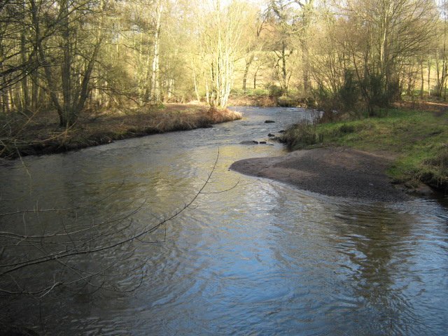
River Leven, Fife

The River Leven (Scottish Gaelic: Lìobhann / Abhainn Lìobhann) is a river in Fife, Scotland. It flows from Loch Leven into the Firth of Forth at the town...
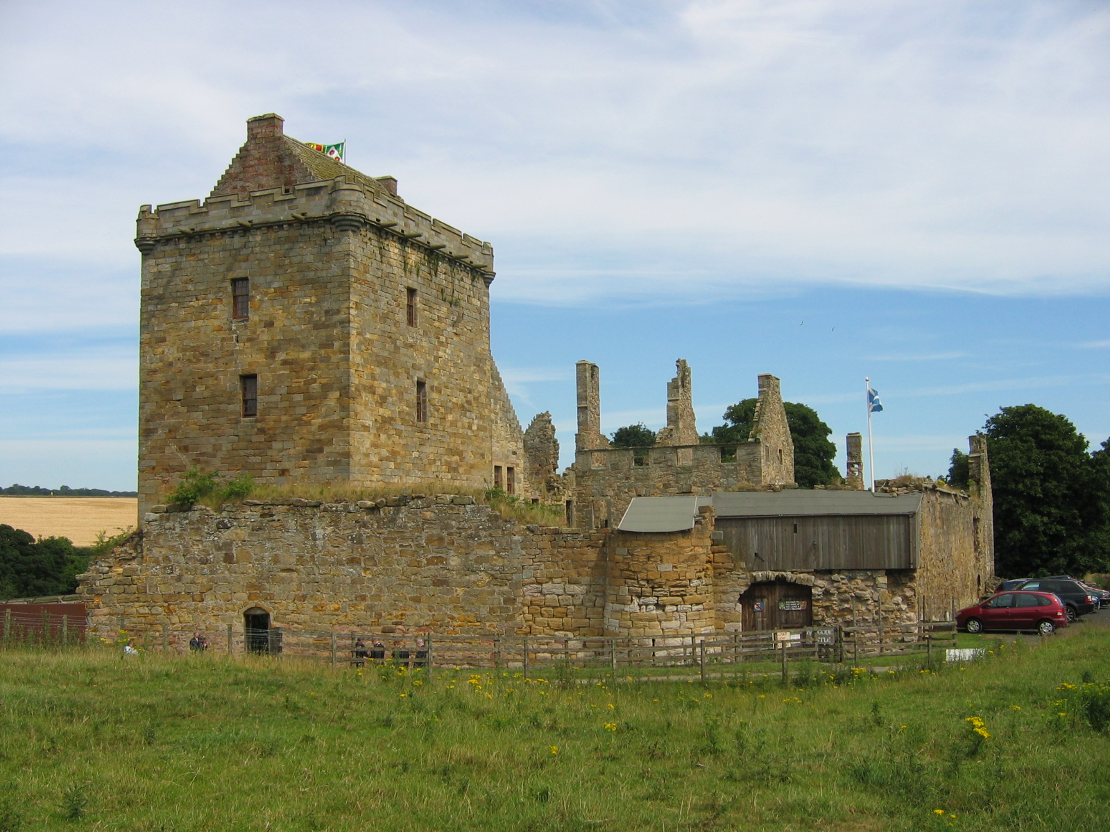
Balgonie Castle

Balgonie Castle is located on the south bank of the River Leven near Milton of Balgonie, 3.5 kilometres (2.2 mi) east of Glenrothes, Fife, Scotland. The...
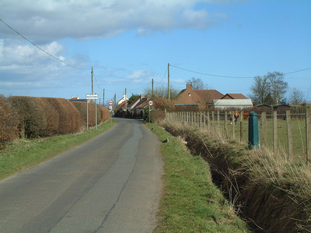
Baintown

Baintown is a hamlet located in Fife, a council area of Scotland, UK.

Balcurvie

Balcurvie is a Scottish rural hamlet located within the Windygates district of Levenmouth in Fife. People from Balcurvie include Sir Robert Blyth Greig...

Kennoway

Kennoway is a village in Fife, Scotland, near the larger population centres in the area of Leven and Methil. It had an estimated population of 4,570 in...

Nearby Amenities

Located within 500m of 56.221279,-3.089341
Generator Method: wind_turbine
Generator Output Electricity: yes
Generator Source: wind
Generator Type: horizontal_axis
Power: generator
Source: Survey Jul 2016
Lat/Long: 56.2247641/-3.0886499
Power: pole
Lat/Long: 56.2171342/-3.0868301
Power: pole
Lat/Long: 56.2172857/-3.0880143
Power: pole
Lat/Long: 56.2174413/-3.0892138
Power: pole
Lat/Long: 56.2175947/-3.0907212
Power: pole
Lat/Long: 56.2177717/-3.092234
Power: pole
Lat/Long: 56.2182445/-3.0947287
Power: pole
Lat/Long: 56.2179432/-3.0934493
Power: pole
Lat/Long: 56.2183757/-3.0954985
Power: pole
Lat/Long: 56.2175806/-3.0866376
Power: pole
Lat/Long: 56.217999/-3.086456
Power: pole
Lat/Long: 56.2183213/-3.087296
Power: pole
Lat/Long: 56.2186388/-3.0881404
Power: pole
Lat/Long: 56.2189854/-3.0888054
Power: pole
Lat/Long: 56.2194208/-3.0896191
Power: pole
Lat/Long: 56.2198015/-3.0905466
Power: pole
Lat/Long: 56.2198672/-3.0914654
Power: pole
Lat/Long: 56.2199231/-3.0922572
Power: pole
Lat/Long: 56.2199669/-3.0931781
Power: pole
Lat/Long: 56.2200083/-3.0940619
Power: pole
Lat/Long: 56.2199645/-3.0948341
Power: pole
Lat/Long: 56.219776/-3.0954575
The data included in this document is from www.openstreetmap.org. The data is made available under ODbL.

Have you been to Carriston Reservoir?

Leave your review of Carriston Reservoir below (or comments, questions and feedback).