Gransmore Green

Settlement in Essex Uttlesford

England

Gransmore Green

Stebbing Road Bridge, A120 The A120 is a trunk road that runs east-west across East Anglia from Harwich to Puckeridge, 63 miles in length. It follows the route of the Roman Road, Stane Street. <span class="nowrap"><a title="http://www.sabre-roads.org.uk/wiki/index.php?title=A120" rel="nofollow ugc noopener" href="http://www.sabre-roads.org.uk/wiki/index.php?title=A120">Link</a><img style="margin-left:2px;" alt="External link" title="External link - shift click to open in new window" src="https://s1.geograph.org.uk/img/external.png" width="10" height="10"/></span>
Stebbing Road Bridge, A120 Credit: N Chadwick

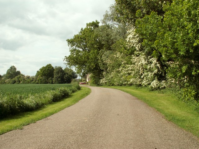
Gransmore Green is a small village located in Essex, England. It is known for its picturesque countryside setting, with rolling green hills and charming old buildings. The village is home to a close-knit community of residents who pride themselves on maintaining the rural charm of the area.

Gransmore Green has a handful of local amenities, including a village hall, a small primary school, and a local pub. The village is surrounded by farmland, making it an ideal location for those who enjoy a peaceful and rural way of life.

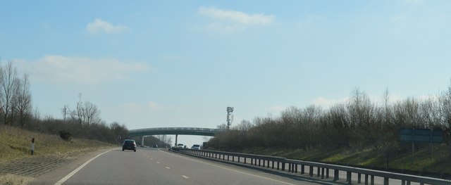
The village is well-connected by road, with easy access to nearby towns and cities such as Chelmsford and Colchester. It is also within close proximity to the M11 motorway, providing convenient links to London and other major cities.

Overall, Gransmore Green offers a tranquil and idyllic setting for those looking to escape the hustle and bustle of urban life. Its welcoming community and beautiful surroundings make it a desirable place to live for those seeking a slower pace of life in the English countryside.

If you have any feedback on the listing, please let us know in the comments section below.

Gransmore Green Images

Images are sourced within 2km of 51.873886/0.462303 or Grid Reference TL6922. Thanks to Geograph Open Source API. All images are credited.

Stebbing Road Bridge, A120 The A120 is a trunk road that runs east-west across East Anglia from Harwich to Puckeridge, 63 miles in length. It follows the route of the Roman Road, Stane Street. <span class="nowrap"><a title="http://www.sabre-roads.org.uk/wiki/index.php?title=A120" rel="nofollow ugc noopener" href="http://www.sabre-roads.org.uk/wiki/index.php?title=A120">Link</a><img style="margin-left:2px;" alt="External link" title="External link - shift click to open in new window" src="https://s1.geograph.org.uk/img/external.png" width="10" height="10"/></span>
Stebbing Road Bridge, A120
The A120 is a trunk road that runs east-west across East Anglia from Harwich to Puckeridge, 63 miles in length. It follows the route of the Roman Road, Stane Street. LinkExternal link
Footbridge, A120 The A120 is a trunk road that runs east-west across East Anglia from Harwich to Puckeridge, 63 miles in length. It follows the route of the Roman Road, Stane Street. <span class="nowrap"><a title="http://www.sabre-roads.org.uk/wiki/index.php?title=A120" rel="nofollow ugc noopener" href="http://www.sabre-roads.org.uk/wiki/index.php?title=A120">Link</a><img style="margin-left:2px;" alt="External link" title="External link - shift click to open in new window" src="https://s1.geograph.org.uk/img/external.png" width="10" height="10"/></span>
Footbridge, A120
The A120 is a trunk road that runs east-west across East Anglia from Harwich to Puckeridge, 63 miles in length. It follows the route of the Roman Road, Stane Street. LinkExternal link
A120, eastbound The A120 is a trunk road that runs east-west across East Anglia from Harwich to Puckeridge, 63 miles in length. It follows the route of the Roman Road, Stane Street. <span class="nowrap"><a title="http://www.sabre-roads.org.uk/wiki/index.php?title=A120" rel="nofollow ugc noopener" href="http://www.sabre-roads.org.uk/wiki/index.php?title=A120">Link</a><img style="margin-left:2px;" alt="External link" title="External link - shift click to open in new window" src="https://s1.geograph.org.uk/img/external.png" width="10" height="10"/></span>
A120, eastbound
The A120 is a trunk road that runs east-west across East Anglia from Harwich to Puckeridge, 63 miles in length. It follows the route of the Roman Road, Stane Street. LinkExternal link
Chaffix, Felsted A small estate that appears to have been built as council houses.
Chaffix, Felsted
A small estate that appears to have been built as council houses.
Stebbing Road meets B1256 The B1256 was formerly the A120, it largely follows a Roman route towards Colchester. A foggy morning with no long distance views available, so instead, some teasels.
Stebbing Road meets B1256
The B1256 was formerly the A120, it largely follows a Roman route towards Colchester. A foggy morning with no long distance views available, so instead, some teasels.
B1256 towards Braintree This was formerly the A120 before the current route was built, and before that, a Roman road to Colchester.
B1256 towards Braintree
This was formerly the A120 before the current route was built, and before that, a Roman road to Colchester.
Cottages, Stebbing Green Grade II listed buildings.
Cottages, Stebbing Green
Grade II listed buildings.
The Former Bannister Green Halt The Braintree to Bishop's Stortford Railway was opened in 1869. Bannister Green Halt was one of those added in 1922 in an attempt to increase passenger numbers. See the scene eight years ago at <a href="https://www.geograph.org.uk/photo/2742166">TL6921 : Remains of Bannister Green Halt</a>.
The Former Bannister Green Halt
The Braintree to Bishop's Stortford Railway was opened in 1869. Bannister Green Halt was one of those added in 1922 in an attempt to increase passenger numbers. See the scene eight years ago at TL6921 : Remains of Bannister Green Halt.
Flitch Way at Braintree Rd One of the colourful waymarker posts in the Flitch Way Country Park <span class="nowrap"><a title="http://www.visitparks.co.uk/places/flitch-way/" rel="nofollow ugc noopener" href="http://www.visitparks.co.uk/places/flitch-way/">Link</a><img style="margin-left:2px;" alt="External link" title="External link - shift click to open in new window" src="https://s1.geograph.org.uk/img/external.png" width="10" height="10"/></span>
Flitch Way at Braintree Rd
One of the colourful waymarker posts in the Flitch Way Country Park LinkExternal link
Seat by The Flitch Way There are strategically placed convenient seats along the length of the Country Park <span class="nowrap"><a title="http://www.visitparks.co.uk/places/flitch-way/" rel="nofollow ugc noopener" href="http://www.visitparks.co.uk/places/flitch-way/">Link</a><img style="margin-left:2px;" alt="External link" title="External link - shift click to open in new window" src="https://s1.geograph.org.uk/img/external.png" width="10" height="10"/></span> the flowers in the bottom right of the picture are <a href="https://www.geograph.org.uk/photo/6198143">TL6821 : Succisa pratensis</a>
Seat by The Flitch Way
There are strategically placed convenient seats along the length of the Country Park LinkExternal link the flowers in the bottom right of the picture are TL6821 : Succisa pratensis
Devil's-bit Scabious <a href="https://www.geograph.org.uk/photo/6198143">TL6821 : Succisa pratensis</a> is very attractive to insects
Devil's-bit Scabious
TL6821 : Succisa pratensis is very attractive to insects
Succisa pratensis <a href="https://www.geograph.org.uk/photo/6198138">TL6821 : Devil's-bit Scabious</a> attract insects of all sorts.
Succisa pratensis
TL6821 : Devil's-bit Scabious attract insects of all sorts.
Old Railway Footpath Crossing Gatepost The waymark is for PROW 15-10 that runs 1130m from Garnetts Lane in the south to the junction with Bridleway 15-4 near Prince's Halfyards.
Old Railway Footpath Crossing Gatepost
The waymark is for PROW 15-10 that runs 1130m from Garnetts Lane in the south to the junction with Bridleway 15-4 near Prince's Halfyards.
Hinge-post and Lichen A closer look at the <a href="https://www.geograph.org.uk/photo/6198175">TL6821 : Old Railway Footpath Crossing Gatepost</a>
Hinge-post and Lichen
B1417 Bridge, A120 The A120 is a trunk road that runs east-west across East Anglia from Harwich to Puckeridge, 63 miles in length. It follows the route of the Roman Road, Stane Street. <span class="nowrap"><a title="http://www.sabre-roads.org.uk/wiki/index.php?title=A120" rel="nofollow ugc noopener" href="http://www.sabre-roads.org.uk/wiki/index.php?title=A120">Link</a><img style="margin-left:2px;" alt="External link" title="External link - shift click to open in new window" src="https://s1.geograph.org.uk/img/external.png" width="10" height="10"/></span>
B1417 Bridge, A120
The A120 is a trunk road that runs east-west across East Anglia from Harwich to Puckeridge, 63 miles in length. It follows the route of the Roman Road, Stane Street. LinkExternal link
A120, eastbound The A120 is a trunk road that runs east-west across East Anglia from Harwich to Puckeridge, 63 miles in length. It follows the route of the Roman Road, Stane Street. <span class="nowrap"><a title="http://www.sabre-roads.org.uk/wiki/index.php?title=A120" rel="nofollow ugc noopener" href="http://www.sabre-roads.org.uk/wiki/index.php?title=A120">Link</a><img style="margin-left:2px;" alt="External link" title="External link - shift click to open in new window" src="https://s1.geograph.org.uk/img/external.png" width="10" height="10"/></span>
A120, eastbound
The A120 is a trunk road that runs east-west across East Anglia from Harwich to Puckeridge, 63 miles in length. It follows the route of the Roman Road, Stane Street. LinkExternal link
Road towards Great Saling Somewhat north of Blake House Farm.
Road towards Great Saling
Somewhat north of Blake House Farm.
Show me another place!

Gransmore Green is located at Grid Ref: TL6922 (Lat: 51.873886, Lng: 0.462303)

Administrative County: Essex

District: Uttlesford

Police Authority: Essex

What 3 Words

///conned.apes.insist. Near Little Dunmow, Essex

Nearby Locations

Gransmore Green

Related Wikis

Gransmore Green

Gransmore Green is a hamlet in the civil parish of Felsted, in the Uttlesford district of Essex, England. Nearby settlements include the towns of Braintree...

Blake End

Blake End is a hamlet on the B1256 road in the civil parish of The Salings, in the Braintree district of Essex, England. The hamlet is situated between...

Bannister Green Halt railway station

Bannister Green Halt railway station was a station in Bannister Green, Essex, England. The station was 13 miles 37 chains (21.67 km) from Bishop's Stortford...

Stebbing Green

Stebbing Green is a hamlet in the Uttlesford district, in the county of Essex. It is near the village of Stebbing; its post town is Dunmow. It is near...

Nearby Amenities

Located within 500m of 51.873886,0.462303
Bus Stop
Gatehouse Farm
Naptan AtcoCode: 150024001006
Naptan NaptanCode: esxgwmta
Naptan Verified: no
Public Transport: platform
Source: naptan_import
Lat/Long: 51.8754784/0.4605172
Bus Stop
Gatehouse Farm
Naptan AtcoCode: 1500IM2116B
Naptan Bearing: SW
Naptan CommonName: Gransmore Green
Naptan Indicator: S-bound
Naptan Landmark: Gransmore Green
Naptan NaptanCode: esxjdadg
Naptan Street: Braintree Road
Naptan Verified: no
Public Transport: platform
Source: naptan_import
Lat/Long: 51.8744754/0.460039
Gransmore Green
Is In: Felsted
Place: hamlet
Wikidata: Q2143600
Lat/Long: 51.8736143/0.4614794
Power: pole
Lat/Long: 51.8760273/0.4561472
Power: pole
Lat/Long: 51.8752176/0.4563135
Power: pole
Lat/Long: 51.8744873/0.4564691
Power: pole
Lat/Long: 51.8738978/0.4567158
Power: pole
Lat/Long: 51.873088/0.4571691
Power: pole
Lat/Long: 51.8723875/0.4576948
Power: pole
Lat/Long: 51.872467/0.4594195
Power: pole
Lat/Long: 51.8728081/0.4618576
Power: pole
Lat/Long: 51.8734573/0.4625174
Power: pole
Lat/Long: 51.8741329/0.4631719
Power: pole
Lat/Long: 51.8752954/0.4643092
Power: pole
Lat/Long: 51.8751017/0.466589
Power: pole
Lat/Long: 51.8754295/0.4678282
Power: pole
Lat/Long: 51.8756696/0.4686195
Power: pole
Lat/Long: 51.8744691/0.4624692
The data included in this document is from www.openstreetmap.org. The data is made available under ODbL.

Have you been to Gransmore Green?

Leave your review of Gransmore Green below (or comments, questions and feedback).