Beacon Tarn

Lake, Pool, Pond, Freshwater Marsh in Lancashire South Lakeland

England

Beacon Tarn

Field by the River Crake The trees mark the route of the River Crake at Lowick
Field by the River Crake Credit: Eirian Evans

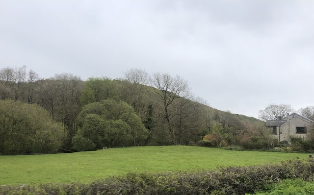
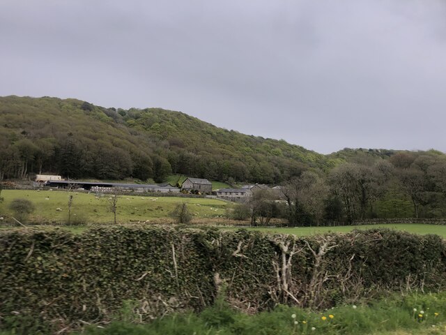
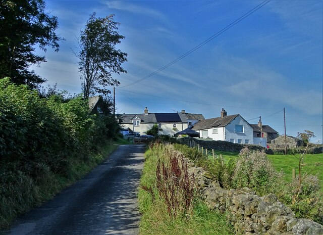
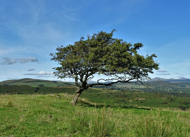
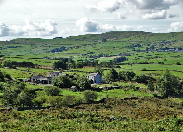
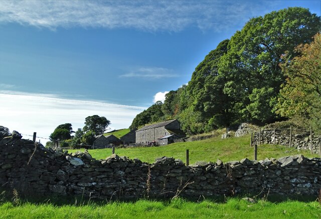
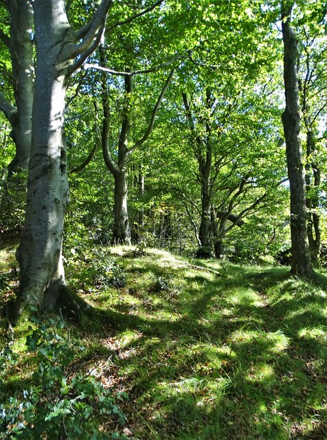
Beacon Tarn is a picturesque freshwater marsh located in Lancashire, England. It is a small, natural body of water that has become a popular destination for nature lovers and outdoor enthusiasts alike. The tarn is situated amidst stunning countryside, surrounded by rolling hills and lush greenery, creating a tranquil and idyllic setting.

Covering an area of approximately 2 hectares, Beacon Tarn is known for its crystal-clear waters and diverse ecosystem. The tarn is primarily fed by natural springs and rainwater, ensuring a constant flow of fresh, clean water. Its depth varies throughout the year, with the deepest parts reaching up to 5 meters.

The tarn is home to a variety of aquatic plants, including lily pads, reeds, and water lilies, which provide shelter and food for the numerous species of wildlife that inhabit the area. Visitors to Beacon Tarn can expect to spot a wide range of bird species, such as swans, ducks, and herons, as well as small mammals like otters and water voles.

The surrounding marshland acts as a natural filter, purifying the water and creating a thriving ecosystem. It also attracts a diverse array of plant species, including marsh marigolds, yellow flag iris, and common reed. The marshland is particularly beautiful in the spring when the flowers are in full bloom, adding vibrant colors to the landscape.

With its serene ambiance and abundant wildlife, Beacon Tarn offers visitors a chance to immerse themselves in nature and enjoy the peace and tranquility of this charming natural gem. Whether it's birdwatching, photography, or simply taking in the beauty of the surroundings, Beacon Tarn is a haven for nature enthusiasts seeking a respite from the hustle and bustle of everyday life.

If you have any feedback on the listing, please let us know in the comments section below.

Beacon Tarn Images

Images are sourced within 2km of 54.252434/-3.0926395 or Grid Reference SD2884. Thanks to Geograph Open Source API. All images are credited.

Field by the River Crake The trees mark the route of the River Crake at Lowick
Field by the River Crake
The trees mark the route of the River Crake at Lowick
Bridgefield Farm Across the River Crake from Lowick.
Bridgefield Farm
Across the River Crake from Lowick.
Ordnance Survey Rivet This OS rivet can be found on a rock south side of the road. It marks a point 75,204m above mean sea level.
Ordnance Survey Rivet
This OS rivet can be found on a rock south side of the road. It marks a point 75,204m above mean sea level.
Ordnance Survey Rivet This OS rivet can be found on the NE parapet of the bridge. It marks a point 61.586m above mean sea level.
Ordnance Survey Rivet
This OS rivet can be found on the NE parapet of the bridge. It marks a point 61.586m above mean sea level.
Ordnance Survey Cut Mark This OS cut mark can be found on the south angle of St Luke's Church. It marks a point 54.979m above mean sea level.
Ordnance Survey Cut Mark
This OS cut mark can be found on the south angle of St Luke's Church. It marks a point 54.979m above mean sea level.
Ordnance Survey Cut Mark This inverted OS cut mark can be found on the wall at the road junction. It marked a point 78.502m above mean sea level.
Ordnance Survey Cut Mark
This inverted OS cut mark can be found on the wall at the road junction. It marked a point 78.502m above mean sea level.
Ordnance Survey Cut Mark This OS cut mark can be found on the gatepost NW side of the road. It marks a point 100.760m above mean sea level.
Ordnance Survey Cut Mark
This OS cut mark can be found on the gatepost NW side of the road. It marks a point 100.760m above mean sea level.
Ordnance Survey Rivet This OS rivet can be found on the wall NW side of the road. It marks a point 111.853m above mean sea level.
Ordnance Survey Rivet
This OS rivet can be found on the wall NW side of the road. It marks a point 111.853m above mean sea level.
Ordnance Survey Rivet This OS rivet can be found on the wall west side of the road. It marks a point 118.233m above mean sea level.
Ordnance Survey Rivet
This OS rivet can be found on the wall west side of the road. It marks a point 118.233m above mean sea level.
Ordnance Survey Cut Mark This OS cut mark can be found on the wall NW side of the road. It marks a point 129.485m above mean sea level.
Ordnance Survey Cut Mark
This OS cut mark can be found on the wall NW side of the road. It marks a point 129.485m above mean sea level.
Ordnance Survey Cut Mark This OS cut mark can be found on the gatepost east side of the road. It marks a point 139.001m above mean sea level.
Ordnance Survey Cut Mark
This OS cut mark can be found on the gatepost east side of the road. It marks a point 139.001m above mean sea level.
Ordnance Survey Cut Mark This OS cut mark can be found on the wall SW side of the road. It marks a point 182.310m above mean sea level.
Ordnance Survey Cut Mark
This OS cut mark can be found on the wall SW side of the road. It marks a point 182.310m above mean sea level.
The hamlet of Wood End
Bent hawthorn tree at Lads Head
A view of Cold Yeat Farm
High Scathwaite Farm
At Lads Head looking north to The Lake District hills
A Sunny September Morning Entering Lads Head Plantation
A Sunny September Morning
Entering Lads Head Plantation
Show me another place!

Beacon Tarn is located at Grid Ref: SD2884 (Lat: 54.252434, Lng: -3.0926395)

Administrative County: Cumbria

District: South Lakeland

Police Authority: Cumbria

What 3 Words

///city.bike.measuring. Near Ulverston, Cumbria

Related Wikis

Beck Bottom

Beck Bottom is a village in Cumbria, England.

Spark Bridge

Spark Bridge is a former mill village in Cumbria, England, within the Lake District National Park, and within the historic boundaries of Lancashire. The...

Gawthwaite

Gawthwaite is a village in Cumbria, England. It is located along the A5092 road, 4.8 miles (7.7 km) north of Ulverston. It is on the Grize Beck stream...

Lowick, Cumbria

Lowick is a village and civil parish in the South Lakeland district of the English county of Cumbria. Prior to 1 April 1974 it was part of Lancashire,...

Furness

Furness ( FUR-niss, fur-NESS) is a peninsula and region of Cumbria, England. Together with the Cartmel Peninsula it forms North Lonsdale, historically...

St John the Evangelist's Church, Osmotherley

St John the Evangelist's Church is in the village of Osmotherley, Cumbria, England. It is an active Anglican parish church in the deanery of Furness,...

St Mary's Church, Penny Bridge

St Mary's Church is on a site overlooking the villages of Penny Bridge and Greenodd, in the parish of Egton with Newland, Cumbria, England. It is an active...

Colton, Cumbria

Colton is a village and civil parish in the South Lakeland district of Cumbria, England. In the 2001 census the parish had a population of 765, decreasing...

Nearby Amenities

Located within 500m of 54.252434,-3.0926395
Ford: yes
Lat/Long: 54.2538712/-3.0943374
Ford: yes
Lat/Long: 54.2505411/-3.096648
Ford: yes
Lat/Long: 54.2515641/-3.0897525
Ford: yes
Lat/Long: 54.2513427/-3.091718
Ford: yes
Lat/Long: 54.2534989/-3.0949135
Turning Circle
Lat/Long: 54.2540832/-3.0858747
Ford: yes
Lat/Long: 54.2498547/-3.0974708
Power: pole
Lat/Long: 54.2506781/-3.0862655
Power: pole
Lat/Long: 54.2519348/-3.0860183
The data included in this document is from www.openstreetmap.org. The data is made available under ODbL.

Have you been to Beacon Tarn?

Leave your review of Beacon Tarn below (or comments, questions and feedback).