Bowstard Loch

Lake, Pool, Pond, Freshwater Marsh in Fife

Scotland

Bowstard Loch

Lindores Hill The foreground and the forestry are all in this grid square, but one has to admit that it's the view that catches the eye. On the left, in the distance, is the prominent hump of West Lomond. Ormiston Hill rises steeply from the town of Newburgh, and in the sunshine to the right is the estuary of the River Tay.
Lindores Hill Credit: Anne Burgess

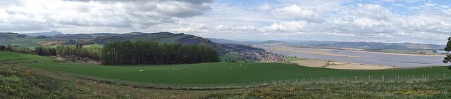
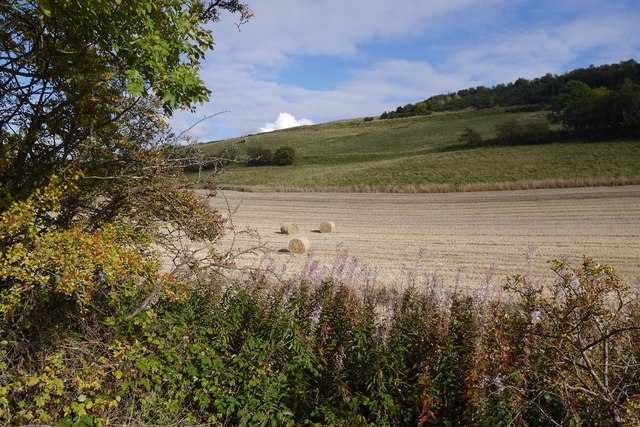
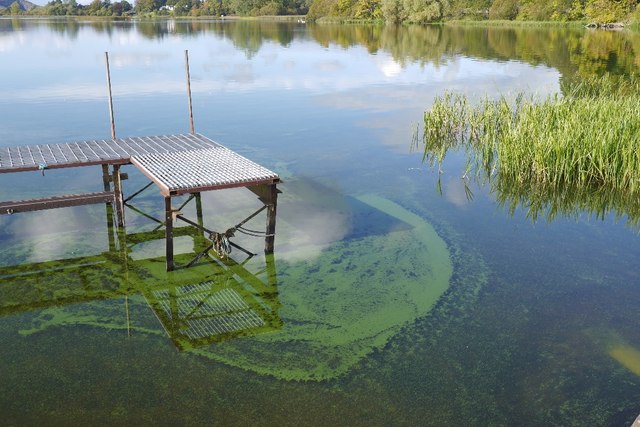
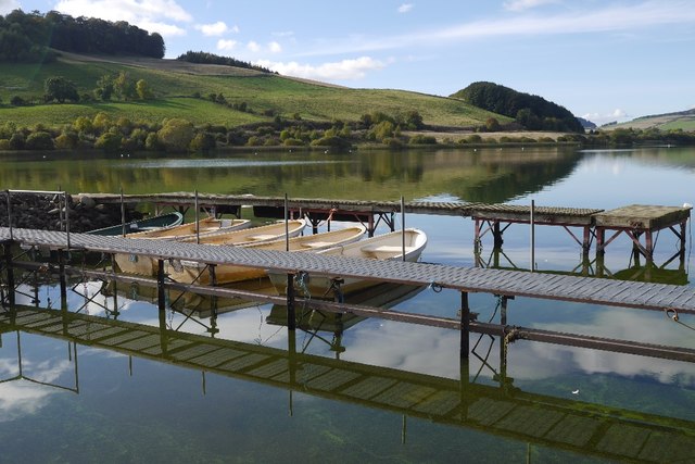
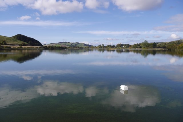
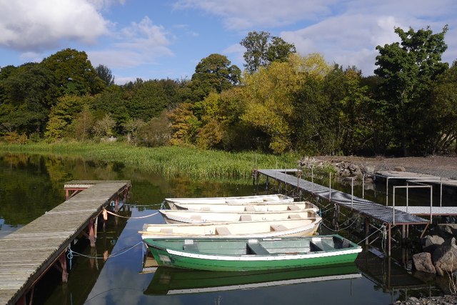
Bowstard Loch is a picturesque freshwater loch located in Fife, Scotland. Covering an area of approximately 12 hectares, it is nestled amidst the rolling hills and lush greenery of the region. The loch is a popular destination for nature enthusiasts and birdwatchers due to its diverse ecosystem and rich biodiversity.

Surrounded by a mix of grassland, woodland, and wetland habitats, Bowstard Loch supports a wide range of flora and fauna. The loch itself is home to various species of waterfowl, including mallards, tufted ducks, and mute swans, which can be observed gliding gracefully across its calm waters. The surrounding wetlands provide a perfect breeding ground for many species of amphibians, such as frogs and newts.

The loch also supports a healthy population of fish, including brown trout, which attracts anglers throughout the year. Fishing is popular on Bowstard Loch, with enthusiasts trying their luck to catch a prized trout.

Nature trails and walking paths surround the loch, allowing visitors to explore the area's natural beauty and enjoy the tranquility it offers. The diverse vegetation around the loch includes reeds, rushes, and water lilies, providing a habitat for a variety of insects and invertebrates.

Bowstard Loch is not only a haven for wildlife but also a recreational spot for locals and tourists alike. Whether it's birdwatching, fishing, or simply enjoying a peaceful walk, this enchanting loch offers a serene escape into nature for all who visit.

If you have any feedback on the listing, please let us know in the comments section below.

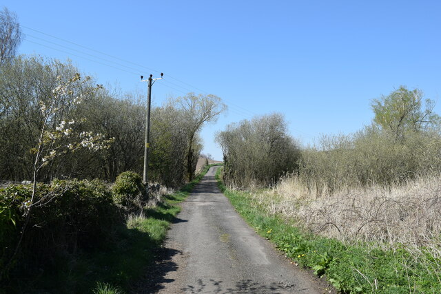
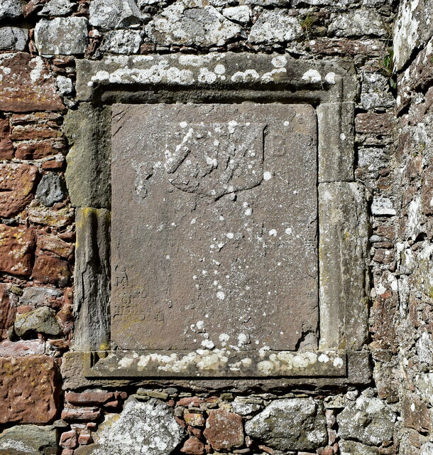
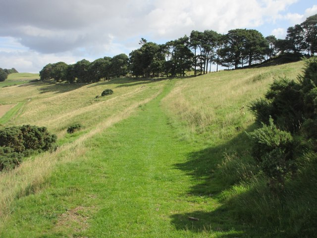
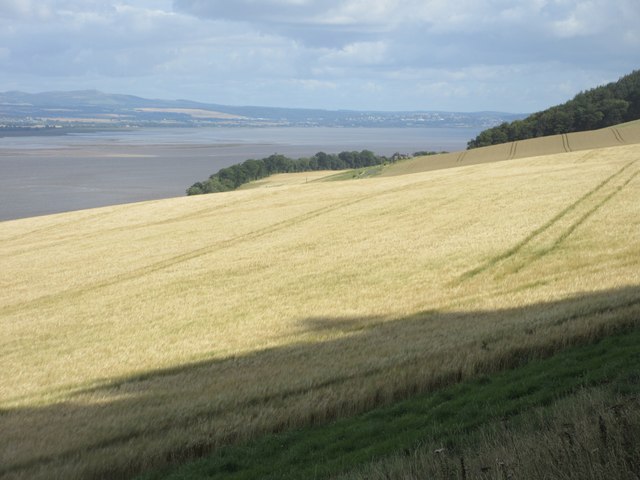
Bowstard Loch Images

Images are sourced within 2km of 56.340103/-3.1919228 or Grid Reference NO2617. Thanks to Geograph Open Source API. All images are credited.

Lindores Hill The foreground and the forestry are all in this grid square, but one has to admit that it's the view that catches the eye. On the left, in the distance, is the prominent hump of West Lomond. Ormiston Hill rises steeply from the town of Newburgh, and in the sunshine to the right is the estuary of the River Tay.
Lindores Hill
The foreground and the forestry are all in this grid square, but one has to admit that it's the view that catches the eye. On the left, in the distance, is the prominent hump of West Lomond. Ormiston Hill rises steeply from the town of Newburgh, and in the sunshine to the right is the estuary of the River Tay.
Meeting the Horses Visitors to the farm at Braeside of Lindores getting to know some of the residents.
Meeting the Horses
Visitors to the farm at Braeside of Lindores getting to know some of the residents.
Braeside of Lindores The farm at Braeside of Lindores is diversifying into all manner of leisure activities including equestrian activities.
Braeside of Lindores
The farm at Braeside of Lindores is diversifying into all manner of leisure activities including equestrian activities.
Abdie Parish Kirk The B-listed (LB2560 <span class="nowrap"><a title="https://portal.historicenvironment.scot/designation/LB2560" rel="nofollow ugc noopener" href="https://portal.historicenvironment.scot/designation/LB2560">Link</a><img style="margin-left:2px;" alt="External link" title="External link - shift click to open in new window" src="https://s1.geograph.org.uk/img/external.png" width="10" height="10"/></span> ) kirk dates from ca. 1827 and replaced the medieval kirk a few hundred metres to the south east.   The Italianate bellcote is unusual.
Abdie Parish Kirk
The B-listed (LB2560 LinkExternal link ) kirk dates from ca. 1827 and replaced the medieval kirk a few hundred metres to the south east. The Italianate bellcote is unusual.
Abdie old kirk The 13th Century kirk is a scheduled monument (SM825 <span class="nowrap"><a title="https://portal.historicenvironment.scot/designation/SM825" rel="nofollow ugc noopener" href="https://portal.historicenvironment.scot/designation/SM825">Link</a><img style="margin-left:2px;" alt="External link" title="External link - shift click to open in new window" src="https://s1.geograph.org.uk/img/external.png" width="10" height="10"/></span> ) but the listing provides no details  whatsoever.  Thankfully, the Canmore listing (30063  <span class="nowrap"><a title="https://canmore.org.uk/site/30063/abdie-old-parish-kirk" rel="nofollow ugc noopener" href="https://canmore.org.uk/site/30063/abdie-old-parish-kirk">Link</a><img style="margin-left:2px;" alt="External link" title="External link - shift click to open in new window" src="https://s1.geograph.org.uk/img/external.png" width="10" height="10"/></span> ) comes to the rescue with a very detailed description.    The church was abandoned and soon fell into ruin when the replacement kirk was built a few hundred metres to the north east in 1827.
Abdie old kirk
The 13th Century kirk is a scheduled monument (SM825 LinkExternal link ) but the listing provides no details whatsoever. Thankfully, the Canmore listing (30063 LinkExternal link ) comes to the rescue with a very detailed description. The church was abandoned and soon fell into ruin when the replacement kirk was built a few hundred metres to the north east in 1827.
Buildings at the entrance to Abdie old kirk The farther building is said to be a " session/offertory house" and the nearer is a "hearse or gig-house and loft".    The ensemble is B-listed (LB2561 <span class="nowrap"><a title="https://portal.historicenvironment.scot/designation/LB2561" rel="nofollow ugc noopener" href="https://portal.historicenvironment.scot/designation/LB2561">Link</a><img style="margin-left:2px;" alt="External link" title="External link - shift click to open in new window" src="https://s1.geograph.org.uk/img/external.png" width="10" height="10"/></span> ).   An enormous yew tree looms behind them.
Buildings at the entrance to Abdie old kirk
The farther building is said to be a " session/offertory house" and the nearer is a "hearse or gig-house and loft". The ensemble is B-listed (LB2561 LinkExternal link ). An enormous yew tree looms behind them.
Minor road to Abdie old kirk
Balfour-Napier monument, Abdie old kirk Arms of Balfour of Denmiln (Or, on a chevron sable between three trefoils slipped vert an otter's head erased argent) impaling Napier (Argent a saltire engrailed between four roses gules barbed vert)  commemorating the marriage between Michael Balfour and Katherine Napier sometime before 1652, when Katherine died.   The memorial is almost completely eroded but the arms at least were more discernible in 1930 and their details were entered into the  ‘Inventory of Monuments and Constructions in the Counties of Five, Kinross, and Clackmannan', published by RCAHMS (the Royal Commission on the Ancient and Historical Monuments of Scotland) published in 1933,
Balfour-Napier monument, Abdie old kirk
Arms of Balfour of Denmiln (Or, on a chevron sable between three trefoils slipped vert an otter's head erased argent) impaling Napier (Argent a saltire engrailed between four roses gules barbed vert) commemorating the marriage between Michael Balfour and Katherine Napier sometime before 1652, when Katherine died. The memorial is almost completely eroded but the arms at least were more discernible in 1930 and their details were entered into the ‘Inventory of Monuments and Constructions in the Counties of Five, Kinross, and Clackmannan', published by RCAHMS (the Royal Commission on the Ancient and Historical Monuments of Scotland) published in 1933,
View over the fields... ...with Braeside Mains in the distance.
View over the fields...
...with Braeside Mains in the distance.
Grassy high section of the Fife Coastal Path The Fife Coastal Path heading east along the hills above the Tay.
Grassy high section of the Fife Coastal Path
The Fife Coastal Path heading east along the hills above the Tay.
Barley field above the Firth of Tay Looking from Silver Hill over a field of barley, with Dundee in the distance across the Firth of Tay.
Barley field above the Firth of Tay
Looking from Silver Hill over a field of barley, with Dundee in the distance across the Firth of Tay.
Stubble, Cairneyhall A field beside the Loch of Lindores.
Stubble, Cairneyhall
A field beside the Loch of Lindores.
Pier, Lindores Loch Clear, shallow water by the boat pier.
Pier, Lindores Loch
Clear, shallow water by the boat pier.
Piers, Lindores Loch Fishing boats tied up at the end of the season.
Piers, Lindores Loch
Fishing boats tied up at the end of the season.
Lindores Loch
Lindores Loch
Fishing boats, Loch of Lindores Tied up at the end of the season.
Fishing boats, Loch of Lindores
Tied up at the end of the season.
Dunbog to Monimail track, looking South West This old unmetalled track runs from Monimail to Dunbog over the North Fife Hills. There is evidence of a route here dating back to the 17th Century
Dunbog to Monimail track, looking South West
This old unmetalled track runs from Monimail to Dunbog over the North Fife Hills. There is evidence of a route here dating back to the 17th Century
View across Inchrye reedbeds to Glenduckie and Norman's Law Standing on the Dunbog to Lindores Loch track looking North East. The extensive reedbeds aren't named on the map but lie between Inchrye and Dunbog. On the Northern side is a dismantled railway that used to connect the Den of Lindores with Kilmany and then Wormit ... now long gone. In the distance is Norman's Law, the highest point in the North Fife Hills.
View across Inchrye reedbeds to Glenduckie and Norman's Law
Standing on the Dunbog to Lindores Loch track looking North East. The extensive reedbeds aren't named on the map but lie between Inchrye and Dunbog. On the Northern side is a dismantled railway that used to connect the Den of Lindores with Kilmany and then Wormit ... now long gone. In the distance is Norman's Law, the highest point in the North Fife Hills.
Show me another place!

Bowstard Loch is located at Grid Ref: NO2617 (Lat: 56.340103, Lng: -3.1919228)

Unitary Authority: Fife

Police Authority: Fife

What 3 Words

///pose.retailing.eyebrows. Near Newburgh, Fife

Related Wikis

Lindores

Lindores is a small village in Fife, Scotland, in the parish of Abdie, about 2 miles south-east of Newburgh. It is situated on the north-east shore of...

Lindores railway station

Lindores railway station served the village of Lindores, Fife, Scotland from 1909 to 1951 on the Newburgh and North Fife Railway. == History == The station...

Lindores (E&NR) railway station

Lindores (E&NR) railway station was a temporary terminus that served the village of Lindores, Fife, Scotland in 1847 on the Edinburgh and Northern Railway...
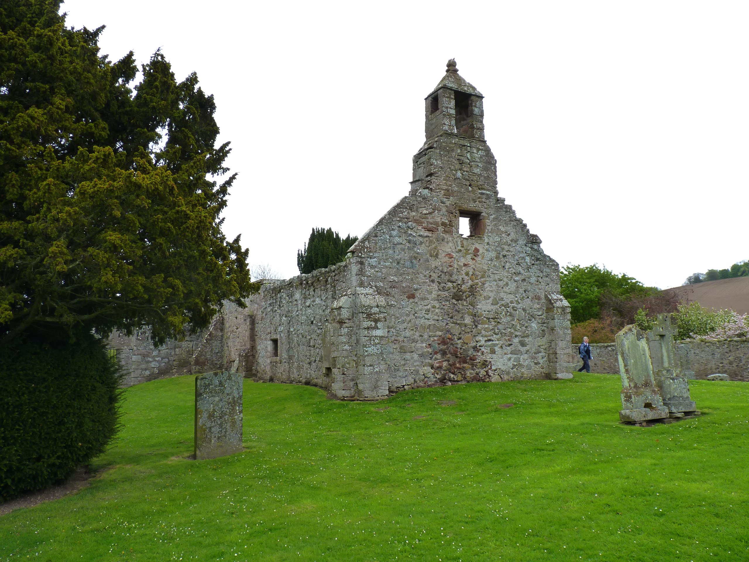
Abdie stone

The Abdie stone is a Class I Pictish stone that stands in Abdie Churchyard, Lindores, Fife, Scotland. == Location == The stone originally stood on the...

Abdie

Abdie is a parish in north-west Fife, Scotland, lying on the south shore of the Firth of Tay on the eastern outskirts of Newburgh, extending about 3 miles...

Lindores Loch

Lindores Loch is a freshwater loch, situated in North Fife in the Parish of Abdie, in the Central Belt of Scotland. The Loch has for many years been used...

Glenburnie railway station

Glenburnie railway station was a temporary terminus that served the area of Glenburnie, Fife, Scotland from 1847 to 1848 on the Edinburgh and Northern...
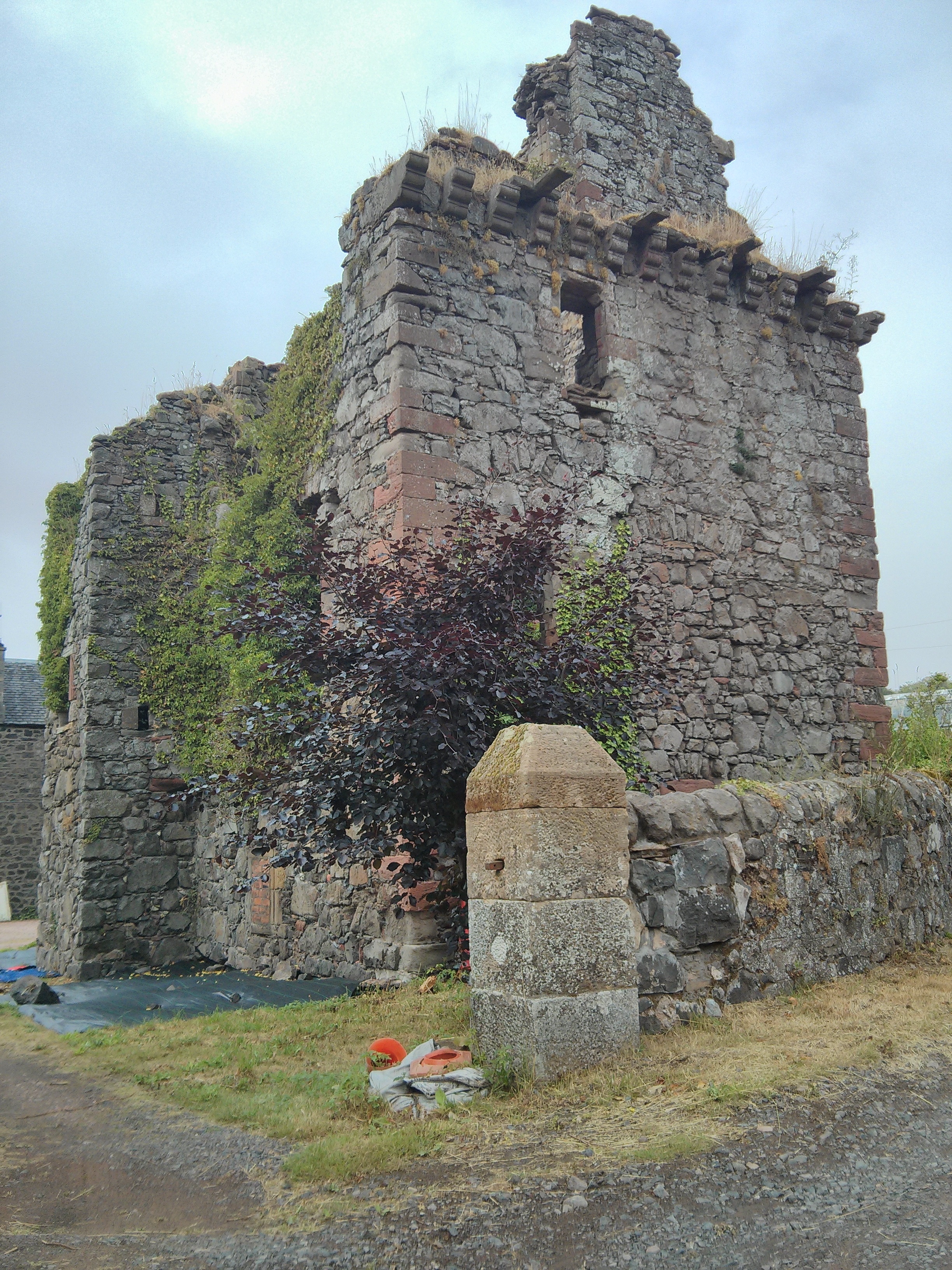
Denmylne Castle

Denmylne Castle is a ruined 16th-century tower house, about 1 mile (1.6 km) south east of Newburgh, Fife, Fife, Scotland, and 1 mile (1.6 km) north west...

Nearby Amenities

Located within 500m of 56.340103,-3.1919228
Lindores
Is In: Fife, Scotland, UK
Place: hamlet
Source: local_knowledge
Wikidata: Q3832628
Wikipedia: en:Lindores
Lat/Long: 56.3388/-3.1906154
Note: sluice gate - disused
Waterway: weir
Lat/Long: 56.3370666/-3.197668
Post Box
Collection Times: Mo-Fr 09:00; Sa 07:00
Operator: Royal Mail
Post Box Design: LB3426
Post Box Mounting: pier
Post Box Type: lamp
Ref: KY14 335D
Royal Cypher: scottish_crown
Source: survey
Lat/Long: 56.3386839/-3.1909595
Material: wood
Power: pole
Lat/Long: 56.3373952/-3.1981221
The data included in this document is from www.openstreetmap.org. The data is made available under ODbL.

Have you been to Bowstard Loch?

Leave your review of Bowstard Loch below (or comments, questions and feedback).