Blind Tarn

Lake, Pool, Pond, Freshwater Marsh in Lancashire South Lakeland

England

Blind Tarn

Goat's Water from Dow Crag View down Easter Gully to Goat’s Water from near the summit of Dow Crag.
Goat's Water from Dow Crag Credit: Adrian Taylor

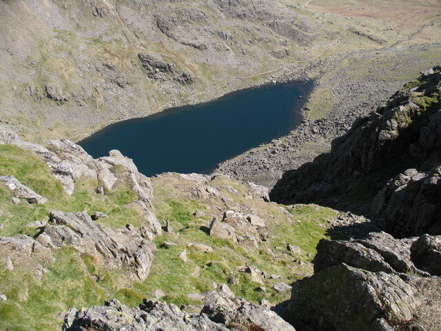
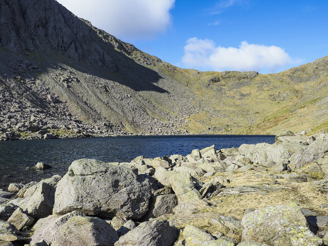
Blind Tarn is a small but picturesque body of water located in the county of Lancashire, England. Nestled amidst the rolling hills and verdant meadows of the region, this tarn is a charming example of a freshwater marsh ecosystem.

With a surface area of approximately 1.5 hectares, Blind Tarn is relatively small in size, but its beauty is not to be underestimated. Surrounded by a dense cover of reeds and grasses, the tarn is a haven for a variety of plant and animal species. The water itself is calm and still, reflecting the surrounding landscape and creating a serene atmosphere.

The tarn serves as a vital habitat for numerous species of birds, including waterfowl such as swans, ducks, and geese. The reed beds provide shelter and nesting sites for smaller birds, while the open water attracts diving birds like grebes and coots. Additionally, the marshy areas around the tarn support a diverse range of plant life, including various types of sedges, rushes, and water lilies.

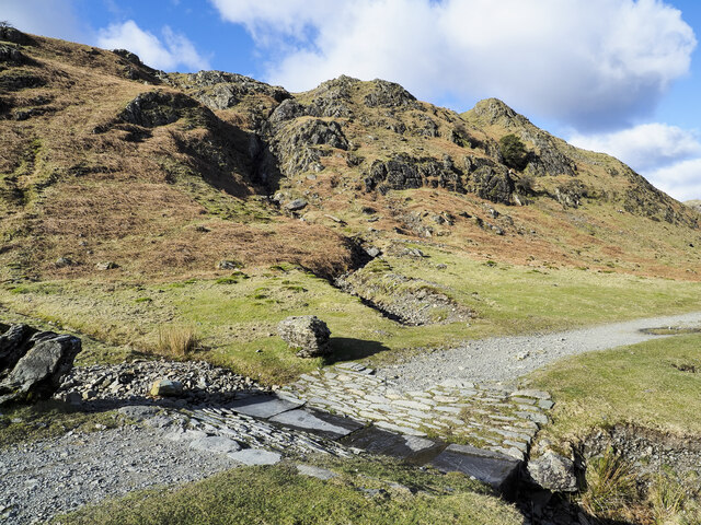
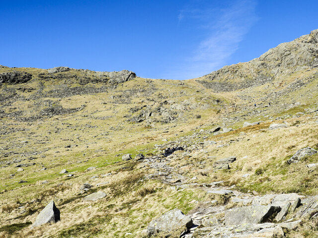
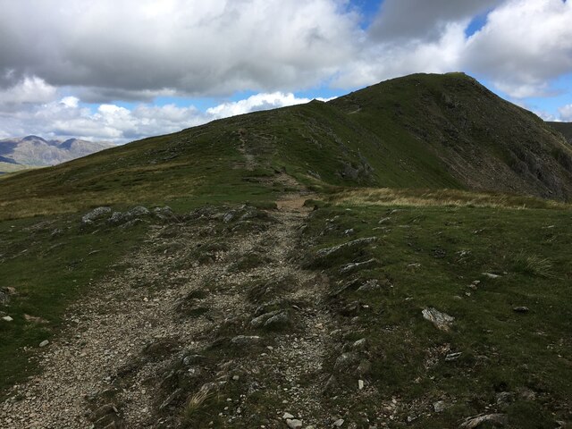
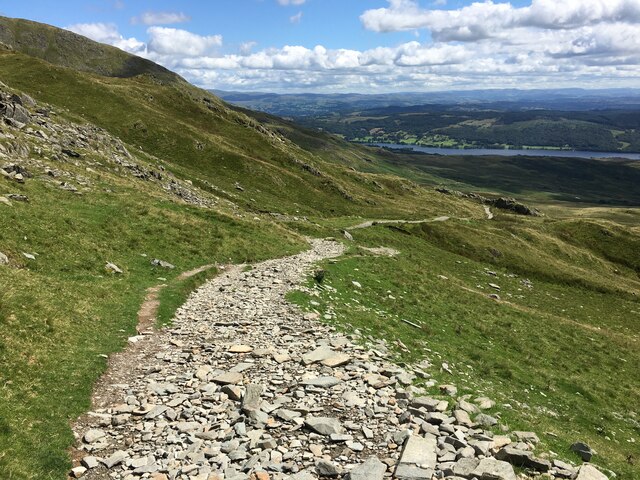
Blind Tarn is also a popular spot for nature enthusiasts and hikers. A network of walking trails surrounds the tarn, allowing visitors to explore the area and admire its natural beauty. The tranquil ambiance and stunning views make it an ideal location for photography, painting, or simply enjoying a peaceful picnic by the water's edge.

Overall, Blind Tarn is a gem of the Lancashire countryside, offering a glimpse into the region's rich biodiversity and providing a serene escape from the bustle of everyday life.

If you have any feedback on the listing, please let us know in the comments section below.

Blind Tarn Images

Images are sourced within 2km of 54.360662/-3.1366159 or Grid Reference SD2696. Thanks to Geograph Open Source API. All images are credited.

Goat's Water from Dow Crag View down Easter Gully to Goat’s Water from near the summit of Dow Crag.
Goat's Water from Dow Crag
View down Easter Gully to Goat’s Water from near the summit of Dow Crag.
Spoil terrace with ruined building A view from the 'Quarries Route', the main ascent path for the Old Man of Coniston. The grassed / mossed-over terrace of spoil is a very small one compared to a number of others along the way. Wetherlam is the mountain in the distance.
Spoil terrace with ruined building
A view from the 'Quarries Route', the main ascent path for the Old Man of Coniston. The grassed / mossed-over terrace of spoil is a very small one compared to a number of others along the way. Wetherlam is the mountain in the distance.
Crag rim at summit area of Coniston Old Man Snow residues lie at the edge of broken ground at the summit of the mountain. The crag rim and broad ridge extend initially to the north-west before turning north.
The Scafell group of mountains lie in the distance at the centre of the image.
Crag rim at summit area of Coniston Old Man
Snow residues lie at the edge of broken ground at the summit of the mountain. The crag rim and broad ridge extend initially to the north-west before turning north. The Scafell group of mountains lie in the distance at the centre of the image.
Northern slope of Dow Crag The darker slope rising to the left reaches Dow Crag. Goat's Hause is the col at the left side of the image from which a stream groove descends.
Harter Fell is the pyramidal peak at the centre of the image.
Northern slope of Dow Crag
The darker slope rising to the left reaches Dow Crag. Goat's Hause is the col at the left side of the image from which a stream groove descends. Harter Fell is the pyramidal peak at the centre of the image.
Boulders at shore of Goat's Water Goat's Water lies between two mountains of the Coniston group. The Old Man of Coniston rises unseen to the right, Dow Crag, to the left, across the lake.
Goat's Hause is the col in the distance.
Boulders at shore of Goat's Water
Goat's Water lies between two mountains of the Coniston group. The Old Man of Coniston rises unseen to the right, Dow Crag, to the left, across the lake. Goat's Hause is the col in the distance.
Walna Scar Road stream crossing A well constructed, stone-built feature allowing Hussey Well Beck to flow across the Walna Scar Road without causing undue erosion to its surface.
Walna Scar Road stream crossing
A well constructed, stone-built feature allowing Hussey Well Beck to flow across the Walna Scar Road without causing undue erosion to its surface.
Path rising towards Goat's Hause The path is partly constructed using rocks set into the ground to minimise erosion. More work on the route seems to be planned - along the path line, below the image centre there are bagged boulders awaiting use to improve or repair the way.
Goat's Hause is the obvious dip on the horizon.
Path rising towards Goat's Hause
The path is partly constructed using rocks set into the ground to minimise erosion. More work on the route seems to be planned - along the path line, below the image centre there are bagged boulders awaiting use to improve or repair the way. Goat's Hause is the obvious dip on the horizon.
Looking from Dow Crag towards Buck Pike
Path towards Buck Pike
Path near Walna Scar
Walna Scar Road
Walna Scar Road
Torver Bridge, Walna Scar Road
Walna Scar Road
Walna Scar Road
Trig point atop The Old Man Of Coniston
Benchmark, Coniston Old Man Detail of the flush bracket benchmark on the Ordnance Survey triangulation pillar on the summit of Coniston Old Man. The flush bracket, benchmark number S5473, is on the south-west face of the pillar and marks a height of 802.233m above mean sea level (Ordnance Datum Newlyn), last levelled for height in 1950 (location photograph <a href="https://www.geograph.org.uk/photo/7333822">SD2797 : Triangulation Pillar, Coniston Old Man</a>).
Prior to 1974 this was the highest benchmark in the county of Lancashire.
Benchmark, Coniston Old Man
Detail of the flush bracket benchmark on the Ordnance Survey triangulation pillar on the summit of Coniston Old Man. The flush bracket, benchmark number S5473, is on the south-west face of the pillar and marks a height of 802.233m above mean sea level (Ordnance Datum Newlyn), last levelled for height in 1950 (location photograph SD2797 : Triangulation Pillar, Coniston Old Man). Prior to 1974 this was the highest benchmark in the county of Lancashire.
Triangulation Pillar, Coniston Old Man The stone built Ordnance Survey triangulation pillar on the summit of Coniston Old Man.
The pillar was constructed in 1950. The flush bracket benchmark number S5473 on the south-west face of the pillar marks a height of 802.233m above mean sea level (Ordnance Datum Newlyn) last levelled for height in 1950 (detail photograph <a href="https://www.geograph.org.uk/photo/7333800">SD2797 : Benchmark, Coniston Old Man</a>).
This was the highest located triangulation pillar in the county of Lancashire until 1974.
Triangulation Pillar, Coniston Old Man
The stone built Ordnance Survey triangulation pillar on the summit of Coniston Old Man. The pillar was constructed in 1950. The flush bracket benchmark number S5473 on the south-west face of the pillar marks a height of 802.233m above mean sea level (Ordnance Datum Newlyn) last levelled for height in 1950 (detail photograph SD2797 : Benchmark, Coniston Old Man). This was the highest located triangulation pillar in the county of Lancashire until 1974.
Busy day on the summit Coniston Old Man is one of the most popular Lake District fells, with extensive views from the summit.  It is busy on an April day early in the season; in the height of summer it can become unpleasantly crowded and litter strewn.
The summit cairn stands on a stone platform and the highest point of the mountain will vary according to the state of repair or dilapidation of the cairn at the time.  The official height is referenced to the nearby trig point (photograph <a href="https://www.geograph.org.uk/photo/7333822">SD2797 : Triangulation Pillar, Coniston Old Man</a>).  Until 1974 the summit of Coniston Old Man was the highest point in the County of Lancashire.
The sheep have become used to eating scraps provided by tourists and in winter, when such food is scarce, they can be pushy and persistent in their belief they have a right to raid the contents of your rucksack. They love fudge!
Busy day on the summit
Coniston Old Man is one of the most popular Lake District fells, with extensive views from the summit. It is busy on an April day early in the season; in the height of summer it can become unpleasantly crowded and litter strewn. The summit cairn stands on a stone platform and the highest point of the mountain will vary according to the state of repair or dilapidation of the cairn at the time. The official height is referenced to the nearby trig point (photograph SD2797 : Triangulation Pillar, Coniston Old Man). Until 1974 the summit of Coniston Old Man was the highest point in the County of Lancashire. The sheep have become used to eating scraps provided by tourists and in winter, when such food is scarce, they can be pushy and persistent in their belief they have a right to raid the contents of your rucksack. They love fudge!
Quarry Disused quarry on the side of The Old Man of Coniston.
Quarry
Disused quarry on the side of The Old Man of Coniston.
Show me another place!

Blind Tarn is located at Grid Ref: SD2696 (Lat: 54.360662, Lng: -3.1366159)

Administrative County: Cumbria

District: South Lakeland

Police Authority: Cumbria

What 3 Words

///forge.pelt.grain. Near Ambleside, Cumbria

Related Wikis

Brown Pike

Brown Pike is a fell located in the Lake District National Park in Cumbria, England. Brown Pike is near the village of Coniston, and is most commonly approached...

Buck Pike

Buck Pike is a fell located in the Lake District National Park in Cumbria. Buck Pike is near the village of Coniston. Other fells in this area include...

Dow Crag

Dow Crag is a fell in the English Lake District near Coniston, Cumbria. The eastern face is one of the many rock faces in the Lake District used for rock...

Goat's Water

Goat's Water is a small accessible tarn in the English Lake District, located between Dow Crag and The Old Man of Coniston to the Duddon Valley, near the...

Nearby Amenities

Located within 500m of 54.360662,-3.1366159
Source: npe
Lat/Long: 54.360991/-3.1369567
Source: npe
Lat/Long: 54.3609481/-3.1364273
Source: npe
Lat/Long: 54.3607481/-3.1360806
Source: npe
Lat/Long: 54.3604923/-3.136176
Buck Pike
Ele: 744
Natural: peak
Wikidata: Q4982920
Wikipedia: en:Buck Pike
Lat/Long: 54.3651015/-3.1368191
Man Made: adit
Lat/Long: 54.3583265/-3.1315695
Goatfoot Crags
Place: locality
Lat/Long: 54.359128/-3.1318756
Blind Tarn Band
Place: locality
Lat/Long: 54.3618846/-3.1370582
Lee Haw
Place: locality
Lat/Long: 54.3571021/-3.1382886
Brown Pike
Ele: 682
Natural: peak
Wikidata: Q4976234
Wikipedia: en:Brown Pike
Lat/Long: 54.3594146/-3.1387821
Ford: yes
Lat/Long: 54.3573895/-3.1356322
Gaer
Place: locality
Lat/Long: 54.363831/-3.1405839
Turn Wheels
Historic: yes
Lat/Long: 54.3614386/-3.1305727
Blind Tarn Crags
Place: locality
Lat/Long: 54.3614859/-3.1420207
Source: npe
Lat/Long: 54.3608436/-3.1371668
Access: permissive
Direction: 220
Fee: no
Natural: cave_entrance
Lat/Long: 54.3595846/-3.1370591
The data included in this document is from www.openstreetmap.org. The data is made available under ODbL.

Have you been to Blind Tarn?

Leave your review of Blind Tarn below (or comments, questions and feedback).