Glencorse Reservoir

Lake, Pool, Pond, Freshwater Marsh in Midlothian

Scotland

Glencorse Reservoir

North side of Den's Cleugh Moorland on the slopes of Bell Hill.
North side of Den's Cleugh Credit: Richard Webb

Glencorse Reservoir is a picturesque freshwater lake located in Midlothian, Scotland. Nestled in the scenic Pentland Hills, this reservoir serves as a vital water source for the surrounding areas. It covers an area of approximately 57 hectares and has a maximum depth of about 15 meters.

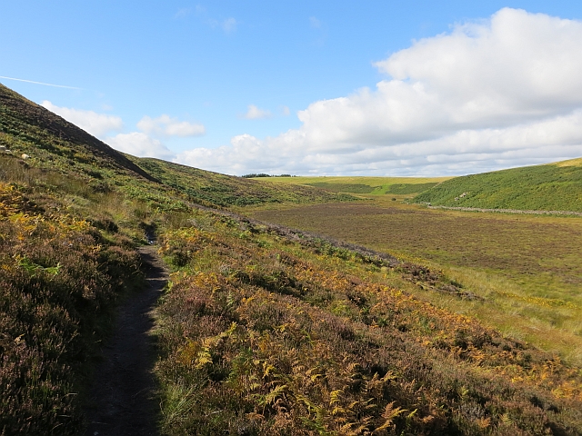
The reservoir is surrounded by lush greenery and offers breathtaking views of the surrounding countryside. It is a popular destination for outdoor enthusiasts and nature lovers who enjoy activities such as fishing, boating, and birdwatching. The calm waters of Glencorse Reservoir provide an ideal environment for various species of fish, including brown trout and rainbow trout, making it a haven for anglers.

The surrounding area of the reservoir is home to a diverse range of flora and fauna. The tranquil atmosphere and abundant vegetation attract a wide variety of bird species, making it a prime spot for birdwatching. Visitors can expect to spot birds such as herons, swans, and various waterfowl.

The reservoir also plays a crucial role in flood prevention and water management for the region. It acts as a storage facility, collecting excess water during heavy rainfall and releasing it gradually to prevent flooding downstream.

Glencorse Reservoir is not only a beautiful natural feature but also an important water resource and habitat for wildlife. Whether it's for recreational activities or appreciating the natural beauty, this Midlothian reservoir offers a serene and peaceful escape for visitors.

If you have any feedback on the listing, please let us know in the comments section below.

Glencorse Reservoir Images

Images are sourced within 2km of 55.862113/-3.2544144 or Grid Reference NT2163. Thanks to Geograph Open Source API. All images are credited.

North side of Den's Cleugh Moorland on the slopes of Bell Hill.
North side of Den's Cleugh
Moorland on the slopes of Bell Hill.
Dyke corner A boundary takes a sharp turn above Den's Cleugh.
Dyke corner
A boundary takes a sharp turn above Den's Cleugh.
West side of Bell's Hill Above Dens Cleugh.
West side of Bell's Hill
Above Dens Cleugh.
Dens Cleugh path A narrow path passing a marsh on the watershed above Threipmuir Reservoir.
Dens Cleugh path
A narrow path passing a marsh on the watershed above Threipmuir Reservoir.
Looking down to Den's Cleugh And a new track in the cleugh.
Looking down to Den's Cleugh
And a new track in the cleugh.
Den's Cleuch A pass between Bells Hill and Black Hill. Probably a meltwater channel, an alternative exit for glacial melt from Glen Corse. Now rather boggy.
Den's Cleuch
A pass between Bells Hill and Black Hill. Probably a meltwater channel, an alternative exit for glacial melt from Glen Corse. Now rather boggy.
Boggy ground east of Threipmuir Were the Threipmuir reservoir to be raised a little then this ground would be underwater.
Boggy ground east of Threipmuir
Were the Threipmuir reservoir to be raised a little then this ground would be underwater.
Meltwater channel, Den's Cleugh A marshy flat area at the head of Threipmuir Reservoir.  Black Hill on the left.
Meltwater channel, Den's Cleugh
A marshy flat area at the head of Threipmuir Reservoir. Black Hill on the left.
Gully, Den's Cleugh One of some of the deep gullies at the foot of Bell's Hill.
Gully, Den's Cleugh
One of some of the deep gullies at the foot of Bell's Hill.
Den's Cleugh Looking towards Glencorse Reservoir and Turnhouse Hill from between Bell's Hill and Black Hill.
Den's Cleugh
Looking towards Glencorse Reservoir and Turnhouse Hill from between Bell's Hill and Black Hill.
White Cleugh, Black Hill Trees surviving in the steep-sided burn on the NE side of this predominantly heathery hill.
White Cleugh, Black Hill
Trees surviving in the steep-sided burn on the NE side of this predominantly heathery hill.
Den's Cleugh from Black Hill The very boggy valley between Black Hill and Bell's Hill.
Den's Cleugh from Black Hill
The very boggy valley between Black Hill and Bell's Hill.
Track from Den's Cleugh A track up Black Hill, probably for access to grouse butts. Fortunately there is a stretch of board walk across the very wet bog in the valley bottom.
Track from Den's Cleugh
A track up Black Hill, probably for access to grouse butts. Fortunately there is a stretch of board walk across the very wet bog in the valley bottom.
Board walk, Den's Cleugh The bog is much wetter than it appears here and the board walk gave easy passage across some very juicy ground. It was several metres short at the far end, but your photographer managed to escape with dry feet.
Board walk, Den's Cleugh
The bog is much wetter than it appears here and the board walk gave easy passage across some very juicy ground. It was several metres short at the far end, but your photographer managed to escape with dry feet.
Path in Den's Cleugh A path on the eastern fringe of the bog.
Path in Den's Cleugh
A path on the eastern fringe of the bog.
Memorial to C.T.R. Wilson, Nobel Prize Winner See <a title="https://www.geograph.org.uk/photo/903255" href="https://www.geograph.org.uk/photo/903255">Link</a>
Memorial to C.T.R. Wilson, Nobel Prize Winner
See Link
Entrance to Kirkton Farm
Turnhouse hill Looking back at the summit of Turnhouse Hill from the ridge walk to Carnethy Hill and Scald Law.
Turnhouse hill
Looking back at the summit of Turnhouse Hill from the ridge walk to Carnethy Hill and Scald Law.
Show me another place!

Glencorse Reservoir is located at Grid Ref: NT2163 (Lat: 55.862113, Lng: -3.2544144)

Unitary Authority: Midlothian

Police Authority: The Lothians and Scottish Borders

What 3 Words

///turntable.circular.bossy. Near Penicuik, Midlothian

Nearby Locations

Glencorse Reservoir

Related Wikis

Glencorse Reservoir

Glencorse Reservoir is a reservoir in Midlothian, Scotland, two miles west of Glencorse, in the Pentland Hills. It is retained by an earth dam, and it...

Castle Law

Castle Law is a hill south west of Fairmilehead in the Pentland Hills in Midlothian, Scotland. It is best known for the Iron Age hill fort on its slopes...

Battle of Rullion Green

The Battle of Rullion Green took place on 28 November 1666, near the Pentland Hills, in Midlothian, Scotland. It was the only significant battle of the...

Carnethy Hill

Carnethy Hill, the second highest of the Pentland Hills, is a hill 3 miles (5 km) north-west of Penicuik, Scotland. It lends its name to the Carnethy 5...

Nearby Amenities

Located within 500m of 55.862113,-3.2544144
Kirkton
Place: hamlet
Lat/Long: 55.8612734/-3.2612562
Bench
Capacity: 2
Material: wood
Lat/Long: 55.8639697/-3.2475442
Bench
Lat/Long: 55.8630948/-3.255067
Power: pole
Lat/Long: 55.8616988/-3.2612151
Power: pole
Lat/Long: 55.8620005/-3.2605734
Power: pole
Lat/Long: 55.8625501/-3.2593898
Power: pole
Lat/Long: 55.8630822/-3.2582688
Power: pole
Lat/Long: 55.863606/-3.257152
Power: pole
Lat/Long: 55.8640784/-3.2561726
Power: pole
Lat/Long: 55.864435/-3.2553954
Power: pole
Lat/Long: 55.8648139/-3.2546036
Power: pole
Lat/Long: 55.8651716/-3.2538389
Power: pole
Lat/Long: 55.8657528/-3.2526429
Power: pole
Lat/Long: 55.8652523/-3.2516052
Power: pole
Lat/Long: 55.8647975/-3.250653
Power: pole
Lat/Long: 55.8643321/-3.249657
Power: pole
Lat/Long: 55.8638305/-3.248686
Power: pole
Lat/Long: 55.8629208/-3.2466835
Bench
Lat/Long: 55.8625023/-3.2553457
The data included in this document is from www.openstreetmap.org. The data is made available under ODbL.

Have you been to Glencorse Reservoir?

Leave your review of Glencorse Reservoir below (or comments, questions and feedback).