Birk Dub

Lake, Pool, Pond, Freshwater Marsh in Cumberland Copeland

England

Birk Dub

They Never Saw This Taken from above the Fort on Hardknott Pass, the Romans would never have seen the fruits of their labours from above like this!
They Never Saw This Credit: Andy Beecroft

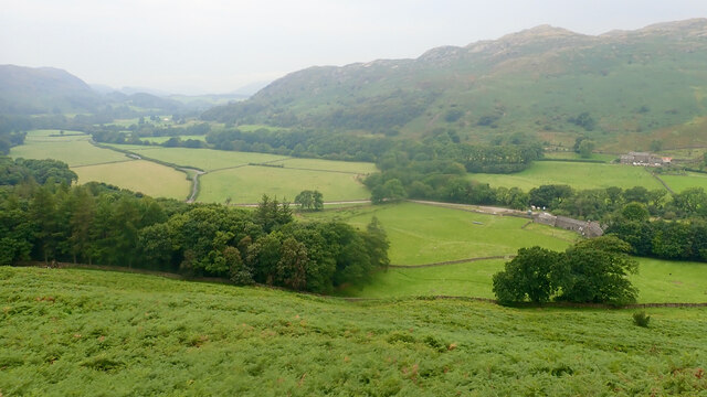
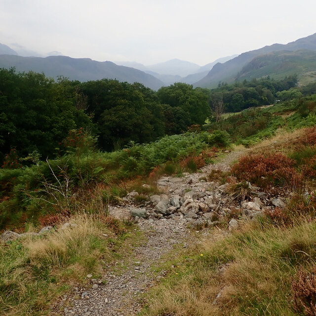
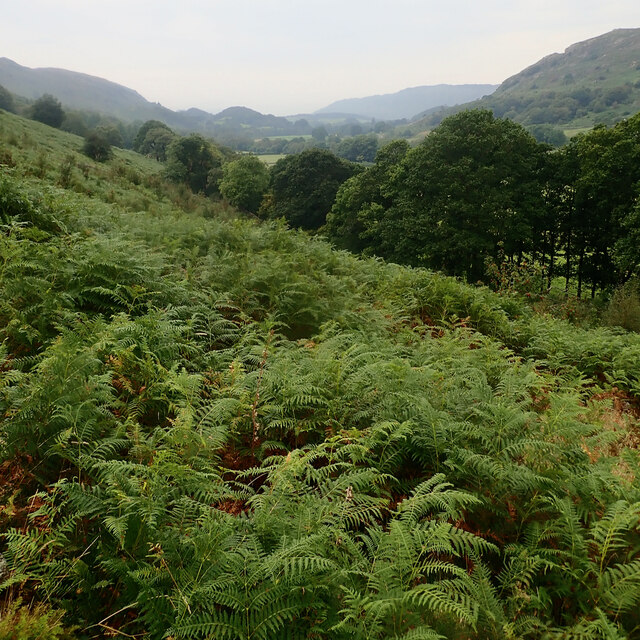
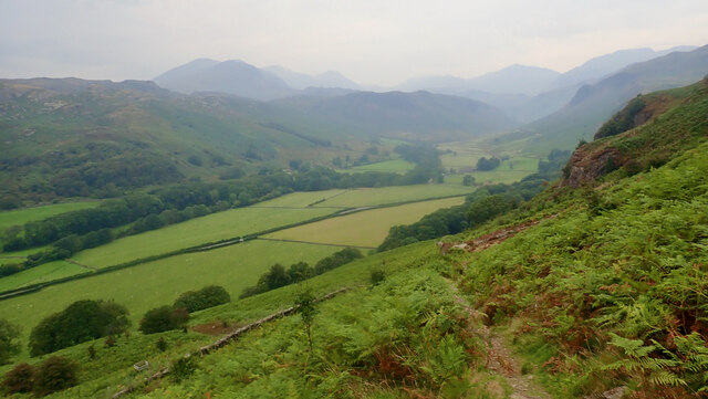
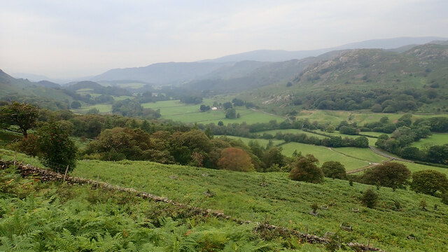
Birk Dub is a picturesque freshwater marsh located in Cumberland, a village in the United Kingdom. This natural marvel is a sanctuary for various aquatic plants and animals, offering a serene and biodiverse environment for visitors to explore. With its tranquil atmosphere and stunning scenery, Birk Dub attracts nature enthusiasts, photographers, and those seeking a peaceful retreat.

Covering a considerable area, Birk Dub consists of a combination of features such as a lake, pool, pond, and freshwater marsh. The lake is a large body of water, characterized by its deep and open expanse. It provides a habitat for several species of fish, including perch and pike, making it a popular spot for anglers.

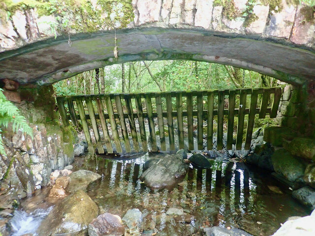
Adjacent to the lake is a pool, which is a smaller body of water that tends to be shallower. This area is often teeming with various waterfowl, such as ducks and geese, creating a delightful spectacle for birdwatchers.

The pond within Birk Dub is a smaller and more enclosed body of water, ideal for observing amphibians like frogs and newts. The presence of lily pads and other aquatic plants adds to the pond's charm and provides a habitat for insects and other invertebrates.

Surrounding these bodies of water is the freshwater marsh, a wetland characterized by its soft, waterlogged ground and abundant vegetation. This marshland is home to a diverse range of plant species, such as reeds, cattails, and marsh marigolds. It also serves as a refuge for various bird species, including herons and kingfishers.

Overall, Birk Dub in Cumberland offers a captivating blend of distinct aquatic environments, making it a haven for both wildlife and visitors seeking to immerse themselves in nature's beauty.

If you have any feedback on the listing, please let us know in the comments section below.
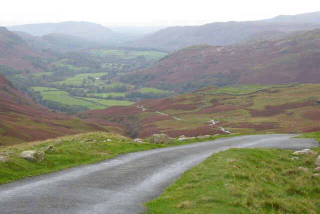
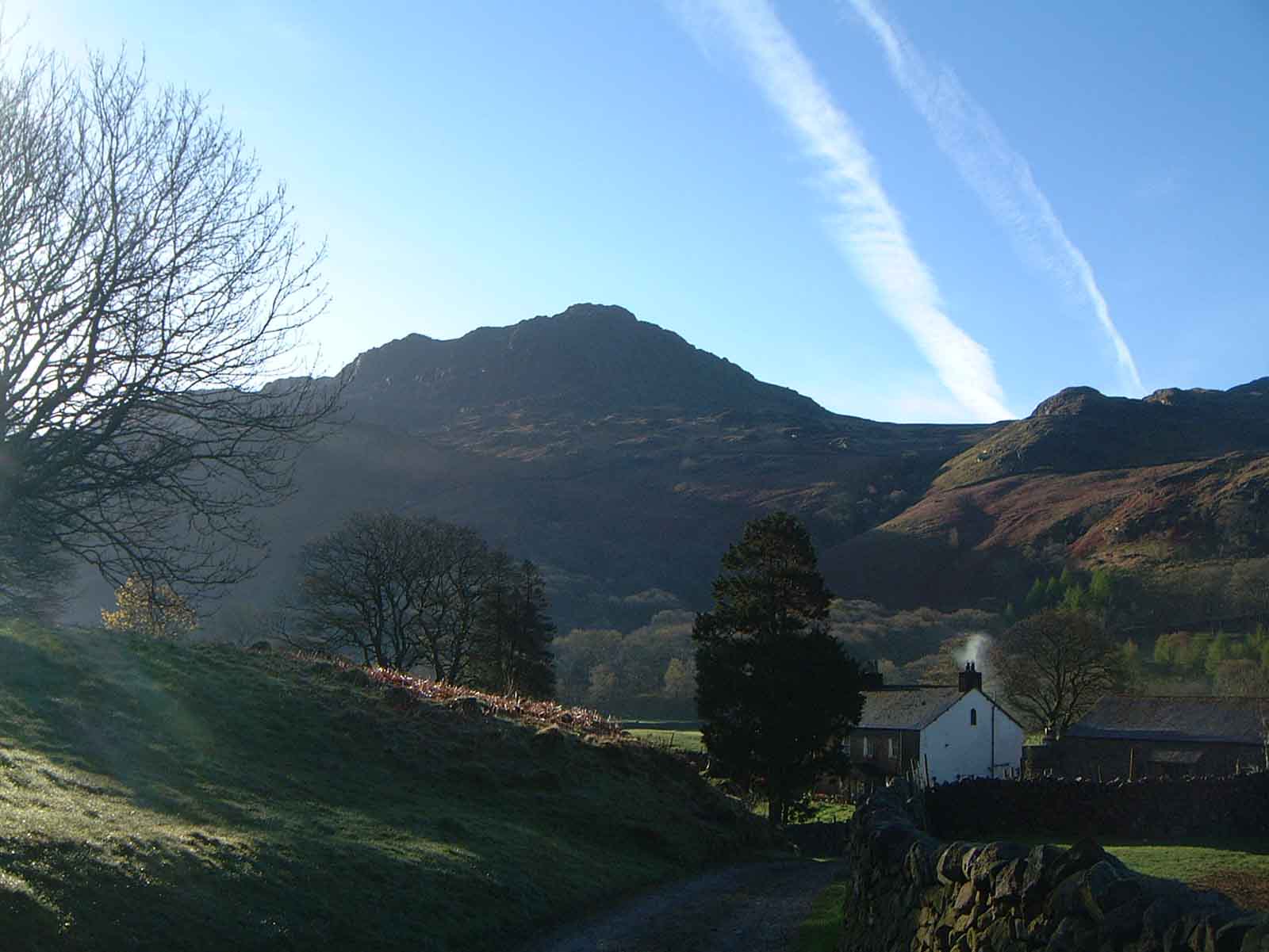
Birk Dub Images

Images are sourced within 2km of 54.408158/-3.2109139 or Grid Reference NY2102. Thanks to Geograph Open Source API. All images are credited.

They Never Saw This Taken from above the Fort on Hardknott Pass, the Romans would never have seen the fruits of their labours from above like this!
They Never Saw This
Taken from above the Fort on Hardknott Pass, the Romans would never have seen the fruits of their labours from above like this!
Near the Top The last couple of hairpin bends of the western approach of Hardknott Pass.
Near the Top
The last couple of hairpin bends of the western approach of Hardknott Pass.
The Final Slog The last few hundred feet of the climb up the western side of Hardknott Pass.
The Final Slog
The last few hundred feet of the climb up the western side of Hardknott Pass.
Brotherilkeld farm According to the O.S. mapping the public right of way goes through the farmyard but we were 'told' by the farmer in no uncertain terms to go around.
Brotherilkeld farm
According to the O.S. mapping the public right of way goes through the farmyard but we were 'told' by the farmer in no uncertain terms to go around.
Eskdale, Brotherilkeld on the right
Heck under Jubilee Bridge
Path climbing Birker Fell
Eskdale
Eskdale
Eskdale
Eskdale
Eskdale
Eskdale
Road over the Hardknott Pass
Road ascending the Hardknott Pass
Farm track near Wha House Farm
Up from the West A pair of very fit cyclists making light work of the climb from Eskdale up to the summit of Hardknott Pass.
Up from the West
A pair of very fit cyclists making light work of the climb from Eskdale up to the summit of Hardknott Pass.
At the top of the Hardknott Pass View to the west into Eskdale from the top of the Hardknott Pass.
At the top of the Hardknott Pass
View to the west into Eskdale from the top of the Hardknott Pass.
View into Eskdale View into Eskdale when descending the Hardknott Pass.
View into Eskdale
View into Eskdale when descending the Hardknott Pass.
On lower slope of Hard Knott On lower slope of Hard Knott looking in the distance to the Scafells
On lower slope of Hard Knott
On lower slope of Hard Knott looking in the distance to the Scafells
Rocks on Peelplace Noddle Rounded rocks on one of the knolls of Peelplace Noddle.
The sunlit, undulating knolled ground in the middle distance include point 272 m. which lies east of Eel Tarn; beyond is Eskdale.
Rocks on Peelplace Noddle
Rounded rocks on one of the knolls of Peelplace Noddle. The sunlit, undulating knolled ground in the middle distance include point 272 m. which lies east of Eel Tarn; beyond is Eskdale.
Show me another place!

Birk Dub is located at Grid Ref: NY2102 (Lat: 54.408158, Lng: -3.2109139)

Administrative County: Cumbria

District: Copeland

Police Authority: Cumbria

What 3 Words

///dispenser.flock.refills. Near Ambleside, Cumbria

Nearby Locations

Kail Pot Birk Dub

Related Wikis

Hardknott Roman Fort

Hardknott Roman Fort is an archeological site, the remains of the Roman fort Mediobogdum, located on the western side of the Hardknott Pass in the English...

Hardknott Pass

Hardknott Pass is a hill pass between Eskdale and the Duddon Valley in the Lake District National Park, Cumbria, England. The tarmac-surfaced road, which...

Hard Knott

Hard Knott is a fell in the English Lake District, at the head of Eskdale. == Geology == Rhyolitic lava-like tuff of the Bad Step Tuff forms the summit...

Harter Fell (Eskdale)

Harter Fell is a fell in the western part of the English Lake District, located between the Eskdale and Duddon valleys. Its height is 653 metres (2,142...

Nearby Amenities

Located within 500m of 54.408158,-3.2109139
Ford: yes
Lat/Long: 54.4061112/-3.2137116
Ford: yes
Lat/Long: 54.4076778/-3.212939
Ford: yes
Lat/Long: 54.4104846/-3.2070146
Barrier: entrance
Lat/Long: 54.4080485/-3.2087319
Barrier: entrance
Lat/Long: 54.406125/-3.2072368
Waterway: waterfall
Lat/Long: 54.41096/-3.2126421
Waterway: waterfall
Lat/Long: 54.4111775/-3.213187
Kail Pot
Place: locality
Lat/Long: 54.4105137/-3.2073553
Birk Dub
Place: locality
Lat/Long: 54.4082581/-3.2101798
Ford: yes
Lat/Long: 54.4097277/-3.2078004
Ford: yes
Lat/Long: 54.4087364/-3.2089095
Ford: yes
Lat/Long: 54.4083055/-3.2129013
Ford: yes
Lat/Long: 54.4095978/-3.2134789
Barrier: entrance
Lat/Long: 54.4080485/-3.2087319
The data included in this document is from www.openstreetmap.org. The data is made available under ODbL.

Have you been to Birk Dub?

Leave your review of Birk Dub below (or comments, questions and feedback).