Foxes Tarn

Lake, Pool, Pond, Freshwater Marsh in Cumberland Copeland

England

Foxes Tarn

Fold, Broad Tongue
Fold, Broad Tongue Credit: Mick Garratt

Foxes Tarn, located in Cumberland, England, is a picturesque freshwater marsh encompassing a small lake, pool, and pond. Nestled amidst the stunning scenery of the Lake District National Park, this natural gem is renowned for its tranquil ambiance and diverse ecosystem. The tarn is situated at an elevation of approximately 400 meters above sea level and covers an area of around 2 hectares.

The tarn is surrounded by lush greenery, with dense woodlands and rolling hills serving as a backdrop. The water of Foxes Tarn is crystal clear, reflecting the surrounding landscape like a mirror. The lake itself is relatively shallow, with a maximum depth of about 5 meters, and is fed by numerous freshwater springs that maintain a constant flow throughout the year.

The marshland surrounding the tarn is home to a wide range of flora and fauna. The reed beds and wetland vegetation provide a habitat for various species of birds, including waterfowl, herons, and warblers. Additionally, the tarn supports a diverse population of fish, such as brown trout and perch, attracting anglers and fishing enthusiasts.

Visitors to Foxes Tarn can enjoy a peaceful stroll along the well-maintained footpaths that encircle the water, offering stunning panoramic views of the landscape. The tarn is also a popular spot for picnicking, wildlife observation, and photography, with its serene atmosphere providing a much-needed respite from the hustle and bustle of everyday life.

Overall, Foxes Tarn in Cumberland is a hidden gem, offering a tranquil haven for nature lovers and a unique opportunity to immerse oneself in the breathtaking beauty of the Lake District National Park.

If you have any feedback on the listing, please let us know in the comments section below.

Foxes Tarn Images

Images are sourced within 2km of 54.447151/-3.2211635 or Grid Reference NY2006. Thanks to Geograph Open Source API. All images are credited.
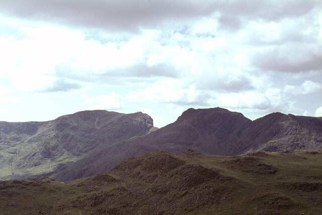
Fold, Broad Tongue
Fold, Broad Tongue
Symonds Knott from the summit of Scafell The view is taken from the summit with Symonds Knott being the rise in the ridge and with Great Gable in the background. With thanks to Ian Taylor for pinpointing the camera position.
Symonds Knott from the summit of Scafell
The view is taken from the summit with Symonds Knott being the rise in the ridge and with Great Gable in the background. With thanks to Ian Taylor for pinpointing the camera position.
The Scafells from Bow Fell north ridge In the foreground is the flattish top of the minor hill Pike de Bield. Along the horizon the Scafells stand proud. From left to right we have Sca Fell, Symonds Knott (a fairly modest top but overlooking the sheer drop of Broad Stand), Mickledore (the sharp dip between the two main hills) and Scafell Pike itself. The cairn on this summit, the highest in England at 978m, is clearly seen from 4km away.

Further to the right is Ill Crag. The 'subject' grid ref is for Symonds Knott.
The Scafells from Bow Fell north ridge
In the foreground is the flattish top of the minor hill Pike de Bield. Along the horizon the Scafells stand proud. From left to right we have Sca Fell, Symonds Knott (a fairly modest top but overlooking the sheer drop of Broad Stand), Mickledore (the sharp dip between the two main hills) and Scafell Pike itself. The cairn on this summit, the highest in England at 978m, is clearly seen from 4km away. Further to the right is Ill Crag. The 'subject' grid ref is for Symonds Knott.
Kettle Cove
Kettle Cove
Long Gill
Long Gill
Path on Green How Path on  Green How on the lower slope of Scafell looking to Yewbarrow in the distance
Path on Green How
Path on Green How on the lower slope of Scafell looking to Yewbarrow in the distance
Boulders, one perched The location is the ground between Lingmell and Scafell Pike. Seatallan is the far off peak. The complex of nuclear industries at Sellafield is seen more distantly just left of the perched boulder.
Boulders, one perched
The location is the ground between Lingmell and Scafell Pike. Seatallan is the far off peak. The complex of nuclear industries at Sellafield is seen more distantly just left of the perched boulder.
Cairn on SW top of Lingmell
Small tarn by Round How
Piers Gill from Piers Gill Head
Ground descending towards Lingmell The image was recorded on the descent from Scafell Pike towards its col with Broad Crag. Lingmell is the peak at the centre of the photograph and mountains of the Mosedale Horseshoe lie beyond it. The head of the massive trench of Piers Gill is right of Lingmell, obscured partly by a rock buttress. The path known as the Corridor Route passes the head of Piers Gill.
Ground descending towards Lingmell
The image was recorded on the descent from Scafell Pike towards its col with Broad Crag. Lingmell is the peak at the centre of the photograph and mountains of the Mosedale Horseshoe lie beyond it. The head of the massive trench of Piers Gill is right of Lingmell, obscured partly by a rock buttress. The path known as the Corridor Route passes the head of Piers Gill.
Scafell range from High Street The Scafells and Great Gable from High Street on a gloriously clear April day
Scafell range from High Street
The Scafells and Great Gable from High Street on a gloriously clear April day
Harter Fell [<a href="https://www.geograph.org.uk/gridref/SD2199">SD2199</a>] Taken on the descent of Horn Crag.
Harter Fell
[SD2199] Taken on the descent of Horn Crag.
Long Green and Sca Fell
On Long Green Looking back to Horn Crag.
On Long Green
Looking back to Horn Crag.
Long Green Descending off Sca Fell.
Long Green
Descending off Sca Fell.
Sca Fell Summit
Sca Fell Summit
Harter Fell Harter Fell is in <a href="https://www.geograph.org.uk/gridref/SD2199">SD2199</a>

View from Horn Crag.
Harter Fell
Harter Fell is in SD2199 View from Horn Crag.
Show me another place!

Foxes Tarn is located at Grid Ref: NY2006 (Lat: 54.447151, Lng: -3.2211635)

Administrative County: Cumbria

District: Copeland

Police Authority: Cumbria

What 3 Words

///expiring.postage.evolves. Near Ambleside, Cumbria

Related Wikis

Scafell

Scafell ( or ; also spelled Sca Fell, previously Scawfell) is a mountain in the Lake District region of Cumbria, England. It has a height of 964 metres...

Mickledore

Mickledore (the name means great door or pass) is a narrow ridge, 840 metres (2755 ft) high, connecting the mountains of Scafell and Scafell Pike in the...

Scafell Pike

Scafell Pike () is a mountain in the Lake District region of Cumbria, England. It has an elevation of 978 metres (3,209 ft) above sea level, making it...

Broad Crag

Broad Crag is a fell in the English Lake District. It is the fifth-highest peak in England at a height of 3,064 feet (934 metres). The mountain was gifted...

Nearby Amenities

Located within 500m of 54.447151,-3.2211635
Sca Fell
Ele: 964
Natural: peak
Source: npe
Wikidata: Q463145
Wikipedia: en:Scafell
Lat/Long: 54.44751/-3.2247052
Broad Stand
Natural: cliff
Sac Scale: demanding_alpine_hiking
Source: NPE
Lat/Long: 54.4507891/-3.2202939
Ford: yes
Lat/Long: 54.4481694/-3.2192034
Symonds Knott
Ele: 959
Natural: peak
Lat/Long: 54.4498452/-3.2235665
Greencove Wyke
Place: locality
Lat/Long: 54.4433643/-3.218557
Mickledore
Ele: 830
Mountain Pass: yes
Natural: saddle
Wikidata: Q938767
Wikipedia: en:Mickledore
Lat/Long: 54.4513682/-3.2194903
Foxes Rake
Place: locality
Sac Scale: demanding_mountain_hiking
Lat/Long: 54.447957/-3.2193703
Ford: yes
Lat/Long: 54.4482422/-3.2171034
Sca Fell Pinnacle
Natural: peak
Lat/Long: 54.4503945/-3.2226502
Ford: yes
Lat/Long: 54.4484929/-3.2185546
The data included in this document is from www.openstreetmap.org. The data is made available under ODbL.

Have you been to Foxes Tarn?

Leave your review of Foxes Tarn below (or comments, questions and feedback).