Blackbeck Tarn

Lake, Pool, Pond, Freshwater Marsh in Cumberland Allerdale

England

Blackbeck Tarn

Operations at Hopper Quarry Hopper Quarry is part of the workings at the Honister Quarries. At the time the image was recorded no work was going on at this site but it's clear that waste slate is being crushed into tiny flakes then added to the growing heap beside and beyond the machinery; what happens to it next is unknown.
Operations at Hopper Quarry Credit: Trevor Littlewood

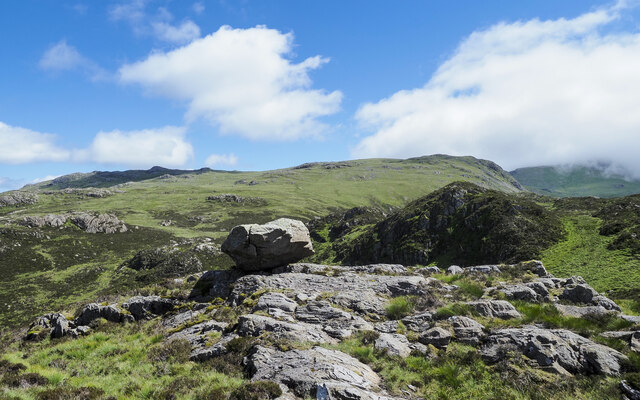
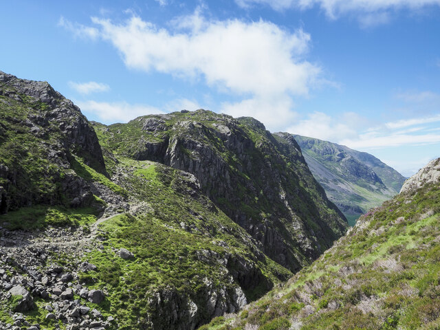
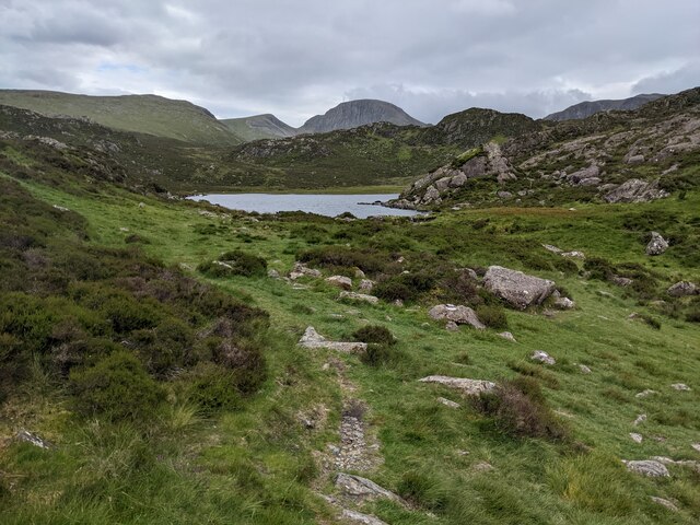
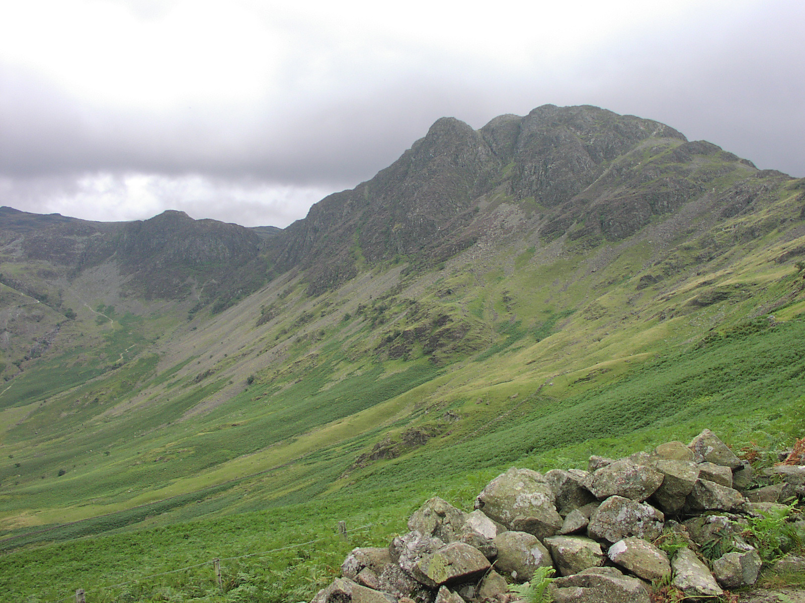
Blackbeck Tarn is a picturesque body of water located in Cumberland, a historic county in northwestern England. Situated amidst the stunning Lake District National Park, it is often referred to as a tarn, which is a term used to describe a small mountain lake. The tarn is nestled within a peaceful and idyllic setting, surrounded by lush greenery and rolling hills.

With a surface area of approximately 10 acres, Blackbeck Tarn boasts crystal-clear freshwater that reflects the beauty of its surroundings. The tarn is fed by a combination of rainfall and natural springs, ensuring a constant supply of clean, unpolluted water. Its depth varies, reaching up to 12 feet in some areas, making it a suitable habitat for a diverse range of flora and fauna.

The tarn is home to a variety of freshwater species, including fish such as brown trout and perch, which attract anglers seeking a peaceful fishing experience. Additionally, the surrounding marshlands provide a haven for many bird species, making it an ideal spot for birdwatching enthusiasts.

Visitors to Blackbeck Tarn can enjoy a range of activities, such as walking along the tranquil shores, picnicking amidst the scenic landscape, or simply taking in the serene atmosphere. The area surrounding the tarn is rich in natural beauty, with an abundance of wildflowers and wildlife to be discovered.

Overall, Blackbeck Tarn offers a sanctuary of natural beauty and tranquility within the enchanting Lake District. Its stunning vistas, diverse wildlife, and recreational opportunities make it a popular destination for nature lovers and those seeking a peaceful retreat in the heart of Cumberland.

If you have any feedback on the listing, please let us know in the comments section below.

Blackbeck Tarn Images

Images are sourced within 2km of 54.504102/-3.2339655 or Grid Reference NY2012. Thanks to Geograph Open Source API. All images are credited.

Operations at Hopper Quarry Hopper Quarry is part of the workings at the Honister Quarries. At the time the image was recorded no work was going on at this site but it's clear that waste slate is being crushed into tiny flakes then added to the growing heap beside and beyond the machinery; what happens to it next is unknown.
Operations at Hopper Quarry
Hopper Quarry is part of the workings at the Honister Quarries. At the time the image was recorded no work was going on at this site but it's clear that waste slate is being crushed into tiny flakes then added to the growing heap beside and beyond the machinery; what happens to it next is unknown.
Shed partly inundated by slate fragments The small corrugated metal shed is at the Hopper Quarry of the Honister Slate Quarries. Apparently waste slate from earlier workings is being crushed into tiny flakes and then added to the tip; the machinery involved may be seen in another image - <a title="https://www.geograph.org.uk/photo/6937758" href="https://www.geograph.org.uk/photo/6937758">Link</a> .
Some years before work was seen at the quarry when it appeared that waste slate was being processed - <a title="https://www.geograph.org.uk/photo/3562933" href="https://www.geograph.org.uk/photo/3562933">Link</a> . It seems that that work was preparatory and the real business of dealing with the quarry spoil is now on-going.
What is being done with the mound of slate flakes is not known.
Shed partly inundated by slate fragments
The small corrugated metal shed is at the Hopper Quarry of the Honister Slate Quarries. Apparently waste slate from earlier workings is being crushed into tiny flakes and then added to the tip; the machinery involved may be seen in another image - Link . Some years before work was seen at the quarry when it appeared that waste slate was being processed - Link . It seems that that work was preparatory and the real business of dealing with the quarry spoil is now on-going. What is being done with the mound of slate flakes is not known.
Survey marker Ordnance Survey (?) marker on the eastermost top of Grey Knotts. This may correspond to the survey point or bench mark shown on 19th-century 25" and 6" maps. There is also a rivet (bottom left of photo) and another rivet on the other side of the little cairn (not in the photo). 2287 feet above old datum.
Survey marker
Ordnance Survey (?) marker on the eastermost top of Grey Knotts. This may correspond to the survey point or bench mark shown on 19th-century 25" and 6" maps. There is also a rivet (bottom left of photo) and another rivet on the other side of the little cairn (not in the photo). 2287 feet above old datum.
A Frosty Dub's Hut in the Sunset This ex-quarry building is now maintained as a basic hiking shelter by volunteers of the Mountain Bothies Association with permission of the landowners.
A Frosty Dub's Hut in the Sunset
This ex-quarry building is now maintained as a basic hiking shelter by volunteers of the Mountain Bothies Association with permission of the landowners.
Warnscale Head Bothy Maintained by volunteers of the Mountain Bothies Association with permission of the landowner. This small hiking shelter is made from local stone and so blends in well with its surroundings.
Warnscale Head Bothy
Maintained by volunteers of the Mountain Bothies Association with permission of the landowner. This small hiking shelter is made from local stone and so blends in well with its surroundings.
Perched boulder on rock slabs The boulder is in rough, complex hill country south of Blackbeck Tarn.
Grey Knotts and Brandreth are two mountain tops on the horizon beyond.
Perched boulder on rock slabs
The boulder is in rough, complex hill country south of Blackbeck Tarn. Grey Knotts and Brandreth are two mountain tops on the horizon beyond.
Path descending to cross cleft between mountains The path on a shelf below crags is descending to cross the stream which issues from Blackbeck Tarn in the cleft before rising again to the camera location. Haystacks is the mountain across the void.
Path descending to cross cleft between mountains
The path on a shelf below crags is descending to cross the stream which issues from Blackbeck Tarn in the cleft before rising again to the camera location. Haystacks is the mountain across the void.
Striddle Crag of Fleetwith Pike The crag is beyond the two walkers along the path which is close to Little Round How.
Striddle Crag of Fleetwith Pike
The crag is beyond the two walkers along the path which is close to Little Round How.
Base of Drum House The Drum House was the location of winding equipment - presumably a large-diameter, vertically mounted drum around which a cable was wound by its rotation. Trucks were hauled along the causeway which is seen reaching the base and also presumably, lowered to Honister Pass. The route to and from the location is now in use as a path.
Base of Drum House
The Drum House was the location of winding equipment - presumably a large-diameter, vertically mounted drum around which a cable was wound by its rotation. Trucks were hauled along the causeway which is seen reaching the base and also presumably, lowered to Honister Pass. The route to and from the location is now in use as a path.
Warnscale Head Bothy, Lake District Lovely bothy with a remarkable view.
Warnscale Head Bothy, Lake District
Lovely bothy with a remarkable view.
Heading for Haystacks from Little Round How
Approaching Haystacks from the East
Blackbeck Tarn
Blackbeck Tarn
Pitched path dropping to Black Beck
Looking up Warnscale Beck That's the far beck, not the one in the foreground which is unnamed.
Looking up Warnscale Beck
That's the far beck, not the one in the foreground which is unnamed.
The path near Blackbeck Tarn With Black Beck in the foreground.
The path near Blackbeck Tarn
With Black Beck in the foreground.
A view of Blackbeck Tarn
Black Beck with Blackbeck Tarn beyond
Show me another place!

Blackbeck Tarn is located at Grid Ref: NY2012 (Lat: 54.504102, Lng: -3.2339655)

Administrative County: Cumbria

District: Allerdale

Police Authority: Cumbria

What 3 Words

///perfect.dispensed.middle. Near Keswick, Cumbria

Nearby Locations

Seavy Knott Blackbeck Tarn

Related Wikis

Blackbeck Tarn

Blackbeck Tarn is a small tarn in Cumbria, England, situated near the summit of Haystacks in the Buttermere Valley. At an elevation of 486 m (1,594 ft...

Innominate Tarn

Innominate Tarn is a small tarn in the north of the Lake District National Park in England. It is situated at 520 metres above sea level, near the summit...

Haystacks (Lake District)

Haystacks, or Hay Stacks, is a hill in England's Lake District, situated at the south-eastern end of the Buttermere Valley. Although not of any great elevation...

Cumbria

Cumbria ( KUM-bree-ə) is a ceremonial county in North West England. It borders the Scottish council areas of Dumfries and Galloway and Scottish Borders...

Nearby Amenities

Located within 500m of 54.504102,-3.2339655
Source: npe
Lat/Long: 54.5051537/-3.2409691
Source: npe
Lat/Long: 54.5053024/-3.2410745
Source: npe
Lat/Long: 54.5055245/-3.2412844
Source: npe
Lat/Long: 54.505811/-3.2411193
Source: npe
Lat/Long: 54.5054834/-3.2403627
Source: npe
Lat/Long: 54.5051763/-3.2407358
Source: npe
Lat/Long: 54.5049821/-3.2347585
Source: npe
Lat/Long: 54.5047703/-3.2341571
Source: npe
Lat/Long: 54.5045415/-3.2337411
Source: npe
Lat/Long: 54.5036638/-3.2333321
Source: npe
Lat/Long: 54.5035657/-3.2335558
Source: npe
Lat/Long: 54.5041625/-3.2345975
Source: npe
Lat/Long: 54.5046074/-3.2345734
Source: npe
Lat/Long: 54.5047554/-3.2347268
Ford: stepping_stones
Lat/Long: 54.5053029/-3.2354071
Ford: yes
Lat/Long: 54.5083199/-3.2321929
Blackbeck Lead Mine
Disused: yes
Historic: mine
Mineral: lead
Lat/Long: 54.5068689/-3.236533
Seavy Knott
Ele: 544
Natural: peak
Source: www.hill-bagging.co.uk
Lat/Long: 54.5002434/-3.2311222
Innominate Peak
Ele: 545
Natural: peak
Source: www.hill-bagging.co.uk
Lat/Long: 54.5043123/-3.2410342
Haystacks SE Top
Ele: 543
Natural: peak
Source: www.hill-bagging.co.uk
Lat/Long: 54.5031344/-3.2376027
Green Crag
Ele: 528
Natural: peak
Source: www.hill-bagging.co.uk
Lat/Long: 54.506537/-3.233164
The data included in this document is from www.openstreetmap.org. The data is made available under ODbL.

Have you been to Blackbeck Tarn?

Leave your review of Blackbeck Tarn below (or comments, questions and feedback).