Craigie Pool

Lake, Pool, Pond, Freshwater Marsh in Peeblesshire

Scotland

Craigie Pool

Making silage bales, Stobo A tractor with a baler collecting up grass for silage in a field next to the River Tweed.
Making silage bales, Stobo Credit: Jim Barton

Craigie Pool is a picturesque freshwater marsh located in Peeblesshire, Scotland. Nestled amidst the scenic rolling hills and lush greenery, this natural gem offers a tranquil retreat for both locals and visitors alike. With an area of approximately 2 hectares, it serves as a haven for a diverse range of flora and fauna.

The pool itself is a shallow body of freshwater surrounded by dense vegetation, including reeds, rushes, and water lilies. These plants provide vital habitats for various species of birds, amphibians, and insects. Birdwatchers will delight in the opportunity to spot species such as the Eurasian teal, mallard ducks, and common snipes, among others. The pool is also home to several species of fish, such as the brown trout and perch.

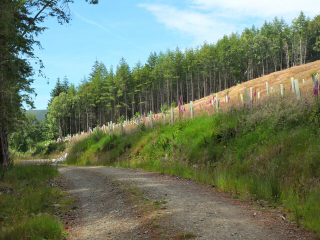
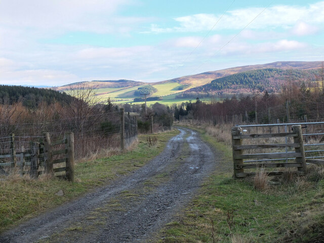
Visitors can explore the area via a network of well-maintained footpaths that wind their way through the marsh. These paths offer stunning views of the surrounding countryside and allow for peaceful walks and nature observation. Additionally, there are several strategically placed benches and observation points where visitors can pause and take in the natural beauty of the pool.

Craigie Pool is a popular destination for nature lovers and photographers, as it provides ample opportunities for capturing stunning vistas and close-up shots of the diverse wildlife. The pool's serene atmosphere and unspoiled environment make it an ideal spot for relaxation and contemplation. Whether one is seeking a peaceful stroll, a birdwatching adventure, or simply a chance to connect with nature, Craigie Pool is a place that promises to leave a lasting impression.

If you have any feedback on the listing, please let us know in the comments section below.
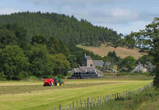
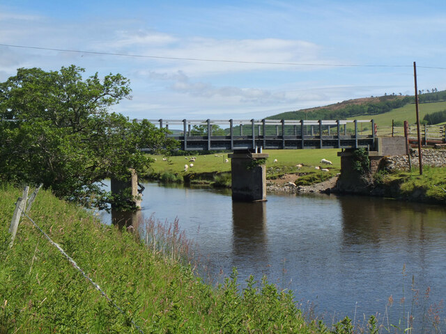
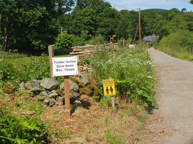
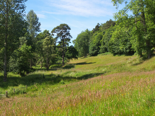
Craigie Pool Images

Images are sourced within 2km of 55.619311/-3.3005415 or Grid Reference NT1836. Thanks to Geograph Open Source API. All images are credited.

Making silage bales, Stobo A tractor with a baler collecting up grass for silage in a field next to the River Tweed.
Making silage bales, Stobo
A tractor with a baler collecting up grass for silage in a field next to the River Tweed.
Silage making, Stobo Two tractors at work, one raking the grass into rows and the other producing round bales.
Silage making, Stobo
Two tractors at work, one raking the grass into rows and the other producing round bales.
Silage making, Stobo (2) A tractor and baler in a field next to the Tweed. Stobo Kirk is in the background.
Silage making, Stobo (2)
A tractor and baler in a field next to the Tweed. Stobo Kirk is in the background.
Recycled plastic bridge, Easter Dawyck The Easter Dawyck bridge over the Tweed was completed in 2011, replacing a previous bridge that dated from 1920. This new bridge was constructed by an American company from 50 tonnes of recycled plastic derived from plastic bottles and scrap car bumpers. At 27m overall in three spans it is thought to be the world's longest bridge made from recycled composite material. See NT1837 : Tweed Bridge, Stobo for a general view. Source: 'Bridging the Tweed' by Jim Lyon (author publication 2019).
Recycled plastic bridge, Easter Dawyck
The Easter Dawyck bridge over the Tweed was completed in 2011, replacing a previous bridge that dated from 1920. This new bridge was constructed by an American company from 50 tonnes of recycled plastic derived from plastic bottles and scrap car bumpers. At 27m overall in three spans it is thought to be the world's longest bridge made from recycled composite material. See NT1837 : Tweed Bridge, Stobo for a general view. Source: 'Bridging the Tweed' by Jim Lyon (author publication 2019).
Signs at the road end, Stobo On the lane to Easterknowe farm, also on the John Buchan Way.
Signs at the road end, Stobo
On the lane to Easterknowe farm, also on the John Buchan Way.
Valley of the Easton Burn, Stobo Two burns, the Easton and Weston, drain eastwards from the Broughton hills into the Tweed.
Valley of the Easton Burn, Stobo
Two burns, the Easton and Weston, drain eastwards from the Broughton hills into the Tweed.
John Buchan Way near Harrowhope Summer grasses in the meadow alongside the Easton Burn.
John Buchan Way near Harrowhope
Summer grasses in the meadow alongside the Easton Burn.
Tree planting on Harrow Hill Broadleaved trees have been planted around the edge of the clear-felled section shown in <a href="https://www.geograph.org.uk/photo/6789832">NT1637 : Clear-felled ground, Harrow Hill</a>.
Tree planting on Harrow Hill
Broadleaved trees have been planted around the edge of the clear-felled section shown in NT1637 : Clear-felled ground, Harrow Hill.
Silage bales at Stobo Silage baling in the field shown in <a href="https://www.geograph.org.uk/photo/7223568">NT1837 : Making silage bales, Stobo</a> has now been completed. When we passed this spot about an hour later, the bales were being machine-wrapped in black plastic to finish the process.
Silage bales at Stobo
Silage baling in the field shown in NT1837 : Making silage bales, Stobo has now been completed. When we passed this spot about an hour later, the bales were being machine-wrapped in black plastic to finish the process.
Stobo Castle, Near Peebles Stobo Castle Health Spa
Stobo Castle, Near Peebles
Stobo Castle Health Spa
Stobo Castle, Near Peebles Stobo Castle Health Spa
Stobo Castle, Near Peebles
Stobo Castle Health Spa
Stobo Castle, Near Peebles Stobo Castle Health Spa
Stobo Castle, Near Peebles
Stobo Castle Health Spa
Stobo Castle, Near Peebles Stobo Castle Health Spa
Stobo Castle, Near Peebles
Stobo Castle Health Spa
Stobo Castle, Near Peebles Sculpture
Stobo Castle, Near Peebles
Sculpture
Sheep in the pen, Stobo Sheep being moved to a pen on the track near the Easton Burn, also used by the John Buchan Way.
Sheep in the pen, Stobo
Sheep being moved to a pen on the track near the Easton Burn, also used by the John Buchan Way.
Track junction, Stobo The waymark indicates that the John Buchan Way keeps to the left.
Track junction, Stobo
The waymark indicates that the John Buchan Way keeps to the left.
Farm track from Stobohope The track to Stobo Castle and Home Farm. The dip in the skyline ahead is the route of the John Buchan Way over the ridge to Glack Hope and the Manor Valley.
Farm track from Stobohope
The track to Stobo Castle and Home Farm. The dip in the skyline ahead is the route of the John Buchan Way over the ridge to Glack Hope and the Manor Valley.
Stobo Castle The castle was completed in 1811, replacing an earlier house on the site. Now it is a hotel and health spa.
Stobo Castle
The castle was completed in 1811, replacing an earlier house on the site. Now it is a hotel and health spa.
Show me another place!

Craigie Pool is located at Grid Ref: NT1836 (Lat: 55.619311, Lng: -3.3005415)

Unitary Authority: The Scottish Borders

Police Authority: The Lothians and Scottish Borders

What 3 Words

///jigging.domain.cringes. Near Peebles, Scottish Borders

Nearby Locations

Craigie Pool Lour Wood

Related Wikis

Stobo Kirk

Stobo Kirk is an ancient church of the Church of Scotland. It is dedicated to St Mungo and is situated near the B712 off the A72 just 6 miles south-west...

Upper Tweeddale National Scenic Area

The Upper Tweeddale National Scenic Area lies in the Borders region of Scotland. It is one of 40 national scenic areas (NSA) in Scotland, which are defined...
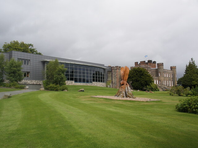
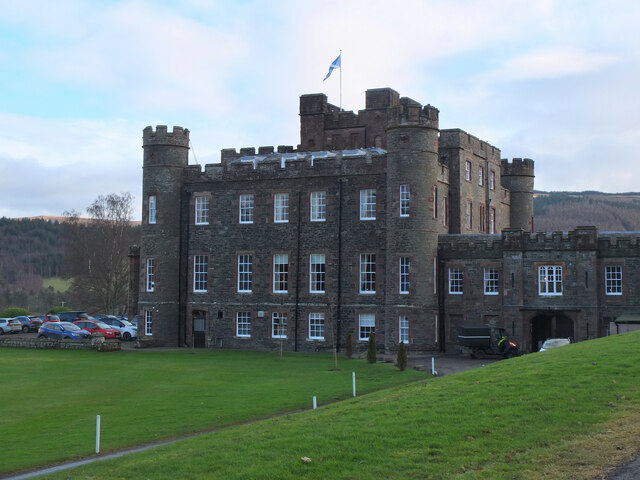
Stobo Castle

Stobo Castle is located at Stobo in the Scottish Borders, in the former county of Peeblesshire. The Manor of Stobo was originally owned by the Balfour...

Stobo railway station

Stobo railway station was a railway station in the Borders east of Biggar, serving the hamlet of Stobo; a rural community within the Parish of Stobo....

Nearby Amenities

Located within 500m of 55.619311,-3.3005415
Bus Stop
Village Hall
Bus: yes
Local Ref: AT
Naptan AtcoCode: 69001110
Naptan Bearing: SW
Naptan CommonName: Village Hall
Naptan Indicator: at
Naptan Landmark: Stobo Hall
Naptan NaptanCode: 72726859
Naptan Street: B712
Operator: Scottish Borders Council
Public Transport: platform
Ref: 69001110
Source: NaPTAN
Lat/Long: 55.6191633/-3.3051071
Bus Stop
Village Hall
Bus: yes
Naptan AtcoCode: 69001546
Naptan Bearing: NE
Naptan CommonName: Village Hall
Naptan Indicator: opp
Naptan Landmark: Village Hall
Naptan NaptanCode: 72732363
Naptan Street: B712
Operator: Scottish Borders Council
Public Transport: platform
Ref: 69001546
Source: NaPTAN
Lat/Long: 55.619208/-3.3052707
Barrier: stile
Lat/Long: 55.6184579/-3.3022177
Power: pole
Lat/Long: 55.6153896/-3.3012266
Power: pole
Lat/Long: 55.6160406/-3.3004312
Power: pole
Lat/Long: 55.6167323/-3.2995851
Power: pole
Lat/Long: 55.6183581/-3.2976242
Power: pole
Lat/Long: 55.6175459/-3.2986037
Power: pole
Lat/Long: 55.6178755/-3.2994666
Power: pole
Lat/Long: 55.618247/-3.3004333
Power: pole
Lat/Long: 55.6184919/-3.3010722
Power: pole
Lat/Long: 55.6186388/-3.3017279
Power: pole
Lat/Long: 55.6189506/-3.3029781
Power: pole
Lat/Long: 55.6192301/-3.3041732
Power: pole
Lat/Long: 55.6195239/-3.3051336
Power: pole
Lat/Long: 55.6198584/-3.306003
Power: pole
Lat/Long: 55.6201988/-3.3068512
Power: pole
Lat/Long: 55.6205225/-3.307727
Power: pole
Lat/Long: 55.6191584/-3.2966384
Power: pole
Lat/Long: 55.6196959/-3.2959912
Power: pole
Lat/Long: 55.6202334/-3.2953312
Power: pole
Lat/Long: 55.6207709/-3.2947029
Power: pole
Lat/Long: 55.6215509/-3.2937468
Power: pole
Lat/Long: 55.6237438/-3.299896
Power: pole
Lat/Long: 55.6181359/-3.3067053
The data included in this document is from www.openstreetmap.org. The data is made available under ODbL.

Have you been to Craigie Pool?

Leave your review of Craigie Pool below (or comments, questions and feedback).