Harlaw Reservoir

Lake, Pool, Pond, Freshwater Marsh in Midlothian

Scotland

Harlaw Reservoir

Boats at Threipmuir Reservoir Boats on the shore of Threipmuir Reservoir below the fishing hut. The level of water in the Reservoir is very low. Easter Bavelaw Farm can be seen on the far side of the Reservoir. Hare Hill <a href="https://www.geograph.org.uk/gridref/NT1761">NT1761</a> lies beyond the Farm, with East Kip <a href="https://www.geograph.org.uk/gridref/NT1860">NT1860</a> and West Kip <a href="https://www.geograph.org.uk/gridref/NT1760">NT1760</a> on the skyline.
Boats at Threipmuir Reservoir Credit: Oliver Dixon

The requested URL returned error: 429 Too Many Requests

If you have any feedback on the listing, please let us know in the comments section below.

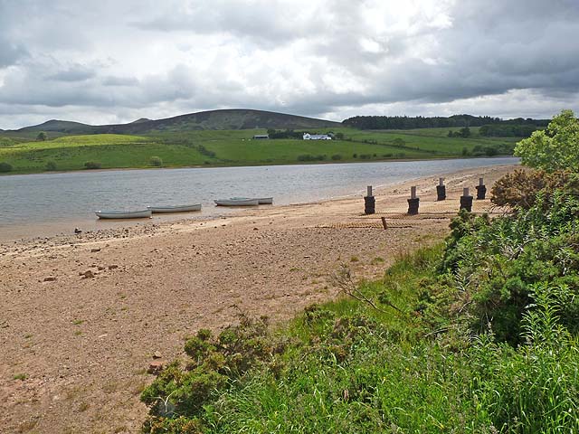
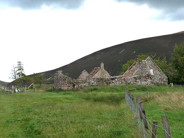
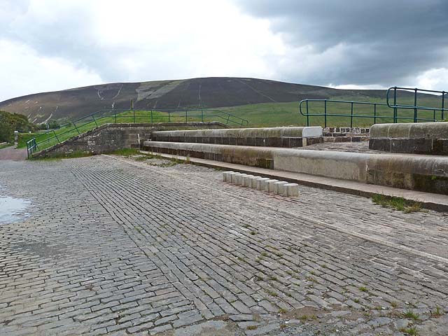
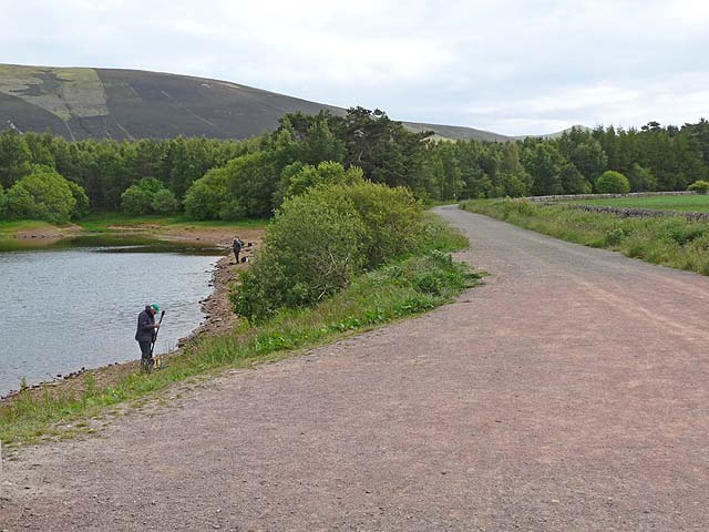
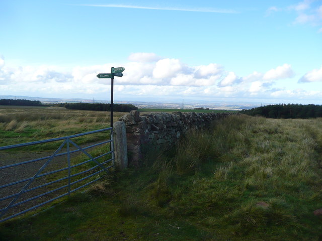
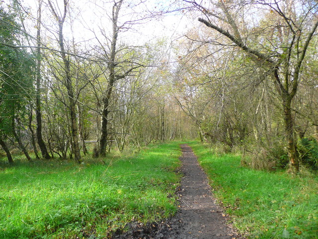
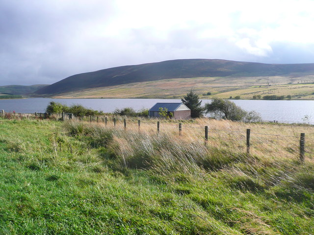
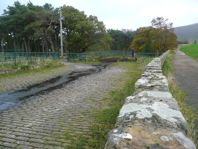
Harlaw Reservoir Images

Images are sourced within 2km of 55.871592/-3.3113442 or Grid Reference NT1865. Thanks to Geograph Open Source API. All images are credited.

Boats at Threipmuir Reservoir Boats on the shore of Threipmuir Reservoir below the fishing hut. The level of water in the Reservoir is very low. Easter Bavelaw Farm can be seen on the far side of the Reservoir. Hare Hill <a href="https://www.geograph.org.uk/gridref/NT1761">NT1761</a> lies beyond the Farm, with East Kip <a href="https://www.geograph.org.uk/gridref/NT1860">NT1860</a> and West Kip <a href="https://www.geograph.org.uk/gridref/NT1760">NT1760</a> on the skyline.
Boats at Threipmuir Reservoir
Boats on the shore of Threipmuir Reservoir below the fishing hut. The level of water in the Reservoir is very low. Easter Bavelaw Farm can be seen on the far side of the Reservoir. Hare Hill NT1761 lies beyond the Farm, with East Kip NT1860 and West Kip NT1760 on the skyline.
Threipmuir Farm Youth Vision secured a long lease on Threipmuir Farm Steading in 2009 and applied to the Heritage Lottery for funds to stop it from falling down. They are in the process of replacing the roof, in the course of which youth groups are learning about the archaeology and history of the building and surrounding land.

Black Hill <a href="https://www.geograph.org.uk/gridref/NT1863">NT1863</a> dominates the skyline beyond.
Threipmuir Farm
Youth Vision secured a long lease on Threipmuir Farm Steading in 2009 and applied to the Heritage Lottery for funds to stop it from falling down. They are in the process of replacing the roof, in the course of which youth groups are learning about the archaeology and history of the building and surrounding land. Black Hill NT1863 dominates the skyline beyond.
Spillway at Threipmuir Reservoir The spillway carries surplus water from Threipmuir Reservoir down into Harlaw Reservoir, as part of a system to control flows in the Water of Leith. The level of water in the reservoir at the time of the photograph was a long way below that required to bring the spillway into operation.

Black Hill <a href="https://www.geograph.org.uk/gridref/NT1863">NT1863</a> beyond.
Spillway at Threipmuir Reservoir
The spillway carries surplus water from Threipmuir Reservoir down into Harlaw Reservoir, as part of a system to control flows in the Water of Leith. The level of water in the reservoir at the time of the photograph was a long way below that required to bring the spillway into operation. Black Hill NT1863 beyond.
Pine trees beside Harlaw Reservoir Black Hill <a href="https://www.geograph.org.uk/gridref/NT1863">NT1863</a> beyond.
Pine trees beside Harlaw Reservoir
Black Hill NT1863 beyond.
Path beside Harlaw Reservoir Showing the north-west corner of Harlaw Reservoir, a popular spot for anglers. The path round the Reservoir is frequented by walkers and cyclists.

Black Hill <a href="https://www.geograph.org.uk/gridref/NT1863">NT1863</a> beyond.
Path beside Harlaw Reservoir
Showing the north-west corner of Harlaw Reservoir, a popular spot for anglers. The path round the Reservoir is frequented by walkers and cyclists. Black Hill NT1863 beyond.
Inlet on Harlaw Reservoir A stream enters the reservoir at its easternmost point.
Inlet on Harlaw Reservoir
A stream enters the reservoir at its easternmost point.
Control valve on Harlaw Reservoir Bridge out from  Harlaw Reservoir dam to the control mechanism.  An angler fishes from the foot of the dam.

West Kip <a href="https://www.geograph.org.uk/gridref/NT1760">NT1760</a> in the Pentland Hills can be seen on the skyline.
Control valve on Harlaw Reservoir
Bridge out from Harlaw Reservoir dam to the control mechanism. An angler fishes from the foot of the dam. West Kip NT1760 in the Pentland Hills can be seen on the skyline.
Gabions by Harlaw Reservoir Adjoining the eastern end of the dam.
Gabions by Harlaw Reservoir
Adjoining the eastern end of the dam.
Harlaw Reservoir outflows Banks supported by gabions.
Harlaw Reservoir outflows
Banks supported by gabions.
Path junction at Cock Rig Right for Currie, left for Balerno.
Path junction at Cock Rig
Right for Currie, left for Balerno.
Path through Redford Wood
Shed by Threipmuir Reservoir Threipmuir Reservoir was completed in 1848 as a water supply for Edinburgh.  Nowadays Threipmuir, along with the smaller Harlaw reservoir, provides essential upstream flood storage to prevent flooding of the Water of Leith, but is no longer used for water supply.
Shed by Threipmuir Reservoir
Threipmuir Reservoir was completed in 1848 as a water supply for Edinburgh. Nowadays Threipmuir, along with the smaller Harlaw reservoir, provides essential upstream flood storage to prevent flooding of the Water of Leith, but is no longer used for water supply.
Spillway and bridge between Threipmuir and Harlaw Reservoirs These two reservoirs were completed in the mid-19th century as a water supply for Edinburgh. Nowadays they provides essential upstream flood storage to prevent flooding of the Water of Leith, but are no longer used for water supply.
Spillway and bridge between Threipmuir and Harlaw Reservoirs
These two reservoirs were completed in the mid-19th century as a water supply for Edinburgh. Nowadays they provides essential upstream flood storage to prevent flooding of the Water of Leith, but are no longer used for water supply.
Through the trees to Harlaw Reservoir Threipmuir and Harlaw Reservoirs were completed in 1848 as a water supply for Edinburgh. Nowadays these reservoirs provide essential upstream flood storage to prevent flooding of the Water of Leith, but are no longer used for water supply.
Through the trees to Harlaw Reservoir
Threipmuir and Harlaw Reservoirs were completed in 1848 as a water supply for Edinburgh. Nowadays these reservoirs provide essential upstream flood storage to prevent flooding of the Water of Leith, but are no longer used for water supply.
Black Hill & Threipmuir Reservoir Black Hill, Threipmuir Reservoir and former Ice Age Glacial Channel
Black Hill & Threipmuir Reservoir
Black Hill, Threipmuir Reservoir and former Ice Age Glacial Channel
Winter wheat at Kinleith Nicely germinated, and looking up the slope to the Whiteside Plantation.
Winter wheat at Kinleith
Nicely germinated, and looking up the slope to the Whiteside Plantation.
Shelter belt by the Kinleith Burn A group of pines, part of the Whiteside Plantations. The lean is genuine - looking south, so the prevailing winds come from the right and at 260 m a.s.l. in the Pentlands they can have quite an effect on the vegetation.
Shelter belt by the Kinleith Burn
A group of pines, part of the Whiteside Plantations. The lean is genuine - looking south, so the prevailing winds come from the right and at 260 m a.s.l. in the Pentlands they can have quite an effect on the vegetation.
Winter wheat at Kinleith Last harvest's stubble in the foreground and next year's crop just emerging in the field beyond. Capelaw Hill on the skyline, under some nice lenticular or wave clouds.
Winter wheat at Kinleith
Last harvest's stubble in the foreground and next year's crop just emerging in the field beyond. Capelaw Hill on the skyline, under some nice lenticular or wave clouds.
Show me another place!

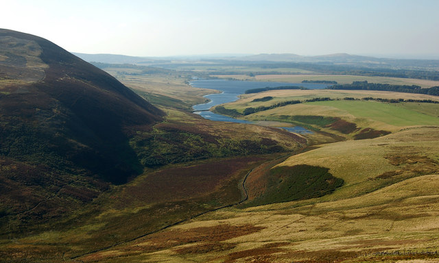
Harlaw Reservoir is located at Grid Ref: NT1865 (Lat: 55.871592, Lng: -3.3113442)

Unitary Authority: City of Edinburgh

Police Authority: Edinburgh

What 3 Words

///agents.speeded.couches. Near Balerno, Edinburgh

Nearby Locations

Harlaw Reservoir

Related Wikis

Harlaw Reservoir

Harlaw Reservoir is a small reservoir in the City of Edinburgh Council area, Scotland, UK, situated at the base of the Pentland Hills near Currie and Balerno...

Threipmuir Reservoir

Threipmuir Reservoir is a reservoir in the City of Edinburgh Council area, Scotland, UK. It is situated to the south of Edinburgh at the base of the Pentland...

Edinburgh South West (UK Parliament constituency)

Edinburgh South West is a Scottish constituency of the House of Commons of the Parliament of the United Kingdom, first used at the 2005 UK general election...

Lennox Tower

Lennox Tower is a ruinous fifteenth-century tower house at Lymphoy, near the Water of Leith, between Balerno and Currie, 11 kilometres (6.8 mi) south-west...

Nearby Amenities

Located within 500m of 55.871592,-3.3113442
Barrier: stile
Lat/Long: 55.8697625/-3.3047835
Tourism: information
Lat/Long: 55.8733908/-3.3107178
Cafe
Vanilla Pod
Opening Hours: Fr-Su 10:00-17:00
Lat/Long: 55.8733622/-3.3106514
Bench
Covered: yes
Seats: 4
Lat/Long: 55.875528/-3.3098121
Bench
Backrest: no
Colour: brown
Material: wood
Seats: 2
Survey Date: 2020-11-21
Lat/Long: 55.8736659/-3.311021
Location Transition: yes
Power: pole
Transformer: distribution
Lat/Long: 55.8735138/-3.3107847
Entrance: main
Lat/Long: 55.8733979/-3.3105882
Pentland Hills Regional Park
Bicycle: yes
Hiking: yes
Information: map
Map Size: site
Map Type: topo
Tourism: information
Lat/Long: 55.8732954/-3.3104314
Information: board
Tourism: information
Lat/Long: 55.8733028/-3.3104469
Bench
Backrest: yes
Material: wood
Lat/Long: 55.8732463/-3.3104669
Bicycle Parking
Bicycle Parking: stands
Capacity: 2
Lat/Long: 55.8733441/-3.3105138
Defibrillator
Access: yes
Defibrillator Location: Harlaw House Visitor Centre, outside wall facing the reservoir
Emergency: defibrillator
Indoor: no
Opening Hours: 24/7
Operator: St John Scotland
Lat/Long: 55.8732608/-3.310465
Harlaw Hydro
Generator Method: water-storage
Generator Output Electricity: 85 kW
Generator Source: hydro
Generator Type: francis_turbine
Power: generator
Start Date: 2015
Website: https://www.harlawhydro.org.uk/
Lat/Long: 55.8731463/-3.3118683
Leisure: picnic_table
Lat/Long: 55.8733102/-3.3107832
Leisure: picnic_table
Lat/Long: 55.8732564/-3.3107459
Bench
Lat/Long: 55.8723143/-3.3119872
Bench
Lat/Long: 55.8723208/-3.3119755
Toilets
Lat/Long: 55.8733481/-3.3106405
The data included in this document is from www.openstreetmap.org. The data is made available under ODbL.

Have you been to Harlaw Reservoir?

Leave your review of Harlaw Reservoir below (or comments, questions and feedback).