Black Loch

Lake, Pool, Pond, Freshwater Marsh in Perthshire

Scotland

Black Loch

A923 Coupar Angus Road The A923 heading into Blairgowrie at Rosemount.
A923 Coupar Angus Road Credit: Scott Cormie

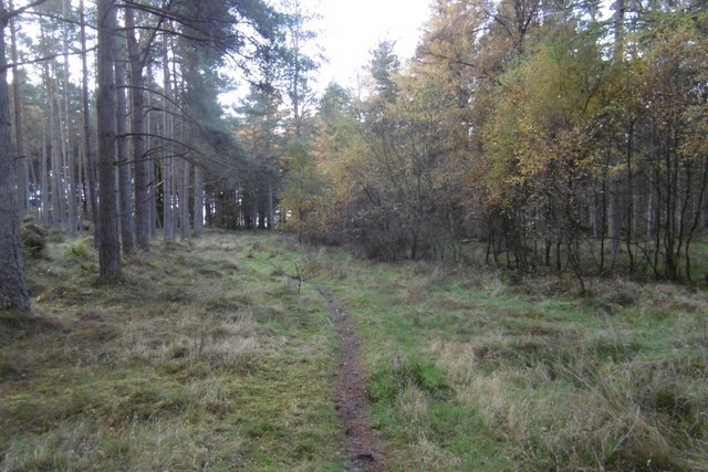
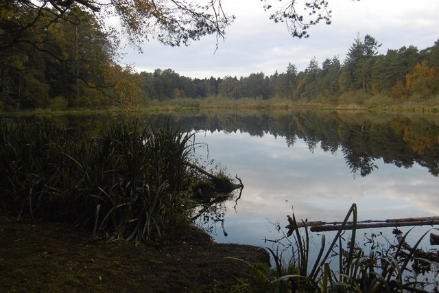
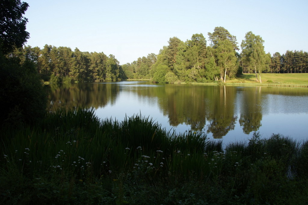
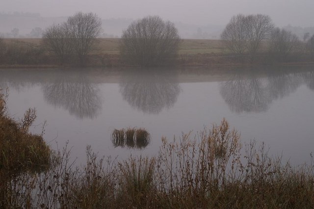
Black Loch, located in Perthshire, Scotland, is a picturesque freshwater loch nestled amidst the stunning Highland landscape. Covering an area of approximately 60 acres, it is a popular destination for outdoor enthusiasts and nature lovers alike.

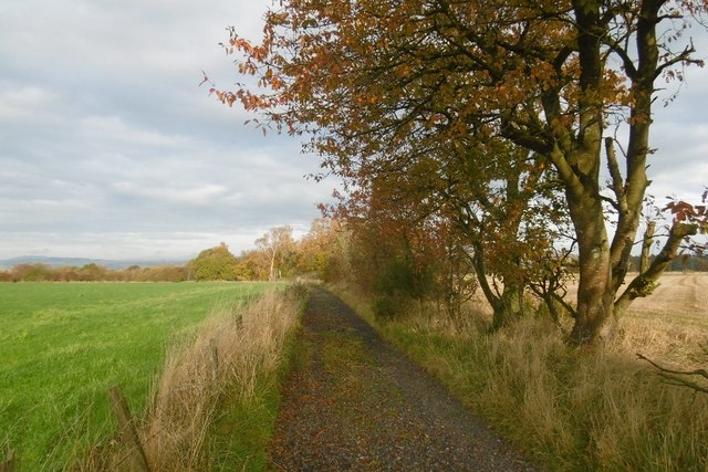
Surrounded by lush greenery and rolling hills, Black Loch offers a tranquil and serene atmosphere. The loch itself is a deep body of water, with its deepest point reaching around 30 feet. Its crystal-clear waters are fed by natural springs and small streams, ensuring a constant flow of freshwater.

The loch is home to a diverse range of aquatic flora and fauna. Anglers flock to the shores of Black Loch, as it is renowned for its excellent fishing opportunities. Trout, pike, and perch are commonly found in its waters, providing a thrilling experience for fishing enthusiasts.

The surrounding area of Black Loch is also a haven for birdlife, attracting a variety of species throughout the year. Visitors can spot graceful swans gliding across the water, as well as ducks, geese, and herons. The loch's freshwater marshes are particularly important for waterfowl, providing them with a rich feeding ground and a safe habitat.

For those seeking outdoor adventures, Black Loch offers plenty of opportunities for sailing, canoeing, and kayaking. Its calm waters and scenic surroundings make it an ideal location for water sports enthusiasts of all skill levels.

In conclusion, Black Loch in Perthshire is a breathtaking natural gem, offering a peaceful and idyllic setting for fishing, birdwatching, and water-based activities. It is a must-visit destination for individuals seeking solace in nature's beauty.

If you have any feedback on the listing, please let us know in the comments section below.

Black Loch Images

Images are sourced within 2km of 56.569232/-3.3435296 or Grid Reference NO1742. Thanks to Geograph Open Source API. All images are credited.

A923 Coupar Angus Road The A923 heading into Blairgowrie at Rosemount.
A923 Coupar Angus Road
The A923 heading into Blairgowrie at Rosemount.
Stormont Crossing Cottage White house viewed from the A923 near Stormont Loch.
Stormont Crossing Cottage
White house viewed from the A923 near Stormont Loch.
Hazelwood Road, Ardblair Beside Blairgowrie's cemetery.
Hazelwood Road, Ardblair
Beside Blairgowrie's cemetery.
Hazelwood Road, Ardblair Beside Blairgowrie cemetery.
Hazelwood Road, Ardblair
Beside Blairgowrie cemetery.
Blairgowrie Golf Club One of the three courses south of Blairgowrie.
Blairgowrie Golf Club
One of the three courses south of Blairgowrie.
Lansdowne Course One of the Blairgowrie Golf Club courses set in woodland south of the town.  This is taken from near the 2nd tee.
Lansdowne Course
One of the Blairgowrie Golf Club courses set in woodland south of the town. This is taken from near the 2nd tee.
Pinewoods and path, Blairgowrie Golf Club A path to Stormont Loch and Meikleour Wood passes through the golf courses.
Pinewoods and path, Blairgowrie Golf Club
A path to Stormont Loch and Meikleour Wood passes through the golf courses.
Sand trap at Blairgowrie A bunker beside what I suspect is the 17th fairway on the Lansdown Course.
Sand trap at Blairgowrie
A bunker beside what I suspect is the 17th fairway on the Lansdown Course.
Track across Meikleour Wood Much of the track runs through the Lansdowne course at Blairgowrie Golf Club.
Track across Meikleour Wood
Much of the track runs through the Lansdowne course at Blairgowrie Golf Club.
Meikleour Wood The southern part of Meikleour Wood has not been affected by the golf club and is an attractive mainly Scots pine plantation on flat ground.
Meikleour Wood
The southern part of Meikleour Wood has not been affected by the golf club and is an attractive mainly Scots pine plantation on flat ground.
Pines, Meikleour Wood Beside the loch at Hare Myre.
Pines, Meikleour Wood
Beside the loch at Hare Myre.
Hare Myre One of the kettlehole lochs in Meikleour Wood. The infertile area, occupied by woodland is an outwash plain from glacial times. The lochs occupy depressions left when large ice bodies within the sands and gravels finally melted.
Hare Myre
One of the kettlehole lochs in Meikleour Wood. The infertile area, occupied by woodland is an outwash plain from glacial times. The lochs occupy depressions left when large ice bodies within the sands and gravels finally melted.
Meikleour Wood Singletrack to the south of Hare Myre.
Meikleour Wood
Singletrack to the south of Hare Myre.
Pines by Hare Myre Singletrack by Hare Myre in Meikleour Woods.
Pines by Hare Myre
Singletrack by Hare Myre in Meikleour Woods.
Long straight track An absolutely straight track across Meikleour Wood from Coupar Angus Road to Perth Road passing Stormont Loch.
Long straight track
An absolutely straight track across Meikleour Wood from Coupar Angus Road to Perth Road passing Stormont Loch.
Road, Whiteloch Muir The road serves a sewage works as well as farmland.
Road, Whiteloch Muir
The road serves a sewage works as well as farmland.
Road to Upper Gothens Autumn beeches on a farm access road near Blairgowrie.
Road to Upper Gothens
Autumn beeches on a farm access road near Blairgowrie.
Show me another place!

Black Loch is located at Grid Ref: NO1742 (Lat: 56.569232, Lng: -3.3435296)

Unitary Authority: Perth and Kinross

Police Authority: Tayside

What 3 Words

///binds.plans.odds. Near Blairgowrie, Perth & Kinross

Related Wikis

Black Loch (Perth and Kinross)

Black Loch is a small lowland freshwater loch that is located directly to the east of Fingask Loch in the valley of the Lunan Burn and is 1 mile south...

White Loch, Perth and Kinross

White Loch is a small lowland freshwater loch that is located directly to the east of Fingask Loch in the valley of the Lunan Burn and is 1.5 miles south...

Fingask Loch

Fingask Loch is a small lowland freshwater loch that is about three-quarters of a mile from Rae Loch in the valley of the Lunan Burn and is 1.5 miles south...

Rosemount Halt railway station

Rosemount Halt railway station served the suburb of Rosemount, Perth and Kinross, Scotland, from 1857 to 1955 on the Scottish Midland Junction Railway...

Stormont Loch

Stormont Loch is a small irregular lowland freshwater loch, that is partially in-filled. It located in a nature reserve owned by the Scottish Wildlife...

Blairgowrie High School

Blairgowrie High School is a high school in Blairgowrie, Scotland. Blairgowrie High School has 719 students (as of September census) from Blairgowrie and...

Blairgowrie Community Hospital

Blairgowrie Community Hospital is a health facility in Perth Road, Blairgowrie and Rattray, Scotland. It is managed by NHS Tayside. == History == The first...

Stormont Loch Halt railway station

Stormont Loch Halt railway station served the area of Stormont, Perth and Kinross, Scotland from 1920 to 1955 on the Scottish Midland Junction Railway...

Nearby Amenities

Located within 500m of 56.569232,-3.3435296
Noexit: yes
Lat/Long: 56.5681954/-3.3504945
Post Box
Collection Times: Mo-Fr 16:00; Sa 09:00
Operator: Royal Mail
Post Box Type: lamp
Ref: PH10 163
Royal Cypher: scottish_crown
Source: survey
Lat/Long: 56.5682944/-3.3473595
Recycling
Recycling Glass: yes
Recycling Type: container
Lat/Long: 56.5683426/-3.3473419
Bus Stop
Shelter: yes
Lat/Long: 56.5684456/-3.3472201
Carsie
Name Gd: Carsaidh
Place: village
Population: 140
Lat/Long: 56.5676887/-3.3492275
Noexit: yes
Lat/Long: 56.5668687/-3.3465646
Noexit: yes
Lat/Long: 56.5675592/-3.3466057
Power: pole
Lat/Long: 56.5682171/-3.3512487
Power: pole
Lat/Long: 56.5683335/-3.3499232
Power: pole
Lat/Long: 56.568482/-3.3491997
Power: pole
Lat/Long: 56.5685909/-3.348146
Power: pole
Lat/Long: 56.5692389/-3.3470282
The data included in this document is from www.openstreetmap.org. The data is made available under ODbL.

Have you been to Black Loch?

Leave your review of Black Loch below (or comments, questions and feedback).