Wast Water

Lake, Pool, Pond, Freshwater Marsh in Cumberland Copeland

England

Wast Water

Wastwater from SW side of Lingmell On the track up from the Wasdale Head Inn
Wastwater from SW side of Lingmell Credit: Johnny Coop

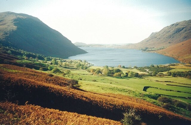
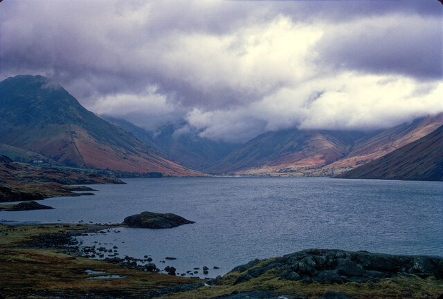
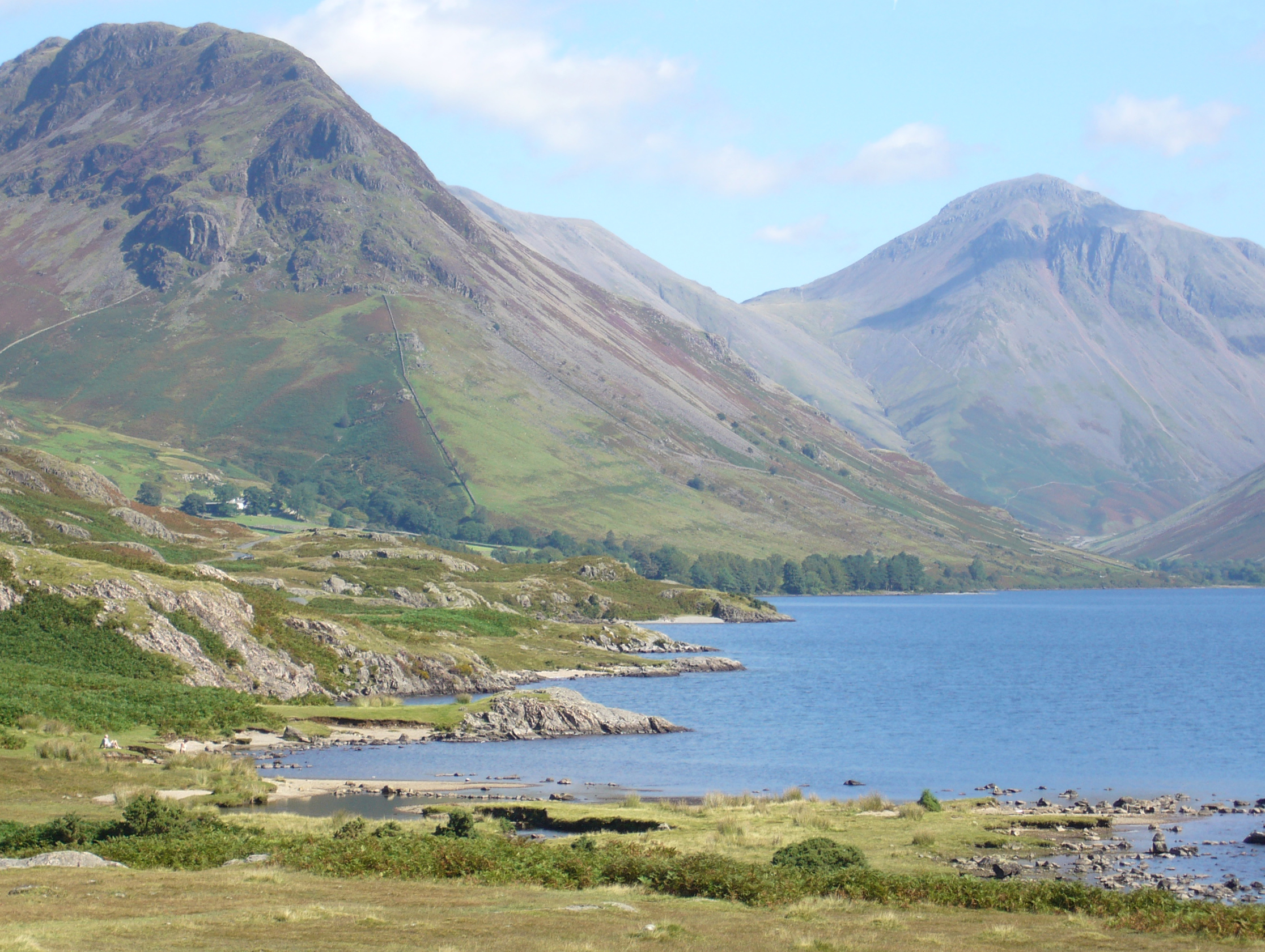
Wast Water, located in the county of Cumberland in the Lake District National Park, England, is a magnificent body of water often described as one of the most stunning lakes in the region. This glacial lake, also known as Wastwater, stretches over 3 miles in length and reaches depths of up to 258 feet, making it the deepest lake in England.

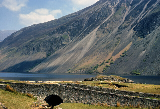
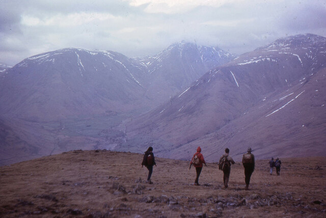
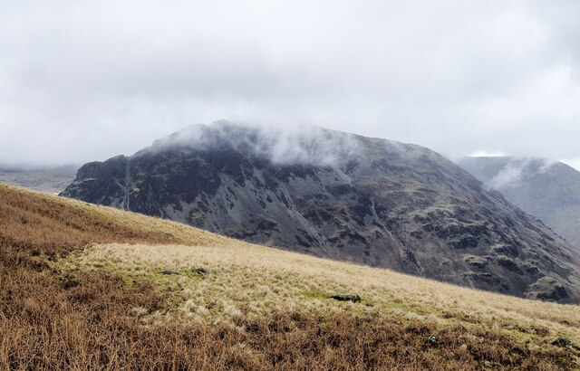
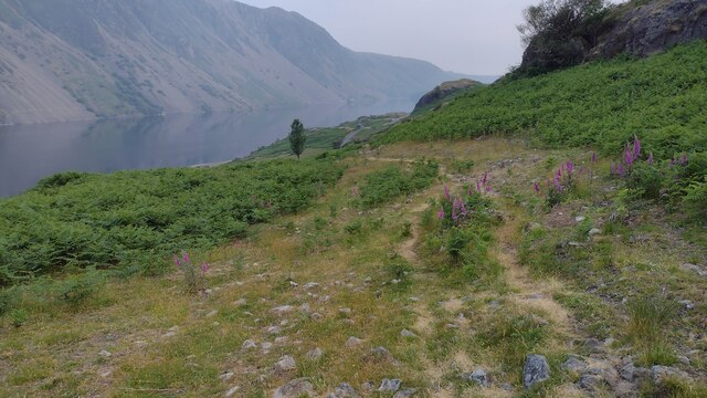
Surrounded by towering mountains, including the famous Scafell Pike, Wast Water offers a picturesque and dramatic landscape. The lake is renowned for its crystal-clear waters, which reflect the rugged peaks and rocky shores, creating a breathtaking panorama. Its unspoiled beauty attracts nature enthusiasts, hikers, and photographers from around the world.

Wast Water is home to various species of freshwater fish, such as brown trout and Arctic char, making it a popular destination for fishing enthusiasts. The lake also provides a habitat for several bird species, including the rare golden eagle and peregrine falcon. Additionally, the surrounding woodlands and marshes are home to diverse flora and fauna, adding to the area's ecological significance.

The lake's proximity to numerous hiking trails and its dramatic backdrop make it a popular destination for outdoor activities. The challenging climb up Scafell Pike, the highest mountain in England, begins near Wast Water, attracting avid hikers and mountaineers. The lake itself offers opportunities for boating, kayaking, and wild swimming, although caution is advised due to its deep and chilly waters.

In summary, Wast Water is a captivating glacial lake nestled in the stunning landscape of the Lake District National Park. Its crystal-clear waters, surrounded by majestic mountains, provide a haven for wildlife and outdoor enthusiasts seeking adventure and natural beauty.

If you have any feedback on the listing, please let us know in the comments section below.

Wast Water Images

Images are sourced within 2km of 54.443323/-3.2919693 or Grid Reference NY1606. Thanks to Geograph Open Source API. All images are credited.

Wastwater from SW side of Lingmell On the track up from the Wasdale Head Inn
Wastwater from SW side of Lingmell
On the track up from the Wasdale Head Inn
Path to Illgill Head from Wasdale Head The path provides a great view of Scafell on a clear day.
Path to Illgill Head from Wasdale Head
The path provides a great view of Scafell on a clear day.
The path from Wasdale Head to Illgill Head
Wast Water with brooding cloud Perhaps not the day to climb the hills.
Wast Water with brooding cloud
Perhaps not the day to climb the hills.
The Screes - Wast Water c.1970
Descending from Illgill Head Walkers descending from Illgill Head with fells around Wasdale Head in view: Kirk Fell, Great Gable (summit in cloud) and the flank of Lingmell.
Descending from Illgill Head
Walkers descending from Illgill Head with fells around Wasdale Head in view: Kirk Fell, Great Gable (summit in cloud) and the flank of Lingmell.
The head of Wastwater A view from the path on Yewbarrow.
The head of Wastwater
A view from the path on Yewbarrow.
Moorland beyond Straighthead Gill The gill lies in the groove beside the wall / fence barrier; the moorland beyond is to the north of Burnmoor Tarn.
The dark hill in the distance is Slight Side which connects to Sca Fell by the ridge running to the left.
Moorland beyond Straighthead Gill
The gill lies in the groove beside the wall / fence barrier; the moorland beyond is to the north of Burnmoor Tarn. The dark hill in the distance is Slight Side which connects to Sca Fell by the ridge running to the left.
Slope rising to Illgill Head The grassy slope with dead bracken climbs to the left to reach the summit of Illgill Head above Wastwater and the Wasdale Screes.
Yewbarrow is the mountain; it's on the far side of Wastwater.
Slope rising to Illgill Head
The grassy slope with dead bracken climbs to the left to reach the summit of Illgill Head above Wastwater and the Wasdale Screes. Yewbarrow is the mountain; it's on the far side of Wastwater.
Wast Water at Over Beck Over Beck flows into the lake across a stony beach
Wast Water at Over Beck
Over Beck flows into the lake across a stony beach
View of Wastwater  View of Wastwater with the mountains of Wasdale Head in the background.
View of Wastwater
View of Wastwater with the mountains of Wasdale Head in the background.
Beside Wast Water With overnight camping not permitted, this group seemed to go to a great deal of trouble to make a coffee and a bacon sandwich.
Beside Wast Water
With overnight camping not permitted, this group seemed to go to a great deal of trouble to make a coffee and a bacon sandwich.
Beside Wast Water With overnight camping not permitted, this group seemed to go to a great deal of trouble to make a coffee and a bacon sandwich.
Beside Wast Water
With overnight camping not permitted, this group seemed to go to a great deal of trouble to make a coffee and a bacon sandwich.
Beside Wast Water With overnight camping not permitted, this group seemed to go to a great deal of trouble to make a coffee and a bacon sandwich.
Beside Wast Water
With overnight camping not permitted, this group seemed to go to a great deal of trouble to make a coffee and a bacon sandwich.
Wast Water Looking up the lake, with Yewbarrow to the left of picture and Great Gable to the right.
Wast Water
Looking up the lake, with Yewbarrow to the left of picture and Great Gable to the right.
Wast Water Looking up the lake to the distant Great Gable, on a damp autumn afternoon.
Wast Water
Looking up the lake to the distant Great Gable, on a damp autumn afternoon.
Direction Sign - Signpost beside Wast Water Located on the southwest side of the junctions of the Wasdale Head and Greendale roads, in Wasdale parish. 3 arms and annulus finial. For an older photo before it was refurbished, see  <a title="https://www.geograph.org.uk/photo/6102831," href="https://www.geograph.org.uk/photo/6102831,">Link</a> and also <a title="https://www.geograph.org.uk/photo/3197897" href="https://www.geograph.org.uk/photo/3197897">Link</a> and <a title="https://www.geograph.org.uk/photo/2162941" href="https://www.geograph.org.uk/photo/2162941">Link</a>.

Milestone Society National ID: CU_NY1505
Direction Sign - Signpost beside Wast Water
Located on the southwest side of the junctions of the Wasdale Head and Greendale roads, in Wasdale parish. 3 arms and annulus finial. For an older photo before it was refurbished, see Link and also Link and Link. Milestone Society National ID: CU_NY1505
Bridleway from Nether Beck Bridleway from Nether Beck coming out on the road by Wast Water
Bridleway from Nether Beck
Bridleway from Nether Beck coming out on the road by Wast Water
Show me another place!

Wast Water is located at Grid Ref: NY1606 (Lat: 54.443323, Lng: -3.2919693)

Administrative County: Cumbria

District: Copeland

Police Authority: Cumbria

What 3 Words

///connects.liquid.bars. Near Seascale, Cumbria

Nearby Locations

Wast Water Wasdale

Related Wikis

Wast Water

Wast Water or Wastwater () is a lake located in Wasdale, a valley in the western part of the Lake District National Park, England. The lake is almost 3...

Illgill Head

Illgill Head is a fell in the English Lake District. It is known more commonly as the northern portion of the Wastwater Screes. The fell is 609 metres...

Middle Fell

Middle Fell is a hill or fell in the English Lake District. It is a satellite of Seatallan standing above the northern shore of Wastwater. Middle Fell...

Yewbarrow

Yewbarrow is a fell, in the English Lake District, which lies immediately north of the head of Wast Water. It is 628 metres (2,060 feet) high and in shape...

Nearby Amenities

Located within 500m of 54.443323,-3.2919693
The data included in this document is from www.openstreetmap.org. The data is made available under ODbL.

Have you been to Wast Water?

Leave your review of Wast Water below (or comments, questions and feedback).