Devoke Water

Lake, Pool, Pond, Freshwater Marsh in Cumberland Copeland

England

Devoke Water

Water Crag across Linbeck Gill
Water Crag across Linbeck Gill Credit: Stephen Dawson

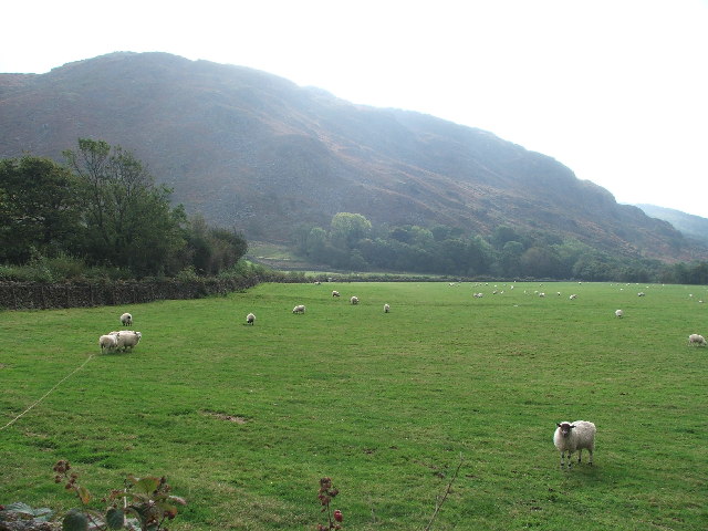
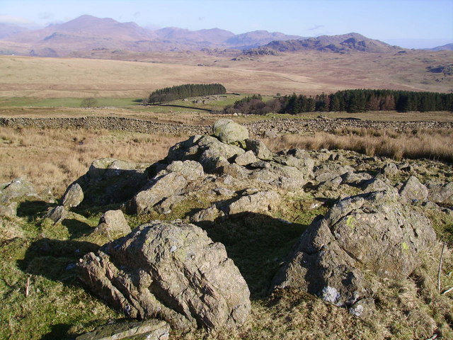
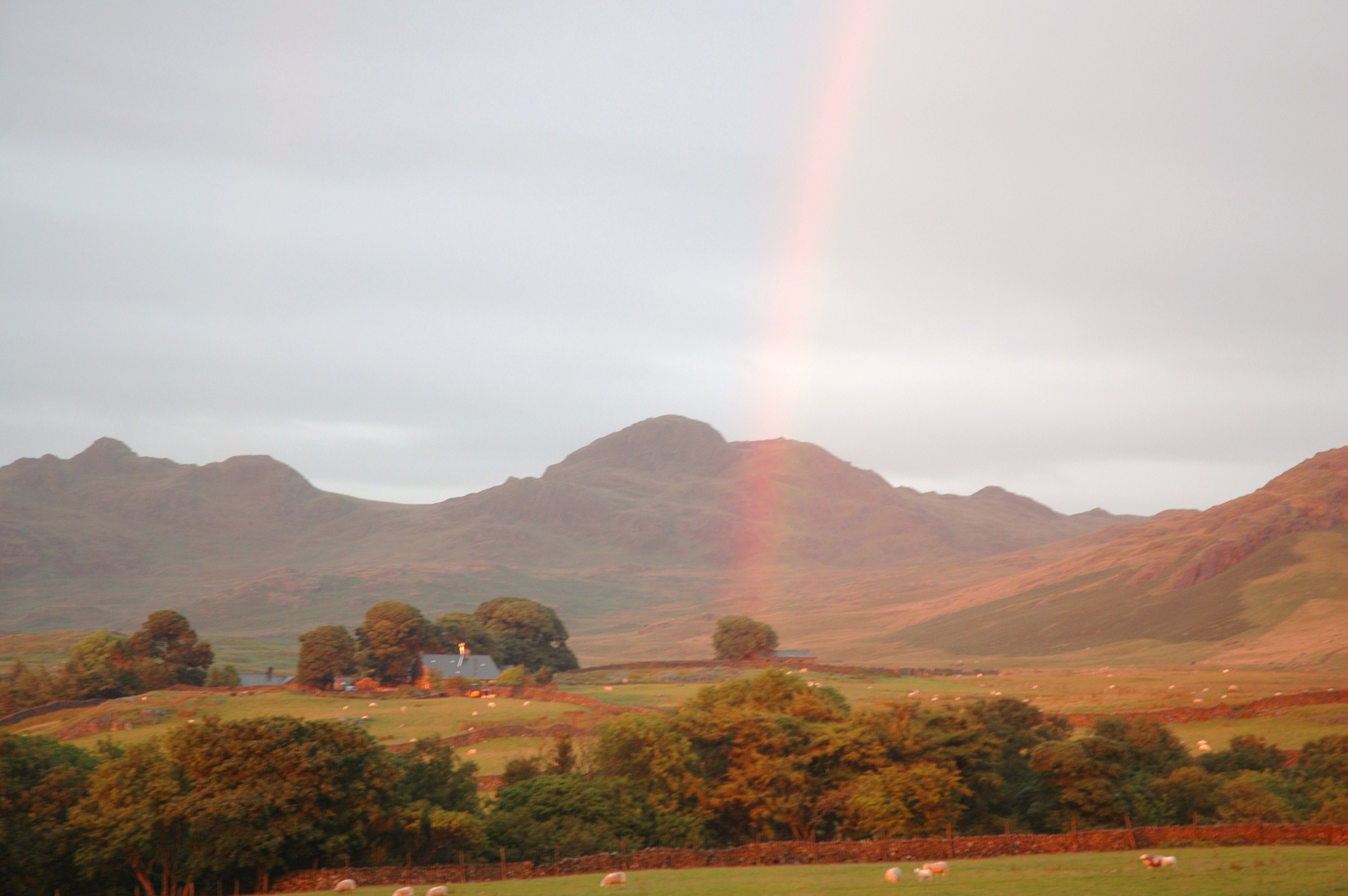
Devoke Water, located in Cumberland, England, is a picturesque and serene lake nestled within the captivating Lake District National Park. With an area of approximately 43 acres, it is often referred to as a pool or pond due to its smaller size compared to other nearby lakes. The lake is situated at an elevation of around 770 feet above sea level, providing visitors with breathtaking panoramic views of the surrounding hills and valleys.

Devoke Water is a freshwater lake, known for its crystal-clear waters that reflect the stunning landscape. It is primarily fed by rainfall and runoff from the surrounding fells, ensuring a constant flow of fresh water. The lake's depth ranges from relatively shallow areas to deeper sections, reaching depths of around 60 feet in some places.

Surrounded by lush vegetation, Devoke Water is home to a diverse range of flora and fauna. The area around the lake includes a freshwater marsh, which supports a variety of wetland plants and provides a habitat for many species of birds, insects, and small mammals.

The lake is a popular destination for outdoor enthusiasts, offering opportunities for fishing, boating, and walking. Anglers are drawn to Devoke Water for its healthy population of brown trout, which thrive in its clean and well-oxygenated waters. The lake is also a haven for birdwatchers, with species such as the common sandpiper, tufted duck, and teal frequently spotted.

Overall, Devoke Water presents a tranquil and idyllic setting, where visitors can escape the hustle and bustle of daily life and immerse themselves in the beauty of nature.

If you have any feedback on the listing, please let us know in the comments section below.

Devoke Water Images

Images are sourced within 2km of 54.361336/-3.2979203 or Grid Reference SD1596. Thanks to Geograph Open Source API. All images are credited.

Water Crag across Linbeck Gill
Boathouse on Devoke Water.
NE tip of Devoke Water. Taken from the access road.
NE tip of Devoke Water.
Taken from the access road.
Water Crag. Looking SW from its neighbour Rough Crag.
Water Crag.
Looking SW from its neighbour Rough Crag.
Brantrake Moss Taken from just above Hare Gill.
Brantrake Moss
Taken from just above Hare Gill.
Brantrake Crags looking S from the near the road junction at SD 148 990
Brantrake Crags
looking S from the near the road junction at SD 148 990
High Ground Farm. Looking NW.
High Ground Farm.
Looking NW.
Signpost on the Ulpha to Eskdale Green road. Looking E at the turnoff for Devoke Water.  The lump directly behind the signpost is Seat How.
Signpost on the Ulpha to Eskdale Green road.
Looking E at the turnoff for Devoke Water. The lump directly behind the signpost is Seat How.
Gate and stile at Brantrake. Gate at SD 145 985 where footpath enters wood near river Esk.
Gate and stile at Brantrake.
Gate at SD 145 985 where footpath enters wood near river Esk.
Stords Hill. Stords Hill, as seen from the boathouse on Devoke Water.
Stords Hill.
Stords Hill, as seen from the boathouse on Devoke Water.
High Coppice The older High Coppice wood now has a backdrop of more recent plantings.
High Coppice
The older High Coppice wood now has a backdrop of more recent plantings.
Red Gill
Red Gill
On Ulpha Fell The wall encloses the farmland around Woodend Farm.
On Ulpha Fell
The wall encloses the farmland around Woodend Farm.
Summit Cairn, Yoadcastle Yoadcastle's top is craggy and a great viewpoint in all directions on the quiet fells above Devoke Water. Hesk Fell in mid shot.
Summit Cairn, Yoadcastle
Yoadcastle's top is craggy and a great viewpoint in all directions on the quiet fells above Devoke Water. Hesk Fell in mid shot.
From White Pike White Pike throws out a steep buttress of crags North West of its summit cairn which sits in the North East corner of the square. Looking down towards Burkby Fell.
From White Pike
White Pike throws out a steep buttress of crags North West of its summit cairn which sits in the North East corner of the square. Looking down towards Burkby Fell.
Birkby Fell From the slopes of White Pike en route for Devoke Water.
Birkby Fell
From the slopes of White Pike en route for Devoke Water.
Devoke Water The largest Tarn in the Lake District having a surface area of over Three Hundred Thousand square feet in old money.The deepest point is at about Forty Six Feet on the North side of the Tarn. According to Heaton Cooper in the Thirteenth Century it was named 'Dudockis Terne and also Fosse Terne.' The locals call it 'Duvvock Water'
Devoke Water
The largest Tarn in the Lake District having a surface area of over Three Hundred Thousand square feet in old money.The deepest point is at about Forty Six Feet on the North side of the Tarn. According to Heaton Cooper in the Thirteenth Century it was named 'Dudockis Terne and also Fosse Terne.' The locals call it 'Duvvock Water'
Waterfall, Linbeck Gill Linbeck Gill is the outflow from Devoke Water. Water Crag in shot.
Waterfall, Linbeck Gill
Linbeck Gill is the outflow from Devoke Water. Water Crag in shot.
Show me another place!

Devoke Water is located at Grid Ref: SD1596 (Lat: 54.361336, Lng: -3.2979203)

Administrative County: Cumbria

District: Copeland

Police Authority: Cumbria

What 3 Words

///thrashed.century.whistle. Near Seascale, Cumbria

Related Wikis

Devoke Water

Devoke Water is a small lake in the south west of the Lake District in North West England. It is the largest tarn in the Lake District, a tarn being a...

Woodend, Ulpha

Woodend is situated between the Duddon Valley and the village of Ulpha and the valley of Eskdale, high up on Birker Fell, approximately 950 feet above...

Birkerthwaite

Birkerthwaite is a village on Birker Fell, Eskdale, Cumbria, England. == See also == List of places in Cumbria == External links == Media related to Birkerthwaite...

Stainton Pike

Stainton Pike is a hill in the English Lake District, near Waberthwaite, Cumbria. It is the subject of a chapter of Wainwright's book The Outlying Fells...

Nearby Amenities

Located within 500m of 54.361336,-3.2979203
Ford: yes
Lat/Long: 54.3575423/-3.2941886
Washford Point
Place: locality
Lat/Long: 54.3609298/-3.2930198
The Wyke
Place: locality
Lat/Long: 54.3588894/-3.3000309
Bicycle: yes
Foot: yes
Ford: yes
Horse: yes
Lat/Long: 54.3597977/-3.2921207
Ford: yes
Lat/Long: 54.3600616/-3.2927448
Ford: yes
Lat/Long: 54.3586023/-3.3036165
Ford: yes
Lat/Long: 54.3587331/-3.3038214
Man Made: cairn
Lat/Long: 54.3650472/-3.2998342
Man Made: cairn
Lat/Long: 54.3648546/-3.2999076
Man Made: cairn
Lat/Long: 54.3651357/-3.30022
Man Made: cairn
Lat/Long: 54.3648235/-3.3001646
Man Made: cairn
Lat/Long: 54.3647348/-3.3002793
Man Made: cairn
Lat/Long: 54.3646979/-3.3002358
Man Made: cairn
Lat/Long: 54.3649007/-3.3003722
Man Made: cairn
Lat/Long: 54.3649663/-3.3005363
Man Made: cairn
Lat/Long: 54.364691/-3.3006589
Man Made: cairn
Lat/Long: 54.3648569/-3.3008784
Man Made: cairn
Lat/Long: 54.3645666/-3.3000539
Man Made: cairn
Lat/Long: 54.3650043/-3.3008131
Man Made: cairn
Lat/Long: 54.3651138/-3.3011729
Man Made: cairn
Lat/Long: 54.3649594/-3.301167
Man Made: cairn
Lat/Long: 54.3651714/-3.301391
Man Made: cairn
Lat/Long: 54.3652036/-3.3016776
Man Made: cairn
Lat/Long: 54.3652617/-3.3008848
Man Made: cairn
Lat/Long: 54.3652249/-3.3001488
The data included in this document is from www.openstreetmap.org. The data is made available under ODbL.

Have you been to Devoke Water?

Leave your review of Devoke Water below (or comments, questions and feedback).