Broken Bank Pool

Lake, Pool, Pond, Freshwater Marsh in Caithness

Scotland

Broken Bank Pool

Bridge over River Thurso at Westerdale The river slips over Caithness slabs past an old mill.
Bridge over River Thurso at Westerdale Credit: Alan Reid

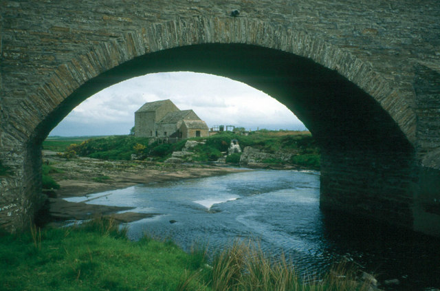
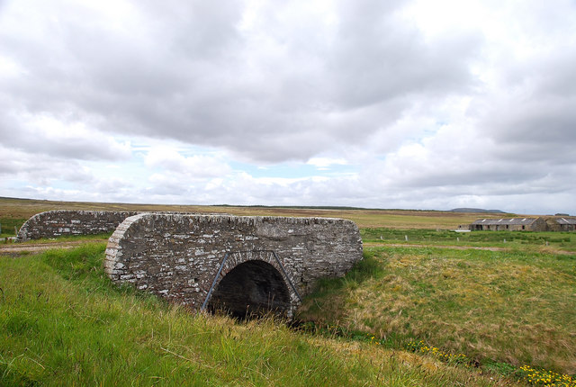
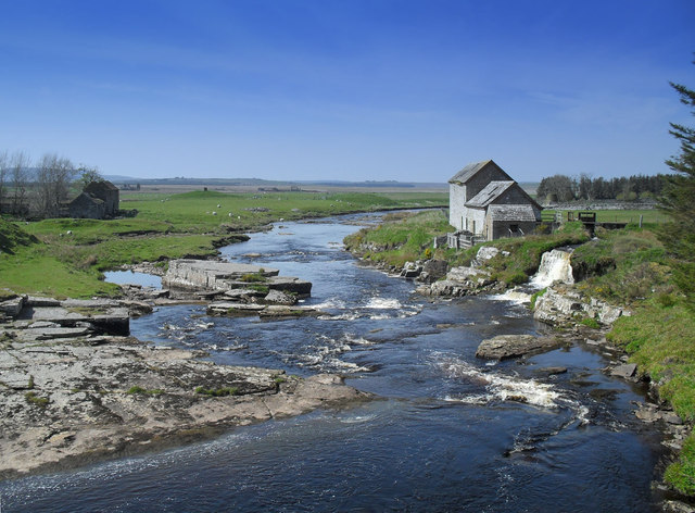
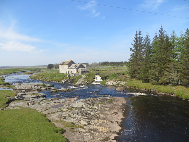
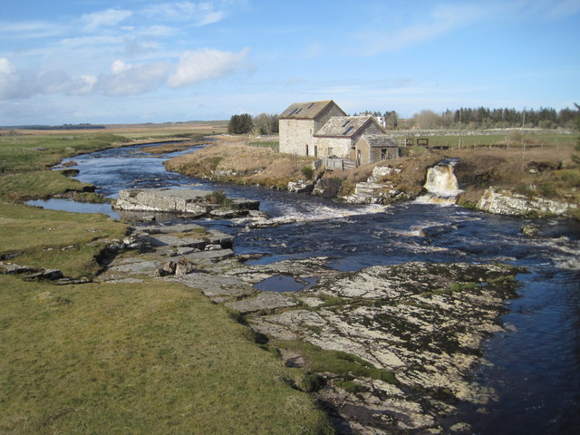
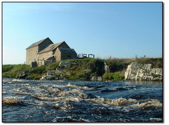
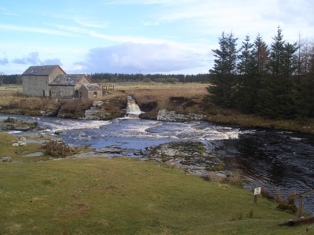
Broken Bank Pool is a freshwater marsh located in the Caithness region of Scotland. It is a natural water feature that encompasses a lake, a pool, a pond, and a freshwater marsh ecosystem. The pool itself is a shallow body of water, covering an area of approximately 2 hectares.

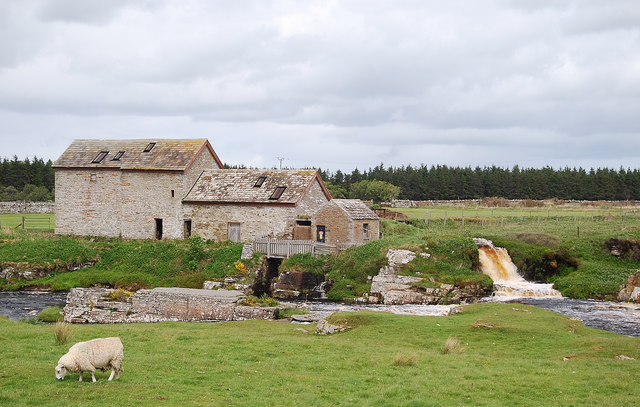
This unique wetland habitat is surrounded by lush vegetation, including reeds, sedges, and various types of aquatic plants. The marshland provides a suitable environment for a wide range of flora and fauna. The pool serves as a vital breeding ground and sanctuary for many bird species, attracting both resident and migratory birds throughout the year.

The diverse bird population includes species such as swans, ducks, geese, and wading birds like herons and egrets. These birds rely on the abundance of aquatic insects and small fish found in the pool for their sustenance. Additionally, the surrounding vegetation offers nesting sites and shelter for the birds.

The pool is also a haven for other wildlife, such as amphibians, reptiles, and small mammals. Frogs, toads, and newts thrive in the marshy areas, while snakes, including adders, can be spotted sunning themselves on the banks. Visitors may also encounter small mammals like water voles and otters, which make their homes in the nearby stream and surrounding wetlands.

Broken Bank Pool, with its tranquil waters, diverse vegetation, and abundant wildlife, provides a picturesque and ecologically significant natural habitat in the Caithness region. It offers a wonderful opportunity for nature enthusiasts to explore and appreciate the beauty and biodiversity of this unique freshwater marsh ecosystem.

If you have any feedback on the listing, please let us know in the comments section below.

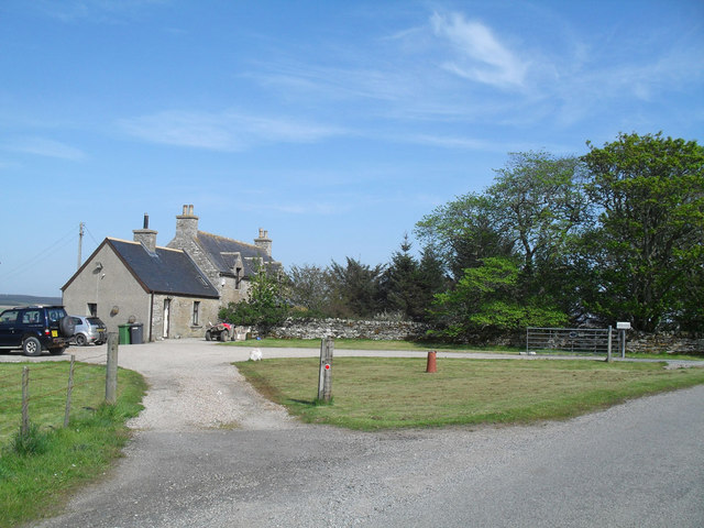
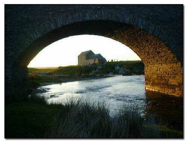
Broken Bank Pool Images

Images are sourced within 2km of 58.457957/-3.4997853 or Grid Reference ND1253. Thanks to Geograph Open Source API. All images are credited.

Bridge over River Thurso at Westerdale The river slips over Caithness slabs past an old mill.
Bridge over River Thurso at Westerdale
The river slips over Caithness slabs past an old mill.
Stone Bridge Over a tributary of the River Thurso an old bridge leads a track to an abandoned farmstead.
Stone Bridge
Over a tributary of the River Thurso an old bridge leads a track to an abandoned farmstead.
Westerdale Mill On the River Thurso this former mill presents a pretty picture.
Westerdale Mill
On the River Thurso this former mill presents a pretty picture.
Corner Cottage As the name suggests this cottage stands at the junction of the Halkirk and Mybster roads.
Corner Cottage
As the name suggests this cottage stands at the junction of the Halkirk and Mybster roads.
Road into the wilds - remote phonebox
Westerdale Mill on the Thurso
Road down to Westerdale Good to cycle down....
Road down to Westerdale
Good to cycle down....
Dale farm
Dale farm
Track to Dale House Peasants not welcome....
Track to Dale House
Peasants not welcome....
Achlibster
Achlibster
Westerdale Mill on the River Thurso
Old Mill at Westerdale
Dale Mill, Westerdale, Caithness Dale Mill is one of these places that is often painted and photographed!  The watermill supplies Dale House (which is now a private hotel) with electricity.
Dale Mill, Westerdale, Caithness
Dale Mill is one of these places that is often painted and photographed! The watermill supplies Dale House (which is now a private hotel) with electricity.
Dale Mill, Caithness A closer view of the mill.  This must be a good fishing beat as there are nearly always people here fishing.
Dale Mill, located by the River Thurso, had a water-powered generator installed in 1919 which supplies electricity to Dale House.
Dale Mill, Caithness
A closer view of the mill. This must be a good fishing beat as there are nearly always people here fishing. Dale Mill, located by the River Thurso, had a water-powered generator installed in 1919 which supplies electricity to Dale House.
Westerdale Rapid In high water this is a nice Grade 3 rapid. It is a shame that it is in the middle of miles of flat water. Easily accessed from the road on the way up to paddle Dirlot Gorge further upstream
Westerdale Rapid
In high water this is a nice Grade 3 rapid. It is a shame that it is in the middle of miles of flat water. Easily accessed from the road on the way up to paddle Dirlot Gorge further upstream
Drive to Bannachmore
Road to Dale Farm
Road to Dale Farm
Hay bales at Strathcoul
Show me another place!

Broken Bank Pool is located at Grid Ref: ND1253 (Lat: 58.457957, Lng: -3.4997853)

Unitary Authority: Highland

Police Authority: Highlands and Islands

What 3 Words

///started.that.unspoiled. Near Halkirk, Highland

Related Wikis

Westerdale, Highland

Westerdale (Scottish Gaelic: An Dail Shuas) is a scattered crofting village which lies on the River Thurso, located five miles (eight kilometres) directly...

Olgrinmore

Olgrinmore is a small area in Halkirk, Northern Scotland, south of Thurso and John o' Groats. The B870 runs directly through the centre with Scotscalder...

Tormsdale

Tormsdale is a megalithic site on the banks of the River Thurso, in Caithness, Scotland. It is 3 kilometres (1.9 mi) south of Westerdale. The site consists...

Battle of Harpsdale

The Battle of Harpsdale (Battle of Achardale, Battle of Harpasdal) was a Scottish clan battle fought in 1426 at Achardale, about 8 miles (13 km) south...

Nearby Amenities

Located within 500m of 58.457957,-3.4997853
Power: pole
Lat/Long: 58.4544808/-3.5034345
Power: pole
Lat/Long: 58.455183/-3.5023686
Power: pole
Lat/Long: 58.4556865/-3.5016112
Power: pole
Lat/Long: 58.4566053/-3.5002326
Power: pole
Lat/Long: 58.4574157/-3.4989738
Power: pole
Lat/Long: 58.4579941/-3.4981413
Power: pole
Lat/Long: 58.4582819/-3.4965312
Power: pole
Lat/Long: 58.4585665/-3.4949028
Power: pole
Lat/Long: 58.4588544/-3.4932927
Power: pole
Lat/Long: 58.459105/-3.4918877
The data included in this document is from www.openstreetmap.org. The data is made available under ODbL.

Have you been to Broken Bank Pool?

Leave your review of Broken Bank Pool below (or comments, questions and feedback).