Black Loch

Lake, Pool, Pond, Freshwater Marsh in Perthshire

Scotland

Black Loch

OS Benchmark - Bolt OS Benchmark Bolt set into the east wall of Lunan Burn bridge.
Ref: <span class="nowrap"><a title="https://www.bench-marks.org.uk/bm80382" rel="nofollow ugc noopener" href="https://www.bench-marks.org.uk/bm80382">Link</a><img style="margin-left:2px;" alt="External link" title="External link - shift click to open in new window" src="https://s1.geograph.org.uk/img/external.png" width="10" height="10"/></span>
OS Benchmark - Bolt Credit: Karl Peet

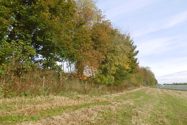
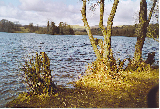
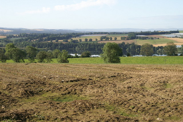
Black Loch is a picturesque freshwater loch located in Perthshire, Scotland. Nestled amidst the stunning scenery of the Scottish Highlands, it covers an area of approximately 44 hectares (109 acres). Surrounded by rolling hills and dense forests, the loch is a popular destination for tourists and nature enthusiasts.

The loch is renowned for its crystal-clear waters, which support a diverse range of aquatic life. It is home to several species of fish, including brown trout, pike, and perch, making it a popular spot for anglers. Fishing permits are available for visitors who wish to try their hand at catching these elusive creatures.

The surrounding area is rich in wildlife, with numerous bird species making their homes along the shores of the loch. Birdwatchers can often spot common species such as mallards, tufted ducks, and swans, as well as more elusive birds like ospreys and herons.

Black Loch is also a haven for outdoor enthusiasts, offering a variety of recreational activities. Visitors can embark on scenic walks or cycle along the well-maintained paths that encircle the loch. The tranquil atmosphere and breathtaking scenery provide the perfect backdrop for picnics and leisurely strolls.

Additionally, the loch is home to a diverse range of flora, including reeds, rushes, and water lilies. These plants create a vibrant and colorful ecosystem, attracting insects and other smaller creatures.

With its natural beauty and abundant wildlife, Black Loch offers a serene and captivating experience for all who visit. Whether it's fishing, birdwatching, or simply enjoying the peaceful surroundings, this freshwater loch is a must-visit destination in Perthshire.

If you have any feedback on the listing, please let us know in the comments section below.

Black Loch Images

Images are sourced within 2km of 56.572017/-3.4257922 or Grid Reference NO1243. Thanks to Geograph Open Source API. All images are credited.

OS Benchmark - Bolt OS Benchmark Bolt set into the east wall of Lunan Burn bridge.
Ref: <span class="nowrap"><a title="https://www.bench-marks.org.uk/bm80382" rel="nofollow ugc noopener" href="https://www.bench-marks.org.uk/bm80382">Link</a><img style="margin-left:2px;" alt="External link" title="External link - shift click to open in new window" src="https://s1.geograph.org.uk/img/external.png" width="10" height="10"/></span>
OS Benchmark - Bolt
OS Benchmark Bolt set into the east wall of Lunan Burn bridge. Ref: LinkExternal link
Clunie Castle (Remains of) Remains of Clunie Castle located on the small island in Loch of Clunie.

Reference: <span class="nowrap"><a title="https://canmore.org.uk/site/28959/loch-of-clunie" rel="nofollow ugc noopener" href="https://canmore.org.uk/site/28959/loch-of-clunie">Link</a><img style="margin-left:2px;" alt="External link" title="External link - shift click to open in new window" src="https://s1.geograph.org.uk/img/external.png" width="10" height="10"/></span>
Clunie Castle (Remains of)
Remains of Clunie Castle located on the small island in Loch of Clunie. Reference: LinkExternal link
Wooden Boat House (Disused) - Loch of Clunie Wooden boat house (disused) on north shore of Loch of Clunie
Wooden Boat House (Disused) - Loch of Clunie
Wooden boat house (disused) on north shore of Loch of Clunie
Former Boat House (Ruin) - Loch of Clunie Former, now disused and roofless, stonewalled boathouse on the west side of Loch of Clunie.
Former Boat House (Ruin) - Loch of Clunie
Former, now disused and roofless, stonewalled boathouse on the west side of Loch of Clunie.
Loch of Clunie A calm and reflective Loch of Clunie looking towards the small island with the ruins of Clunie Castle.
Loch of Clunie
A calm and reflective Loch of Clunie looking towards the small island with the ruins of Clunie Castle.
OS Benchmark Rivet Os Benchmark rivet set into a stone wall.
Ref: <span class="nowrap"><a title="https://www.bench-marks.org.uk/bm165605" rel="nofollow ugc noopener" href="https://www.bench-marks.org.uk/bm165605">Link</a><img style="margin-left:2px;" alt="External link" title="External link - shift click to open in new window" src="https://s1.geograph.org.uk/img/external.png" width="10" height="10"/></span>
OS Benchmark Rivet
Os Benchmark rivet set into a stone wall. Ref: LinkExternal link
Clunie Parish Church
The Ward and Summerhouse (Ruin) Ruins of a 19th Century summerhouse.
Ref: <span class="nowrap"><a title="https://canmore.org.uk/site/28996/clunie-the-ward-and-summerhouse" rel="nofollow ugc noopener" href="https://canmore.org.uk/site/28996/clunie-the-ward-and-summerhouse">Link</a><img style="margin-left:2px;" alt="External link" title="External link - shift click to open in new window" src="https://s1.geograph.org.uk/img/external.png" width="10" height="10"/></span>
The Ward and Summerhouse (Ruin)
Ruins of a 19th Century summerhouse. Ref: LinkExternal link
Crannog - Loch of Clunie Peak of a crannog, Loch of Clunie.  Only visible when the loch water level is particularly low.

Reference: <span class="nowrap"><a title="https://canmore.org.uk/site/28944/loch-of-clunie" rel="nofollow ugc noopener" href="https://canmore.org.uk/site/28944/loch-of-clunie">Link</a><img style="margin-left:2px;" alt="External link" title="External link - shift click to open in new window" src="https://s1.geograph.org.uk/img/external.png" width="10" height="10"/></span>
Crannog - Loch of Clunie
Peak of a crannog, Loch of Clunie. Only visible when the loch water level is particularly low. Reference: LinkExternal link
Unknown Stone Structure - Lunan Burn, Loch of Clunie Located adjacent to where the Lunan Burn enters the Loch of Clunie.

Original purpose unknown.  A folly?
Unknown Stone Structure - Lunan Burn, Loch of Clunie
Located adjacent to where the Lunan Burn enters the Loch of Clunie. Original purpose unknown. A folly?
Loch of Clunie
Loch of Clunie
Wester Tullyneddie Seen from the A923.
Wester Tullyneddie
Seen from the A923.
Hill of Lethendy Patterns in the stubble below Hill of Lethendy.
Hill of Lethendy
Patterns in the stubble below Hill of Lethendy.
Strawberry field, Lethendy Hoops of a polytunnel deep in berry country.
Strawberry field, Lethendy
Hoops of a polytunnel deep in berry country.
Round bales, Lethendy The straw has yet to be removed from the field and there is an unusual backdrop of polytunnel hoops.
Round bales, Lethendy
The straw has yet to be removed from the field and there is an unusual backdrop of polytunnel hoops.
Strip wood below Lethendybank Barley stubble with polytunnels as neighbours.
Strip wood below Lethendybank
Barley stubble with polytunnels as neighbours.
Partly ruined wall, Kirkton of Lethendy A wall accompanies the road as it climbs out of Kirkton of Lethendy.
Partly ruined wall, Kirkton of Lethendy
A wall accompanies the road as it climbs out of Kirkton of Lethendy.
Fields by Kirkton of Lethendy South facing slopes.
Fields by Kirkton of Lethendy
South facing slopes.
Show me another place!

Black Loch is located at Grid Ref: NO1243 (Lat: 56.572017, Lng: -3.4257922)

Unitary Authority: Perth and Kinross

Police Authority: Tayside

What 3 Words

///seat.lung.orbited. Near Blairgowrie, Perth & Kinross

Nearby Locations

Black Loch

Related Wikis

Gourdie House

Gourdie House is an historic building in Craigie, Perth and Kinross, Scotland. It is a Category A listed building dating to 1765.The building is two storeys...

Craigie (hamlet), Perth and Kinross

Craigie is a village 6 kilometres (3.7 miles) west of Blairgowrie, in Perth and Kinross, Scotland. It is situated on the eastern side of Loch Clunie.Robert...

Loch of Clunie

Loch of Clunie is a small lowland freshwater loch that is located two miles (three kilometres) west of Blairgowrie, Perth and Kinross, Scotland. ��2�...

Clunie

Clunie is a small settlement in Perthshire, Scotland, four miles (six kilometres) west of Blairgowrie. It lies on the western shore of the Loch of Clunie...

Loch of Drumellie

Loch of Drumellie also known as Marlee Loch or Loch of Marlee is a small lowland freshwater loch that is located 2.3 miles west of Blairgowrie, in Perth...

Tower of Lethendy

Tower of Lethendy is a 17th-century L-plan tower house, about 3.5 miles (5.6 km) south west of Blairgowrie, Perth and Kinross, Scotland, and about 0.5...

Achalader

Achalader (Scottish Gaelic: Achadh Chaladair) is a settlement in the council area of Perth and Kinross, Scotland. Achalader is situated 3 miles (5 kilometres...

Kinloch, Blairgowrie

Kinloch is a hamlet and civil parish immediately north of the Loch of Drumellie, about two miles (three kilometres) west of Blairgowrie in Perth and Kinross...

Related Videos

Loch of Clunie, Scotland | Camping Trip July 2020

A wee camping montage video I put together from our first ever camping trip with a couple friends at Loch of Clunie in July 2020.

Scotland after dark | Night kayaking in Perthshire

Try NIGHT KAYAKING in Scotland this winter! A truly amazing way to discover the nature, history and gain a unique sense of ...

Summer Road Trip Drive With Music On History Visit Spittalfield Perthshire Scotland

Tour Scotland 4K Summer travel video of a road trip drive, with Scottish music, East on the A984 old military road through Caputh, ...

Loch Clunie

Some clips while was up camping.

Nearby Amenities

Located within 500m of 56.572017,-3.4257922
Blackloch Bothy
Designation: B&B
Source: www.blackloch.com
Tourism: guest_house
Lat/Long: 56.5731802/-3.4276212
Berrybrae
Place: locality
Lat/Long: 56.5713895/-3.4182715
Power: pole
Lat/Long: 56.5736405/-3.4331878
Power: pole
Lat/Long: 56.5730831/-3.4326962
Power: pole
Lat/Long: 56.5726515/-3.4323143
Power: pole
Lat/Long: 56.5723976/-3.4320904
Power: pole
Lat/Long: 56.5720385/-3.431792
Power: pole
Lat/Long: 56.5713591/-3.431375
Material: wood
Power: pole
Lat/Long: 56.5706397/-3.4309185
Material: wood
Power: pole
Lat/Long: 56.5698816/-3.4304554
Power: pole
Lat/Long: 56.5692879/-3.4300648
Power: pole
Lat/Long: 56.5685769/-3.429639
The data included in this document is from www.openstreetmap.org. The data is made available under ODbL.

Have you been to Black Loch?

Leave your review of Black Loch below (or comments, questions and feedback).