Black Loch

Lake, Pool, Pond, Freshwater Marsh in Morayshire

Scotland

Black Loch

Gravel Quarry near Clashgour
Gravel Quarry near Clashgour Credit: Alan Hodgson

Black Loch is a freshwater loch located in Morayshire, Scotland. It is situated approximately 4 miles southeast of Elgin, the administrative center of Moray. Spanning an area of around 22 hectares, Black Loch is a significant water body in the region.

The loch is surrounded by a diverse landscape, predominantly characterized by grassy marshes and reed beds. These marshy areas provide a vital habitat for various flora and fauna species. The loch's water is mainly sourced from rainfall and small streams that flow into it. The water is generally calm and clear, making it ideal for a range of recreational activities such as fishing and boating.

Black Loch is renowned for its rich biodiversity. It supports a variety of aquatic plants, including water lilies and pondweeds, which provide shelter and food for numerous species of fish and invertebrates. The loch is home to a wide range of fish species, including perch, pike, and roach, attracting anglers from near and far. Birdwatchers are also drawn to Black Loch due to its significance as a nesting and feeding ground for various waterfowl species, including swans, ducks, and herons.

The surrounding marshland is teeming with wildlife, with frequent sightings of otters, water voles, and dragonflies. The loch and its surrounding areas have been designated as a Site of Special Scientific Interest (SSSI) to protect and conserve the unique ecosystem.

Overall, Black Loch in Morayshire serves as not only a picturesque water body but also a crucial habitat for diverse plant and animal species, making it a valuable natural asset in the region.

If you have any feedback on the listing, please let us know in the comments section below.

Black Loch Images

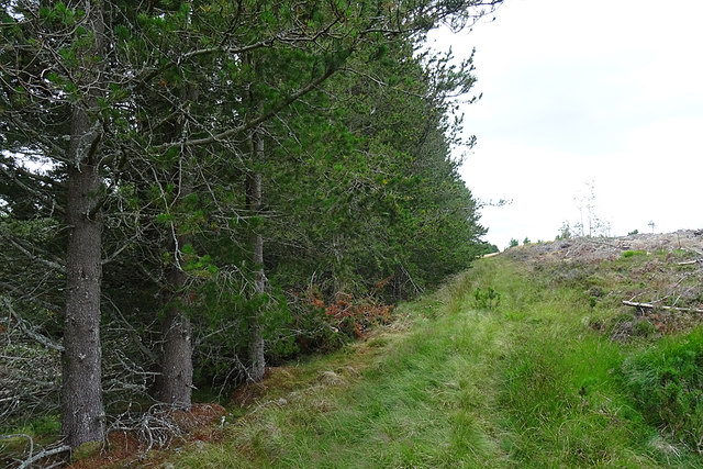
Images are sourced within 2km of 57.509379/-3.5246804 or Grid Reference NJ0847. Thanks to Geograph Open Source API. All images are credited.

Gravel Quarry near Clashgour
A Nice View from the Forest Track at Carnachie
Looking back towards Park Park is nothing more now than a few boulders among the whins on the left of the road when seen from this direction.
Looking back towards Park
Park is nothing more now than a few boulders among the whins on the left of the road when seen from this direction.
Old Road to Dunphail The drove road is still easy to follow at this point, and is carpeted with wild flowers.
Old Road to Dunphail
The drove road is still easy to follow at this point, and is carpeted with wild flowers.
Approaching Redcraig The croft of Redcraig was on the far back of the burn of Auchness, but has been obliterated by forestry plantations. It is still marked on the 1:25,000 map so there may be some remnants still to be found. We didn't attempt to find it. The old road at this point is still easy to find and pleasant walking; it was lulling us into a false sense of security, however.
Approaching Redcraig
The croft of Redcraig was on the far back of the burn of Auchness, but has been obliterated by forestry plantations. It is still marked on the 1:25,000 map so there may be some remnants still to be found. We didn't attempt to find it. The old road at this point is still easy to find and pleasant walking; it was lulling us into a false sense of security, however.
Ford on the Lone Burn The Lone Burn is a headwater of the Burn of Auchness. This was the first obstacle on our route, and one entirely missing from the walk description. I gather from the Edinkillie web site that there was once a bridge, but it had collapsed many years ago. I was able to work my way across the boulders on the right, using my hands to steady me and prevent me falling on the slippery weed-grown boulders. Once across, I hit on the idea of putting down some more of the plentiful large flat boulders to make dry stepping stones on the left, and my companion was then able to cross using these. There is a new forestry road to the left that bypasses the ford and a lot of the old road, but it isn't on the maps and we didn't know where it went, so we stuck to what was on the map and in the walk description.
Ford on the Lone Burn
The Lone Burn is a headwater of the Burn of Auchness. This was the first obstacle on our route, and one entirely missing from the walk description. I gather from the Edinkillie web site that there was once a bridge, but it had collapsed many years ago. I was able to work my way across the boulders on the right, using my hands to steady me and prevent me falling on the slippery weed-grown boulders. Once across, I hit on the idea of putting down some more of the plentiful large flat boulders to make dry stepping stones on the left, and my companion was then able to cross using these. There is a new forestry road to the left that bypasses the ford and a lot of the old road, but it isn't on the maps and we didn't know where it went, so we stuck to what was on the map and in the walk description.
Felled Forest We saw a lot of felled forest on this walk. This is a definite bonus because we got good views, and otherwise we would have been walking in the shade of trees for several miles. With the benefit of hindsight we would have done better to take the road that is at the foot of the brae, but as it wasn't on the walk description and isn't on the maps we had no way of knowing where it went. It would have been a bit longer, but much easier and very probably quicker than the described route.
Felled Forest
We saw a lot of felled forest on this walk. This is a definite bonus because we got good views, and otherwise we would have been walking in the shade of trees for several miles. With the benefit of hindsight we would have done better to take the road that is at the foot of the brae, but as it wasn't on the walk description and isn't on the maps we had no way of knowing where it went. It would have been a bit longer, but much easier and very probably quicker than the described route.
Deteriorated Track This is part of the second obstacle on our route. Until this point, some 500 metres from <a href="https://www.geograph.org.uk/photo/6559072">NJ1048 : Ford on the Lone Burn</a>, the track had been getting steadily wetter and more indistinct, but this was a bit daunting. We were able to avoid it only by diverting to the right and using tree stumps as stepping stones. In the process of watching our steps very carefully, we managed not to notice whether <a href="https://www.geograph.org.uk/photo/580371">NJ0948 : Sheanballie Ruin engulfed in firs</a> can still be seen.
Deteriorated Track
This is part of the second obstacle on our route. Until this point, some 500 metres from NJ1048 : Ford on the Lone Burn, the track had been getting steadily wetter and more indistinct, but this was a bit daunting. We were able to avoid it only by diverting to the right and using tree stumps as stepping stones. In the process of watching our steps very carefully, we managed not to notice whether NJ0948 : Sheanballie Ruin engulfed in firs can still be seen.
Old Fence The fence leads arrow-straight up the hill to the north end of Loch Dallas. I drew my companion's attention to this but neither of us was at all keen to plod through the obvious boggy ground to get there. <a href="https://www.geograph.org.uk/photo/580530">NJ0948 : Site of former bridge on old drove road to Dunphail station</a> shows the remains of another bridge here that used to carry the road, but we didn't see it; I don't know whether that is because it has crumbled away since 2007, or whether we were too preoccupied with staying in one piece to look around us. Probably the former, as I do recall jumping across a small burn here.
Old Fence
The fence leads arrow-straight up the hill to the north end of Loch Dallas. I drew my companion's attention to this but neither of us was at all keen to plod through the obvious boggy ground to get there. NJ0948 : Site of former bridge on old drove road to Dunphail station shows the remains of another bridge here that used to carry the road, but we didn't see it; I don't know whether that is because it has crumbled away since 2007, or whether we were too preoccupied with staying in one piece to look around us. Probably the former, as I do recall jumping across a small burn here.
Old Drove Road While plowtering through the bog between the ford and the fence we had agreed an escape strategy (via Dunphail) in case the whole route proved to be as boggy, but fortunately the track improved greatly, and from now on was easy to follow and comfortable to walk on. It curves gently between the Scots Pine on the right and the small remaining stand of trees on this side of the burn.
Old Drove Road
While plowtering through the bog between the ford and the fence we had agreed an escape strategy (via Dunphail) in case the whole route proved to be as boggy, but fortunately the track improved greatly, and from now on was easy to follow and comfortable to walk on. It curves gently between the Scots Pine on the right and the small remaining stand of trees on this side of the burn.
Clear Felled Forest This block of plantation has been harvested, leaving only stumps and brash.
Clear Felled Forest
This block of plantation has been harvested, leaving only stumps and brash.
Forest Edge The old road passes very close to this stand of Lodgepole Pine.
Forest Edge
The old road passes very close to this stand of Lodgepole Pine.
Old Road from Dallas Looking towards Dallas on the old road that links it to Dunphail.
Old Road from Dallas
Looking towards Dallas on the old road that links it to Dunphail.
Abandoned Logs There were quite a few logs lying beside the track, some in a pile and others just scattered in the ground.
Abandoned Logs
There were quite a few logs lying beside the track, some in a pile and others just scattered in the ground.
Old Drove Road Believe it or not, this is the same section of road as <a href="https://www.geograph.org.uk/photo/580704">NJ0748 : Lush vegetation but poorly drained section of the drove road</a>. The trees alongside it have been felled, and the road itself has been repaired so that it is no longer reverting to bog.
Old Drove Road
Believe it or not, this is the same section of road as NJ0748 : Lush vegetation but poorly drained section of the drove road. The trees alongside it have been felled, and the road itself has been repaired so that it is no longer reverting to bog.
Reprieved Trees For some reason these few trees have been spared the forester's saw.
Reprieved Trees
For some reason these few trees have been spared the forester's saw.
Souter's Stripe A stripe is a small burn, and a souter is a shoemaker. I have no idea why this burn is so named, and would be delighted if someone were able to enlighten me.
Souter's Stripe
A stripe is a small burn, and a souter is a shoemaker. I have no idea why this burn is so named, and would be delighted if someone were able to enlighten me.
A Messy Scene Swathes of brash aren't photogenic at the best of times, but this chaotic scene is worse than usual.
A Messy Scene
Swathes of brash aren't photogenic at the best of times, but this chaotic scene is worse than usual.
Show me another place!

Black Loch is located at Grid Ref: NJ0847 (Lat: 57.509379, Lng: -3.5246804)

Unitary Authority: Moray

Police Authority: North East

What 3 Words

///bulb.occupy.trapdoor. Near Forres, Moray

Nearby Locations

Black Loch

Related Wikis

Dallas, Moray

Dallas (Scottish Gaelic: Dalais [ˈt̪al̪ˠɪʃ]) is a small rural village in Moray, Scotland. It is located 12 miles (19 km) south west of Elgin just off the...

Edinkillie House

Edinkillie House is a country house in Edinkillie in Moray, Scotland, built in 1822–1823 by John Paterson as a manse for the nearby Edinkillie Church....

Dunphail railway station

Dunphail railway station was opened with the Inverness and Perth Junction Railway in 1863. == Station layout == The station layout was double platform...

Dunphail House

Dunphail House is an Italianate country house in Moray, Scotland. It was designed by William Henry Playfair for Charles Lennox Cumming-Bruce, and was completed...

Have you been to Black Loch?

Leave your review of Black Loch below (or comments, questions and feedback).