Loch Rig

Lake, Pool, Pond, Freshwater Marsh in Dumfriesshire

Scotland

Loch Rig

Quarry at Moannathairy The source of many of the recent forest roads in the area.
Quarry at Moannathairy Credit: Iain Russell

Loch Rig is a small freshwater loch located in Dumfriesshire, Scotland. It is situated in a picturesque rural setting, surrounded by rolling hills and lush greenery. The loch covers an area of approximately 10 acres and has a maximum depth of around 10 meters.

The water in Loch Rig is clear and clean, supporting a diverse range of aquatic plant and animal species. It is a popular spot for fishing, with anglers drawn to the loch in search of brown trout and perch. The peaceful and tranquil atmosphere of Loch Rig makes it a popular destination for birdwatchers, who come to observe a variety of waterfowl and other bird species that frequent the area.

Surrounding the loch is a freshwater marsh, providing important habitat for a variety of wildlife, including amphibians, insects, and waterfowl. The marsh is home to a variety of plant species, adding to the overall biodiversity of the area.

Visitors to Loch Rig can enjoy scenic walks along the shoreline, taking in the stunning views of the surrounding countryside. The loch is a hidden gem in Dumfriesshire, offering a peaceful retreat for nature lovers and outdoor enthusiasts alike.

If you have any feedback on the listing, please let us know in the comments section below.
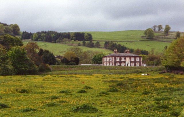
Loch Rig Images

Images are sourced within 2km of 55.290573/-3.542946 or Grid Reference NT0200. Thanks to Geograph Open Source API. All images are credited.

Quarry at Moannathairy The source of many of the recent forest roads in the area.
Quarry at Moannathairy
The source of many of the recent forest roads in the area.
Turbines on Lamb Hill Small part of a far larger wind farm.
Turbines on Lamb Hill
Small part of a far larger wind farm.
Met station near Queensberry Looking down a wind farm access road towards the meteorological station beneath Queensberry.
Met station near Queensberry
Looking down a wind farm access road towards the meteorological station beneath Queensberry.
Lochanhead to Ae track
Lochanhead path at Shepherds Cairn
Old Deer Hide and small stream in a gap in Earshaig Forest An uninspiring area of blanket forestry, I longed to see a real tree!
Old Deer Hide and small stream in a gap in Earshaig Forest
An uninspiring area of blanket forestry, I longed to see a real tree!
A rare view within Earshaig Forest down a forest ride. Forest ride off the main track and cycle path through Earshaig Forest - obvious signs of use by quad bikes.
A rare view within Earshaig Forest down a forest ride.
Forest ride off the main track and cycle path through Earshaig Forest - obvious signs of use by quad bikes.
New road A new logging road which will soon be put to work removing the trees from nearby blocks. It's a race against windthrow.
New road
A new logging road which will soon be put to work removing the trees from nearby blocks. It's a race against windthrow.
New road The waymarked route from Beatock to Ae uses this newish road which also carries an underground power line.
New road
The waymarked route from Beatock to Ae uses this newish road which also carries an underground power line.
Timber Haul Route A new road out to the A701 for modern timber lorries. It is gated and closed to wind farm traffic, but as is custom, open to non motorised traffic.
Timber Haul Route
A new road out to the A701 for modern timber lorries. It is gated and closed to wind farm traffic, but as is custom, open to non motorised traffic.
Quarry, Moanathairy Quarry dug to supply the road and wind turbine construction of recent years.
Quarry, Moanathairy
Quarry dug to supply the road and wind turbine construction of recent years.
Wind farm construction The construction phase is more or less over, and the waymarks are back up on the track that goes from Ae to Beattock.
Wind farm construction
The construction phase is more or less over, and the waymarks are back up on the track that goes from Ae to Beattock.
Road from Ae to Beattock Now the forest road runs for a long time through an enormous wind farm.  This one is somewhat less offensive than usual and is almost hidden away - unless you are in the forest.
Road from Ae to Beattock
Now the forest road runs for a long time through an enormous wind farm. This one is somewhat less offensive than usual and is almost hidden away - unless you are in the forest.
Hareshaw Rig In Ae Forest, home to a large wind farm.
Hareshaw Rig
In Ae Forest, home to a large wind farm.
Hareshaw Rig The trees are down and turbines up.  Some parts of the forest have survived the huge wind farm here.
Hareshaw Rig
The trees are down and turbines up. Some parts of the forest have survived the huge wind farm here.
Quarry, Moanathairy Roadstone and windfarm installation quarry. The yellow posts mark a buried electricity cable.
Quarry, Moanathairy
Roadstone and windfarm installation quarry. The yellow posts mark a buried electricity cable.
Ae Haul Road A new logging road for taking timber out of the Forest of Ae.
Ae Haul Road
A new logging road for taking timber out of the Forest of Ae.
Ae Haul Road The western end of a new road used to export timber from the Forest of Ae.
Ae Haul Road
The western end of a new road used to export timber from the Forest of Ae.
Show me another place!

Loch Rig is located at Grid Ref: NT0200 (Lat: 55.290573, Lng: -3.542946)

Unitary Authority: Dumfries and Galloway

Police Authority: Dumfries and Galloway

What 3 Words

///euphoric.eyebrows.mining. Near Beattock, Dumfries & Galloway

Nearby Locations

Loch Rig

Related Wikis

Queensberry (hill)

Queensberry is a hill in the Lowther Hills range, part of the Southern Uplands of Scotland. The most southerly mountain in the range, it lies in the parish...

Beattock

Beattock is a village in Dumfries and Galloway, Scotland, approximately 1⁄2 mile (800 metres) southwest of Moffat and 19 miles (31 kilometres) north of...

Beattock railway station

Beattock railway station was a station which served the village of Beattock, in the parish of Kirkpatrick-Juxta in the Scottish county of Dumfries and...

Auchencastle railway station

Auchencastle railway station was a private station which served Auchencastle, near Beattock, in the Scottish county of Dumfries and Galloway. It was used...

Nearby Amenities

Located within 500m of 55.290573,-3.542946
The data included in this document is from www.openstreetmap.org. The data is made available under ODbL.

Have you been to Loch Rig?

Leave your review of Loch Rig below (or comments, questions and feedback).