Cobbinshaw Reservoir

Lake, Pool, Pond, Freshwater Marsh in Midlothian

Scotland

Cobbinshaw Reservoir

Road near Baad's Mill A straight road through conifer plantations. The Pate's Hill powerstation now dominates the view.
Road near Baad's Mill Credit: Richard Webb

Cobbinshaw Reservoir is a freshwater lake located in Midlothian, Scotland. It is situated near the village of West Calder and covers an area of approximately 200 hectares. The reservoir was created in the mid-19th century to supply water to the nearby Edinburgh and Glasgow canal networks.

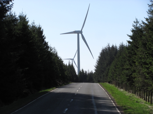
The lake is surrounded by scenic landscapes, including rolling hills and dense woodlands, making it a popular destination for nature enthusiasts and outdoor activities. The reservoir itself is surrounded by a mixture of farmland and moorland, providing a diverse habitat for various plant and animal species.

Cobbinshaw Reservoir is known for its rich biodiversity. The lake supports a wide range of aquatic life, including various species of fish such as brown trout and pike. It also attracts a variety of bird species, including waterfowl like swans, ducks, and geese, as well as wading birds like herons and lapwings.

The surrounding area of the reservoir is home to numerous species of mammals, including otters, red deer, and rabbits. Additionally, the diverse vegetation around the lake includes reeds, rushes, and water lilies, creating a thriving habitat for insects and invertebrates.

The reservoir is a popular spot for recreational activities such as fishing, boating, and birdwatching. It offers a tranquil environment for visitors to enjoy the natural beauty of the Scottish countryside while engaging in outdoor pursuits.

Overall, Cobbinshaw Reservoir is a picturesque freshwater lake that provides a haven for various plant and animal species, making it an important ecological site in Midlothian.

If you have any feedback on the listing, please let us know in the comments section below.

Cobbinshaw Reservoir Images

Images are sourced within 2km of 55.805939/-3.5686191 or Grid Reference NT0158. Thanks to Geograph Open Source API. All images are credited.

Road near Baad's Mill A straight road through conifer plantations. The Pate's Hill powerstation now dominates the view.
Road near Baad's Mill
A straight road through conifer plantations. The Pate's Hill powerstation now dominates the view.
Woodland on Pearie Law Until the inevitable arrival of a wind farm, much of the higher land here is covered in conifers. Before the trees it was used for sheep rearing.
Woodland on Pearie Law
Until the inevitable arrival of a wind farm, much of the higher land here is covered in conifers. Before the trees it was used for sheep rearing.
West Harwood woodland A young but maturing plantation.
West Harwood woodland
A young but maturing plantation.
Woolfords Bridge The mainline railway between Edinburgh and Carlisle is crossed by Woolfords Bridge just outside the hamlet of Woolfords.
Woolfords Bridge
The mainline railway between Edinburgh and Carlisle is crossed by Woolfords Bridge just outside the hamlet of Woolfords.
Road through the woods to Cobbinshaw Loch
West Lothian Boundary at Pates Hill Looking across Benry's Bog to the Pates Hill Windfarm.
West Lothian Boundary at Pates Hill
Looking across Benry's Bog to the Pates Hill Windfarm.
Cobbinshaw Loch Cobbinshaw Loch was built to store water for the Union Canal. Water is released into the Murieston Water and then into the River Almond and then taken from the river and entering the canal at the Almond Aqueduct.
The Loch is used for angling.
Cobbinshaw Loch
Cobbinshaw Loch was built to store water for the Union Canal. Water is released into the Murieston Water and then into the River Almond and then taken from the river and entering the canal at the Almond Aqueduct. The Loch is used for angling.
South Cobbinshaw Seen from North Cobbinshaw, looking across the reservoir from near the start of the causeway. The reservoir is the source of water for the Union Canal [Edinburgh-Falkirk], entering at Linn's Mill via the Bog Burn, Murieston Water, Linhouse water and the River Almond.
South Cobbinshaw
Seen from North Cobbinshaw, looking across the reservoir from near the start of the causeway. The reservoir is the source of water for the Union Canal [Edinburgh-Falkirk], entering at Linn's Mill via the Bog Burn, Murieston Water, Linhouse water and the River Almond.
Cobbinshaw Reservoir Looking northeast from North Cobbinshaw. The reservoir is the source of water for the Union Canal, and is about 2.5km long.
Cobbinshaw Reservoir
Looking northeast from North Cobbinshaw. The reservoir is the source of water for the Union Canal, and is about 2.5km long.
Shelter belt at South Cobbinshaw Looking across the reservoir to pastures south of the reservoir.
Shelter belt at South Cobbinshaw
Looking across the reservoir to pastures south of the reservoir.
Fishery at North Cobbinshaw At the southern end of the main part of the reservoir.
Fishery at North Cobbinshaw
At the southern end of the main part of the reservoir.
Mute swans at Cobbinshaw Unsuccessfully soliciting for food.
Mute swans at Cobbinshaw
Unsuccessfully soliciting for food.
Railway crossing at site of Cobbinshaw station View eastward over the ex-Caledonian Railway main line, Edinburgh (to left) - Carstairs/Symington - Carlisle (to right), elecctrified in 1989. The station had been on the left and was closed 18/4/66.
Railway crossing at site of Cobbinshaw station
View eastward over the ex-Caledonian Railway main line, Edinburgh (to left) - Carstairs/Symington - Carlisle (to right), elecctrified in 1989. The station had been on the left and was closed 18/4/66.
Harburnhead Hill from the air The shake holes ( <span class="nowrap"><a title="http://mapzone.ordnancesurvey.co.uk/mapzone/didyouknow/whatis/q_12_75.html" rel="nofollow ugc noopener" href="http://mapzone.ordnancesurvey.co.uk/mapzone/didyouknow/whatis/q_12_75.html">Link</a><img style="margin-left:2px;" alt="External link" title="External link - shift click to open in new window" src="https://s1.geograph.org.uk/img/external.png" width="10" height="10"/></span> ) as shown on the larger scale OS maps can be seen to the left of centre.
Harburnhead Hill from the air
The shake holes ( LinkExternal link ) as shown on the larger scale OS maps can be seen to the left of centre.
Cobbinshaw Reservoir from the air The Carstairs to Edinburgh railway line, which connects the east and west coast main lines, can be seen to the left of the reservoir.
Cobbinshaw Reservoir from the air
The Carstairs to Edinburgh railway line, which connects the east and west coast main lines, can be seen to the left of the reservoir.
Cobbinshaw Reservoir The reservoir that is the source of water for the Union Canal, which goes from Edinburgh to Falkirk. The water level seems very low. Woolfords Cottages are visible at the lower left. The railway is the Carstairs-Edinburgh line.
Cobbinshaw Reservoir
The reservoir that is the source of water for the Union Canal, which goes from Edinburgh to Falkirk. The water level seems very low. Woolfords Cottages are visible at the lower left. The railway is the Carstairs-Edinburgh line.
Cobbinshaw Reservoir A view of the reservoir in late afternoon on a cold December day.  West Cairn Hill is visible in the distance.
Cobbinshaw Reservoir
A view of the reservoir in late afternoon on a cold December day. West Cairn Hill is visible in the distance.
Pates Hill Wind Farm The control station and turbines 5, 6 and 7. The rain was just starting.
Pates Hill Wind Farm
The control station and turbines 5, 6 and 7. The rain was just starting.
Show me another place!

Cobbinshaw Reservoir is located at Grid Ref: NT0158 (Lat: 55.805939, Lng: -3.5686191)

Unitary Authority: West Lothian

Police Authority: The Lothians and Scottish Borders

What 3 Words

///workforce.cooked.umbrellas. Near Addiebrownhill, West Lothian

Nearby Locations

Cobbinshaw Reservoir

Related Wikis

Cobbinshaw Reservoir

Cobbinshaw Reservoir is a reservoir in West Lothian, Scotland. It is situated near the Pentland Hills, 5 km south of West Calder. The 310-acre (1.3 km2...

Cobbinshaw

Cobbinshaw is a small hamlet in West Lothian, Scotland. It is at the end of a dead end road from nearby Woolfords. Cobbinshaw is at 1,000 feet (300 m...

Cobbinshaw railway station

Cobbinshaw railway station was on the Caledonian Railway Edinburgh to Carstairs line sited near a village called Woolfords in South Lanarkshire. The freight...

Castle Greg

Castle Greg is the archaeological remains of a Roman fortlet in Harburn on the Camilty Plantation, approximately three miles south-east of West Calder...

Have you been to Cobbinshaw Reservoir?

Leave your review of Cobbinshaw Reservoir below (or comments, questions and feedback).