Nant Fach
Lake, Pool, Pond, Freshwater Marsh in Denbighshire
Wales
Nant Fach

Nant Fach is a small, picturesque freshwater marsh located in Denbighshire, Wales. It is known for its serene beauty and rich ecosystems, making it a popular destination for nature enthusiasts and birdwatchers.
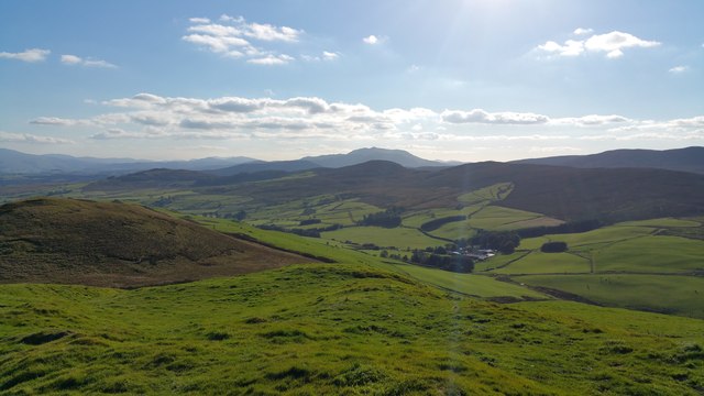
The marsh is nestled within a lush valley, surrounded by rolling hills and dense woodland. It is fed by several small streams and springs, resulting in a crystal-clear lake that stretches for approximately 2 hectares. The lake is home to a variety of freshwater species, including fish, amphibians, and water insects.
Surrounding the lake, there are patches of dense vegetation, including reed beds, sedges, and aquatic plants, creating a diverse habitat for various bird species. Nant Fach is particularly renowned for its birdlife, with over 100 species recorded in the area. Visitors may spot common waterfowl such as mallards and coots, as well as more elusive species such as kingfishers and herons.
The marsh also plays a crucial role in water management and flood prevention for the surrounding area. The vegetation and wetland areas act as natural sponges, absorbing excess water during periods of heavy rainfall and gradually releasing it back into the ecosystem.
Access to Nant Fach is provided by well-maintained footpaths and boardwalks, allowing visitors to explore the area while minimizing disruption to the delicate ecosystems. Interpretive signs and information boards are placed strategically along the paths, providing educational insights into the flora and fauna found in the marsh.
Overall, Nant Fach offers a tranquil and scenic experience, showcasing the beauty and importance of freshwater marshes in supporting local biodiversity and maintaining ecological balance.
If you have any feedback on the listing, please let us know in the comments section below.
Nant Fach Images
Images are sourced within 2km of 53.009735/-3.6325156 or Grid Reference SH9047. Thanks to Geograph Open Source API. All images are credited.


Nant Fach is located at Grid Ref: SH9047 (Lat: 53.009735, Lng: -3.6325156)
Unitary Authority: Conwy
Police Authority: North Wales
What 3 Words
///partly.obscuring.plausible. Near Llangwm, Conwy
Nearby Locations
Related Wikis

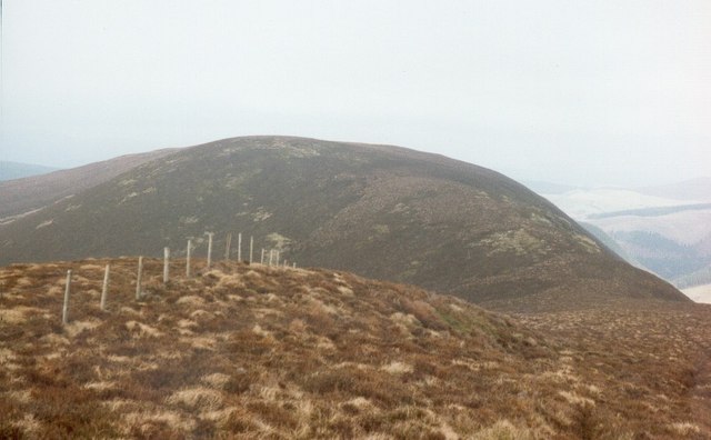
Moel y Gydros
Moel y Gydros (English: Bare Hill of Gydros) is a hill located just outside the Snowdonia National Park on the Gwynedd / Conwy border in North Wales. The...
Waun Garnedd-y-filiast
Waun Garnedd-y-filiast is a top of Carnedd y Filiast on the border of the Snowdonia National park near Cerrigydrudion in North Wales. It is part of the...

Carnedd y Filiast (Cerrigydrudion)
Carnedd y Filiast is a mountain near Cerrigydrudion on the border of the Snowdonia National Park, North Wales and is 669 metres (2,195 ft) high. ��2...

Carnedd Llechwedd-llyfn
Carnedd Llechwedd-llyfn is a subsidiary summit of Carnedd y Filiast on the border of Snowdonia National Park in Llandderfel, in Gwynedd. The northern...
Trum y Gwragedd
Trum y Gwragedd is a top of Foel y Geifr in the Hirnantau. These hills rise from the south east shores of Bala Lake.The summit is boggy and marked by a...

Cerrigydrudion
Cerrigydrudion, sometimes spelt Cerrig-y-drudion, () is a village and community in Conwy, Wales. Until 1974 it was part of the historic county Denbighshire...
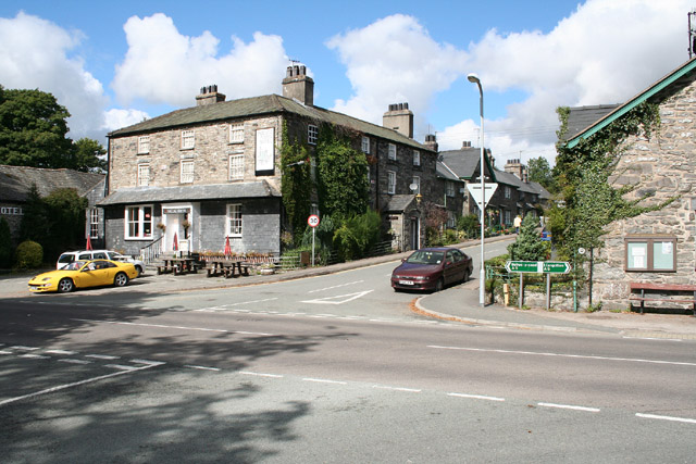
Pentrefoelas
Pentrefoelas is a village and community in Conwy County Borough, Wales. The village lies on the A5 road between Betws-y-Coed to the west and Cerrigydrudion...

Afon Merddwr
Afon Merddwr is a river in the south of the county of Conwy, Wales. It is a tributary of the River Conwy and joins it near Pentrefoelas. It is about 10...
Nearby Amenities
Located within 500m of 53.009735,-3.6325156Have you been to Nant Fach?
Leave your review of Nant Fach below (or comments, questions and feedback).