Loch an Tubairnaich

Lake, Pool, Pond, Freshwater Marsh in Sutherland

Scotland

Loch an Tubairnaich

Summit vegetation on Col-bheinn (538m) The view to the south-west is blighted by the intrusive Kilbraur Wind Farm (centred at NC 790 080) above Loch Brora
Summit vegetation on Col-bheinn (538m) Credit: Mick Crawley

Loch an Tubairnaich is a picturesque freshwater loch located in the remote region of Sutherland, in the northern part of Scotland. Nestled amidst the rugged and dramatic landscape of the Scottish Highlands, this natural gem is a haven for nature enthusiasts and those seeking tranquility away from the bustling cities.

The loch spans an area of approximately 5 hectares, or 12 acres, and is surrounded by rolling hills covered in heather and scattered with granite boulders. Its crystal-clear waters reflect the surrounding landscape, creating a mesmerizing mirror-like effect. The loch is fed by several small streams that flow down from the nearby mountains, ensuring a constant supply of fresh water.

Surrounded by a diverse array of plant and animal life, Loch an Tubairnaich is a thriving ecosystem. The loch is home to a variety of freshwater fish species, including brown trout and salmon, making it a popular spot for fishing enthusiasts. Its shores are adorned with beautiful reed beds, providing a habitat for numerous bird species, such as grebes, ducks, and herons. Additionally, the loch attracts a wide range of migratory birds during the summer months.

Visitors to Loch an Tubairnaich can enjoy a peaceful walk along its shores, taking in the breathtaking scenery and observing the abundant wildlife. The loch's tranquil atmosphere offers the perfect escape from the stresses of modern life, allowing visitors to connect with nature and enjoy the serenity of this remote corner of Scotland.

If you have any feedback on the listing, please let us know in the comments section below.

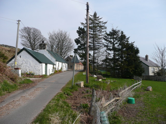
Loch an Tubairnaich Images

Images are sourced within 2km of 58.055212/-3.9050585 or Grid Reference NC8708. Thanks to Geograph Open Source API. All images are credited.

Summit vegetation on Col-bheinn (538m) The view to the south-west is blighted by the intrusive Kilbraur Wind Farm (centred at NC 790 080) above Loch Brora
Summit vegetation on Col-bheinn (538m)
The view to the south-west is blighted by the intrusive Kilbraur Wind Farm (centred at NC 790 080) above Loch Brora
Lone Gateway on Col-bheinn, above Strath Brora, Sutherland This abandoned rusting gateway stands alone on the southwestern slopes of the hill Col-bheinn, in the county of Sutherland, Scottish Highlands.
Lone Gateway on Col-bheinn, above Strath Brora, Sutherland
This abandoned rusting gateway stands alone on the southwestern slopes of the hill Col-bheinn, in the county of Sutherland, Scottish Highlands.
The line of fenceposts still heading uphill
Looking downhill, Loch Brora in the distance
Across the south side of Col Bheinn
View towards Beinn Smeorail and Cnoc Cragaidh View facing north looking over a small valley towards the summits of Cnoc Cragaidh (396m) and Beinn Smeorail (486m) beyond.  Photo taken on a sunny winter afternoon.
View towards Beinn Smeorail and Cnoc Cragaidh
View facing north looking over a small valley towards the summits of Cnoc Cragaidh (396m) and Beinn Smeorail (486m) beyond. Photo taken on a sunny winter afternoon.
Killin Broch above Loch Brora - View to West A view of a ruined Broch at Killin, above Loch Brora in East Sutherland.  This Broch is in a relatively ruinous state and in considerably poorer condition than some of the other Brochs to be found in the area.  (Examples of other nearby Brochs in better condition; <a href="https://www.geograph.org.uk/photo/3831926">NC8406 : Carrol Broch above Loch Brora - view to East</a>, <a href="https://www.geograph.org.uk/photo/3582699">NC8701 : Carn Liath</a> )  In the background is the top of Loch Brora.
Killin Broch above Loch Brora - View to West
A view of a ruined Broch at Killin, above Loch Brora in East Sutherland. This Broch is in a relatively ruinous state and in considerably poorer condition than some of the other Brochs to be found in the area. (Examples of other nearby Brochs in better condition; NC8406 : Carrol Broch above Loch Brora - view to East, NC8701 : Carn Liath ) In the background is the top of Loch Brora.
Redundant fence on the moors Only a line of iron posts remain of the fence that crossed this grid square in East Sutherland.  The view is to the south and the distinctive summit of Ben Horn (520m) is visible approximately 4 miles in the distance.
Redundant fence on the moors
Only a line of iron posts remain of the fence that crossed this grid square in East Sutherland. The view is to the south and the distinctive summit of Ben Horn (520m) is visible approximately 4 miles in the distance.
Allt nam Ban A watercourse to north of Loch Brora in Sutherland, Scotland
Allt nam Ban
A watercourse to north of Loch Brora in Sutherland, Scotland
Track to Achrimsdale from An Dubh Lochan The Track/Path Junction shown on the 1:25000 OS map, close by the SW end of An Dubh Lochan. The track is seen winding away into the distance across the SW slopes of Creag an Lochain Dearg. The buildings in the far distance on the right are part of Brora.
Track to Achrimsdale from An Dubh Lochan
The Track/Path Junction shown on the 1:25000 OS map, close by the SW end of An Dubh Lochan. The track is seen winding away into the distance across the SW slopes of Creag an Lochain Dearg. The buildings in the far distance on the right are part of Brora.
Dam and outlet, An Dubh Lochan The dam at the SW end of An Dubh Lochan. Also shown in the foreground is the end of the track from Achrimsdale and the start of the short path along the NE bank of the lochan. The flat topped hill in the right background is unnamed height 309m. in NC8707
Dam and outlet, An Dubh Lochan
The dam at the SW end of An Dubh Lochan. Also shown in the foreground is the end of the track from Achrimsdale and the start of the short path along the NE bank of the lochan. The flat topped hill in the right background is unnamed height 309m. in NC8707
SW spur (just over 360m) of Col-Bheinn Col-Bheinn (542m) is the hill behind the spur.
SW spur (just over 360m) of Col-Bheinn
Col-Bheinn (542m) is the hill behind the spur.
Loch an Tubairnaich Taken from the small hillock (just over 310m) W of the loch. The small lumpy hill in the right background is Creag an Lochan Deirg <a href="https://www.geograph.org.uk/gridref/NC8808">NC8808</a>. Water flowing from the E end of the loch feeds Clynemilton Burn which supplies the Clynelish distillery <a href="https://www.geograph.org.uk/gridref/NC8905">NC8905</a>.
Loch an Tubairnaich
Taken from the small hillock (just over 310m) W of the loch. The small lumpy hill in the right background is Creag an Lochan Deirg NC8808. Water flowing from the E end of the loch feeds Clynemilton Burn which supplies the Clynelish distillery NC8905.
Killin Broch and sheepfold A ruined broch takes its name from the house at the narrows of Loch Brora in the valley below. Very little of the original structure is visible. Details can be found here <span class="nowrap"><a title="http://www.rcahms.gov.uk/pls/portal/newcanmore.details_gis?inumlink=6475" rel="nofollow ugc noopener" href="http://www.rcahms.gov.uk/pls/portal/newcanmore.details_gis?inumlink=6475">Link</a><img style="margin-left:2px;" alt="External link" title="External link - shift click to open in new window" src="https://s1.geograph.org.uk/img/external.png" width="10" height="10"/></span>
Killin Broch and sheepfold
A ruined broch takes its name from the house at the narrows of Loch Brora in the valley below. Very little of the original structure is visible. Details can be found here LinkExternal link
New forestry and fencing up the line of Clynemilton burn
The upper end of the deer fence protecting new forestry
The upper end of Clynemilton burn
View back downhill, Brora in the distance
Show me another place!

Loch an Tubairnaich is located at Grid Ref: NC8708 (Lat: 58.055212, Lng: -3.9050585)

Unitary Authority: Highland

Police Authority: Highlands and Islands

What 3 Words

///acquaint.backpack.bucket. Near Brora, Highland

Nearby Locations

Loch an Tubairnaich

Related Wikis

Loch Brora

Loch Brora is a loch in the Golspie parish near the east coast of Sutherland in the Highland council area in Northern Scotland. It is located directly...

Achrimsdale

Achrimsdale (Scottish Gaelic: Achadh Rumasdail) is a village in Highland, Scotland. == References ==

Brora distillery

Brora distillery is a producer of single malt Scotch whisky based in Brora, Scotland. It operated between 1819 and 1983 before being mothballed until 2021...

Clynelish distillery

Clynelish distillery is a distillery near Brora, Sutherland in the Highlands of Scotland. The original Clynelish distillery was built in 1819, adjacent...

Related Videos

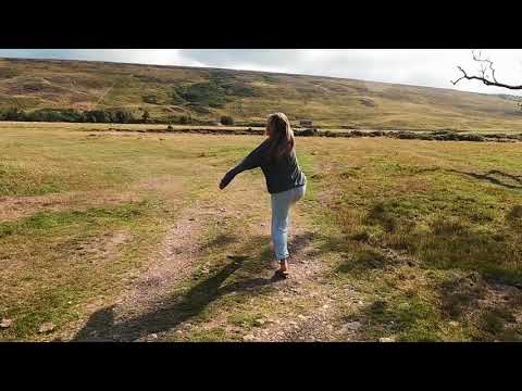
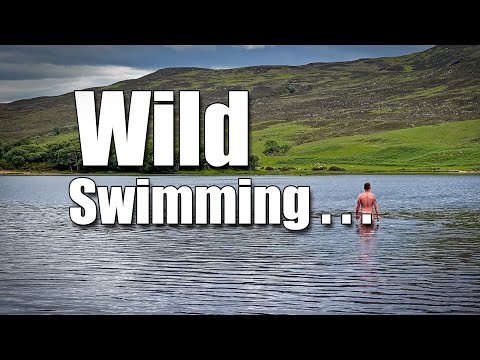
NAKED Wild Swimming Improves Your Mental Health! Ep. 202.

What is Wild Swimming? Is the the same as open water or cold water swimming? I'm off Wild Swimming in a spectacular Highland ...

Loch Brora

Brora.The river was in great fettle and although I'd never previously fished the Loch during August's, “Scarecrow Festival”, I fully ...

SLOW TV - Early Morning Flight Above The Mist Covered Mountains of Scotland - Ep. 192a.

Join us for some Slow TV, an early morning flight above Loch Brora and the mist covered mountains of Highland Scotland.

Have you been to Loch an Tubairnaich?

Leave your review of Loch an Tubairnaich below (or comments, questions and feedback).