Gorsley

Settlement in Gloucestershire Forest of Dean

England

Gorsley

Llama in field A llama in a field belonging to Briery Hill Llamas, a llama trekking company.
Llama in field Credit: Pebble

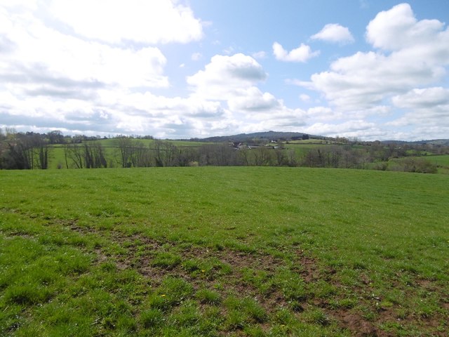
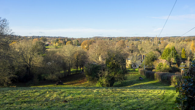
Gorsley is a charming village located in the English county of Gloucestershire. Situated in the Forest of Dean district, Gorsley lies about 15 miles southwest of Gloucester and 10 miles northwest of Ross-on-Wye. The village is surrounded by picturesque countryside, offering residents and visitors a tranquil and scenic environment.

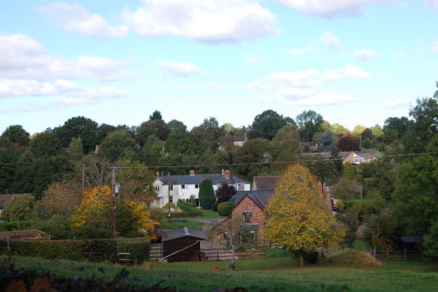
Gorsley is a small community with a population of around 600 people. The village is known for its tight-knit and friendly atmosphere, providing a close sense of community for its residents. Traditional stone cottages and historic buildings can be found throughout the village, adding to its quaint and timeless charm.

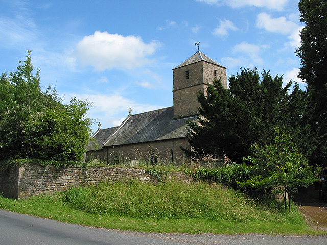
Despite its small size, Gorsley offers a range of amenities and services for its residents. These include a primary school, a village hall, a local pub, and a post office. The village is also home to a beautiful 12th-century church, St. Peter's Church, which adds a sense of history and heritage to Gorsley.

The surrounding area of Gorsley is rich in natural beauty, with numerous walking trails and outdoor activities available for nature enthusiasts. The nearby Forest of Dean provides ample opportunities for hiking, cycling, and exploring the ancient woodland. Additionally, the market towns of Ross-on-Wye and Gloucester are a short drive away, offering a wider range of amenities, shopping, and cultural attractions.

Overall, Gorsley is a delightful village in Gloucestershire, offering a peaceful and idyllic lifestyle in a picturesque countryside setting.

If you have any feedback on the listing, please let us know in the comments section below.
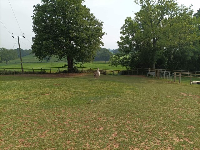
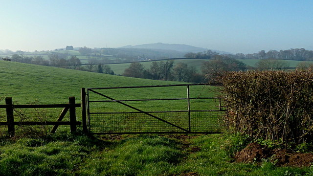
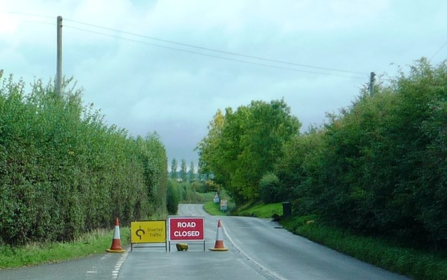
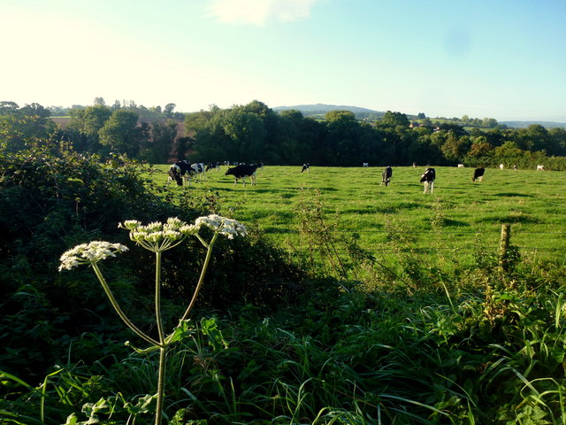
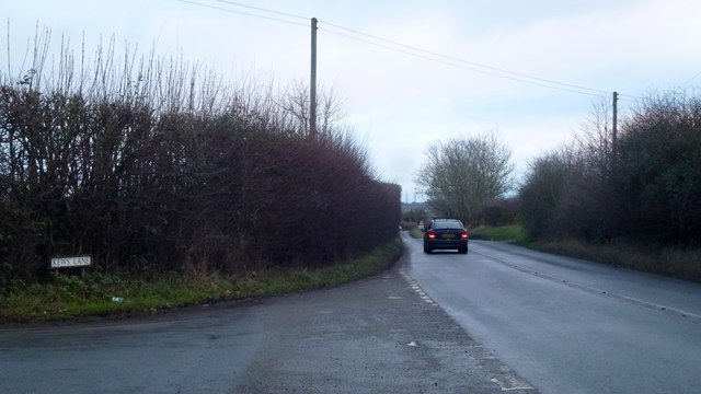
Gorsley Images

Images are sourced within 2km of 51.929236/-2.459543 or Grid Reference SO6825. Thanks to Geograph Open Source API. All images are credited.

Llama in field A llama in a field belonging to Briery Hill Llamas, a llama trekking company.
Llama in field
A llama in a field belonging to Briery Hill Llamas, a llama trekking company.
May Hill, Easter Monday morning For another view from Whitehouse Lane see <a href="https://www.geograph.org.uk/photo/4419776">SO7026 : Misty view of May Hill</a>.
May Hill, Easter Monday morning
For another view from Whitehouse Lane see SO7026 : Misty view of May Hill.
B4221 during period of closure Taken just past road junction near the Kilcot Inn. Cars were diverted down side roads that led into Watery Lane.
B4221 during period of closure
Taken just past road junction near the Kilcot Inn. Cars were diverted down side roads that led into Watery Lane.
Dairy pasture View south of Hawthorne Hill with May Hill in the distance.
Dairy pasture
View south of Hawthorne Hill with May Hill in the distance.
View towards May Hill May Hill with its clump of trees is a landmark seen from over a great area.   It is on the northern edge of the Forest of Dean and is well wooded.
View towards May Hill
May Hill with its clump of trees is a landmark seen from over a great area. It is on the northern edge of the Forest of Dean and is well wooded.
B4221 at Kews lane, Kilcot Looking east towards Newent.
B4221 at Kews lane, Kilcot
Looking east towards Newent.
Farmland to the East of Kilcot View across farmland to the east of Kilcot.
Farmland to the East of Kilcot
View across farmland to the east of Kilcot.
Ploughed field near Kilcot The yellow building is the Kilcot Inn on the B4221, Newent to Ross road.
Ploughed field near Kilcot
The yellow building is the Kilcot Inn on the B4221, Newent to Ross road.
Arable land east of Kilcot viewed from Wyatts Lane
Footpath to Newent Looking south-east from Whitehouse Lane.
Footpath to Newent
Looking south-east from Whitehouse Lane.
Blind bend in Whitehouse Lane The verge needs cutting around here for safety reasons.
Blind bend in Whitehouse Lane
The verge needs cutting around here for safety reasons.
New raspberry plantation 1 The planting is next to the B4221 near Kilcot, viewed from Conigree Lane to the south.
New raspberry plantation 1
The planting is next to the B4221 near Kilcot, viewed from Conigree Lane to the south.
New raspberry plantation 2 Looking west along the rows, from Conigree Lane.
This is probably an "autumn" (August to October) fruiting crop as the canes are still below ground. As they grow in the spring and summer, they are held in place by wires attached to the end-posts seen here.
The crop is irrigated and plastic mulched to keep out weed competition.
New raspberry plantation 2
Looking west along the rows, from Conigree Lane. This is probably an "autumn" (August to October) fruiting crop as the canes are still below ground. As they grow in the spring and summer, they are held in place by wires attached to the end-posts seen here. The crop is irrigated and plastic mulched to keep out weed competition.
Track to Briery Hill A fine sunny scene with late autumnal lighting.
Track to Briery Hill
A fine sunny scene with late autumnal lighting.
Herefordshire meets Gloucestershire Woodland and small slivers of pasture land.
Herefordshire meets Gloucestershire
Woodland and small slivers of pasture land.
Snowdrops, sandstone wall Near the road junction by Gorsley Cross and the Roadmaker PH.
Snowdrops, sandstone wall
Near the road junction by Gorsley Cross and the Roadmaker PH.
Gorsley Goffs Summer Fete, 2022 Plenty of activity here, but those clouds approaching are going to stop play temporarily within ten minutes of this photo being taken.
Gorsley Goffs Summer Fete, 2022
Plenty of activity here, but those clouds approaching are going to stop play temporarily within ten minutes of this photo being taken.
Christ Church, Gorsley Church of England church in the Diocese of Gloucester viewed from the south side of the B4221.
Christ Church, Gorsley
Church of England church in the Diocese of Gloucester viewed from the south side of the B4221.
Show me another place!

Gorsley is located at Grid Ref: SO6825 (Lat: 51.929236, Lng: -2.459543)

Administrative County: Gloucestershire

District: Forest of Dean

Police Authority: Gloucestershire

What 3 Words

///committee.apart.moves. Near Linton, Herefordshire

Nearby Locations

Gorsley

Related Wikis

Gorsley and Kilcot

Gorsley and Kilcot is a civil parish forming part of the district of the Forest of Dean in the English county of Gloucestershire. The single parish of...

Gorsley

Gorsley is a small village in the Forest of Dean district of Gloucestershire, forming part of the civil parish of Gorsley and Kilcot in the South West...

Gorsley Common

Gorsley Common is a village in Herefordshire, west of Gorsley and Kilcot and east of Linton. == References == == External links == Media related to Gorsley...

Aston Ingham

Aston Ingham is a village in south-eastern Herefordshire, England, near Newent and about 7 miles (11 km) east of Ross-on-Wye. The population of the village...

Nearby Amenities

Located within 500m of 51.929236,-2.459543
Bus Stop
Christ Church
Naptan AtcoCode: 1600GLF037
Naptan Bearing: NW
Naptan CommonName: Christ Church
Naptan NaptanCode: gloamawj
Naptan Street: B4221
Naptan Verified: no
Source: naptan_import
Lat/Long: 51.9296682/-2.4570232
Bus Stop
Christ Church
Naptan AtcoCode: 1600GLF038
Naptan Bearing: SE
Naptan CommonName: Christ Church
Naptan Indicator: Opp
Naptan NaptanCode: gloamawa
Naptan Street: B4221
Naptan Verified: no
Source: naptan_import
Lat/Long: 51.9298555/-2.4574178
Bus Stop
Sterrys Rd
Naptan AtcoCode: 1600GLF039
Naptan Bearing: NW
Naptan CommonName: Sterrys Rd
Naptan NaptanCode: gloamapa
Naptan Street: B4221
Naptan Verified: no
Source: naptan_import
Lat/Long: 51.9304026/-2.4600704
Bus Stop
Sterrys Rd
Naptan AtcoCode: 1600GLF040
Naptan Bearing: SE
Naptan CommonName: Sterrys Rd
Naptan Indicator: Opp
Naptan NaptanCode: gloamapd
Naptan Street: B4221
Naptan Verified: no
Source: naptan_import
Lat/Long: 51.9306077/-2.4605088
Sterrys Corner
Place: locality
Lat/Long: 51.9304996/-2.4610241
Barrier: kissing_gate
Lat/Long: 51.9271852/-2.4578993
Barrier: kissing_gate
Lat/Long: 51.9262485/-2.4577475
Generator Output Electricity: yes
Generator Source: solar
Location: roof
Power: generator
Lat/Long: 51.9251526/-2.4586791
Barrier: kissing_gate
Lat/Long: 51.9277844/-2.4575174
Barrier: stile
Lat/Long: 51.9249802/-2.4571883
Power: pole
Lat/Long: 51.9301249/-2.4611796
Power: pole
Lat/Long: 51.925096/-2.4623624
Power: pole
Lat/Long: 51.9250294/-2.4615484
Mount Pleasant South
Power: pole
Transformer: distribution
Voltage Primary: 11000
Lat/Long: 51.9249855/-2.4610113
Power: pole
Lat/Long: 51.9249351/-2.4603742
Power: pole
Lat/Long: 51.9248772/-2.4595904
Power: pole
Lat/Long: 51.9248329/-2.4590023
Gorsley
Power: pole
Transformer: distribution
Voltage Primary: 11000
Lat/Long: 51.9307712/-2.4646604
Power: pole
Lat/Long: 51.93076/-2.4638819
Power: pole
Lat/Long: 51.9307522/-2.4632087
Power: pole
Lat/Long: 51.9307464/-2.4624885
Power: pole
Lat/Long: 51.9302635/-2.4614746
Gorsley Court
Power: pole
Transformer: distribution
Voltage Primary: 11000
Lat/Long: 51.931218/-2.4604581
Power: pole
Lat/Long: 51.9308762/-2.4602559
Power: pole
Lat/Long: 51.9305409/-2.4600584
Power: pole
Lat/Long: 51.9300983/-2.4600215
Power: pole
Lat/Long: 51.9295589/-2.4599846
Power: pole
Lat/Long: 51.9291328/-2.4590921
Power: pole
Lat/Long: 51.928795/-2.4583938
Christ Church
Power: pole
Transformer: distribution
Voltage Primary: 11000
Lat/Long: 51.9292914/-2.4572468
Power: pole
Lat/Long: 51.9287402/-2.4574882
Power: pole
Lat/Long: 51.9284884/-2.4578959
Power: pole
Lat/Long: 51.9285181/-2.4584893
Mount Pleasant
Power: pole
Transformer: distribution
Voltage Primary: 11000
Lat/Long: 51.9281034/-2.4586335
Power: pole
Lat/Long: 51.9276043/-2.4588139
Power: pole
Lat/Long: 51.9271553/-2.4586174
Power: pole
Lat/Long: 51.926676/-2.4584015
Power: pole
Lat/Long: 51.9261934/-2.4581862
Power: pole
Lat/Long: 51.9256645/-2.4577852
Power: pole
Lat/Long: 51.9251319/-2.4573916
Brassfields
Power: pole
Transformer: distribution
Voltage Primary: 11000
Lat/Long: 51.9289804/-2.4528781
Power: pole
Lat/Long: 51.9287431/-2.4523102
Brockmoor Head
Power: pole
Transformer: distribution
Voltage Primary: 11000
Lat/Long: 51.9331035/-2.4566681
Power: pole
Lat/Long: 51.933118/-2.4569826
Power: pole
Lat/Long: 51.9334703/-2.4598995
Power: pole
Lat/Long: 51.9331445/-2.458026
Power: pole
Lat/Long: 51.9331734/-2.4590023
The data included in this document is from www.openstreetmap.org. The data is made available under ODbL.

Have you been to Gorsley?

Leave your review of Gorsley below (or comments, questions and feedback).