Clunas Reservoir

Lake, Pool, Pond, Freshwater Marsh in Nairnshire

Scotland

Clunas Reservoir

Unclassified road at Rereach
Unclassified road at Rereach Credit: Douglas Nelson

Clunas Reservoir is a small freshwater loch located in the county of Nairnshire, in the Highlands of Scotland. Situated about 8 miles southeast of the town of Nairn, the reservoir serves as a vital water source for the surrounding area.

The reservoir covers an area of approximately 30 acres and has a maximum depth of around 8 meters. It is a man-made structure, created in the early 20th century by damming the Clunas Burn, a small stream that flows through the surrounding hilly terrain. The dam was constructed to regulate water flow and ensure a consistent supply for agriculture and public consumption.

Clunas Reservoir is surrounded by a picturesque landscape of rolling hills and dense vegetation, consisting mainly of heather and grassland. The area around the loch is rich in biodiversity, attracting various bird species, including ducks, geese, and swans. The reservoir also supports a diverse population of fish, such as brown trout and perch, making it a popular spot for angling enthusiasts.

The serene and peaceful atmosphere around Clunas Reservoir makes it an ideal location for leisure activities like picnicking, walking, and wildlife observation. The surrounding area has several walking trails, offering panoramic views of the reservoir and the surrounding countryside.

Overall, Clunas Reservoir is a beautiful and tranquil freshwater body, providing both practical water supply benefits and opportunities for recreational enjoyment in the heart of Nairnshire.

If you have any feedback on the listing, please let us know in the comments section below.

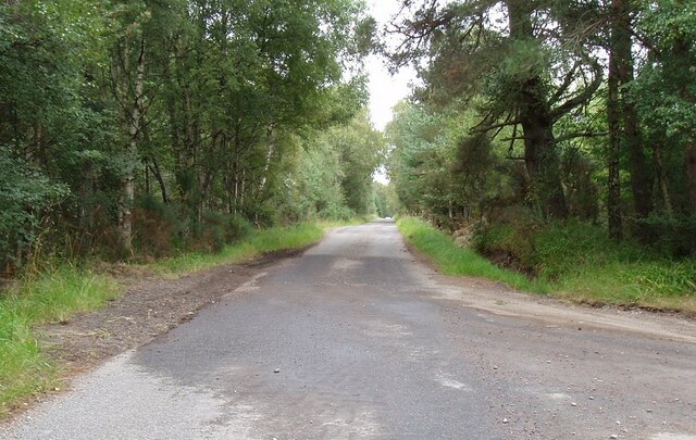
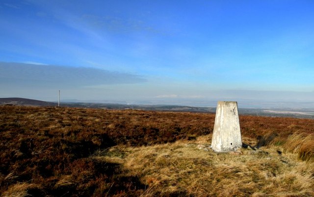
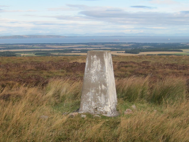
Clunas Reservoir Images

Images are sourced within 2km of 57.488941/-3.908734 or Grid Reference NH8545. Thanks to Geograph Open Source API. All images are credited.

Unclassified road at Rereach
Glengeoullie Bridge The bridge spans the Riereach Burn
Glengeoullie Bridge
The bridge spans the Riereach Burn
Old Military road near Rereach
Track in Cawdor Wood It is always hard to be definite about these things when named woods merge into one another, but in area, Cawdor Wood - named after the village and/or castle at its Northern end - covers about two and a half grid-squares and parts of it appear in seven.
Some of the wood is a protected area, and some of it is not. The trees on the left side of the track  are unprotected, whereas those on the right are. Confusingly, the protected part of this 'ancient' mixed wood is also just named Cawdor Wood by the relevant official organisations.
It is officially designated as a Special Area of Conservation (SAC), one of 200-odd in Scotland. In the hierarchy of these things, this really means that it is a Site of Special Scientific Interest (SSSI) with greater protection. The big oak trees further North, along with the rare lichens that grow on some of their trunks, are the main reasons for this. The thing I remember the most about this wood, though, is the unbelievable amount of slugs that were very slowly wriggling their way along the many tracks and paths.
The SAC is, very roughly, in the shape of a letter 'q', the land on the right of the track here being part of the tail of the letter, which straddles Riereach Burn.
I put 'ancient' within quotation marks above because, although the wood is definitely old, nobody really seems to know exactly how old, tree felling and replanting having taken place throughout the years. There is actually a mention of cows grazing amongst the trees as recently as the 1950s in a report somewhere online.
Track in Cawdor Wood
It is always hard to be definite about these things when named woods merge into one another, but in area, Cawdor Wood - named after the village and/or castle at its Northern end - covers about two and a half grid-squares and parts of it appear in seven. Some of the wood is a protected area, and some of it is not. The trees on the left side of the track are unprotected, whereas those on the right are. Confusingly, the protected part of this 'ancient' mixed wood is also just named Cawdor Wood by the relevant official organisations. It is officially designated as a Special Area of Conservation (SAC), one of 200-odd in Scotland. In the hierarchy of these things, this really means that it is a Site of Special Scientific Interest (SSSI) with greater protection. The big oak trees further North, along with the rare lichens that grow on some of their trunks, are the main reasons for this. The thing I remember the most about this wood, though, is the unbelievable amount of slugs that were very slowly wriggling their way along the many tracks and paths. The SAC is, very roughly, in the shape of a letter 'q', the land on the right of the track here being part of the tail of the letter, which straddles Riereach Burn. I put 'ancient' within quotation marks above because, although the wood is definitely old, nobody really seems to know exactly how old, tree felling and replanting having taken place throughout the years. There is actually a mention of cows grazing amongst the trees as recently as the 1950s in a report somewhere online.
Carn Maol summit Trig post and flagpole, (flag flown to warn that a shoot is in progress).
Carn Maol summit
Trig post and flagpole, (flag flown to warn that a shoot is in progress).
Hut on grouse moor
Hut on grouse moor
Riereach Burn with Scots Pines The Riereach Burn (Cawdor estate) looking north towards the Moray Firth.
Riereach Burn with Scots Pines
The Riereach Burn (Cawdor estate) looking north towards the Moray Firth.
Glengeoullie Cottage The ancillary buildings, kennels etc., suggest this is a former gamekeeper's cottage connected with Cawdor Castle estate.
Glengeoullie Cottage
The ancillary buildings, kennels etc., suggest this is a former gamekeeper's cottage connected with Cawdor Castle estate.
Wall end This wall end and old cast iron post dates back to the original enclosure of these fields, c.1850.
Wall end
This wall end and old cast iron post dates back to the original enclosure of these fields, c.1850.
Derelict building This building appears to have been a former dwelling.
Derelict building
This building appears to have been a former dwelling.
The Glengoullie Burn Viewed from the bridge that General Wade and his troops trooped over a few centuries ago.....
The Glengoullie Burn
Viewed from the bridge that General Wade and his troops trooped over a few centuries ago.....
Triangulation Pillar S7086 at Carn Maol
Minor road through Cawdor Wood
Achneim Wood Widely spaced pines, Cawdor.
Achneim Wood
Widely spaced pines, Cawdor.
Foxmoss Wood Cawdor Estate woodlands.
Foxmoss Wood
Cawdor Estate woodlands.
Riereach Burn The start of a long deep gorge through the Cawdor woodlands.
Riereach Burn
The start of a long deep gorge through the Cawdor woodlands.
Ford over the Riereach Burn
Clunas Reservoir Landrover track at this point is extremely steep and badly scoured, with numerous rocks exposed – making it very hard going on a bike.
Clunas Reservoir
Landrover track at this point is extremely steep and badly scoured, with numerous rocks exposed – making it very hard going on a bike.
Show me another place!

Clunas Reservoir is located at Grid Ref: NH8545 (Lat: 57.488941, Lng: -3.908734)

Unitary Authority: Highland

Police Authority: Highlands and Islands

What 3 Words

///rocket.trying.porridge. Near Nairn, Highland

Nearby Locations

Clunas Reservoir

Related Wikis

Cawdor

Cawdor (Scottish Gaelic: Caladair) is a village and parish in the Highland council area, Scotland. The village is 5 miles (8 kilometres) south-southwest...

Dun Evan

Dun Evan or the Doune of Cawdor is a hill fort located 2.5 kilometres (1.6 mi) south west of Cawdor in the Highland area of Scotland. It is situated on...

Cawdor Castle

Cawdor Castle is a castle in the parish of Cawdor in Nairnshire, Scotland. It is built around a 15th-century tower house, with substantial additions in...

Culcharry

Culcharry is a small residential settlement, close to the village of Cawdor and the hamlet of Brackla, lying 4 miles southwest of Nairn, in Nairnshire...

Nearby Amenities

Located within 500m of 57.488941,-3.908734
Hunting Stand
Hunting Stand: grouse_butt
Lat/Long: 57.492591/-3.9066946
Hunting Stand
Hunting Stand: grouse_butt
Lat/Long: 57.492844/-3.9062451
Hunting Stand
Hunting Stand: grouse_butt
Lat/Long: 57.4919843/-3.9077741
Hunting Stand
Hunting Stand: grouse_butt
Lat/Long: 57.4910057/-3.9094976
Hunting Stand
Hunting Stand: grouse_butt
Lat/Long: 57.4913347/-3.9089101
Hunting Stand
Hunting Stand: grouse_butt
Lat/Long: 57.4906604/-3.9101327
Hunting Stand
Hunting Stand: grouse_butt
Lat/Long: 57.4917007/-3.908309
Hunting Stand
Hunting Stand: grouse_butt
Lat/Long: 57.4922755/-3.9072419
Hunting Stand
Hunting Stand: grouse_butt
Lat/Long: 57.4903413/-3.9106806
The data included in this document is from www.openstreetmap.org. The data is made available under ODbL.

Have you been to Clunas Reservoir?

Leave your review of Clunas Reservoir below (or comments, questions and feedback).