Loch Glassie
Lake, Pool, Pond, Freshwater Marsh in Perthshire
Scotland
Loch Glassie
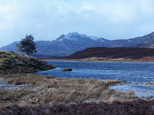
Loch Glassie is a picturesque freshwater loch located in the heart of Perthshire, Scotland. Nestled amidst lush greenery and rolling hills, this tranquil water body stretches over an area of approximately 50 acres. It is known for its serene beauty and attracts both locals and tourists seeking a peaceful escape from the bustling city life.
The loch is known for its crystal-clear, unpolluted waters, which are home to a diverse range of aquatic plants and wildlife. The surrounding area is rich in biodiversity, with numerous species of birds, insects, and small mammals making Loch Glassie their habitat. Birdwatchers often visit the loch to catch a glimpse of rare species such as the osprey and the golden eagle.
The calm waters of Loch Glassie offer opportunities for various recreational activities. Fishing enthusiasts can enjoy angling for brown trout and pike, as the loch is renowned for its abundant fish population. Additionally, the loch is a popular spot for boating and kayaking, allowing visitors to explore its peaceful waters at their own pace.
Surrounding the loch, there is a freshwater marsh, which serves as a natural habitat for a variety of wetland plants and animals. This marshland is particularly important for its role in water filtration and flood prevention, contributing to the overall health and balance of the ecosystem.
Loch Glassie, with its scenic beauty and rich biodiversity, is a true gem of Perthshire. It offers visitors a chance to immerse themselves in nature, relax, and appreciate the wonders of the Scottish countryside.
If you have any feedback on the listing, please let us know in the comments section below.
Loch Glassie Images
Images are sourced within 2km of 56.653351/-3.8760481 or Grid Reference NN8552. Thanks to Geograph Open Source API. All images are credited.


Loch Glassie is located at Grid Ref: NN8552 (Lat: 56.653351, Lng: -3.8760481)
Unitary Authority: Perth and Kinross
Police Authority: Tayside
What 3 Words
///finest.agent.crunched. Near Aberfeldy, Perth & Kinross
Nearby Locations
Related Wikis

Loch Derculich
Loch Derculich is a freshwater loch in central highlands of Scotland, in Perth and Kinross. Loch Tummel is located three miles to the north. == Habitation... ==
Farragon Hill
Farragon Hill (782 m) is a peak in the foothills of the Grampian Mountains of Scotland. It lies above the town of Aberfeldy in Perthshire. The hill is...

Weem Castle
Weem Castle is a former castle near Weem, Scotland. The castle was located near Castle Menzies. The castle became the seat of the Menzies family after...

Weem
Weem (Scottish Gaelic: Baile a' Chlachain) is a village on the B846 near Aberfeldy in Perthshire, Scotland. The name Weem is derived from the Gaelic uamh...

Cluny House
Cluny House is Category B listed building in Aberfeldy, Perth and Kinross, Scotland. It dates to around 1825. Its tower was added about fifty years later...
Aberfeldy Footbridge
Aberfeldy Footbridge is a pedestrian bridge crossing the River Tay in Aberfeldy, Perth and Kinross. Built in 1992 and is the world’s first all-plastic...

Wade's Bridge
Wade's Bridge (originally known as Tay Bridge) is five-arch bridge crossing the River Tay at Aberfeldy, Perth and Kinross, Scotland. A Category A listed...
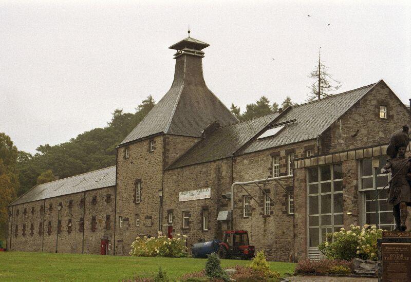
Aberfeldy distillery
Aberfeldy distillery is a single malt Scotch whisky distillery in Scotland. == History == Aberfeldy Distillery was founded by the John Dewar & Sons, Ltd...
Nearby Amenities
Located within 500m of 56.653351,-3.8760481Have you been to Loch Glassie?
Leave your review of Loch Glassie below (or comments, questions and feedback).