Buckieburn Reservoir

Lake, Pool, Pond, Freshwater Marsh in Stirlingshire

Scotland

Buckieburn Reservoir

Old fingerpost A photo taken in poor light showing the unique fingerpost at the crossroads just north of Carron Bridge which is the southernmost boundary of Stirlingshire with North Lanarkshire and Falkirk.  The only other recorded post of this style was, in 1983, at the junction of the A836 and B838 north of Lairg.  Now lost.
Old fingerpost Credit: John Riddell

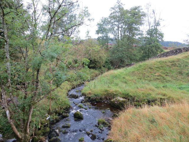
Buckieburn Reservoir is a freshwater lake located in Stirlingshire, Scotland. It covers an area of approximately 30 acres and is situated in a picturesque setting surrounded by rolling hills and lush greenery. The reservoir is an important water source for the local community and plays a vital role in supplying clean drinking water to the surrounding area.

The lake is relatively shallow, with an average depth of around 10 feet, and its waters are fed by various streams and springs in the area. It is a popular spot for anglers, as it provides a habitat for a variety of fish species, including brown trout, rainbow trout, and pike. Fishing permits are required for those wishing to fish in the reservoir.

Buckieburn Reservoir also serves as a habitat for various bird species, making it a haven for birdwatchers. Visitors can spot a range of water birds such as mallards, swans, and herons, as well as woodland birds like robins and thrushes.

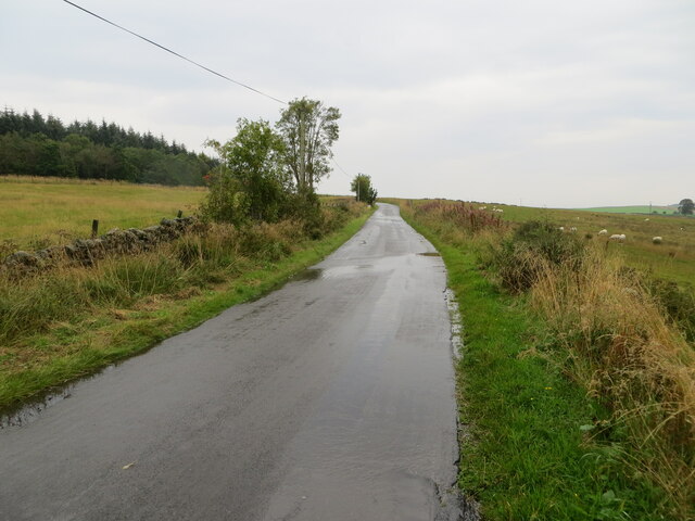
The surrounding area of the reservoir features a network of walking trails, offering visitors the opportunity to explore the beautiful landscape and enjoy scenic views of the water. The reservoir is also a popular spot for picnicking and family outings, with designated areas for relaxation and recreation.

Overall, Buckieburn Reservoir is a tranquil and scenic freshwater lake, providing a valuable water source, recreational opportunities, and a habitat for diverse wildlife.

If you have any feedback on the listing, please let us know in the comments section below.

Buckieburn Reservoir Images

Images are sourced within 2km of 56.044435/-4.0290739 or Grid Reference NS7385. Thanks to Geograph Open Source API. All images are credited.

Old fingerpost A photo taken in poor light showing the unique fingerpost at the crossroads just north of Carron Bridge which is the southernmost boundary of Stirlingshire with North Lanarkshire and Falkirk.  The only other recorded post of this style was, in 1983, at the junction of the A836 and B838 north of Lairg.  Now lost.
Old fingerpost
A photo taken in poor light showing the unique fingerpost at the crossroads just north of Carron Bridge which is the southernmost boundary of Stirlingshire with North Lanarkshire and Falkirk. The only other recorded post of this style was, in 1983, at the junction of the A836 and B838 north of Lairg. Now lost.
Old fingerpost A clearer view of the unique fingerpost at the crossroads on the B818 near Carron Bridge.  It was cast at the Smith and Wellstead Foundry in Bonnybridge and is the only known survivor in Scotland of this style of fingerpost with a 6" diameter ball finial and arrowhead ends to the fingers.
Old fingerpost
A clearer view of the unique fingerpost at the crossroads on the B818 near Carron Bridge. It was cast at the Smith and Wellstead Foundry in Bonnybridge and is the only known survivor in Scotland of this style of fingerpost with a 6" diameter ball finial and arrowhead ends to the fingers.
Old fingerpost This photograph shows the zigzag pattern of 4 inverted Vs cast around the post beneath the fingers of the unique fingerpost on the B818 near Carron Bridge.  The two lost fingers may have indicated the routes to Denny and Stirling.
Old fingerpost
This photograph shows the zigzag pattern of 4 inverted Vs cast around the post beneath the fingers of the unique fingerpost on the B818 near Carron Bridge. The two lost fingers may have indicated the routes to Denny and Stirling.
Buckie Burn and a tributary Looking south-westward from the road bridge near Easter Buckieburn. Buckie Burn is joining from the right.
Buckie Burn and a tributary
Looking south-westward from the road bridge near Easter Buckieburn. Buckie Burn is joining from the right.
Minor road heading in the direction of Buckieburn Looking north-eastward.
Minor road heading in the direction of Buckieburn
Looking north-eastward.
Minor road leaving the B818 at Carron Bridge Looking north-eastward. Signage suggests that this road leads to Stirling.
Minor road leaving the B818 at Carron Bridge
Looking north-eastward. Signage suggests that this road leads to Stirling.
Earl's Burn View from the A818
Earl's Burn
View from the A818
River Carron Downstream of the dam and Forestry car park.
River Carron
Downstream of the dam and Forestry car park.
About to cross Carron Bridge Approaching from the south.
About to cross Carron Bridge
Approaching from the south.
Bridge, River Carron
Road to Shankhead Between Stirling and Carron Bridge.
Road to Shankhead
Between Stirling and Carron Bridge.
River Carron at Townfoot Townfoot is the farm on the left of the photograph.
River Carron at Townfoot
Townfoot is the farm on the left of the photograph.
New Carron Bridge New being a relative term, as this Category B listed stone bridge carrying the B818 over the River Carron dates from the 19th century. The river forms the boundary between Falkirk and Stirling districts, and the purple Stirling sign can be seen on the far side of the bridge.
New Carron Bridge
New being a relative term, as this Category B listed stone bridge carrying the B818 over the River Carron dates from the 19th century. The river forms the boundary between Falkirk and Stirling districts, and the purple Stirling sign can be seen on the far side of the bridge.
Townfoot Seen from the other side of the River Carron.
Townfoot
Seen from the other side of the River Carron.
New Carron Bridge Category B listed stone bridge carrying the B818 over the River Carron dating from the 19th century. The river forms the boundary between Falkirk and Stirling districts, and the purple Stirling sign can be seen on the far side of the bridge.
New Carron Bridge
Category B listed stone bridge carrying the B818 over the River Carron dating from the 19th century. The river forms the boundary between Falkirk and Stirling districts, and the purple Stirling sign can be seen on the far side of the bridge.
River Carron Seen from New Carron Bridge.
River Carron
Seen from New Carron Bridge.
River Carron Seen from New Carron Bridge. Townfoot [<a title="https://www.geograph.org.uk/photo/5817070" href="https://www.geograph.org.uk/photo/5817070">Link</a>] can be seen on the left.
River Carron
Seen from New Carron Bridge. Townfoot [Link] can be seen on the left.
Road towards Stirling at Easter Buckieburn
Show me another place!

Buckieburn Reservoir is located at Grid Ref: NS7385 (Lat: 56.044435, Lng: -4.0290739)

Unitary Authority: Stirling

Police Authority: Forth Valley

What 3 Words

///listening.variances.scorch. Near Dunipace, Falkirk

Nearby Locations

Buckieburn Reservoir

Related Wikis

Duncarron

Duncarron is a modern reproduction of a fortified village from the early Middle Ages of Scotland. It is the reconstruction of a typical residence of a...

Stirling Transmitting Station

Stirling Transmitting Station is a transmission facility on Earl's Hill southwest of Stirling, Scotland. It was built at the end of the 1950s for the radio...

Central 103.1 FM

Central 103.1 FM is an Independent Local Radio station serving Falkirk, Stirling, Clackmannanshire and the Forth Valley. It is owned and operated by businessman...

Kingdom of Strathclyde

Strathclyde (lit. "broad valley of the Clyde", Welsh: Ystrad Clud, Latin: Cumbria) was a Brittonic kingdom in northern Britain during the Middle Ages....

Have you been to Buckieburn Reservoir?

Leave your review of Buckieburn Reservoir below (or comments, questions and feedback).