Boat Pool

Lake, Pool, Pond, Freshwater Marsh in Kirkcudbrightshire

Scotland

Boat Pool

The back road to Tongland This road runs parallel to the River Dee, but maintains some distance from it.
The back road to Tongland Credit: Gordon Hatton

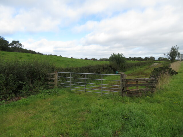
Boat Pool is a freshwater marsh located in Kirkcudbrightshire, Scotland. It is a small body of water that is surrounded by lush greenery and provides a habitat for a variety of plant and animal species. The pool is fed by natural springs and is known for its clear, clean water.

Boat Pool is a popular spot for fishing, as it is home to a diverse range of fish species including trout, perch, and pike. Anglers can often be seen casting their lines into the water in the hopes of catching a big one.

The pool is also a tranquil spot for birdwatching, with a number of bird species frequenting the area. Visitors can spot ducks, herons, and other waterfowl enjoying the peaceful surroundings of Boat Pool.

Overall, Boat Pool is a picturesque and serene natural attraction that offers visitors the chance to connect with nature and enjoy the beauty of the Scottish countryside. Whether you are a fisherman, a birdwatcher, or simply looking for a peaceful spot to relax, Boat Pool is a must-visit destination in Kirkcudbrightshire.

If you have any feedback on the listing, please let us know in the comments section below.

Boat Pool Images

Images are sourced within 2km of 54.89238/-4.0077305 or Grid Reference NX7157. Thanks to Geograph Open Source API. All images are credited.

The back road to Tongland This road runs parallel to the River Dee, but maintains some distance from it.
The back road to Tongland
This road runs parallel to the River Dee, but maintains some distance from it.
Cattle near Netherthird Occupying a field in the NW corner of the grid square.
Cattle near Netherthird
Occupying a field in the NW corner of the grid square.
The road to Castle Douglas This is the minor road linking Tongland and Castle Douglas. Anyone in a hurry would be well advised to use the A711 on the other side of the Dee.
The road to Castle Douglas
This is the minor road linking Tongland and Castle Douglas. Anyone in a hurry would be well advised to use the A711 on the other side of the Dee.
Old road alignment near Bridge of Dee A tidying up of the A75 through verdant fields.
Old road alignment near Bridge of Dee
A tidying up of the A75 through verdant fields.
Netherthird Farm A track leads to open farmland at Netherthird Farm.
Netherthird Farm
A track leads to open farmland at Netherthird Farm.
Farmland near to Mayfield The track marks the edge of the field boundary and continues to the River Dee.
Farmland near to Mayfield
The track marks the edge of the field boundary and continues to the River Dee.
From Billies Bridge to Billies Farm The beginning of the track to Billies Farm.
From Billies Bridge to Billies Farm
The beginning of the track to Billies Farm.
The road at Mayfield The entrance to Mayfield farm is to the right from the main road.
The road at Mayfield
The entrance to Mayfield farm is to the right from the main road.
A lay-by on the A711 A much needed lay-by on the A711 just before it joins the A75.
A lay-by on the A711
A much needed lay-by on the A711 just before it joins the A75.
Lay-by on the A75 Looking east from a lay-by on the A75.
Lay-by on the A75
Looking east from a lay-by on the A75.
Near to Barstibly A lay-by on the A711 south of Barstibly.
Near to Barstibly
A lay-by on the A711 south of Barstibly.
A75 eastbound nears the A711 junction
Dismantled Railway at Barncrosh Drive Entrance The bank can be seen running through the woods here.

Railway Link : <span class="nowrap"><a title="https://en.wikipedia.org/wiki/Castle_Douglas_and_Dumfries_Railway" rel="nofollow ugc noopener" href="https://en.wikipedia.org/wiki/Castle_Douglas_and_Dumfries_Railway">Link</a><img style="margin-left:2px;" alt="External link" title="External link - shift click to open in new window" src="https://s1.geograph.org.uk/img/external.png" width="10" height="10"/></span>
Dismantled Railway at Barncrosh Drive Entrance
The bank can be seen running through the woods here. Railway Link : LinkExternal link
Eastbound A75 near A711 Junction The A75 is a Primary Trunk Road; the main through route for traffic between northern England and Northern Ireland (more specifically the ferry terminal from Cairnryan to Belfast and Larne). It runs for 95½ miles between Stranraer and the A74(M) at Gretna, close to the Border with England and the M6 Motorway. Although it is an important trunk route (it is also a Euroroute, the E18), and has been subject to a number of upgrades over the years, the majority of the road is still single-carriageway although there are a few short dual carriageway sections and some three-lane sections which allow overtaking in one direction.
Eastbound A75 near A711 Junction
The A75 is a Primary Trunk Road; the main through route for traffic between northern England and Northern Ireland (more specifically the ferry terminal from Cairnryan to Belfast and Larne). It runs for 95½ miles between Stranraer and the A74(M) at Gretna, close to the Border with England and the M6 Motorway. Although it is an important trunk route (it is also a Euroroute, the E18), and has been subject to a number of upgrades over the years, the majority of the road is still single-carriageway although there are a few short dual carriageway sections and some three-lane sections which allow overtaking in one direction.
Layby on the A75 The A75 is a Primary Trunk Road; the main through route for traffic between northern England and Northern Ireland (more specifically the ferry terminal from Cairnryan to Belfast and Larne). It runs for 95½ miles between Stranraer and the A74(M) at Gretna, close to the Border with England and the M6 Motorway. Although it is an important trunk route (it is also a Euroroute, the E18), and has been subject to a number of upgrades over the years, the majority of the road is still single-carriageway although there are a few short dual carriageway sections and some three-lane sections which allow overtaking in one direction.
Layby on the A75
The A75 is a Primary Trunk Road; the main through route for traffic between northern England and Northern Ireland (more specifically the ferry terminal from Cairnryan to Belfast and Larne). It runs for 95½ miles between Stranraer and the A74(M) at Gretna, close to the Border with England and the M6 Motorway. Although it is an important trunk route (it is also a Euroroute, the E18), and has been subject to a number of upgrades over the years, the majority of the road is still single-carriageway although there are a few short dual carriageway sections and some three-lane sections which allow overtaking in one direction.
A714 Looking south from layby
A714
Looking south from layby
View to the west From layby on A714
View to the west
From layby on A714
Road to Barstibly
Road to Barstibly
Show me another place!

Boat Pool is located at Grid Ref: NX7157 (Lat: 54.89238, Lng: -4.0077305)

Unitary Authority: Dumfries and Galloway

Police Authority: Dumfries and Galloway

What 3 Words

///erupt.crowds.shampoo. Near Kirkcudbright, Dumfries & Galloway

Nearby Locations

Boat Pool

Related Wikis

Ringford

Ringford is a village in the historical county of Kirkcudbrightshire in Dumfries and Galloway located at grid reference NX689578 beside the Tarff Water...

Tarff railway station

Tarff railway station served the village of Ringford, Dumfries and Galloway, Scotland from 1864 to 1965 on the Kirkcudbright Railway. == History == The...

Bridge of Dee, Galloway

Bridge of Dee, Galloway is a settlement on the River Dee, Galloway. It lies on the A75 just west of Castle Douglas, and north-east of Kirkcudbright. The...

Tongland

Tongland is a small village about 2 miles (3 km) north of Kirkcudbright, in the historic county of Kirkcudbrightshire in Dumfries and Galloway, Scotland...

Nearby Amenities

Located within 500m of 54.89238,-4.0077305
Source: OS OpenData Vectormap District
Lat/Long: 54.8902249/-4.0085196
Source: OS OpenData Vectormap District
Lat/Long: 54.8902592/-4.008512
Source: OS OpenData Vectormap District
Lat/Long: 54.8903064/-4.0085377
Source: OS OpenData Vectormap District
Lat/Long: 54.8903354/-4.008522
Source: OS OpenData Vectormap District
Lat/Long: 54.8903785/-4.0084711
Source: OS OpenData Vectormap District
Lat/Long: 54.890425/-4.0083783
Source: OS OpenData Vectormap District
Lat/Long: 54.8905166/-4.0083299
Source: OS OpenData Vectormap District
Lat/Long: 54.8905719/-4.0082437
Source: OS OpenData Vectormap District
Lat/Long: 54.8906422/-4.0081771
Source: OS OpenData Vectormap District
Lat/Long: 54.8907111/-4.00809
Source: OS OpenData Vectormap District
Lat/Long: 54.8907512/-4.008
Source: OS OpenData Vectormap District
Lat/Long: 54.890848/-4.0079082
Source: OS OpenData Vectormap District
Lat/Long: 54.8909185/-4.0077776
Source: OS OpenData Vectormap District
Lat/Long: 54.8909376/-4.0077068
Source: OS OpenData Vectormap District
Lat/Long: 54.890934/-4.0075975
Source: OS OpenData Vectormap District
Lat/Long: 54.8909137/-4.0075247
Source: OS OpenData Vectormap District
Lat/Long: 54.890882/-4.0074811
Source: OS OpenData Vectormap District
Lat/Long: 54.8908398/-4.0074805
Source: OS OpenData Vectormap District
Lat/Long: 54.8906259/-4.0076414
Source: OS OpenData Vectormap District
Lat/Long: 54.8904919/-4.0077564
Source: OS OpenData Vectormap District
Lat/Long: 54.8903093/-4.0079266
Source: OS OpenData Vectormap District
Lat/Long: 54.890247/-4.0079984
Source: OS OpenData Vectormap District
Lat/Long: 54.8902006/-4.008088
Source: OS OpenData Vectormap District
Lat/Long: 54.8901685/-4.0081816
Source: OS OpenData Vectormap District
Lat/Long: 54.8901596/-4.0082326
Source: OS OpenData Vectormap District
Lat/Long: 54.8901656/-4.0083545
Source: OS OpenData Vectormap District
Lat/Long: 54.8902012/-4.0084857
Source: OS OpenData Vectormap District
Lat/Long: 54.8904344/-4.0094937
Source: OS OpenData Vectormap District
Lat/Long: 54.8904778/-4.0094771
Source: OS OpenData Vectormap District
Lat/Long: 54.8905218/-4.0093156
Source: OS OpenData Vectormap District
Lat/Long: 54.8905423/-4.0092714
Source: OS OpenData Vectormap District
Lat/Long: 54.8905699/-4.0092384
Source: OS OpenData Vectormap District
Lat/Long: 54.8909636/-4.0090164
Source: OS OpenData Vectormap District
Lat/Long: 54.8911514/-4.0088573
Source: OS OpenData Vectormap District
Lat/Long: 54.891231/-4.0088285
Source: OS OpenData Vectormap District
Lat/Long: 54.8913761/-4.00875
Source: OS OpenData Vectormap District
Lat/Long: 54.8914707/-4.0086829
Source: OS OpenData Vectormap District
Lat/Long: 54.891561/-4.0084941
Source: OS OpenData Vectormap District
Lat/Long: 54.8916166/-4.0082832
Source: OS OpenData Vectormap District
Lat/Long: 54.8917115/-4.0080883
Source: OS OpenData Vectormap District
Lat/Long: 54.8917382/-4.0079384
Source: OS OpenData Vectormap District
Lat/Long: 54.8918058/-4.0077656
Source: OS OpenData Vectormap District
Lat/Long: 54.8918093/-4.0077143
Source: OS OpenData Vectormap District
Lat/Long: 54.8918019/-4.0076765
Source: OS OpenData Vectormap District
Lat/Long: 54.8917454/-4.0075567
Source: OS OpenData Vectormap District
Lat/Long: 54.8916863/-4.0075476
Source: OS OpenData Vectormap District
Lat/Long: 54.8916535/-4.0075709
Source: OS OpenData Vectormap District
Lat/Long: 54.8915975/-4.0076414
Source: OS OpenData Vectormap District
Lat/Long: 54.8915318/-4.0077597
Source: OS OpenData Vectormap District
Lat/Long: 54.8914227/-4.0078884
Source: OS OpenData Vectormap District
Lat/Long: 54.8913559/-4.0080114
Source: OS OpenData Vectormap District
Lat/Long: 54.891333/-4.0080383
Source: OS OpenData Vectormap District
Lat/Long: 54.8912895/-4.0080627
Source: OS OpenData Vectormap District
Lat/Long: 54.8912562/-4.008061
Source: OS OpenData Vectormap District
Lat/Long: 54.8911763/-4.0080025
Source: OS OpenData Vectormap District
Lat/Long: 54.891146/-4.0080431
Source: OS OpenData Vectormap District
Lat/Long: 54.8910958/-4.0081435
Source: OS OpenData Vectormap District
Lat/Long: 54.8909502/-4.0083592
Source: OS OpenData Vectormap District
Lat/Long: 54.8909157/-4.0084339
Source: OS OpenData Vectormap District
Lat/Long: 54.8907835/-4.0086035
Source: OS OpenData Vectormap District
Lat/Long: 54.8907601/-4.0086569
Source: OS OpenData Vectormap District
Lat/Long: 54.890733/-4.0087757
Source: OS OpenData Vectormap District
Lat/Long: 54.890678/-4.0088415
Source: OS OpenData Vectormap District
Lat/Long: 54.8905603/-4.0090524
Source: OS OpenData Vectormap District
Lat/Long: 54.8904999/-4.0091196
Source: OS OpenData Vectormap District
Lat/Long: 54.8904434/-4.0092774
Source: OS OpenData Vectormap District
Lat/Long: 54.8904108/-4.0094005
Source: OS OpenData Vectormap District
Lat/Long: 54.8904149/-4.0094771
Source: OS OpenData Vectormap District
Lat/Long: 54.8961288/-4.0034301
Source: OS OpenData Vectormap District
Lat/Long: 54.8961508/-4.0036215
Source: OS OpenData Vectormap District
Lat/Long: 54.8961757/-4.0036898
Source: OS OpenData Vectormap District
Lat/Long: 54.8962605/-4.0038215
Source: OS OpenData Vectormap District
Lat/Long: 54.8963562/-4.0040853
Source: OS OpenData Vectormap District
Lat/Long: 54.8963629/-4.0041497
Source: OS OpenData Vectormap District
Lat/Long: 54.8963601/-4.0044295
Source: OS OpenData Vectormap District
Lat/Long: 54.8963659/-4.0044794
Source: OS OpenData Vectormap District
Lat/Long: 54.8963593/-4.0046266
Source: OS OpenData Vectormap District
Lat/Long: 54.8963299/-4.0048076
Source: OS OpenData Vectormap District
Lat/Long: 54.8963065/-4.004861
Source: OS OpenData Vectormap District
Lat/Long: 54.8962764/-4.0048861
Source: OS OpenData Vectormap District
Lat/Long: 54.8962114/-4.0049078
Source: OS OpenData Vectormap District
Lat/Long: 54.8961162/-4.0050075
Source: OS OpenData Vectormap District
Lat/Long: 54.8960391/-4.0051066
Source: OS OpenData Vectormap District
Lat/Long: 54.8959826/-4.0051553
Source: OS OpenData Vectormap District
Lat/Long: 54.8958757/-4.0052046
Source: OS OpenData Vectormap District
Lat/Long: 54.8958479/-4.0052016
Source: OS OpenData Vectormap District
Lat/Long: 54.8957684/-4.0051166
Source: OS OpenData Vectormap District
Lat/Long: 54.8957334/-4.0051133
Source: OS OpenData Vectormap District
Lat/Long: 54.895699/-4.0051303
Source: OS OpenData Vectormap District
Lat/Long: 54.895668/-4.0051568
Source: OS OpenData Vectormap District
Lat/Long: 54.8956072/-4.0052474
Source: OS OpenData Vectormap District
Lat/Long: 54.8955834/-4.005268
Source: OS OpenData Vectormap District
Lat/Long: 54.8954829/-4.0053065
Source: OS OpenData Vectormap District
Lat/Long: 54.8952624/-4.0055467
Source: OS OpenData Vectormap District
Lat/Long: 54.895008/-4.0057633
Source: OS OpenData Vectormap District
Lat/Long: 54.8948727/-4.0059062
Source: OS OpenData Vectormap District
Lat/Long: 54.8947974/-4.0059477
Source: OS OpenData Vectormap District
Lat/Long: 54.8946069/-4.005996
Source: OS OpenData Vectormap District
Lat/Long: 54.8944234/-4.0060704
Source: OS OpenData Vectormap District
Lat/Long: 54.8943771/-4.0060978
Source: OS OpenData Vectormap District
Lat/Long: 54.8943087/-4.0061599
Source: OS OpenData Vectormap District
Lat/Long: 54.8939212/-4.0066006
Source: OS OpenData Vectormap District
Lat/Long: 54.8938685/-4.0066885
Source: OS OpenData Vectormap District
Lat/Long: 54.8937697/-4.0067925
Source: OS OpenData Vectormap District
Lat/Long: 54.8936693/-4.0068584
Source: OS OpenData Vectormap District
Lat/Long: 54.8935346/-4.006982
Source: OS OpenData Vectormap District
Lat/Long: 54.8934014/-4.0071569
Source: OS OpenData Vectormap District
Lat/Long: 54.8933072/-4.007197
Source: OS OpenData Vectormap District
Lat/Long: 54.8932717/-4.0072755
Source: OS OpenData Vectormap District
Lat/Long: 54.8932293/-4.0073341
Source: OS OpenData Vectormap District
Lat/Long: 54.8931689/-4.0073707
Source: OS OpenData Vectormap District
Lat/Long: 54.8930881/-4.0074005
Source: OS OpenData Vectormap District
Lat/Long: 54.8930493/-4.0074656
Source: OS OpenData Vectormap District
Lat/Long: 54.8930217/-4.0075695
Source: OS OpenData Vectormap District
Lat/Long: 54.8930303/-4.0078107
Source: OS OpenData Vectormap District
Lat/Long: 54.893008/-4.007911
Source: OS OpenData Vectormap District
Lat/Long: 54.8929909/-4.0079449
Source: OS OpenData Vectormap District
Lat/Long: 54.8929722/-4.00796
Source: OS OpenData Vectormap District
Lat/Long: 54.8928812/-4.0079563
Source: OS OpenData Vectormap District
Lat/Long: 54.8928611/-4.0079755
Source: OS OpenData Vectormap District
Lat/Long: 54.8928571/-4.0080084
Source: OS OpenData Vectormap District
Lat/Long: 54.8928088/-4.0080639
Source: OS OpenData Vectormap District
Lat/Long: 54.8927836/-4.0080537
Source: OS OpenData Vectormap District
Lat/Long: 54.8927356/-4.0080083
Source: OS OpenData Vectormap District
Lat/Long: 54.8927283/-4.0080157
Source: OS OpenData Vectormap District
Lat/Long: 54.8926717/-4.0081267
Source: OS OpenData Vectormap District
Lat/Long: 54.8924155/-4.0085584
Source: OS OpenData Vectormap District
Lat/Long: 54.8923903/-4.0086149
Source: OS OpenData Vectormap District
Lat/Long: 54.8922593/-4.008769
Source: OS OpenData Vectormap District
Lat/Long: 54.8920397/-4.0089498
Source: OS OpenData Vectormap District
Lat/Long: 54.8918373/-4.0090745
Source: OS OpenData Vectormap District
Lat/Long: 54.8917258/-4.0091229
Source: OS OpenData Vectormap District
Lat/Long: 54.8915029/-4.0093395
Source: OS OpenData Vectormap District
Lat/Long: 54.8914166/-4.0093991
Source: OS OpenData Vectormap District
Lat/Long: 54.8913305/-4.0094416
Source: OS OpenData Vectormap District
Lat/Long: 54.8912373/-4.0095305
Source: OS OpenData Vectormap District
Lat/Long: 54.8910992/-4.0096195
Source: OS OpenData Vectormap District
Lat/Long: 54.8910145/-4.0096909
Source: OS OpenData Vectormap District
Lat/Long: 54.8908522/-4.0097733
Source: OS OpenData Vectormap District
Lat/Long: 54.8907333/-4.0097923
Source: OS OpenData Vectormap District
Lat/Long: 54.8906536/-4.0098242
Source: OS OpenData Vectormap District
Lat/Long: 54.8904621/-4.0099363
Source: OS OpenData Vectormap District
Lat/Long: 54.8902641/-4.0101151
Source: OS OpenData Vectormap District
Lat/Long: 54.8901444/-4.0101793
Source: OS OpenData Vectormap District
Lat/Long: 54.8900687/-4.0102473
Source: OS OpenData Vectormap District
Lat/Long: 54.8899157/-4.0104206
Source: OS OpenData Vectormap District
Lat/Long: 54.8897935/-4.0105314
Source: OS OpenData Vectormap District
Lat/Long: 54.8896406/-4.0106969
Source: OS OpenData Vectormap District
Lat/Long: 54.8893078/-4.0110904
Source: OS OpenData Vectormap District
Lat/Long: 54.8891974/-4.0111956
Source: OS OpenData Vectormap District
Lat/Long: 54.888965/-4.0106289
Source: OS OpenData Vectormap District
Lat/Long: 54.889089/-4.010356
Source: OS OpenData Vectormap District
Lat/Long: 54.8891333/-4.0101212
Source: OS OpenData Vectormap District
Lat/Long: 54.8892574/-4.0097407
Source: OS OpenData Vectormap District
Lat/Long: 54.8893145/-4.0096562
Source: OS OpenData Vectormap District
Lat/Long: 54.8894467/-4.0095412
Source: OS OpenData Vectormap District
Lat/Long: 54.8895654/-4.0094863
Source: OS OpenData Vectormap District
Lat/Long: 54.889697/-4.0093556
Source: OS OpenData Vectormap District
Lat/Long: 54.8897258/-4.0092978
Source: OS OpenData Vectormap District
Lat/Long: 54.8897816/-4.009076
Source: OS OpenData Vectormap District
Lat/Long: 54.889799/-4.0088945
Source: OS OpenData Vectormap District
Lat/Long: 54.889835/-4.0087279
Source: OS OpenData Vectormap District
Lat/Long: 54.8898331/-4.0086794
Source: OS OpenData Vectormap District
Lat/Long: 54.889807/-4.0085897
Source: OS OpenData Vectormap District
Lat/Long: 54.8897502/-4.0082785
Source: OS OpenData Vectormap District
Lat/Long: 54.8896706/-4.0079293
Source: OS OpenData Vectormap District
Lat/Long: 54.8896432/-4.0077507
Source: OS OpenData Vectormap District
Lat/Long: 54.8896132/-4.0076104
Source: OS OpenData Vectormap District
Lat/Long: 54.8896098/-4.0075181
Source: OS OpenData Vectormap District
Lat/Long: 54.889617/-4.0074723
Source: OS OpenData Vectormap District
Lat/Long: 54.8896419/-4.0074197
Source: OS OpenData Vectormap District
Lat/Long: 54.8896979/-4.0073541
Source: OS OpenData Vectormap District
Lat/Long: 54.8897734/-4.0073271
Source: OS OpenData Vectormap District
Lat/Long: 54.8899027/-4.007358
Source: OS OpenData Vectormap District
Lat/Long: 54.8900303/-4.0073545
Source: OS OpenData Vectormap District
Lat/Long: 54.8904244/-4.0072166
Source: OS OpenData Vectormap District
Lat/Long: 54.8904749/-4.0072098
Source: OS OpenData Vectormap District
Lat/Long: 54.8905556/-4.00722
Source: OS OpenData Vectormap District
Lat/Long: 54.8906409/-4.0071713
Source: OS OpenData Vectormap District
Lat/Long: 54.8906988/-4.0072038
Source: OS OpenData Vectormap District
Lat/Long: 54.8907894/-4.0071584
Source: OS OpenData Vectormap District
Lat/Long: 54.8909406/-4.0072017
Source: OS OpenData Vectormap District
Lat/Long: 54.8910872/-4.0071966
Source: OS OpenData Vectormap District
Lat/Long: 54.8911633/-4.0071598
Source: OS OpenData Vectormap District
Lat/Long: 54.8913017/-4.0071573
Source: OS OpenData Vectormap District
Lat/Long: 54.8914491/-4.0070273
Source: OS OpenData Vectormap District
Lat/Long: 54.8915528/-4.0069152
Source: OS OpenData Vectormap District
Lat/Long: 54.8916058/-4.0068158
Source: OS OpenData Vectormap District
Lat/Long: 54.8916112/-4.0067857
Source: OS OpenData Vectormap District
Lat/Long: 54.8915988/-4.0066753
Source: OS OpenData Vectormap District
Lat/Long: 54.8915288/-4.0064077
Source: OS OpenData Vectormap District
Lat/Long: 54.8913182/-4.0058123
Source: OS OpenData Vectormap District
Lat/Long: 54.8912836/-4.0056765
Source: OS OpenData Vectormap District
Lat/Long: 54.8912372/-4.0054083
Source: OS OpenData Vectormap District
Lat/Long: 54.891279/-4.005283
Source: OS OpenData Vectormap District
Lat/Long: 54.8912922/-4.0052826
Source: OS OpenData Vectormap District
Lat/Long: 54.8912691/-4.0054107
Source: OS OpenData Vectormap District
Lat/Long: 54.8912928/-4.0056115
Source: OS OpenData Vectormap District
Lat/Long: 54.8913279/-4.0057691
Source: OS OpenData Vectormap District
Lat/Long: 54.8913901/-4.005978
Source: OS OpenData Vectormap District
Lat/Long: 54.8914463/-4.0061103
Source: OS OpenData Vectormap District
Lat/Long: 54.8915061/-4.0061815
Source: OS OpenData Vectormap District
Lat/Long: 54.8915318/-4.0062313
Source: OS OpenData Vectormap District
Lat/Long: 54.8916155/-4.0065865
Source: OS OpenData Vectormap District
Lat/Long: 54.8916247/-4.0066836
Source: OS OpenData Vectormap District
Lat/Long: 54.8916396/-4.0067547
Source: OS OpenData Vectormap District
Lat/Long: 54.8916591/-4.0067839
Source: OS OpenData Vectormap District
Lat/Long: 54.8916956/-4.0068059
Source: OS OpenData Vectormap District
Lat/Long: 54.8917569/-4.0068085
Source: OS OpenData Vectormap District
Lat/Long: 54.8918275/-4.0067812
Source: OS OpenData Vectormap District
Lat/Long: 54.8918797/-4.006776
Source: OS OpenData Vectormap District
Lat/Long: 54.8919634/-4.0068207
Source: OS OpenData Vectormap District
Lat/Long: 54.8919913/-4.006822
Source: OS OpenData Vectormap District
Lat/Long: 54.892103/-4.0067527
Source: OS OpenData Vectormap District
Lat/Long: 54.8922998/-4.0067002
Source: OS OpenData Vectormap District
Lat/Long: 54.8924564/-4.0066877
Source: OS OpenData Vectormap District
Lat/Long: 54.8926054/-4.0066452
Source: OS OpenData Vectormap District
Lat/Long: 54.8929389/-4.0066384
Source: OS OpenData Vectormap District
Lat/Long: 54.893113/-4.0066002
Source: OS OpenData Vectormap District
Lat/Long: 54.8933737/-4.0063263
Source: OS OpenData Vectormap District
Lat/Long: 54.8935313/-4.0062546
Source: OS OpenData Vectormap District
Lat/Long: 54.8936707/-4.0060988
Source: OS OpenData Vectormap District
Lat/Long: 54.8937591/-4.0060203
Source: OS OpenData Vectormap District
Lat/Long: 54.8940285/-4.0057077
Source: OS OpenData Vectormap District
Lat/Long: 54.8941234/-4.005622
Source: OS OpenData Vectormap District
Lat/Long: 54.8942151/-4.0055704
Source: OS OpenData Vectormap District
Lat/Long: 54.8943499/-4.0054633
Source: OS OpenData Vectormap District
Lat/Long: 54.8944495/-4.0054065
Source: OS OpenData Vectormap District
Lat/Long: 54.894652/-4.0053323
Source: OS OpenData Vectormap District
Lat/Long: 54.8947511/-4.005264
Source: OS OpenData Vectormap District
Lat/Long: 54.8948426/-4.0052248
Source: OS OpenData Vectormap District
Lat/Long: 54.8952038/-4.0049028
Source: OS OpenData Vectormap District
Lat/Long: 54.8954666/-4.0047209
Source: OS OpenData Vectormap District
Lat/Long: 54.8956016/-4.0045516
Source: OS OpenData Vectormap District
Lat/Long: 54.8956738/-4.0044787
Source: OS OpenData Vectormap District
Lat/Long: 54.8957034/-4.0044241
Source: OS OpenData Vectormap District
Lat/Long: 54.8957116/-4.0043652
Source: OS OpenData Vectormap District
Lat/Long: 54.8956973/-4.0042507
Source: OS OpenData Vectormap District
Lat/Long: 54.895718/-4.0041955
Source: OS OpenData Vectormap District
Lat/Long: 54.8957176/-4.0041675
Source: OS OpenData Vectormap District
Lat/Long: 54.8956893/-4.0039711
Source: OS OpenData Vectormap District
Lat/Long: 54.8956897/-4.0037826
Source: OS OpenData Vectormap District
Lat/Long: 54.8956198/-4.003447
Source: OS OpenData Vectormap District
Lat/Long: 54.8956147/-4.0033204
Source: OS OpenData Vectormap District
Lat/Long: 54.8955787/-4.003085
Source: OS OpenData Vectormap District
Lat/Long: 54.8955175/-4.0025874
Source: OS OpenData Vectormap District
Lat/Long: 54.8955274/-4.0025083
Source: OS OpenData Vectormap District
Lat/Long: 54.8955203/-4.0023956
Source: OS OpenData Vectormap District
Lat/Long: 54.895535/-4.0022092
Source: OS OpenData Vectormap District
Lat/Long: 54.8889804/-4.0114343
Source: OS OpenData Vectormap District
Lat/Long: 54.888874/-4.0115085
Source: OS OpenData Vectormap District
Lat/Long: 54.8886188/-4.0117187
Source: OS OpenData Vectormap District
Lat/Long: 54.8886799/-4.0109624
Source: OS OpenData Vectormap District
Lat/Long: 54.8888608/-4.0107828
Source: OS OpenData Vectormap District
Lat/Long: 54.8891146/-4.0112523
Power: pole
Lat/Long: 54.8907767/-4.0008677
Power: pole
Lat/Long: 54.8914841/-4.0022018
Power: pole
Lat/Long: 54.8920767/-4.0033384
Power: pole
Lat/Long: 54.8927952/-4.0047066
Power: pole
Lat/Long: 54.8931287/-4.0053524
Power: pole
Lat/Long: 54.894447/-4.0065315
Power: pole
Lat/Long: 54.8948721/-4.0069861
Power: pole
Lat/Long: 54.8954647/-4.0081758
Power: pole
Lat/Long: 54.8965337/-4.0099115
The data included in this document is from www.openstreetmap.org. The data is made available under ODbL.

Have you been to Boat Pool?

Leave your review of Boat Pool below (or comments, questions and feedback).