Earlsburn Reservoir Number 1

Lake, Pool, Pond, Freshwater Marsh in Stirlingshire

Scotland

Earlsburn Reservoir Number 1

Head of the Earl's Burn A tough wet moorland, unless you come in on the power station road. I had waded through the moorland east of the reservoir.
Head of the Earl's Burn Credit: Richard Webb

Earlsburn Reservoir Number 1 is a freshwater lake located in the county of Stirlingshire, Scotland. Situated in the heart of the Carron Valley Forest, the reservoir covers an area of approximately 28 hectares and is a popular destination for outdoor enthusiasts.

The lake, also known as a pool or pond, was created in the 1920s as part of a hydroelectric scheme to provide water for the nearby Carron Valley Power Station. It is fed by the Carron Water, a river that flows through the surrounding hills and valleys. The reservoir is characterized by its deep blue waters, which are surrounded by lush greenery and rolling hills.

Earlsburn Reservoir Number 1 is not only a beautiful natural feature but also serves as an important habitat for various species of flora and fauna. The freshwater marshes that border the lake provide a breeding ground for numerous bird species, including ducks, geese, and swans. These marshes are also home to a variety of plants such as reeds and rushes.

The reservoir offers several recreational activities for visitors to enjoy. Fishing is a popular pastime, with anglers frequently catching brown trout and rainbow trout in the lake's well-stocked waters. Additionally, the tranquil surroundings make it an ideal location for birdwatching, hiking, and picnicking.

Overall, Earlsburn Reservoir Number 1 is a picturesque freshwater lake nestled within the scenic landscape of Stirlingshire. Its natural beauty, diverse wildlife, and range of recreational opportunities make it a beloved destination for locals and tourists alike.

If you have any feedback on the listing, please let us know in the comments section below.

Earlsburn Reservoir Number 1 Images

Images are sourced within 2km of 56.082422/-4.0925608 or Grid Reference NS6989. Thanks to Geograph Open Source API. All images are credited.

Head of the Earl's Burn A tough wet moorland, unless you come in on the power station road. I had waded through the moorland east of the reservoir.
Head of the Earl's Burn
A tough wet moorland, unless you come in on the power station road. I had waded through the moorland east of the reservoir.
Head of the Earl's Burn Very boggy ground around Earlsburn No. 1 Reservoir.
Head of the Earl's Burn
Very boggy ground around Earlsburn No. 1 Reservoir.
Earlsburn Windfarm from the North Looking back to windfarm from the northernmost turbine.
Earlsburn Windfarm from the North
Looking back to windfarm from the northernmost turbine.
Moorland South of Carleatheran Looking across remote moorland to the windfarm from a line of grouse butts. The terrain north of here is tough going unless ATV or sheep tracks can be found.
Moorland South of Carleatheran
Looking across remote moorland to the windfarm from a line of grouse butts. The terrain north of here is tough going unless ATV or sheep tracks can be found.
Gargunnock and Campsie Fells. The vast basalt plateau north of Glasgow goes under many local names. Here the view is to Meikle Bin in the Campsie Fells from east of Caerletheran in the Gargunnock Hills. 
The hills form a scarp on their southern and northern edges, but dip gently towards Fintry in the centre. This dip slope is mostly covered in bogland giving tough going. The drained scarp edges however are very pleasant to walk along.
Gargunnock and Campsie Fells.
The vast basalt plateau north of Glasgow goes under many local names. Here the view is to Meikle Bin in the Campsie Fells from east of Caerletheran in the Gargunnock Hills. The hills form a scarp on their southern and northern edges, but dip gently towards Fintry in the centre. This dip slope is mostly covered in bogland giving tough going. The drained scarp edges however are very pleasant to walk along.
Earlsburn No. 1 Reservoir Its northern end.
Earlsburn No. 1 Reservoir
Its northern end.
Earlsburn No. 1 Reservoir The shoreline just west of the inflow of Earl's Burn.
Earlsburn No. 1 Reservoir
The shoreline just west of the inflow of Earl's Burn.
T1, Earlsburn The farthest north of the turbines above the top of the No. 1 Reservoir which can be seen below.
T1, Earlsburn
The farthest north of the turbines above the top of the No. 1 Reservoir which can be seen below.
Gargunnock Hills approaching Carleatheran
Grouse Moor and Mary Glyn's Burn Heather grouse moor with small burn. Earlsburn Windfarm to the south east. The hill on the skyline is Meikle Bin
Grouse Moor and Mary Glyn's Burn
Heather grouse moor with small burn. Earlsburn Windfarm to the south east. The hill on the skyline is Meikle Bin
Grouse Moor east of Mary Glyn's Burn Grouse moor with heather burning strips just visible. Looking south east towards Earlsburn Windfarm.
Grouse Moor east of Mary Glyn's Burn
Grouse moor with heather burning strips just visible. Looking south east towards Earlsburn Windfarm.
Gargunnock Hills The plateau before the wind turbines went up. Turbine parts were being carried up the hill at the time.
Gargunnock Hills
The plateau before the wind turbines went up. Turbine parts were being carried up the hill at the time.
Turbine 1, Earlsburn A time of visit the northernmost turbine on Carletheran, but more are under construction to the north.
Turbine 1, Earlsburn
A time of visit the northernmost turbine on Carletheran, but more are under construction to the north.
Carleatheran The southern slopes of Carletheran contrast with the verticalities above Gargunnock. There is a wind farm under construction here with a borrow pit and new road.
Carleatheran
The southern slopes of Carletheran contrast with the verticalities above Gargunnock. There is a wind farm under construction here with a borrow pit and new road.
Construction, Kingsburn wind farm A nacelle and hub are being carried up through the established Earlsburn site. They were going to the westernmost turbine, above the Spout of Ballochleam. <a href="https://www.geograph.org.uk/photo/4668026">NS6689 : Turbine construction, Ling Hill</a>
Construction, Kingsburn wind farm
A nacelle and hub are being carried up through the established Earlsburn site. They were going to the westernmost turbine, above the Spout of Ballochleam. NS6689 : Turbine construction, Ling Hill
Construction, Kingsburn wind farm Parts for a turbine pass the last turbine of the Earlsburn site on the way up to Carleatheran.
Construction, Kingsburn wind farm
Parts for a turbine pass the last turbine of the Earlsburn site on the way up to Carleatheran.
Construction, Kingsburn wind farm Nacelle being slowly carried up to the far western end <a href="https://www.geograph.org.uk/photo/4668026">NS6689 : Turbine construction, Ling Hill</a> of the new Kingsburn wind farm (an extension of the established Earlsburn site).
Construction, Kingsburn wind farm
Nacelle being slowly carried up to the far western end NS6689 : Turbine construction, Ling Hill of the new Kingsburn wind farm (an extension of the established Earlsburn site).
Turbine hub, Kingsburn Wind turbine parts being carried up to the Kingsburn wind farm on Carleatheran. The road is the service road for the established Earlsburn site and has been extended to Spout of Ballochleam. This hub was destined for the turbine at the far west end of the site. <a href="https://www.geograph.org.uk/photo/4668026">NS6689 : Turbine construction, Ling Hill</a>
Turbine hub, Kingsburn
Wind turbine parts being carried up to the Kingsburn wind farm on Carleatheran. The road is the service road for the established Earlsburn site and has been extended to Spout of Ballochleam. This hub was destined for the turbine at the far west end of the site. NS6689 : Turbine construction, Ling Hill
Show me another place!

Earlsburn Reservoir Number 1 is located at Grid Ref: NS6989 (Lat: 56.082422, Lng: -4.0925608)

Unitary Authority: Stirling

Police Authority: Forth Valley

What 3 Words

///mock.rooms.importing. Near Kippen, Stirling

Related Wikis

Gargunnock Hills

The Gargunnock Hills are a range of hills west of the city of Stirling, Scotland. They culminate in the peak of Carleatheran, whose 485-metre (1,591 ft...

Central 103.1 FM

Central 103.1 FM is an Independent Local Radio station serving Falkirk, Stirling, Clackmannanshire and the Forth Valley. It is owned and operated by businessman...

Stirling Transmitting Station

Stirling Transmitting Station is a transmission facility on Earl's Hill southwest of Stirling, Scotland. It was built at the end of the 1950s for the radio...
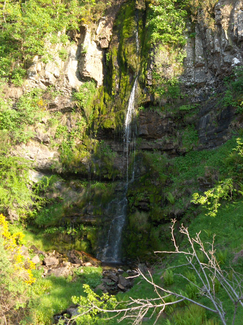
Downie's Loup

Downie's Loup is a waterfall of Scotland located near the village of Gargunnock. == See also == Waterfalls of Scotland == References ==

Nearby Amenities

Located within 500m of 56.082422,-4.0925608
Generator Method: wind_turbine
Generator Output Electricity: 2.5 MW
Generator Source: wind
Generator Type: horizontal_axis
Height: 80 m
Manufacturer: Nordex
Model: N80/2500
Operator: Falck Renewables
Operator Wikidata: Q5431701
Power: generator
Start Date: 12/2017
Lat/Long: 56.0820517/-4.1001705
The data included in this document is from www.openstreetmap.org. The data is made available under ODbL.

Have you been to Earlsburn Reservoir Number 1?

Leave your review of Earlsburn Reservoir Number 1 below (or comments, questions and feedback).