Loch Cruinn

Lake, Pool, Pond, Freshwater Marsh in Perthshire

Scotland

Loch Cruinn

Loch Con View from the slopes of
Loch Con Credit: Richard Webb

The requested URL returned error: 429 Too Many Requests

If you have any feedback on the listing, please let us know in the comments section below.
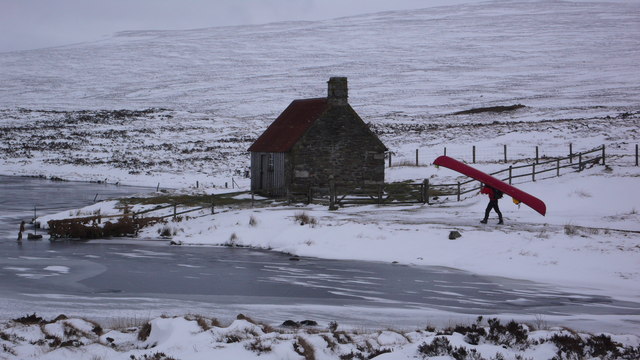
Loch Cruinn Images

Images are sourced within 2km of 56.78598/-4.1414779 or Grid Reference NN6968. Thanks to Geograph Open Source API. All images are credited.

Loch Con View from the slopes of
Loch Con
View from the slopes of
Small island in Loch Con Loch Con lies to the north of Sròn Chon. The Loch has a number of islands, several of them are elongated and all have trees; this island is more circular and is smaller.
Meall Dail-chealach is the hill in the distance.
Small island in Loch Con
Loch Con lies to the north of Sròn Chon. The Loch has a number of islands, several of them are elongated and all have trees; this island is more circular and is smaller. Meall Dail-chealach is the hill in the distance.
Loch Con Loch Con is an irregularly shaped body of water in a shallow depression to the north of the hill, Sròn Chon. It has several tree-covered, linear promontories and islands orientated nearly west to east.
Loch Con
Loch Con is an irregularly shaped body of water in a shallow depression to the north of the hill, Sròn Chon. It has several tree-covered, linear promontories and islands orientated nearly west to east.
Trees on eastern face of Sròn Chon Scattered trees on the lower slope of the hill in this view from a location south-east of the summit.
Loch Con is in the middle distance beyond which showers are passing over  mountains.
Trees on eastern face of Sròn Chon
Scattered trees on the lower slope of the hill in this view from a location south-east of the summit. Loch Con is in the middle distance beyond which showers are passing over mountains.
Hill walker at summit area of Sròn Chon A hill walker at the summit cairn of Sròn Chon. The view beyond is to the west where the prominent mountain, sunlit against the sky just left of centre, must be Beinn Mholach.
Hill walker at summit area of Sròn Chon
A hill walker at the summit cairn of Sròn Chon. The view beyond is to the west where the prominent mountain, sunlit against the sky just left of centre, must be Beinn Mholach.
Tussocky ground south-east of Meall a' Bhiord near Dalnaspidal Good walking ground existed in the form of sandy or rocky little ridges but the predominant condition was a sea of tussocky and wet ground.
Tussocky ground south-east of Meall a' Bhiord near Dalnaspidal
Good walking ground existed in the form of sandy or rocky little ridges but the predominant condition was a sea of tussocky and wet ground.
Ridge forming the western bounds of the Allt Garbh-bhruaich near Dalnacardoch Lodge
The sea of tussock to the south of Meall a' Bhiord near Dalnaspidal Schiehallion in the background along with Beinn a Chuallaich above Kinloch Rannoch.
The sea of tussock to the south of Meall a' Bhiord near Dalnaspidal
Schiehallion in the background along with Beinn a Chuallaich above Kinloch Rannoch.
Ridge just peering out from the sea of tussocky ground
A confusion of course on Caochan Ban above Loch Con near Trinafour This seepage from the Caochan Ban follows the mapped course of the burn but the main flow goes directly south and usurps the minor course mapped on the 1:25000 version as sourcing just south of the Caochan Ban. The previous picture on 'outflow' gives the clue - the outflow has banked up to such an extent that the burn's flow has split then 'majored'.
A confusion of course on Caochan Ban above Loch Con near Trinafour
This seepage from the Caochan Ban follows the mapped course of the burn but the main flow goes directly south and usurps the minor course mapped on the 1:25000 version as sourcing just south of the Caochan Ban. The previous picture on 'outflow' gives the clue - the outflow has banked up to such an extent that the burn's flow has split then 'majored'.
Caochan Ban on its new course to Loch Con The burn should flow to the left but clearly has changed course and now flows directly south.
Caochan Ban on its new course to Loch Con
The burn should flow to the left but clearly has changed course and now flows directly south.
Caochan Ban splitting in two above Loch Con near Trinafour
Sump area into which Caochan Ban partly flows above Loch Con near Trinafour
Low ridge enclosing the sump area mapped as Caochan Ban's course The mapping clues are only vestigial even on the large scale but on the ground this sump and ridge are so close to being a lochan except for the one breach.
Low ridge enclosing the sump area mapped as Caochan Ban's course
The mapping clues are only vestigial even on the large scale but on the ground this sump and ridge are so close to being a lochan except for the one breach.
Breach in the low ridge above Loch Con near Trinafour
East end of sump above Loch Con near Trinafour
Track to Loch Con With a glimpse of Loch Con to the left.
Track to Loch Con
With a glimpse of Loch Con to the left.
Allt Con Flowing out of Loch Con towards Loch Errochty.
Allt Con
Flowing out of Loch Con towards Loch Errochty.
Show me another place!

Loch Cruinn is located at Grid Ref: NN6968 (Lat: 56.78598, Lng: -4.1414779)

Unitary Authority: Perth and Kinross

Police Authority: Tayside

What 3 Words

///forms.toddler.spouting. Near Blair Atholl, Perth & Kinross

Nearby Locations

Loch Cruinn

Related Wikis

Loch Con

Loch Con is a small, remote, shallow, irregular shaped freshwater loch that is located in Glen Errochty in the Perth and Kinross council area, at the...

Loch Errochty

Loch Errochty is a man made freshwater loch situated within the Perth and Kinross council area at the edge of the Scottish Highlands near the Highland...

Geographical centre of Scotland

There is some debate as to the location of the geographical centre of Scotland. This is due to different methods of calculating the centre, and whether...

Trinafour

Trinafour (; Scottish Gaelic: Trian a' Phùir) is a village in Perth and Kinross, Scotland, approximately 17 miles (27 km) north-west of Pitlochry, its...

Have you been to Loch Cruinn?

Leave your review of Loch Cruinn below (or comments, questions and feedback).