Aylworth

Settlement in Gloucestershire Cotswold

England

Aylworth

Private road to Tally Ho House The road is shared by a public footpath and bridleway.
Private road to Tally Ho House Credit: Bill Boaden

Aylworth is a small village located in the county of Gloucestershire, England. Situated in the picturesque region known as the Cotswolds, Aylworth is characterized by its stunning natural beauty and tranquil atmosphere. The village is nestled amidst rolling hills and lush green landscapes, providing residents and visitors with breathtaking views and a sense of serenity.

Aylworth is a relatively small settlement, with a population of fewer than 100 people. It retains a close-knit community feel, where neighbors often know each other by name and locals take pride in preserving the village's heritage. The architecture in Aylworth is predominantly composed of traditional Cotswold stone buildings, which contribute to its charm and idyllic appearance.

Despite its size, Aylworth boasts a rich history. The village is believed to have roots dating back to the Anglo-Saxon era, and remnants of its past can still be seen today. Aylworth Manor, a Grade II listed building, stands as an example of the village's historical significance. The manor, with its well-preserved features, serves as a reminder of Aylworth's heritage and adds to its appeal.

For those seeking outdoor pursuits, Aylworth offers ample opportunities. The surrounding countryside is a haven for walkers, hikers, and nature enthusiasts. The nearby Cotswold Way provides stunning trails with panoramic views of the area's rolling hills and valleys.

Although Aylworth may be small in size, its natural beauty, historical significance, and close community make it a hidden gem within Gloucestershire's countryside.

If you have any feedback on the listing, please let us know in the comments section below.
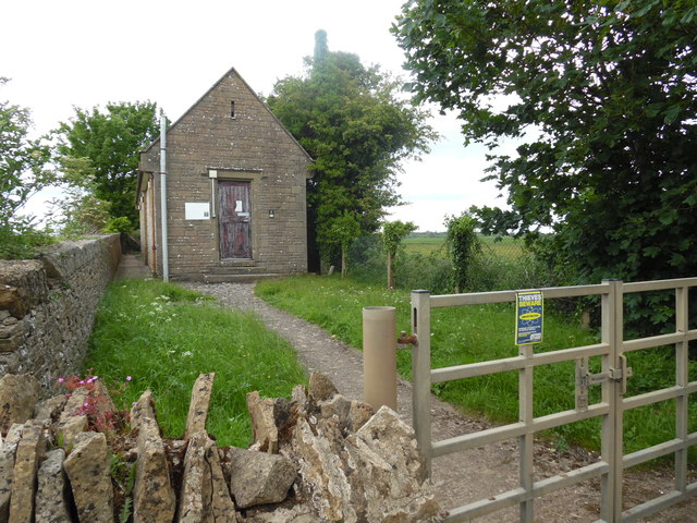
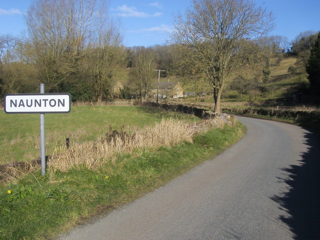
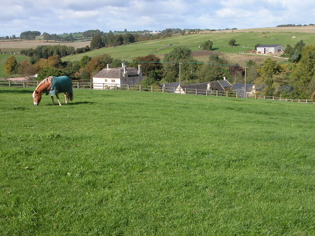
Aylworth Images

Images are sourced within 2km of 51.896853/-1.844319 or Grid Reference SP1022. Thanks to Geograph Open Source API. All images are credited.

Private road to Tally Ho House The road is shared by a public footpath and bridleway.
Private road to Tally Ho House
The road is shared by a public footpath and bridleway.
Windrush Way Windrush Way heading past Downs Barn
Windrush Way
Windrush Way heading past Downs Barn
Windrush Way Windrush Way rerouted now around Westfield House
Windrush Way
Windrush Way rerouted now around Westfield House
Windrush Way Windrush Way heading down to the cottage by the B4068
Windrush Way
Windrush Way heading down to the cottage by the B4068
Cropmark on field and a dismantled railway NW of Notgrove: aerial 2019 (1)
Cropmark on field and a dismantled railway NW of Notgrove: aerial 2019 (2)
From maize back to oats The path to Naunton passes through a section of maize in the middle of a field of oats.
From maize back to oats
The path to Naunton passes through a section of maize in the middle of a field of oats.
Oats near Naunton Rolling hills with a mobile phone mast on top.
Oats near Naunton
Rolling hills with a mobile phone mast on top.
Harvested field near Naunton The straw is still to be gathered.
Harvested field near Naunton
The straw is still to be gathered.
Hillside sloping down into the Windrush Valley The village of Guiting Power can be seen in the centre.
Hillside sloping down into the Windrush Valley
The village of Guiting Power can be seen in the centre.
Guiting Power Telephone Exchange (1) Situated on the B4068 Stow Road, this TE, built of Cotswold stone, dates from the GPO era and is one mile South of Guiting Power, from which it used to take its name until quite recently. It has the code SSGPR and provides telephone and broadband services to 566 residential and 49 non-residential premises in Guiting Power, plus Hawling, Kineton, Naunton, Notgrove, Salperton and Temple Guiting nearby. A BT warning notice can be seen on the front of the TE, whilst a small Thieves Beware notice has been fixed on the metal gate.
Guiting Power Telephone Exchange (1)
Situated on the B4068 Stow Road, this TE, built of Cotswold stone, dates from the GPO era and is one mile South of Guiting Power, from which it used to take its name until quite recently. It has the code SSGPR and provides telephone and broadband services to 566 residential and 49 non-residential premises in Guiting Power, plus Hawling, Kineton, Naunton, Notgrove, Salperton and Temple Guiting nearby. A BT warning notice can be seen on the front of the TE, whilst a small Thieves Beware notice has been fixed on the metal gate.
Guiting Power Telephone Exchange (2) This photo shows the TE on the B4068 Stow Road with a field of cow parsley and trees indicating its rural setting. Its numbering range is (01451) 850xxx, the (01451) referring to the Stow-on-the-Wold group of TEs, and its postcode is GL54 3AJ.
Guiting Power Telephone Exchange (2)
This photo shows the TE on the B4068 Stow Road with a field of cow parsley and trees indicating its rural setting. Its numbering range is (01451) 850xxx, the (01451) referring to the Stow-on-the-Wold group of TEs, and its postcode is GL54 3AJ.
Entering Naunton From B4068 the minor road entering Naunton
Entering Naunton
From B4068 the minor road entering Naunton
Windrush Way Windrush Way heading along the valley to Aylworth
Windrush Way
Windrush Way heading along the valley to Aylworth
Windrush Way Windrush Way heading past Aylworth
Windrush Way
Windrush Way heading past Aylworth
Windrush Way Windrush Way heading to Downs Barn
Windrush Way
Windrush Way heading to Downs Barn
Warden's Way Warden's Way heading to Naunton
Warden's Way
Warden's Way heading to Naunton
River Windrush River Windrush in Naunton
River Windrush
River Windrush in Naunton
Show me another place!

Aylworth is located at Grid Ref: SP1022 (Lat: 51.896853, Lng: -1.844319)

Administrative County: Gloucestershire

District: Cotswold

Police Authority: Gloucestershire

What 3 Words

///replayed.ideals.bought. Near Westfield, Gloucestershire

Nearby Locations

Aylworth

Related Wikis

Naunton

Naunton is a village in Gloucestershire, England. It lies on the River Windrush in the Cotswolds, an area of outstanding natural beauty. Stow-on-the-Wold...

Aylworth

Aylworth is a village in Gloucestershire, England. == References == == External links == Media related to Aylworth at Wikimedia Commons Aylworth in the...

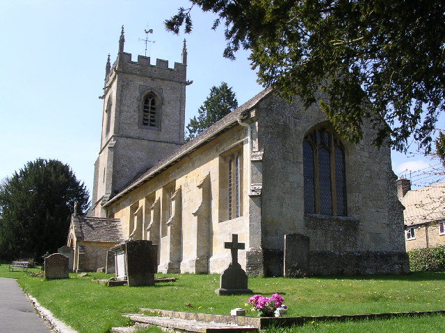
St Andrew's Church, Naunton

St Andrew's Church is an Anglican parish church in Naunton, Gloucestershire, dedicated to St Andrew the Apostle. == History == Dating from the 13th century...

Notgrove Long Barrow

Notgrove Long Barrow is a prehistoric long barrow burial mound in Gloucestershire, England. It consists of a large mound with a passage running through...

Nearby Amenities

Located within 500m of 51.896853,-1.844319
Aylworth
Created By: Potlatch 0.10b
Place: hamlet
Source: NPE
Wikidata: Q4831451
Lat/Long: 51.896518/-1.8419116
Barrier: cattle_grid
Lat/Long: 51.8964047/-1.8435817
Barrier: stile
Lat/Long: 51.8967449/-1.8428138
Hiking: yes
Information: guidepost
Source: GPS Survey
Tourism: information
Lat/Long: 51.897462/-1.8420808
Noexit: yes
Lat/Long: 51.8974397/-1.8428358
Barrier: cattle_grid
Lat/Long: 51.8965459/-1.8432301
Power: pole
Lat/Long: 51.892556/-1.8424017
Power: pole
Lat/Long: 51.8933704/-1.8427701
Power: pole
Lat/Long: 51.8938951/-1.8425475
Power: pole
Lat/Long: 51.8944124/-1.8423276
Power: pole
Lat/Long: 51.8953583/-1.8419293
Power: pole
Lat/Long: 51.8962024/-1.8418689
Aylworth Farm
Power: pole
Transformer: distribution
Voltage Primary: 11000
Lat/Long: 51.8971773/-1.8424147
Power: pole
Lat/Long: 51.8973056/-1.8417871
Power: pole
Lat/Long: 51.8980446/-1.8417335
Power: pole
Lat/Long: 51.8990095/-1.8416718
Power: pole
Lat/Long: 51.8997493/-1.8416195
Power: pole
Lat/Long: 51.9004262/-1.8415725
The data included in this document is from www.openstreetmap.org. The data is made available under ODbL.

Have you been to Aylworth?

Leave your review of Aylworth below (or comments, questions and feedback).