Loch Achray

Lake, Pool, Pond, Freshwater Marsh in Perthshire

Scotland

Loch Achray

Track in the Achray Forest Just round the corner we were about to come on a huge number of fallen trees, covering the track.  It took us over 30 minutes to cover the next 200 yards of track, ducking and diving trees and not helped by a trackside ditch a foot deep in water.
Track in the Achray Forest Credit: Gordon Brown

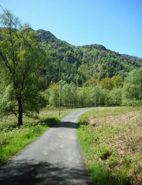
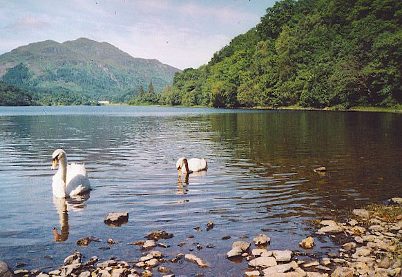
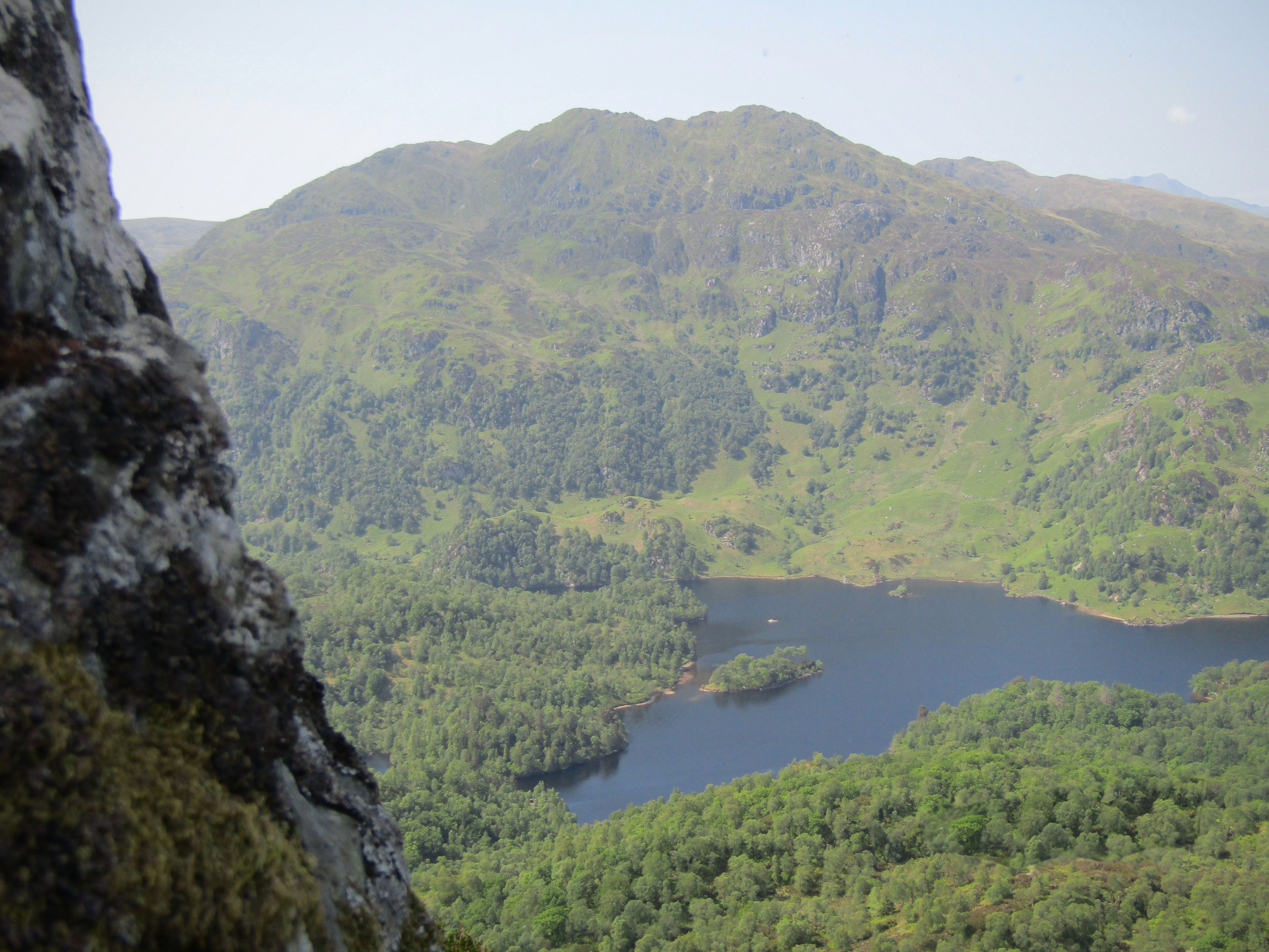
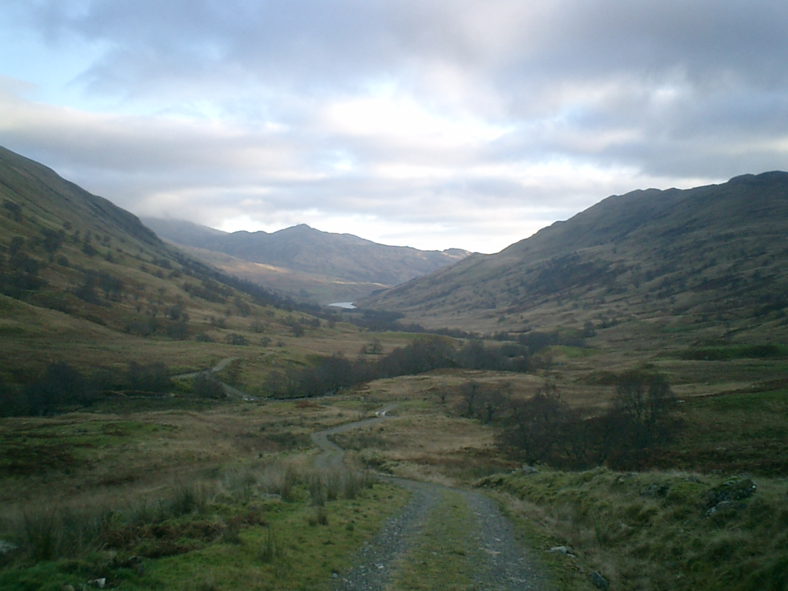
Loch Achray is a picturesque freshwater loch located in Perthshire, Scotland. Nestled amidst the stunning Trossachs National Park, this body of water is surrounded by rugged hills and dense forests, offering visitors a truly breathtaking natural setting.

Covering an area of approximately 1.5 square kilometers, Loch Achray boasts crystal-clear waters that are fed by various mountain streams and springs. The loch's depth varies, with some areas reaching up to 30 meters, providing a habitat for a diverse range of aquatic flora and fauna.

The surrounding landscape of Loch Achray is characterized by its lush greenery and rich biodiversity. The area is home to an array of bird species, including ospreys, golden eagles, and various waterfowl, making it a popular destination for birdwatching enthusiasts. In addition, the loch supports a variety of fish such as brown trout and pike, attracting anglers from near and far.

Visitors to Loch Achray can enjoy a range of recreational activities. The loch is ideal for boating, with boat hire services available, allowing visitors to explore the tranquil waters and take in the stunning scenery. There are also several walking trails that surround the loch, offering hikers the opportunity to immerse themselves in the natural beauty of the area.

Overall, Loch Achray is a captivating freshwater loch that offers a peaceful retreat for nature lovers and outdoor enthusiasts alike. Its idyllic surroundings, diverse wildlife, and recreational opportunities make it a must-visit destination in Perthshire.

If you have any feedback on the listing, please let us know in the comments section below.

Loch Achray Images

Images are sourced within 2km of 56.228143/-4.4015968 or Grid Reference NN5106. Thanks to Geograph Open Source API. All images are credited.

Track in the Achray Forest Just round the corner we were about to come on a huge number of fallen trees, covering the track.  It took us over 30 minutes to cover the next 200 yards of track, ducking and diving trees and not helped by a trackside ditch a foot deep in water.
Track in the Achray Forest
Just round the corner we were about to come on a huge number of fallen trees, covering the track. It took us over 30 minutes to cover the next 200 yards of track, ducking and diving trees and not helped by a trackside ditch a foot deep in water.
Blocked path The sign says the path is blocked but fails to say why.
Blocked path
The sign says the path is blocked but fails to say why.
SS Sir Walter Scott, the engine room Looking down from the main deck.
SS Sir Walter Scott, the engine room
Looking down from the main deck.
SS Sir Walter Scott at Loch Katrine Pier - 1998 This shows the vessel before the addition of the forward deck cabin and the new funnel <a title="https://www.geograph.org.uk/photo/6858686" href="https://www.geograph.org.uk/photo/6858686">Link</a> – not – in my opinion – an improvement.
SS Sir Walter Scott at Loch Katrine Pier - 1998
This shows the vessel before the addition of the forward deck cabin and the new funnel Link – not – in my opinion – an improvement.
Sad view of the SS Sir Walter Scott Tied up and awaiting new boiler and other repairs, the venerable steam ship looks unlikely to be in service in summer 2022.
Sad view of the SS Sir Walter Scott
Tied up and awaiting new boiler and other repairs, the venerable steam ship looks unlikely to be in service in summer 2022.
View of Loch Katrine leaving the pier
The Lady of the Lake leaves Trossachs Pier for an excursion on Loch Katrine
Waterfall on the Achray Water The Achray Water splits into two separate parts upstream from here and these join up again downstream. This is therefore only about half of the full flow, but still produces impressive falls.
Waterfall on the Achray Water
The Achray Water splits into two separate parts upstream from here and these join up again downstream. This is therefore only about half of the full flow, but still produces impressive falls.
Pass of Achray On the road to the Loch Katrine Dam. Ben Venue is in the distance.

This view replicates the first image for this square <a href="https://www.geograph.org.uk/photo/94439">NN4906 : Pass of Achray</a> taken in 2002 and submitted in 2005.
Pass of Achray
On the road to the Loch Katrine Dam. Ben Venue is in the distance. This view replicates the first image for this square NN4906 : Pass of Achray taken in 2002 and submitted in 2005.
Road to the dam Heading for the Loch Katrine Dam, with Ben Venue in the distance.
Road to the dam
Heading for the Loch Katrine Dam, with Ben Venue in the distance.
Bridge over the Achray Water The footbridge crosses the river just downstream from a group of waterfalls, giving good views <a href="https://www.geograph.org.uk/photo/7495093">NN4906 : Waterfalls on the Achray Water</a>.
Bridge over the Achray Water
The footbridge crosses the river just downstream from a group of waterfalls, giving good views NN4906 : Waterfalls on the Achray Water.
Waterfalls on the Achray Water The Achray Water splits into several waterfalls just upstream from a footbridge over the river.
Waterfalls on the Achray Water
The Achray Water splits into several waterfalls just upstream from a footbridge over the river.
SS Sir Walter Scott The SS Sir Walter Scott is the fourth steamship to plough the waters of Loch Katrine and was launched in 1900.
SS Sir Walter Scott
The SS Sir Walter Scott is the fourth steamship to plough the waters of Loch Katrine and was launched in 1900.
Walkers on wide path, Loch Katrine 1968 A wide tarmac path in the Trossachs, here a family are walking seven abreast. Photo from car park at end of road to the loch.
Walkers on wide path, Loch Katrine 1968
A wide tarmac path in the Trossachs, here a family are walking seven abreast. Photo from car park at end of road to the loch.
Timber stacks by Loch Katrine, 1968 A pile of timber just by the car park.
Timber stacks by Loch Katrine, 1968
A pile of timber just by the car park.
SS Sir Walter Scott Loch Katrine At Trossachs Pier on Loch Katrine
SS Sir Walter Scott Loch Katrine
At Trossachs Pier on Loch Katrine
Pass of Achray Track leading through the Pass of Achray to the Loch Katrine sluices and to Ben Venue (in the background)
Pass of Achray
Track leading through the Pass of Achray to the Loch Katrine sluices and to Ben Venue (in the background)
The Trossachs Note the SS Sir Walter Scott just right of telescope - approaching the pier at the east end of Loch Katrine.
The Trossachs
Note the SS Sir Walter Scott just right of telescope - approaching the pier at the east end of Loch Katrine.
Show me another place!

Loch Achray is located at Grid Ref: NN5106 (Lat: 56.228143, Lng: -4.4015968)

Unitary Authority: Stirling

Police Authority: Forth Valley

What 3 Words

///campers.convinces.swing. Near Callander, Stirling

Nearby Locations

Loch Achray

Related Wikis

Loch Achray

Loch Achray is a small freshwater loch 11 km (6.8 mi) west of Callander in Stirling district, Scotland. The loch lies between Loch Katrine and Loch Venachar...

Trossachs

The Trossachs (; Scottish Gaelic: Na Tròiseachan) generally refers to an area of wooded glens, braes, and lochs lying to the east of Ben Lomond in the...

Ben A'an

Ben A'an is a hill in the Trossachs in Scotland. The pointed peak of its west top (454 m/1491 ft) resembles a small mountain. == Location == Ben A'an is...

Bicycle Tree (Trossachs)

The Bicycle Tree is a veteran tree near Brig o' Turk in the Trossachs, Scotland. Dating from the late 19th century, the tree grew in or near to the scrap...

Craiglich

Craiglich is a hill in western Aberdeenshire, with a height of 476 metres (1562 feet). Its ease of access, Marilyn status and scenic views make it popular...

Brig o' Turk

Brig o' Turk (Scottish Gaelic: Àird Cheannchnocain) is a small rural village historically in Perthshire and today within the council area of Stirling,...

Glen Finglas

Glen Finglas (Scottish Gaelic: Gleann Fhionnghlais) is a glen in the Trossachs, in the Stirling council area of Scotland. It is an area of forest in Highlands...

Dalrigh

Dalrigh is a hamlet in Scotland near Tyndrum. The name means "The King's Field" in Scottish Gaelic. The origin of the name stems specifically from the...

Nearby Amenities

Located within 500m of 56.228143,-4.4015968
Parking
Capacity: 4
Supervised: no
Lat/Long: 56.2258034/-4.4080985
Loch Achray South
Description: Camping in the park (march to sept only with permit, permit can be bought online)
Tourism: camp_site
Website: https://www.lochlomond-trossachs.org/
Lat/Long: 56.2258117/-4.4079284
Turning Loop
Lat/Long: 56.2307964/-4.4060326
Entrance: yes
Lat/Long: 56.2291128/-4.3967915
The data included in this document is from www.openstreetmap.org. The data is made available under ODbL.

Have you been to Loch Achray?

Leave your review of Loch Achray below (or comments, questions and feedback).