Black Loch

Lake, Pool, Pond, Freshwater Marsh in Kirkcudbrightshire

Scotland

Black Loch

Black Dubs Black Dubs is the stream - certainly black on this day! It lies to the west of the minor hill feature, Poultrybuie Hill. Many wind-thrown trees at the edge of the adjacent plantation.
Black Dubs Credit: Trevor Littlewood

Black Loch is a picturesque freshwater loch situated in Kirkcudbrightshire, Scotland. With a surface area of approximately 40 hectares, it is known for its natural beauty and diverse ecosystem. The loch is nestled amidst rolling hills and lush greenery, creating a tranquil and serene environment for visitors.

The water in Black Loch is crystal clear and teeming with various species of fish, making it a popular spot for anglers. Trout, pike, and perch are among the commonly found fish in the loch. Fishing enthusiasts can enjoy a day out on the water, hoping to catch their next big catch.

Surrounding the loch, there is a mixture of woodland and open grassy areas, home to an array of wildlife. Birdwatchers will delight in the opportunity to spot various species of waterfowl, including swans, ducks, and herons. In the surrounding woods, one can find woodland birds such as woodpeckers and owls.

The loch also boasts a thriving freshwater marsh ecosystem, characterized by its reeds and other aquatic vegetation. This marshland provides a habitat for numerous plant and animal species, including frogs, newts, and dragonflies. It is a haven for nature lovers and photographers, offering countless opportunities to capture the beauty of the marshland and its inhabitants.

Black Loch, Kirkcudbrightshire, is a true gem of Scotland's natural landscape. Its tranquil waters, diverse wildlife, and stunning surroundings make it a must-visit destination for those seeking a peaceful retreat in the heart of nature.

If you have any feedback on the listing, please let us know in the comments section below.

Black Loch Images

Images are sourced within 2km of 55.027517/-4.3536597 or Grid Reference NX4972. Thanks to Geograph Open Source API. All images are credited.

Black Dubs Black Dubs is the stream - certainly black on this day! It lies to the west of the minor hill feature, Poultrybuie Hill. Many wind-thrown trees at the edge of the adjacent plantation.
Black Dubs
Black Dubs is the stream - certainly black on this day! It lies to the west of the minor hill feature, Poultrybuie Hill. Many wind-thrown trees at the edge of the adjacent plantation.
Forest road heading south-west The road lies to the west of the minor hill, Poultrybuie Hill which rises to 354 metres.
Forest road heading south-west
The road lies to the west of the minor hill, Poultrybuie Hill which rises to 354 metres.
Walking party ahead in falling rain The party is heading north along a forest road, itself north of the minor, moorland feature, Poultrybuie Hill.
Walking party ahead in falling rain
The party is heading north along a forest road, itself north of the minor, moorland feature, Poultrybuie Hill.
Hill rising beyond Tonderghie Burn The burn flows where the road bends sharply to the right. Prominent though it appears, the hill has little identity of its own being just a steep rise climbing to undulating ground mainly covered with coniferous trees.
Hill rising beyond Tonderghie Burn
The burn flows where the road bends sharply to the right. Prominent though it appears, the hill has little identity of its own being just a steep rise climbing to undulating ground mainly covered with coniferous trees.
Path from Talnotry Car Park Just off the A712.
Path from Talnotry Car Park
Just off the A712.
Murray's Monument Viewed from the Talnotry car park next to the A712.
Murray's Monument
Viewed from the Talnotry car park next to the A712.
The A712 (Queen's Way) Going towards Newton Stewart from the junction with Talnotry car park.
The A712 (Queen's Way)
Going towards Newton Stewart from the junction with Talnotry car park.
The A712 (Queen's Way) Going towards New Galloway, viewed from the junction at Talnotry car park.
The A712 (Queen's Way)
Going towards New Galloway, viewed from the junction at Talnotry car park.
Entrance to Talnotry Car Park Small car park off the A712 (The Queen's Way).
Entrance to Talnotry Car Park
Small car park off the A712 (The Queen's Way).
Murray's Monument Zoomed in from Talnotry car park just off the A712.
Murray's Monument
Zoomed in from Talnotry car park just off the A712.
Murray's Monument Viewed from the Talnotry car park just off the A712.
Murray's Monument
Viewed from the Talnotry car park just off the A712.
Craigdews Hill At the Wild Goat Park, viewed from the car park at Talnotry.
Craigdews Hill
At the Wild Goat Park, viewed from the car park at Talnotry.
The A712 to New Galloway From the entrance to Talnotry car park.
The A712 to New Galloway
From the entrance to Talnotry car park.
Murray's Monument Viewed from the A712 just above Talnotry car park.
Murray's Monument
Viewed from the A712 just above Talnotry car park.
Approaching Talnotry Car Park On the A712 with Murray's Monument in view. On the mid right is Craigdews Hill at the Wild Goat Park.
Approaching Talnotry Car Park
On the A712 with Murray's Monument in view. On the mid right is Craigdews Hill at the Wild Goat Park.
Wild Goat Park: Car Park Off the A712 in Galloway Forest Park
Wild Goat Park: Car Park
Off the A712 in Galloway Forest Park
Wild Goat Park: Galloway Forest Spot the goat in front of feeder
Wild Goat Park: Galloway Forest
Spot the goat in front of feeder
Small Waterfall On Grey Mare's Tail Burn. Map shows Grey Mare's Tail waterfalls further upstream
Small Waterfall
On Grey Mare's Tail Burn. Map shows Grey Mare's Tail waterfalls further upstream
Show me another place!

Black Loch is located at Grid Ref: NX4972 (Lat: 55.027517, Lng: -4.3536597)

Unitary Authority: Dumfries and Galloway

Police Authority: Dumfries and Galloway

What 3 Words

///attaching.plants.denser. Near Newton Stewart, Dumfries & Galloway

Related Wikis

Talnotrie Hoard

The Talnotrie Hoard is a 9th-century mixed hoard of jewellery, coinage, metal-working objects and raw materials found in Talnotrie, Scotland, in 1912....
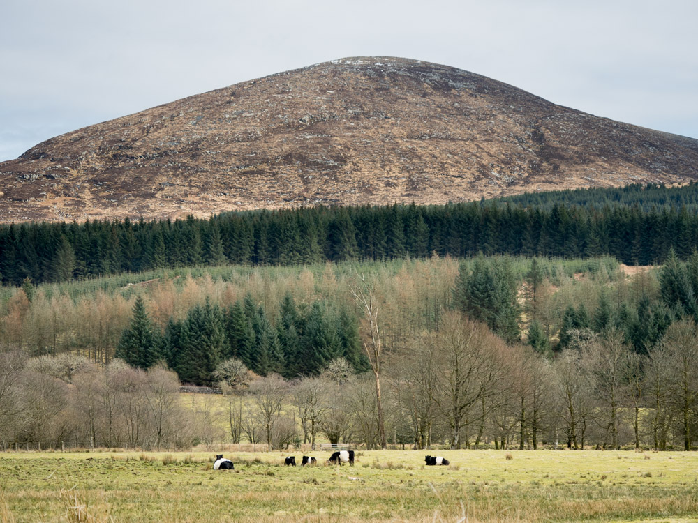
Millfore

Millfore is a hill in the Minnigaff Hills, a sub-range of the Galloway Hills range, part of the Southern Uplands of Scotland. It lies northeast of Newton...
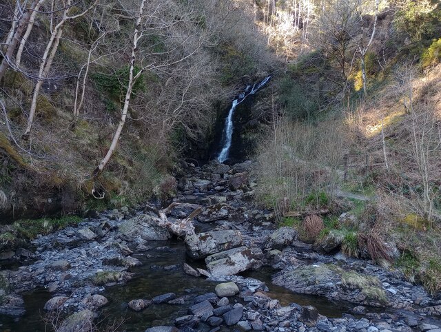
Hespies Linn

Hespies Linn is a waterfall of Scotland. == See also == Waterfalls of Scotland == References ==
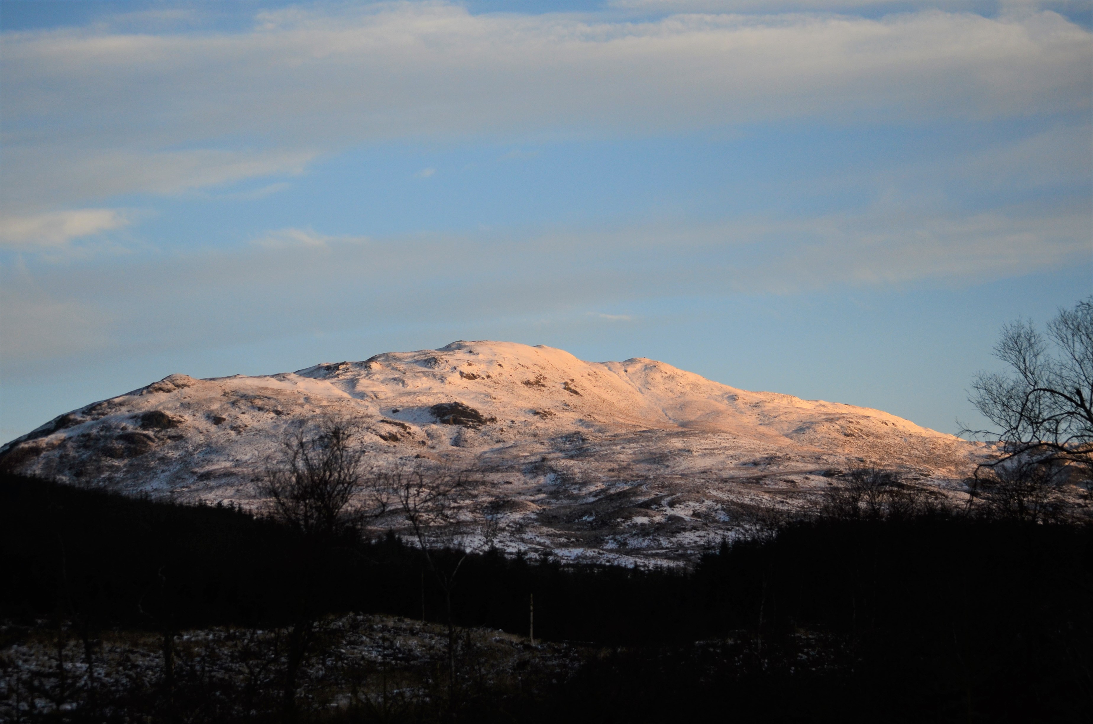
Cairnsmore of Fleet

Cairnsmore of Fleet is an isolated mountain in the Southern Uplands of Scotland. The mountain forms an unafforested granite massif, whose highest point...

Nearby Amenities

Located within 500m of 55.027517,-4.3536597
The Eye
Artist Name: Colin Rose
Artwork Type: sculpture
Material: brick
Tourism: artwork
Wheelchair: yes
Lat/Long: 55.0268741/-4.3559851
The data included in this document is from www.openstreetmap.org. The data is made available under ODbL.

Have you been to Black Loch?

Leave your review of Black Loch below (or comments, questions and feedback).