Goldington

Settlement in Bedfordshire

England

Goldington

Parking, and coffee shop at Priory Country Park
Parking, and coffee shop at Priory Country Park Credit: Rob Purvis

Goldington is a small village located in the county of Bedfordshire, England. It is situated approximately 2 miles north of Bedford town center and falls within the Borough of Bedford. The village is surrounded by picturesque countryside, providing a tranquil and scenic setting.

Goldington has a rich history, dating back to the Domesday Book of 1086, where it was recorded as "Golendone." Over the centuries, it has evolved from an agricultural community to a residential area with a mix of modern and traditional architecture.

The village is home to a range of amenities, including a primary school, a community center, and a local pub. It also benefits from its proximity to Bedford, where residents can access a wider range of shops, restaurants, and entertainment options.

Nature enthusiasts will appreciate the village's close proximity to the River Great Ouse, which offers opportunities for walking, boating, and fishing. The nearby Priory Country Park is also popular among locals, providing a peaceful environment for outdoor activities.

Goldington enjoys good transport links, with easy access to major road networks such as the A421 and A428. The village is well-connected to other parts of Bedfordshire and beyond, making it an attractive location for commuters.

Overall, Goldington offers a charming and idyllic setting, combining the tranquility of rural living with the convenience of nearby urban amenities.

If you have any feedback on the listing, please let us know in the comments section below.
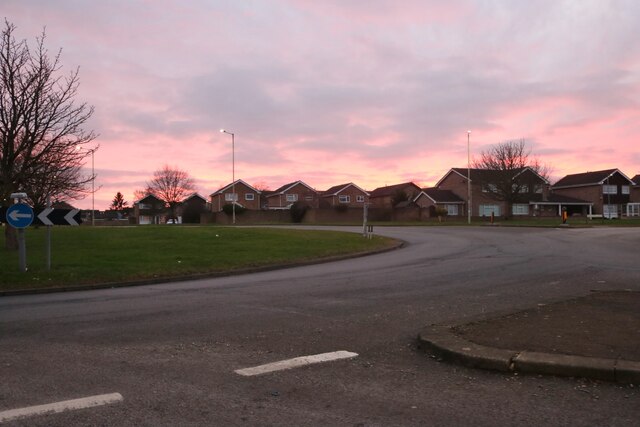
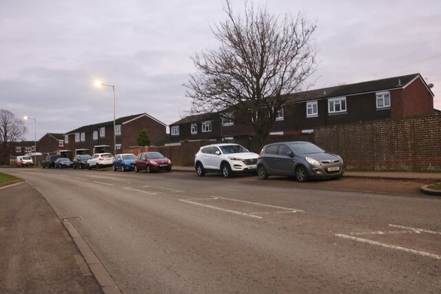
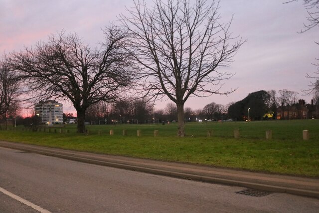
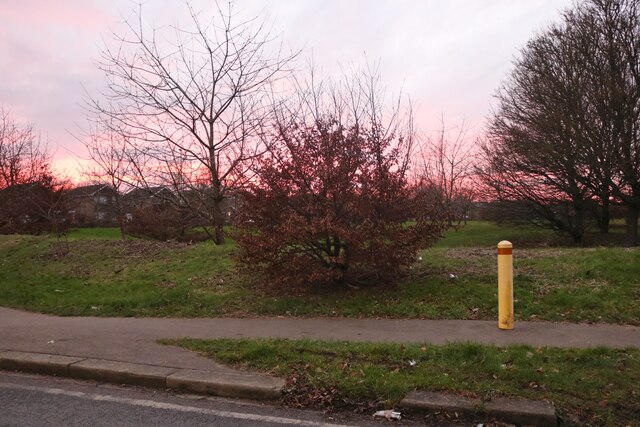
Goldington Images

Images are sourced within 2km of 52.143631/-0.428999 or Grid Reference TL0750. Thanks to Geograph Open Source API. All images are credited.

Parking, and coffee shop at Priory Country Park
Path and old wall, Priory Country Park
Walking next to the lake at Priory Country Park
Otter sculpture and beach at Priory Country Park
Roundabout on Hookhams Lane, Bedford This is the first main road entering Bedford from this direction.
Roundabout on Hookhams Lane, Bedford
This is the first main road entering Bedford from this direction.
Norse Road, Bedford
Norse Road, Bedford
Go Outdoors on Norse Road, Bedford
Norse Road, Bedford
Norse Road, Bedford
Barons bodyshop on St Neots Road, Goldington
Goldington Green
Goldington Green
Flats on Goldington Green
Goldington Road at the junction of Polhill Avenue The University of Bedfordshire is on the right
Goldington Road at the junction of Polhill Avenue
The University of Bedfordshire is on the right
Houses on Hookhams Lane, Salph End
Park by Hookhams Lane, Salph End Entering the urban area of Bedford
Park by Hookhams Lane, Salph End
Entering the urban area of Bedford
Bower Street, Bedford All is quiet after Christmas Day dinner!
Bower Street, Bedford
All is quiet after Christmas Day dinner!
Archaeological dig east of Bedford The alluvium of the Gt Ouse floodplain has been stripped to reveal river terrace sands and gravels; small trial pits and trenches have been excavated for selected study.
Archaeological dig east of Bedford
The alluvium of the Gt Ouse floodplain has been stripped to reveal river terrace sands and gravels; small trial pits and trenches have been excavated for selected study.
Goldington Avenue, Bedford A house on the west side of Goldington Avenue, viewed in 1949 from the corner of Campbell Road.
See <a href="https://www.geograph.org.uk/photo/760544">TL0550 : House on Goldington Avenue</a> for the same view 59 years later.
And a picture taken by the son of the couple in the picture, 60 years later - <a href="https://www.geograph.org.uk/photo/1396639">TL0550 : Goldington Avenue, Bedford</a>
Goldington Avenue, Bedford
A house on the west side of Goldington Avenue, viewed in 1949 from the corner of Campbell Road. See TL0550 : House on Goldington Avenue for the same view 59 years later. And a picture taken by the son of the couple in the picture, 60 years later - TL0550 : Goldington Avenue, Bedford
Gravel pit SE of Bedford in the terraces of the Gt Ouse on the site of the Castle Mill airfield.
Gravel pit SE of Bedford in the terraces of the Gt Ouse
on the site of the Castle Mill airfield.
Show me another place!

Goldington is located at Grid Ref: TL0750 (Lat: 52.143631, Lng: -0.428999)

Unitary Authority: Bedford

Police Authority: Bedfordshire

What 3 Words

///incomes.keys.mice. Near Bedford, Bedfordshire

Nearby Locations

Goldington

Related Wikis

Goldington Bury

Goldington Bury is a cricket ground in the Goldington area of Bedford, in England. The first recorded match on the ground was in 1941, when Bedford Town...

Goldington

Goldington is part of Bedford, Bedfordshire, England. It encompasses much of the historic village and parish of Goldington that was merged with Bedford...

Newnham, Bedford

Newnham is an electoral ward and area within the town of Bedford, Bedfordshire, England. The boundaries of Newnham are approximately Goldington Road to...

Goldington Power Station

Goldington Power Station was a 180 MW coal-fired electricity generating station located to the east of Bedford in Bedfordshire, England. It was commissioned...

Nearby Amenities

Located within 500m of 52.143631,-0.428999
Mini Roundabout
Lat/Long: 52.1424971/-0.4321767
Mini Roundabout
Lat/Long: 52.1426057/-0.4306227
Crossing
Crossing: traffic_signals
Crossing Ref: pelican
Source: bing
Lat/Long: 52.1427963/-0.4291238
Crossing
Button Operated: yes
Crossing: traffic_signals
Crossing Island: no
Lat/Long: 52.1439202/-0.4251942
Traffic Signals
Lat/Long: 52.1472176/-0.4288423
Traffic Signals
Lat/Long: 52.147586/-0.4286999
Mini Roundabout
Direction: clockwise
Lat/Long: 52.1471211/-0.4247025
Source: bing
Traffic Calming: bump
Lat/Long: 52.1470358/-0.4261182
Pub
The New Sportsman
Addr City: Bedford
Addr Country: GB
Addr Housenumber: 58
Addr Postcode: MK41 9HA
Addr Street: The Boundary
Fhrs Authority: Bedford
Fhrs Id: 101060
Fhrs Local Authority Id: 32832
Lat/Long: 52.1459306/-0.4325746
Restaurant
Toby Carvery
Addr City: Bedford
Addr Country: GB
Addr Housenumber: 403
Addr Postcode: MK41 0DS
Addr Street: Goldington Road
Brand: Toby Carvery
Brand Wikidata: Q7811777
Contact Website: https://www.tobycarvery.co.uk/restaurants/east-of-england/goldingtonbedford
Cuisine: british
Fhrs Authority: Bedford
Fhrs Id: 92396
Fhrs Local Authority Id: 26002
Lat/Long: 52.1431164/-0.4267529
Turning Circle
Source: bing
Lat/Long: 52.1414102/-0.4334336
Post Box
Brand: Royal Mail
Brand Wikidata: Q638098
Collection Times: Mo-Fr 09:00; Sa 07:00
Operator: Royal Mail
Operator Wikidata: Q638098
Post Box Type: pillar
Ref: MK41 85D
Royal Cypher: GR
Royal Cypher Wikidata: Q33102273
Source: survey
Survey Date: 2015-08-29
Lat/Long: 52.1458552/-0.4320214
Telephone
Booth: KX100
Covered: booth
Lat/Long: 52.1458712/-0.4320226
Sunda Stores
Addr City: Bedford
Addr Country: GB
Addr Housenumber: 7
Addr Postcode: MK41 9HD
Addr Street: The Fairway
Fhrs Authority: Bedford
Fhrs Id: 101191
Fhrs Local Authority Id: 32961
Shop: convenience
Lat/Long: 52.1460832/-0.4320816
Eric The Butcher
Addr City: Bedford
Addr Country: GB
Addr Housenumber: 3
Addr Postcode: MK41 9HD
Addr Street: The Fairway
Fhrs Authority: Bedford
Fhrs Id: 101182
Fhrs Local Authority Id: 32955
Shop: butcher
Lat/Long: 52.1459736/-0.4320846
Post Office
Addr City: Bedford
Addr Country: GB
Addr Housenumber: 432
Addr Postcode: MK41 9NU
Addr Street: Goldington Road
Brand: Post Office
Brand Wikidata: Q1783168
Check Date Opening Hours: 2018-02
Opening Hours: Mo,Tu 09:00-18:00; We-Fr 09:00-17:30; Sa 09:00-17:00; Su 10:00-19:00
Operator: Premier
Operator Wikidata: Q7240340
Ref Pol Id: 633
Website: https://www.postoffice.co.uk/branch-finder/074106x/goldington
Lat/Long: 52.1423758/-0.4339099
Crossing
Crossing Ref: zebra
Source: bing
Lat/Long: 52.1426257/-0.4234152
Crossing
Crossing Ref: zebra
Source: bing
Lat/Long: 52.1433598/-0.4235665
Recycling
Recycling Clothes: yes
Recycling Glass: yes
Lat/Long: 52.1428015/-0.4255315
Bus Stop
Goldington Green
Bench: yes
Bin: no
Bus: yes
Check Date Shelter: 2021-08-23
Naptan AtcoCode: 020035260
Naptan Bearing: E
Naptan CommonName: Goldington Green
Naptan Crossing: Barker's Lane
Naptan Indicator: adj
Naptan NaptanCode: bfsampdw
Naptan PlusbusZoneRef: BEDFDM
Naptan Street: Goldington Road
Public Transport: platform
Shelter: yes
Source: naptan_import
Lat/Long: 52.1427474/-0.4300593
Bus Stop
Goldington Green
Bench: no
Bin: no
Bus: yes
Lit: no
Naptan AtcoCode: 020035258
Naptan Bearing: W
Naptan CommonName: Goldington Green
Naptan Crossing: Sandy Road
Naptan Indicator: opp
Naptan NaptanCode: bfsampdp
Naptan PlusbusZoneRef: BEDFDM
Naptan Street: Goldington Road
Public Transport: platform
Shelter: no
Source: naptan_import
Tactile Paving: yes
Lat/Long: 52.142513/-0.4314155
Crossing
Crossing: unmarked
Crossing Island: yes
Crossing Markings: no
Tactile Paving: yes
Lat/Long: 52.1425898/-0.4322103
Crossing
Crossing: traffic_signals
Crossing Island: no
Crossing Ref: pelican
Source: bing
Tactile Paving: yes
Lat/Long: 52.1420637/-0.4345582
Source: bing
Traffic Calming: bump
Lat/Long: 52.1476206/-0.4273891
Source: bing
Traffic Calming: bump
Lat/Long: 52.1475499/-0.4282584
Noexit: yes
Lat/Long: 52.1401612/-0.4263454
Noexit: yes
Lat/Long: 52.1399556/-0.4262997
Bicycle Parking
Bicycle Parking: stands
Capacity: 30
Cyclestreets Id: 30694
Lat/Long: 52.1423725/-0.4246442
Bicycle Parking
Bicycle Parking: stands
Capacity: 12
Covered: yes
Cyclestreets Id: 30695
Lat/Long: 52.1446973/-0.4231611
Bicycle Parking
Bicycle Parking: stands
Capacity: 6
Covered: no
Cyclestreets Id: 30698
Lat/Long: 52.1427557/-0.4224107
Atm
Lat/Long: 52.1424064/-0.4246253
Post Box
Ref: MK41 307
Lat/Long: 52.1423347/-0.4338162
Travelodge
Addr City: Bedford
Addr Country: GB
Addr Housenumber: 403
Addr Postcode: MK41 0DS
Addr Street: Goldington Road
Brand: Travelodge
Brand Wikidata: Q9361374
Brand Wikipedia: en:Travelodge UK
Fhrs Authority: Bedford
Fhrs Id: 50321
Fhrs Local Authority Id: 112001
Internet Access: wlan
Internet Access Fee: customers
Internet Access Ssid: Travelodge WiFi
Tourism: hotel
Website: https://www.travelodge.co.uk/hotels/443/Bedford-Goldington-Road-hotel
Wheelchair: yes
Lat/Long: 52.1428048/-0.4268277
Check Date: 2022-04-09
Source: bing
Traffic Calming: bump
Lat/Long: 52.1470729/-0.4251878
Source: bing
Lat/Long: 52.1428852/-0.4232276
Atm
Lat/Long: 52.1413946/-0.4240784
Elliot Reeve
Shop: hairdresser
Lat/Long: 52.1426455/-0.4250277
Post Box
Ref: MK41 66
Source: Bing
Lat/Long: 52.1424676/-0.4249767
Entrance: yes
Lat/Long: 52.1430087/-0.4267838
Entrance: yes
Lat/Long: 52.1431587/-0.4268661
Entrance: main
Lat/Long: 52.1427437/-0.4274136
Crossing
Crossing: marked
Kerb: flush
Tactile Paving: yes
Lat/Long: 52.1426469/-0.4231811
Crossing
Crossing: marked
Kerb: lowered
Tactile Paving: yes
Lat/Long: 52.1427201/-0.4230929
Bus Stop
The Wayfarer Hotel
Bus: yes
Naptan AtcoCode: 020035262
Naptan Bearing: SW
Naptan CommonName: The Wayfarer Hotel
Naptan Indicator: opp
Naptan Landmark: Goldington Green
Naptan NaptanCode: bfsampgd
Naptan PlusbusZoneRef: BEDFDM
Naptan Street: Goldington Road
Note: Stop name is a bit suspect, there hasn't been a hotel by that name here for many years
Public Transport: platform
Shelter: no
Source: naptan_import;survey;Bing
Lat/Long: 52.1434489/-0.4268174
Bus Stop
The Wayfarer Hotel
Bus: yes
Naptan AtcoCode: 020035261
Naptan Bearing: SW
Naptan CommonName: The Wayfarer Hotel
Naptan Indicator: o/s
Naptan Landmark: Goldington Green
Naptan NaptanCode: bfsampga
Naptan PlusbusZoneRef: BEDFDM
Naptan Street: Goldington Road
Note: Stop name is a bit suspect, there hasn't been a hotel by that name here for many years
Public Transport: platform
Shelter: yes
Source: naptan_import;survey;Bing
Lat/Long: 52.1432866/-0.4269945
Bus Stop
Goldington Tesco
Bus: yes
Naptan AtcoCode: 020035271
Naptan Bearing: N
Naptan CommonName: Goldington Tesco
Naptan Indicator: o/s
Naptan Landmark: Tesco
Naptan NaptanCode: bfsampjm
Naptan PlusbusZoneRef: BEDFDM
Naptan Street: Riverfield Drive
Public Transport: platform
Shelter: yes
Source: naptan_import;survey;Bing
Lat/Long: 52.1429224/-0.4233208
Bus Stop
Goldington Tesco
Bench: yes
Bin: yes
Bus: yes
Check Date Shelter: 2022-04-09
Naptan AtcoCode: 020035270
Naptan Bearing: SW
Naptan CommonName: Goldington Tesco
Naptan Indicator: opp
Naptan Landmark: Tesco
Naptan NaptanCode: bfsampjg
Naptan PlusbusZoneRef: BEDFDM
Naptan Street: Riverfield Drive
Public Transport: platform
Shelter: yes
Source: naptan_import;survey;Bing
Tactile Paving: yes
Lat/Long: 52.1423332/-0.4229924
Bus Stop
Ballinghall Close
Bus: yes
Naptan AtcoCode: 020035221
Naptan Bearing: SW
Naptan CommonName: Ballinghall Close
Naptan Indicator: opp
Naptan Landmark: Ballinghall Close
Naptan NaptanCode: bfsamjmg
Naptan PlusbusZoneRef: BEDFDM
Naptan Street: Goldington Green
Public Transport: platform
Shelter: yes
Source: naptan_import;survey;Bing
Lat/Long: 52.1431643/-0.4319057
Bus Stop
Ballinghall Close
Bus: yes
Naptan AtcoCode: 020035220
Naptan Bearing: NE
Naptan CommonName: Ballinghall Close
Naptan Indicator: adj
Naptan Landmark: Ballinghall Close
Naptan NaptanCode: bfsamjmd
Naptan PlusbusZoneRef: BEDFDM
Naptan Street: Goldington Green
Public Transport: platform
Shelter: no
Source: naptan_import;survey;Bing
Lat/Long: 52.1434856/-0.4318758
Janta Supermarket
Addr City: Bedford
Addr Country: GB
Addr Housenumber: 343
Addr Postcode: MK41 9NX
Addr Street: Goldington Road
Fhrs Authority: Bedford
Fhrs Id: 1257401
Fhrs Local Authority Id: 130766
Shop: convenience
Source: Bing
Lat/Long: 52.1423615/-0.4316957
Addr Housenumber: 341
Addr Street: Goldington Road
Disused Shop: yes
Source: Bing
Lat/Long: 52.142314/-0.4320213
Johnsons
Brand: Johnsons
Brand Wikidata: Q6268527
Brand Wikipedia: en:Johnsons Cleaners UK
Shop: dry_cleaning
Source: Bing
Lat/Long: 52.142719/-0.4249431
Entrance: main
Lat/Long: 52.1426181/-0.4246974
Timpson
Brand: Timpson
Brand Wikidata: Q7807658
Craft: key_cutter
Source: Bing
Lat/Long: 52.1426758/-0.4249862
Crossing
Crossing: marked
Crossing Island: no
Lat/Long: 52.1438711/-0.4309043
Post Box
Brand: Royal Mail
Brand Wikidata: Q638098
Check Date: 2022-04-09
Check Date Collection Times: 2022-04-09
Collection Times: Mo-Fr 09:00; Sa 07:00
Operator: Royal Mail
Operator Wikidata: Q638098
Post Box Type: pillar
Ref: MK41 352D
Royal Cypher: EIIR
Royal Cypher Wikidata: Q33102113
Source: survey
Lat/Long: 52.1478112/-0.4268874
Bar
Bedford Cricket Club
Addr City: Bedford
Addr Country: GB
Addr Postcode: MK41 0UZ
Addr Street: Church Lane
Fhrs Authority: Bedford
Fhrs Id: 802848
Fhrs Local Authority Id: 49817
Lat/Long: 52.1456566/-0.4286331
Community Centre
Goldington Family Centre
Addr City: Bedford
Addr Country: GB
Addr Housenumber: 28-30
Addr Postcode: MK41 9HU
Addr Street: Meadway
Fhrs Authority: Bedford
Fhrs Id: 95939
Fhrs Local Authority Id: 28886
Lat/Long: 52.1466688/-0.4330426
Place Of Worship
Kingdom Hall of Jehovahs Witnesses
Addr City: Goldington
Addr Country: GB
Addr Postcode: MK41 9HJ
Addr Street: Link Way
Building: yes
Denomination: jehovahs_witness
Religion: christian
Lat/Long: 52.1463792/-0.4314521
Fast Food
Tasty Plaice
Addr City: Bedford
Addr Country: GB
Addr Housenumber: 5
Addr Postcode: MK41 9HD
Addr Street: The Fairway
Fhrs Authority: Bedford
Fhrs Id: 922960
Fhrs Local Authority Id: 122728
Lat/Long: 52.1460187/-0.4320878
The Fairway Laundrette
Shop: laundry
Lat/Long: 52.1459216/-0.4320851
Generator Method: photovoltaic
Generator Output Electricity: yes
Generator Source: solar
Generator Type: solar_photovoltaic_panel
Location: roof
Power: generator
Lat/Long: 52.1471284/-0.4253238
Generator Method: photovoltaic
Generator Output Electricity: yes
Generator Source: solar
Generator Type: solar_photovoltaic_panel
Location: roof
Power: generator
Lat/Long: 52.146475/-0.4267024
Generator Method: photovoltaic
Generator Output Electricity: yes
Generator Source: solar
Generator Type: solar_photovoltaic_panel
Location: roof
Power: generator
Lat/Long: 52.1464832/-0.4267722
Generator Method: photovoltaic
Generator Output Electricity: yes
Generator Source: solar
Generator Type: solar_photovoltaic_panel
Location: roof
Power: generator
Lat/Long: 52.1476567/-0.4279791
Generator Method: photovoltaic
Generator Output Electricity: yes
Generator Source: solar
Generator Type: solar_photovoltaic_panel
Location: roof
Power: generator
Lat/Long: 52.1448701/-0.4352265
Crossing
Crossing: unmarked
Crossing Island: yes
Tactile Paving: no
Lat/Long: 52.1441369/-0.4237867
Crossing
Crossing: unmarked
Crossing Island: no
Tactile Paving: yes
Lat/Long: 52.1425206/-0.4305989
Addr City: Bedford
Addr Country: GB
Addr Housenumber: 432
Addr Postcode: MK41 9NU
Addr Street: Goldington Road
Brand: Premier
Brand Wikidata: Q7240340
Fhrs Id: 1542479
Shop: convenience
Lat/Long: 52.142353/-0.4338983
The data included in this document is from www.openstreetmap.org. The data is made available under ODbL.

Have you been to Goldington?

Leave your review of Goldington below (or comments, questions and feedback).