Westdown Pool

Lake, Pool, Pond, Freshwater Marsh in Devon West Devon

England

Westdown Pool

Bridge over the River Lew This bridge over the River Lew is near the Dower House <a href="https://www.geograph.org.uk/photo/5723279">SX4686 : Lewtrenchard: Dower House at Lew Mill</a>. There used to be a cut benchmark on the left hand (NE) parapet, but the parapet has been replaced -- perhaps washed away in a flood sometime? <span class="nowrap"><a title="https://www.bench-marks.org.uk/bm160323" rel="nofollow ugc noopener" href="https://www.bench-marks.org.uk/bm160323">Link</a><img style="margin-left:2px;" alt="External link" title="External link - shift click to open in new window" src="https://s1.geograph.org.uk/img/external.png" width="10" height="10"/></span>
Bridge over the River Lew Credit: Neville Goodman

The requested URL returned error: 429 Too Many Requests

If you have any feedback on the listing, please let us know in the comments section below.

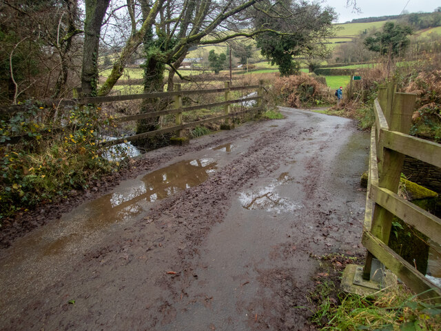
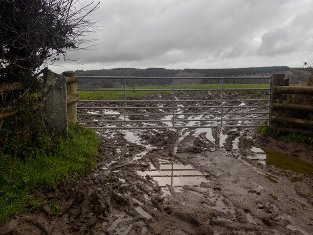
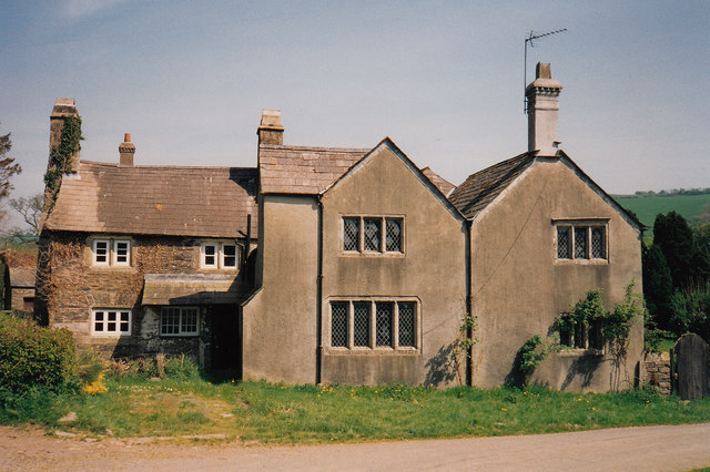
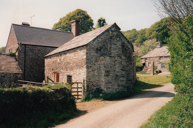
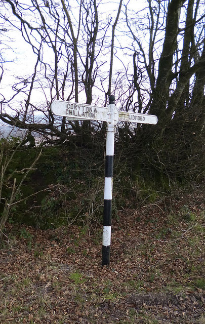
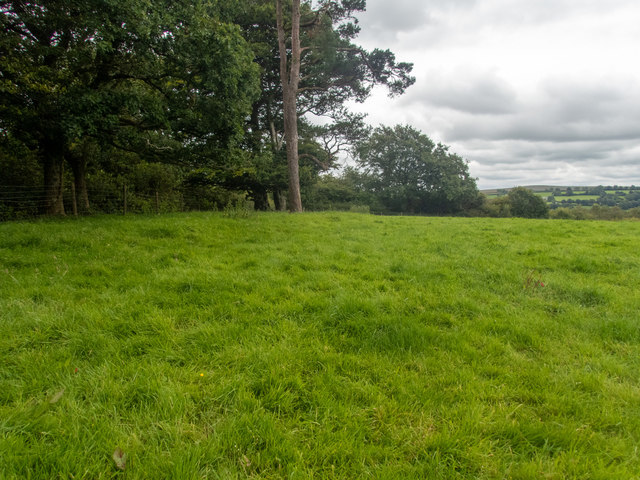
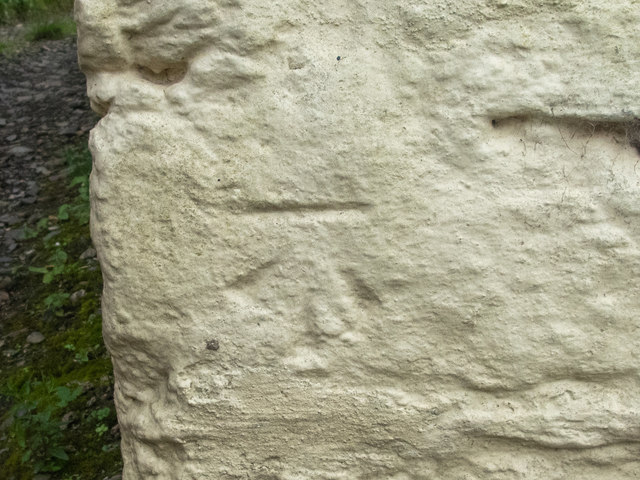
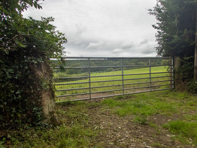
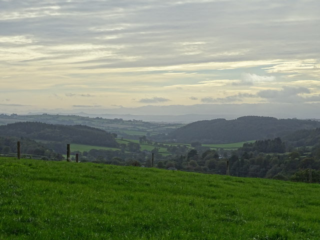
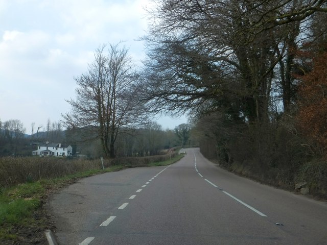
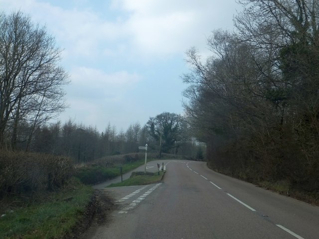
Westdown Pool Images

Images are sourced within 2km of 50.653099/-4.1502971 or Grid Reference SX4885. Thanks to Geograph Open Source API. All images are credited.

Bridge over the River Lew This bridge over the River Lew is near the Dower House <a href="https://www.geograph.org.uk/photo/5723279">SX4686 : Lewtrenchard: Dower House at Lew Mill</a>. There used to be a cut benchmark on the left hand (NE) parapet, but the parapet has been replaced -- perhaps washed away in a flood sometime? <span class="nowrap"><a title="https://www.bench-marks.org.uk/bm160323" rel="nofollow ugc noopener" href="https://www.bench-marks.org.uk/bm160323">Link</a><img style="margin-left:2px;" alt="External link" title="External link - shift click to open in new window" src="https://s1.geograph.org.uk/img/external.png" width="10" height="10"/></span>
Bridge over the River Lew
This bridge over the River Lew is near the Dower House SX4686 : Lewtrenchard: Dower House at Lew Mill. There used to be a cut benchmark on the left hand (NE) parapet, but the parapet has been replaced -- perhaps washed away in a flood sometime? LinkExternal link
A very muddy field entrance The view here is through the gate into the field near Waddlestone - the rising ground and trees are in <a href="https://www.geograph.org.uk/gridref/SX4785">SX4785</a>. There is a clear, cut benchmark about one third of the way up what used to be the gatepost (which is slate). As is common around here, the stone post has been replaced by timber. Many of the stone posts, carrying benchmarks, have disappeared. Fortunately, we did not have to go through the gate. <span class="nowrap"><a title="https://www.bench-marks.org.uk/bm160325" rel="nofollow ugc noopener" href="https://www.bench-marks.org.uk/bm160325">Link</a><img style="margin-left:2px;" alt="External link" title="External link - shift click to open in new window" src="https://s1.geograph.org.uk/img/external.png" width="10" height="10"/></span>
A very muddy field entrance
The view here is through the gate into the field near Waddlestone - the rising ground and trees are in SX4785. There is a clear, cut benchmark about one third of the way up what used to be the gatepost (which is slate). As is common around here, the stone post has been replaced by timber. Many of the stone posts, carrying benchmarks, have disappeared. Fortunately, we did not have to go through the gate. LinkExternal link
Lewtrenchard: Dower House at Lew Mill
Lewtrenchard: Lew Mill Buildings, formerly a water mill
Lewtrenchard: Lew Mill
Buildings, formerly a water mill
Old Milestone by the former A30, Combebow wood, Thrushelton Parish Carved stone post by the UC road (was A30), in parish of THRUSHELTON (WEST DEVON District), by a wood West of Combebow, 10m West of entrance through spinney edge, in hedge bank by road, on North side of road. Launceston gable, erected by the Launceston turnpike trust in the 19th century. 

Inscription reads:-
LAUNCESTON
10
OKEHAMPTON
8½

Devon & Dartmoor HER listed.
HER Number: MDV39618 <span class="nowrap"><a title="https://www.heritagegateway.org.uk/Gateway/Results_Single.aspx?uid=MDV39618&resourceID=104" rel="nofollow ugc noopener" href="https://www.heritagegateway.org.uk/Gateway/Results_Single.aspx?uid=MDV39618&resourceID=104">Link</a><img style="margin-left:2px;" alt="External link" title="External link - shift click to open in new window" src="https://s1.geograph.org.uk/img/external.png" width="10" height="10"/></span>

Milestone Society National ID: DV_LAOK10.
Old Milestone by the former A30, Combebow wood, Thrushelton Parish
Carved stone post by the UC road (was A30), in parish of THRUSHELTON (WEST DEVON District), by a wood West of Combebow, 10m West of entrance through spinney edge, in hedge bank by road, on North side of road. Launceston gable, erected by the Launceston turnpike trust in the 19th century. Inscription reads:- LAUNCESTON 10 OKEHAMPTON 8½ Devon & Dartmoor HER listed. HER Number: MDV39618 LinkExternal link Milestone Society National ID: DV_LAOK10.
Old Milestone near Lobhill Cross, Thrushelton Carved stone post by the UC road (was A30), in parish of THRUSHELTON (WEST DEVON District), just East of Lobhill Cross, 50m up (West) from Lobhill Lodge, in hedge bank, on North side of road. Launceston gable, erected by the Launceston turnpike trust in the 19th century. 

Inscription reads:-  : LAUNCESTON / 9 / OKEHAMPTON 9½ : 

Milestone Society National ID: DV_LAOK09.
Old Milestone near Lobhill Cross, Thrushelton
Carved stone post by the UC road (was A30), in parish of THRUSHELTON (WEST DEVON District), just East of Lobhill Cross, 50m up (West) from Lobhill Lodge, in hedge bank, on North side of road. Launceston gable, erected by the Launceston turnpike trust in the 19th century. Inscription reads:- : LAUNCESTON / 9 / OKEHAMPTON 9½ : Milestone Society National ID: DV_LAOK09.
Old Direction Sign - Signpost by Hedge Cross, Bridestowe parish Fir cone finial - 3 arms; Devon compass points by the UC road, in parish of Bridestowe (West Devon District), Hedge Cross, under trees.

Surveyed

Milestone Society National ID: DV_SX4885
Old Direction Sign - Signpost by Hedge Cross, Bridestowe parish
Fir cone finial - 3 arms; Devon compass points by the UC road, in parish of Bridestowe (West Devon District), Hedge Cross, under trees. Surveyed Milestone Society National ID: DV_SX4885
Old Boundary Marker by Lobhillcross, Lewtrenchard parish Parish Boundary Marker by the UC road (was A30), in parish of Lewtrenchard (West Devon District), Lobhillcross, 50m West of Lobhill lodge, on grass verge/bank above path by fence.

Devon & Dartmoor HER.
HER Number: MDV59500 <span class="nowrap"><a title="https://www.heritagegateway.org.uk/Gateway/Results_Single.aspx?uid=MDV59500&resourceID=104" rel="nofollow ugc noopener" href="https://www.heritagegateway.org.uk/Gateway/Results_Single.aspx?uid=MDV59500&resourceID=104">Link</a><img style="margin-left:2px;" alt="External link" title="External link - shift click to open in new window" src="https://s1.geograph.org.uk/img/external.png" width="10" height="10"/></span>

Carved benchmark on lower East face.

Surveyed

Milestone Society National ID: DV_LAEX07pb
Old Boundary Marker by Lobhillcross, Lewtrenchard parish
Parish Boundary Marker by the UC road (was A30), in parish of Lewtrenchard (West Devon District), Lobhillcross, 50m West of Lobhill lodge, on grass verge/bank above path by fence. Devon & Dartmoor HER. HER Number: MDV59500 LinkExternal link Carved benchmark on lower East face. Surveyed Milestone Society National ID: DV_LAEX07pb
A mysterious circle in a wall The 1:25000 OS map clearly shows a circular enclosure here. There is little sign of it on the ground, just a slightly raised circular area of field, which is very difficult to show in a photograph.
A mysterious circle in a wall
The 1:25000 OS map clearly shows a circular enclosure here. There is little sign of it on the ground, just a slightly raised circular area of field, which is very difficult to show in a photograph.
Track through Wooda Farm This track runs up the hillside beyond Wooda Farm. There is a cut benchmark low down on the whitewashed wall lower right <a href="https://www.geograph.org.uk/photo/6561075">SX4685 : Well preserved cut benchmark</a>.
Track through Wooda Farm
This track runs up the hillside beyond Wooda Farm. There is a cut benchmark low down on the whitewashed wall lower right SX4685 : Well preserved cut benchmark.
Well preserved cut benchmark The OS description is NE ANG FM WOODA W SIDE TK. The surroundings are shown in <a href="https://www.geograph.org.uk/photo/6561072">SX4685 : Track through Wooda Farm</a>.
Well preserved cut benchmark
The OS description is NE ANG FM WOODA W SIDE TK. The surroundings are shown in SX4685 : Track through Wooda Farm.
Benchmark on a gatepost This area has many granite gateposts, and a number of them hold cut benchmarks. This one is on the left hand post, just below the vegetation <a href="https://www.geograph.org.uk/photo/6561078">SX4885 : Benchmark on a granite gatepost</a>. Often, one has to do a good deal of gardening to find the benchmarks, but this one was fairly obvious.
Benchmark on a gatepost
This area has many granite gateposts, and a number of them hold cut benchmarks. This one is on the left hand post, just below the vegetation SX4885 : Benchmark on a granite gatepost. Often, one has to do a good deal of gardening to find the benchmarks, but this one was fairly obvious.
Benchmark on a granite gatepost The OS description is GTP 3.0M SW HEDGE JUNC W SIDE RD NE FACE. The vegetation needed a bit of attention for the benchmark to be seen properly <a href="https://www.geograph.org.uk/photo/6561077">SX4885 : Benchmark on a gatepost</a>.
Benchmark on a granite gatepost
The OS description is GTP 3.0M SW HEDGE JUNC W SIDE RD NE FACE. The vegetation needed a bit of attention for the benchmark to be seen properly SX4885 : Benchmark on a gatepost.
Benchmark right on the northern edge There is a cut benchmark <a href="https://www.geograph.org.uk/photo/6561083">SX4885 : A camouflaged benchmark</a> on the left-hand gatepost, just as one comes off Galford Down. According to the OS database, its coordinate is SX 4876 8599, so just a little bit further north and it would have been in the next square north. Fortunately, the benchmark was on the south face of the post, so I was able to stand in the square to show the mark's surroundings.
Benchmark right on the northern edge
There is a cut benchmark SX4885 : A camouflaged benchmark on the left-hand gatepost, just as one comes off Galford Down. According to the OS database, its coordinate is SX 4876 8599, so just a little bit further north and it would have been in the next square north. Fortunately, the benchmark was on the south face of the post, so I was able to stand in the square to show the mark's surroundings.
A camouflaged benchmark Sometimes, one spots benchmarks without knowing they are there. One gets used to walking past houses and gateposts and looking a metre or so off the ground on corners. This one is not so obvious because of the large feldspar crystals in the granite and, I suspect, the years of ivy cladding <a href="https://www.geograph.org.uk/photo/6561082">SX4885 : Benchmark right on the northern edge</a>. The OS description is GTP HEDGE JUNC W SIDE RD S FACE.
A camouflaged benchmark
Sometimes, one spots benchmarks without knowing they are there. One gets used to walking past houses and gateposts and looking a metre or so off the ground on corners. This one is not so obvious because of the large feldspar crystals in the granite and, I suspect, the years of ivy cladding SX4885 : Benchmark right on the northern edge. The OS description is GTP HEDGE JUNC W SIDE RD S FACE.
View from Waddlestone Lodge
Lay-by in Dawe's Wood The woodland lies to the north of the road; the white house is in Alder Quarry
Lay-by in Dawe's Wood
The woodland lies to the north of the road; the white house is in Alder Quarry
Junction for Beechcombe Farm The side road has climbed steeply from the valley of the River Lew, necessitating the Y-shaped junction.
Junction for Beechcombe Farm
The side road has climbed steeply from the valley of the River Lew, necessitating the Y-shaped junction.
Show me another place!

Westdown Pool is located at Grid Ref: SX4885 (Lat: 50.653099, Lng: -4.1502971)

Administrative County: Devon

District: West Devon

Police Authority: Devon and Cornwall

What 3 Words

///gloom.throw.trains. Near Lifton, Devon

Nearby Locations

Westdown Pool Holdstrong

Related Wikis

Combebow

Combebow is a small settlement in Devon, England. It is situated by the River Lew. == External links == Media related to Combebow at Wikimedia Commons...

Burley Wood

Burley Wood is the site of an Iron Age hill fort north of Lydford in Devon, England. The fort occupies much of a hilltop some 220 metres above sea level...

Lewtrenchard

Lewtrenchard is a village and civil parish in the West Devon district, in the county of Devon, England. Most of the larger village of Lewdown is in the...

Lydford Castle

Lydford Castle is a medieval castle in the town of Lydford, Devon, England. The first castle in Lydford, sometimes termed the Norman fort, was a small...

Have you been to Westdown Pool?

Leave your review of Westdown Pool below (or comments, questions and feedback).