Lower Glen Dam

Lake, Pool, Pond, Freshwater Marsh in Renfrewshire

Scotland

Lower Glen Dam

Dry-stone wall and fence The space between the wall and fence is more worn than the surrounding moorland because, as shown on the map, the route between them is part of a footpath. For a good summary of that path, see <a href="https://www.geograph.org.uk/photo/369064">NS4859 : Paisley - Brownside Braes - Harelaw  Reservoir</a>.

The same fence and wall are shown in <a href="https://www.geograph.org.uk/photo/2308667">NS4860 : Dry-stone wall and fence</a>, which was taken at a point about 270 metres further along the same path.
Dry-stone wall and fence Credit: Lairich Rig

Lower Glen Dam is a picturesque freshwater body located in Renfrewshire, Scotland. This man-made feature was constructed in the mid-20th century and serves as both a water reservoir and a recreational area for local residents and tourists alike.

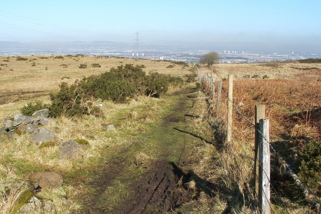
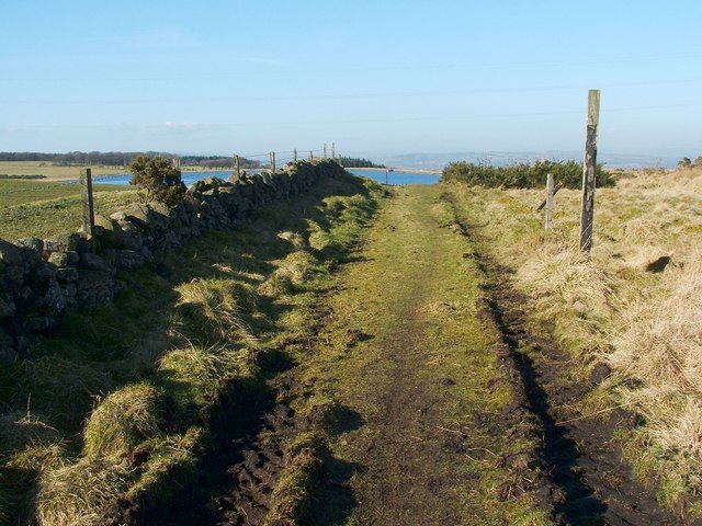
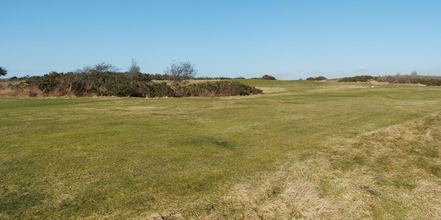
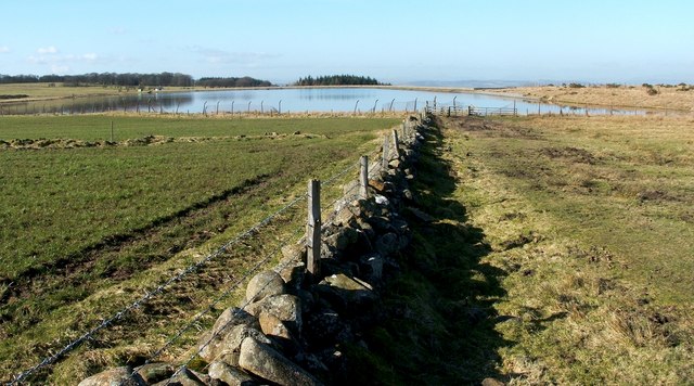
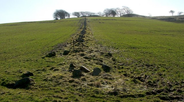
Covering an area of approximately 40 acres, Lower Glen Dam is characterized by its calm and serene atmosphere. The dam is nestled within a lush green landscape, surrounded by rolling hills and dense forests, creating a tranquil and idyllic setting for visitors to enjoy.

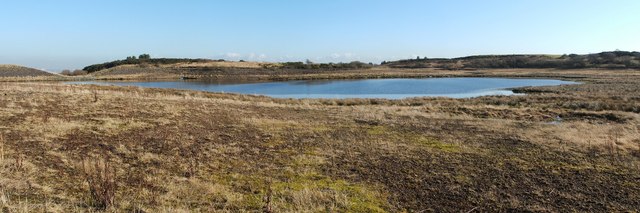
The main attraction of Lower Glen Dam is its crystal-clear water, which is sourced from nearby rivers and stored in the reservoir. The water is relatively shallow, with an average depth of around 5 meters, making it suitable for various water activities such as fishing, canoeing, and kayaking.

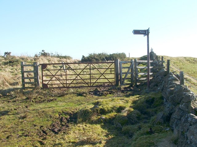
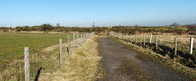
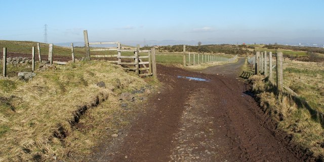
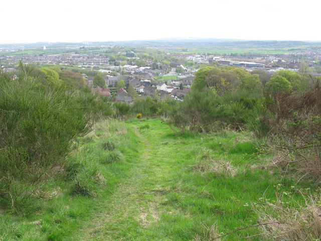
The dam also features a small sandy beach area, providing a perfect spot for sunbathing and picnicking. The beach is lined with tall trees, offering shade and shelter on hot summer days. Additionally, there are several walking trails that wind their way around the dam, allowing visitors to explore the surrounding natural beauty and observe the diverse wildlife that inhabits the area.

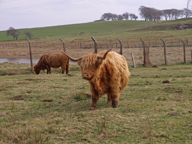
Lower Glen Dam is a haven for birdwatchers, as it attracts a wide range of avian species. The freshwater marshes surrounding the dam provide an ideal habitat for waterfowl, including ducks, geese, and swans. The tranquil waters also attract various fish species, making it a popular spot for anglers.

Overall, Lower Glen Dam is a serene and scenic freshwater body that offers a range of recreational activities, making it a beloved destination for nature lovers and outdoor enthusiasts.

If you have any feedback on the listing, please let us know in the comments section below.

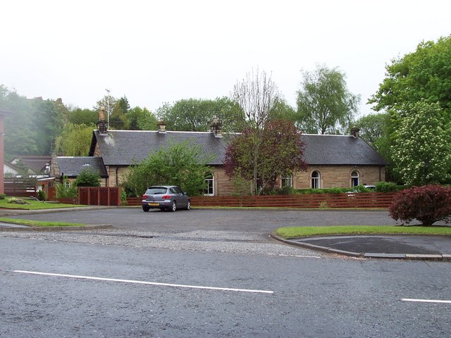
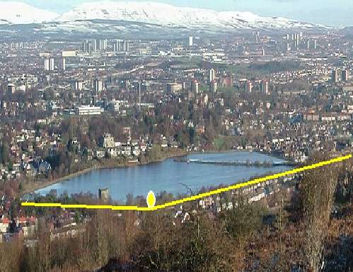
Lower Glen Dam Images

Images are sourced within 2km of 55.81555/-4.4290085 or Grid Reference NS4760. Thanks to Geograph Open Source API. All images are credited.

Dry-stone wall and fence The space between the wall and fence is more worn than the surrounding moorland because, as shown on the map, the route between them is part of a footpath. For a good summary of that path, see <a href="https://www.geograph.org.uk/photo/369064">NS4859 : Paisley - Brownside Braes - Harelaw  Reservoir</a>.

The same fence and wall are shown in <a href="https://www.geograph.org.uk/photo/2308667">NS4860 : Dry-stone wall and fence</a>, which was taken at a point about 270 metres further along the same path.
Dry-stone wall and fence
The space between the wall and fence is more worn than the surrounding moorland because, as shown on the map, the route between them is part of a footpath. For a good summary of that path, see NS4859 : Paisley - Brownside Braes - Harelaw Reservoir. The same fence and wall are shown in NS4860 : Dry-stone wall and fence, which was taken at a point about 270 metres further along the same path.
Signpost at footpath junction The signpost is located at a three-way junction of paths.

The sign pointing to the left says "Paisley", and points along the route shown in <a href="https://www.geograph.org.uk/photo/2308698">NS4859 : Dry-stone wall and fence</a> and <a href="https://www.geograph.org.uk/photo/2308667">NS4860 : Dry-stone wall and fence</a>.

Another, pointing towards the photographer's position, reads "Killoch Glen via Glenburn Resr"; for that route, see <a href="https://www.geograph.org.uk/photo/2309088">NS4859 : Path to Glenburn Reservoir</a>.

The third, pointing in the opposite direction, reads "Barrhead / Killoch Glen via Harelaw Resr"; for a view back along that route, see <a href="https://www.geograph.org.uk/photo/2309100">NS4859 : Path from Killoch Glen</a>.
Signpost at footpath junction
The signpost is located at a three-way junction of paths. The sign pointing to the left says "Paisley", and points along the route shown in NS4859 : Dry-stone wall and fence and NS4860 : Dry-stone wall and fence. Another, pointing towards the photographer's position, reads "Killoch Glen via Glenburn Resr"; for that route, see NS4859 : Path to Glenburn Reservoir. The third, pointing in the opposite direction, reads "Barrhead / Killoch Glen via Harelaw Resr"; for a view back along that route, see NS4859 : Path from Killoch Glen.
Path to Glenburn Reservoir This photograph, which was taken from beside the signpost that is shown in <a href="https://www.geograph.org.uk/photo/2309070">NS4859 : Signpost at footpath junction</a>, shows one of the three paths that is indicated there. <a href="https://www.geograph.org.uk/photo/2308500">NS4760 : Glenburn Reservoir</a> is visible about 240 metres ahead.

For a view from a point a little further along the path, see <a href="https://www.geograph.org.uk/photo/2310062">NS4759 : Path to Glenburn Reservoir</a>.
Path to Glenburn Reservoir
This photograph, which was taken from beside the signpost that is shown in NS4859 : Signpost at footpath junction, shows one of the three paths that is indicated there. NS4760 : Glenburn Reservoir is visible about 240 metres ahead. For a view from a point a little further along the path, see NS4759 : Path to Glenburn Reservoir.
Path from Killoch Glen For the previous part of the route, see <a href="https://www.geograph.org.uk/photo/2310031">NS4859 : Path from Killoch Glen</a>. That path makes a sharp turn near <a href="https://www.geograph.org.uk/photo/2309150">NS4859 : Harelaw Reservoir</a>. The present photograph shows the part of the route beyond that corner; it leads towards the signpost that is shown in <a href="https://www.geograph.org.uk/photo/2309070">NS4859 : Signpost at footpath junction</a>.

The top of that signpost is just visible in this photograph; it can be seen straight ahead on the path, with <a href="https://www.geograph.org.uk/photo/2308500">NS4760 : Glenburn Reservoir</a> visible behind it.
Path from Killoch Glen
For the previous part of the route, see NS4859 : Path from Killoch Glen. That path makes a sharp turn near NS4859 : Harelaw Reservoir. The present photograph shows the part of the route beyond that corner; it leads towards the signpost that is shown in NS4859 : Signpost at footpath junction. The top of that signpost is just visible in this photograph; it can be seen straight ahead on the path, with NS4760 : Glenburn Reservoir visible behind it.
Harelaw Reservoir Unlike nearby <a href="https://www.geograph.org.uk/photo/2308500">NS4760 : Glenburn Reservoir</a>, Harelaw Reservoir appears on the first-edition OS map, which was surveyed in 1858.

The water level has been lowered considerably in recent years. Relative to the OS map that was current when this picture was taken, the photographer's position would be in the water of the reservoir, although not very far from the edge. The changes being made here are part of a Local Biodiversity Action Plan; this body of water will be de-classified as a reservoir.

For other pictures, see <a href="https://www.geograph.org.uk/photo/369064">NS4859 : Paisley - Brownside Braes - Harelaw  Reservoir</a>, <a href="https://www.geograph.org.uk/photo/441217">NS4859 : Harelaw Reservoir</a>, and <a href="https://www.geograph.org.uk/photo/441118">NS4859 : Grazing on Fereneze Hills and Harelaw Reservoir</a>.
Harelaw Reservoir
Unlike nearby NS4760 : Glenburn Reservoir, Harelaw Reservoir appears on the first-edition OS map, which was surveyed in 1858. The water level has been lowered considerably in recent years. Relative to the OS map that was current when this picture was taken, the photographer's position would be in the water of the reservoir, although not very far from the edge. The changes being made here are part of a Local Biodiversity Action Plan; this body of water will be de-classified as a reservoir. For other pictures, see NS4859 : Paisley - Brownside Braes - Harelaw Reservoir, NS4859 : Harelaw Reservoir, and NS4859 : Grazing on Fereneze Hills and Harelaw Reservoir.
Fereneze Golf Course This is part of the course of Fereneze Golf Club. The picture was taken from near what used to be the edge of <a href="https://www.geograph.org.uk/photo/2309150">NS4859 : Harelaw Reservoir</a>.

See also <a href="https://www.geograph.org.uk/photo/369064">NS4859 : Paisley - Brownside Braes - Harelaw  Reservoir</a>.
Fereneze Golf Course
This is part of the course of Fereneze Golf Club. The picture was taken from near what used to be the edge of NS4859 : Harelaw Reservoir. See also NS4859 : Paisley - Brownside Braes - Harelaw Reservoir.
Path from Killoch Glen For the previous part of the route, see <a href="https://www.geograph.org.uk/photo/2310037">NS4859 : Path from Killoch Glen</a>.

The present photograph was taken from about 100 metres further along the path. About 50 metres ahead, the route turns sharply to the left; the section beyond that corner is shown in <a href="https://www.geograph.org.uk/photo/2309100">NS4859 : Path from Killoch Glen</a>.
Path from Killoch Glen
For the previous part of the route, see NS4859 : Path from Killoch Glen. The present photograph was taken from about 100 metres further along the path. About 50 metres ahead, the route turns sharply to the left; the section beyond that corner is shown in NS4859 : Path from Killoch Glen.
Path from Killoch Glen The footpath continues straight ahead; the gate on the left leads into a field instead.

For a view from a point further along this path, see <a href="https://www.geograph.org.uk/photo/2310031">NS4859 : Path from Killoch Glen</a>. Visible in the background, on the right, is part of a <a href="https://www.geograph.org.uk/photo/2310006">NS4859 : Fereneze Golf Course</a>.
Path from Killoch Glen
The footpath continues straight ahead; the gate on the left leads into a field instead. For a view from a point further along this path, see NS4859 : Path from Killoch Glen. Visible in the background, on the right, is part of a NS4859 : Fereneze Golf Course.
Path to Glenburn Reservoir This is a view from a point further along the path that is shown in <a href="https://www.geograph.org.uk/photo/2309088">NS4859 : Path to Glenburn Reservoir</a>; <a href="https://www.geograph.org.uk/photo/2308500">NS4760 : Glenburn Reservoir</a> is visible ahead. Not far ahead, the wall and fence whose line the present photograph follows is met from the left by an old field boundary; see <a href="https://www.geograph.org.uk/photo/2310077">NS4759 : View along old field boundary</a>.

Still further ahead is <a href="https://www.geograph.org.uk/photo/5423845">NS4760 : The start of a path beside the Glenburn Reservoir</a>.
Path to Glenburn Reservoir
This is a view from a point further along the path that is shown in NS4859 : Path to Glenburn Reservoir; NS4760 : Glenburn Reservoir is visible ahead. Not far ahead, the wall and fence whose line the present photograph follows is met from the left by an old field boundary; see NS4759 : View along old field boundary. Still further ahead is NS4760 : The start of a path beside the Glenburn Reservoir.
View along old field boundary This boundary is in the form of a dry-stone dyke, which is now in poor condition. It is marked on the first-edition OS map, which was surveyed in 1858, and it may be considerably older than that.

See <a href="https://www.geograph.org.uk/photo/2310062">NS4759 : Path to Glenburn Reservoir</a>, where the line of the boundary can be seen not far ahead, approaching the more recent wall from the left. The present photograph was taken from the point where the two meet.

Even in this photograph, it is clear that at the top of the hill, among the trees, there are some ruins; one section lies directly beyond the far end of the field boundary, and a smaller section to the left. These are the remains of the farmstead of Duchallaw, which is shown on the first-edition OS map.
View along old field boundary
This boundary is in the form of a dry-stone dyke, which is now in poor condition. It is marked on the first-edition OS map, which was surveyed in 1858, and it may be considerably older than that. See NS4759 : Path to Glenburn Reservoir, where the line of the boundary can be seen not far ahead, approaching the more recent wall from the left. The present photograph was taken from the point where the two meet. Even in this photograph, it is clear that at the top of the hill, among the trees, there are some ruins; one section lies directly beyond the far end of the field boundary, and a smaller section to the left. These are the remains of the farmstead of Duchallaw, which is shown on the first-edition OS map.
Highland Cows, Brownside Braes Fenced off Glenburn Reservoir on the left.
Highland Cows, Brownside Braes
Fenced off Glenburn Reservoir on the left.
Path to the Fereneze Braes Near the start of the path from Barrhead with an excellent view back over Barrhead.
Path to the Fereneze Braes
Near the start of the path from Barrhead with an excellent view back over Barrhead.
Fereneze Golf Club - Hole 15 (Forebrae) Fereneze Golf Club is a 5962 yard par 71 moorland course on the Fereneze Braes.
Fereneze Golf Club - Hole 15 (Forebrae)
Fereneze Golf Club is a 5962 yard par 71 moorland course on the Fereneze Braes.
Harelaw Reservoir Looking across the 9th green of the Fereneze Golf Course towards the reservoir.
Harelaw Reservoir
Looking across the 9th green of the Fereneze Golf Course towards the reservoir.
An unnamed summit in the Fereneze Braes A large cairn and a wind-battered beech tree at the summit. Despite the relatively modest height, there is a wonderful 360° panorama from the summit.
An unnamed summit in the Fereneze Braes
A large cairn and a wind-battered beech tree at the summit. Despite the relatively modest height, there is a wonderful 360° panorama from the summit.
Glenburn Reservoir Viewed from an unnamed summit in the Fereneze Braes.
Glenburn Reservoir
Viewed from an unnamed summit in the Fereneze Braes.
Highland Cattle This bull took a close interest as I passed by on the Fereneze Braes.
Highland Cattle
This bull took a close interest as I passed by on the Fereneze Braes.
Footbridge over the Harelaw Burn The bridge is shown (as "FB") on the 1:25000 map. For more context, and for a view in the opposite direction, see <a href="https://www.geograph.org.uk/photo/4057485">NS4859 : Track beside golf course</a>.
Footbridge over the Harelaw Burn
The bridge is shown (as "FB") on the 1:25000 map. For more context, and for a view in the opposite direction, see NS4859 : Track beside golf course.
Show me another place!

Lower Glen Dam is located at Grid Ref: NS4760 (Lat: 55.81555, Lng: -4.4290085)

Unitary Authority: Renfrewshire

Police Authority: Renfrewshire and Inverclyde

What 3 Words

///nails.diary.soon. Near Paisley, Renfrewshire

Related Wikis

Glenfield railway station (Scotland)

Glenfield was a railway station to the south west of Paisley, Renfrewshire, Scotland. == History == The station was originally part of the Paisley and...

Potterhill railway station

Potterhill railway station was a railway station to the south of Paisley, Renfrewshire, Scotland. The station was originally part of the Glasgow and South...

Stanely railway station

Stanely was a railway station to the west of Paisley, Renfrewshire, Scotland. == History == The station was originally part of the Paisley and Barrhead...
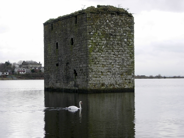
Stanely Castle

Stanely Castle is located in the waters of Stanely Reservoir, to the south of Paisley, Scotland, at the foot of the Gleniffer Braes. It was probably built...
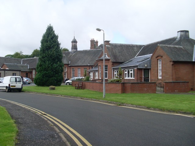
Dykebar Hospital

Dykebar Hospital is a mental health facility in Dykebar, Paisley, Renfrewshire, Scotland. The main building is a Grade B listed building. The hospital...

Charleston, Paisley

Charleston is a district in the burgh of Paisley in Renfrewshire, Scotland. Once a village distinct from Paisley, Charleston has become absorbed as Paisley...

Gleniffer High School

Gleniffer High School is a Scottish state state school school located in Paisley for boys and girls aged 11 to 18. Since 1988, Gleniffer has been located...

Riccartsbar Hospital

Riccartsbar Hospital was a mental health facility in Paisley, Renfrewshire, Scotland. == History == The hospital, which was designed by John Honeyman,...

Related Videos

Waterfall Wander at Gleniffer Braes | Paisley

When you can't travel far to scratch the hiking itch we looked a bit closer to home for somewhere we could stretch the legs but still ...

Hiking Gleniffer Braes and I Eventually Find a Beautiful Waterfall

I have been told many times that a good walk/hike, pretty close to me is Gleniffer Braes, which is situated between Paisley and ...

Boylestone quarry Barrhead

Exploring boylestone quarry Barrhead Scotland.

Nearby Amenities

Located within 500m of 55.81555,-4.4290085
Crossing
Bicycle: yes
Crossing: traffic_signals
Crossing Ref: toucan
Lat/Long: 55.8186479/-4.4274584
Bus Stop
Bus: yes
Naptan AtcoCode: 6140420
Naptan NaptanCode: 73924789
Public Transport: platform
Lat/Long: 55.8191605/-4.4330877
Bus Stop
Glenburn Road / Jura Road
Bus: yes
Nat Ref: 6140419
Public Transport: platform
Lat/Long: 55.8185677/-4.4278578
Speed Camera
Lat/Long: 55.8185972/-4.4286181
Bus Stop
Bus: yes
Public Transport: platform
Lat/Long: 55.8186983/-4.4275711
Power: tower
Lat/Long: 55.812562/-4.4237522
Bench
Lat/Long: 55.8142773/-4.4296916
Bench
Backrest: yes
Lat/Long: 55.8135566/-4.4351006
Barrier: kissing_gate
Lat/Long: 55.8147527/-4.4265688
The data included in this document is from www.openstreetmap.org. The data is made available under ODbL.

Have you been to Lower Glen Dam?

Leave your review of Lower Glen Dam below (or comments, questions and feedback).