Golch

Settlement in Flintshire

Wales

Golch

Giat ar batrwm croes / A cross-barred gate
Giat ar batrwm croes / A cross-barred gate Credit: Ceri Thomas

Golch is a small village located in the county of Flintshire, Wales. Situated in the northeastern part of the country, Golch is surrounded by picturesque countryside and offers a tranquil and rural setting for its residents. The village is positioned approximately 8 miles to the south of Flint, the nearest town.

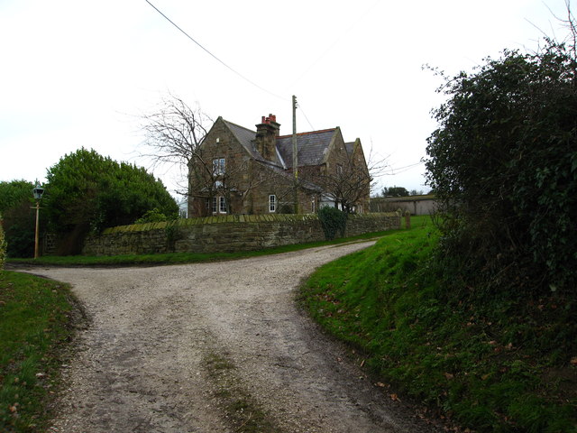
Golch is characterized by its charming and traditional architecture, with many of its buildings dating back to the 19th century. The village primarily comprises of residential properties, with a close-knit community that takes pride in maintaining its rural heritage and sense of community.

Despite its small size, Golch offers a few amenities to its residents. There is a local village hall which serves as a gathering place for community events and activities. Additionally, there is a small convenience store that caters to the daily needs of the villagers.

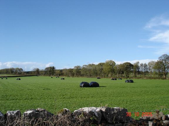
The natural beauty surrounding Golch provides ample opportunities for outdoor activities and exploration. The village is in close proximity to the Clwydian Range, an Area of Outstanding Natural Beauty, which offers stunning views, walking trails, and ample wildlife.

Overall, Golch is a charming village in Flintshire that provides a peaceful and idyllic lifestyle for its residents. With its traditional architecture, close-knit community, and beautiful surroundings, Golch offers a retreat from the hustle and bustle of modern life.

If you have any feedback on the listing, please let us know in the comments section below.
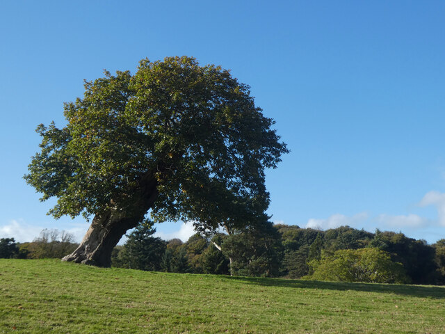
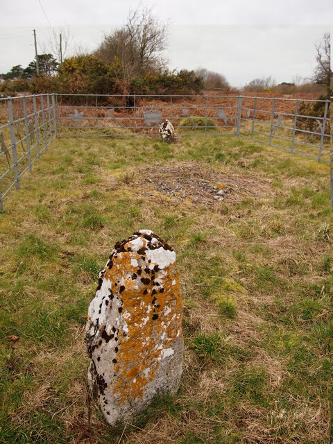
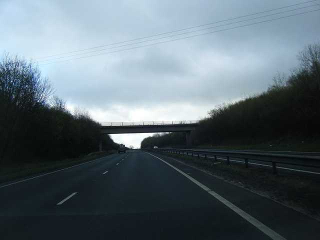
Golch Images

Images are sourced within 2km of 53.283102/-3.252861 or Grid Reference SJ1676. Thanks to Geograph Open Source API. All images are credited.

Giat ar batrwm croes / A cross-barred gate
Derwen ar ogwydd / A leaning oak
Holway Level Mine, Holywell This is the entrance to the Holway Level, a two mile tunnel that lead to one of the most productive lead mines in Britain. The Level drained the water from the mine and also allowed the ore to be brought out by boat. The tunnel was developed into a tourist attraction in 1788. The galena in the mine contained up to 80% lead and 12% silver. Since 1917 this level has supplied St Winefride's well as the original supply was interrupted by the construction of the Milwr Tunnel.
Holway Level Mine, Holywell
This is the entrance to the Holway Level, a two mile tunnel that lead to one of the most productive lead mines in Britain. The Level drained the water from the mine and also allowed the ore to be brought out by boat. The tunnel was developed into a tourist attraction in 1788. The galena in the mine contained up to 80% lead and 12% silver. Since 1917 this level has supplied St Winefride's well as the original supply was interrupted by the construction of the Milwr Tunnel.
Naid-y-March Standing Stones Possibly re-positioned Bronze Age stones, a filled mine shaft lies between them.
Naid-y-March Standing Stones
Possibly re-positioned Bronze Age stones, a filled mine shaft lies between them.
Metal stile near Stokyn Hall
Footbridge over Afon Marsiandwr Replacing an earlier bridge.
Footbridge over Afon Marsiandwr
Replacing an earlier bridge.
A55 near Pantasaph
A55 near Pantasaph
Pasture land between Whitford and Holywell Typical scene for this area.  In the near distance to the left is Pennant Park Golf Club, to the right Highbrook,far centre - a view across the Dee Estuary to The Wirral
Pasture land between Whitford and Holywell
Typical scene for this area. In the near distance to the left is Pennant Park Golf Club, to the right Highbrook,far centre - a view across the Dee Estuary to The Wirral
A5026 north of Gorsedd
A5026 looking to the Dee estuary and Liverpool beyond
A5026 at Carmel village boundary
Ffordd Holway at Holywell village boundary
Footpath (left) past Kennels Farm Heading east
Footpath (left) past Kennels Farm
Heading east
Large grazing field with a view Plas-tirion Wood is on the left and in the distance are lovely views across The Dee Estuary to The Wirral with Hilbre Island in the distant left
Large grazing field with a view
Plas-tirion Wood is on the left and in the distance are lovely views across The Dee Estuary to The Wirral with Hilbre Island in the distant left
Stile on a footpath leading from Kennels Farm Mertyn Isaf is in the background
Stile on a footpath leading from Kennels Farm
Mertyn Isaf is in the background
Mertyn-Crew Farm From a footpath stile which leads into a narrow track with footpaths south past Mertyn Crew or east past Mertyn Isaf
Mertyn-Crew Farm
From a footpath stile which leads into a narrow track with footpaths south past Mertyn Crew or east past Mertyn Isaf
10th Tee Pennant Park Golf Course A little gem of a course.
10th Tee Pennant Park Golf Course
A little gem of a course.
12th Tee Pennant Park Golf Course Mostyn Dock is just visible to the right.
12th Tee Pennant Park Golf Course
Mostyn Dock is just visible to the right.
Show me another place!

Golch is located at Grid Ref: SJ1676 (Lat: 53.283102, Lng: -3.252861)

Unitary Authority: Flintshire

Police Authority: North Wales

What 3 Words

///rags.rolled.hooks. Near Whitford, Flintshire

Nearby Locations

Golch Carmel Mwdwl-eithin

Related Wikis

Pantasaph

Pantasaph is a small village in Flintshire, north-east Wales, two miles south of Holywell in the community of Whitford. Its name translates into English...

Carmel, Flintshire

Carmel is a small village in Flintshire, Wales, just outside Holywell. Carmel has a primary school and a village hall. The village had two functioning...

Gorsedd, Flintshire

Gorsedd is a village in Flintshire, Wales, in the community of Whitford, with a population of 391 in the 2011 census. == References ==
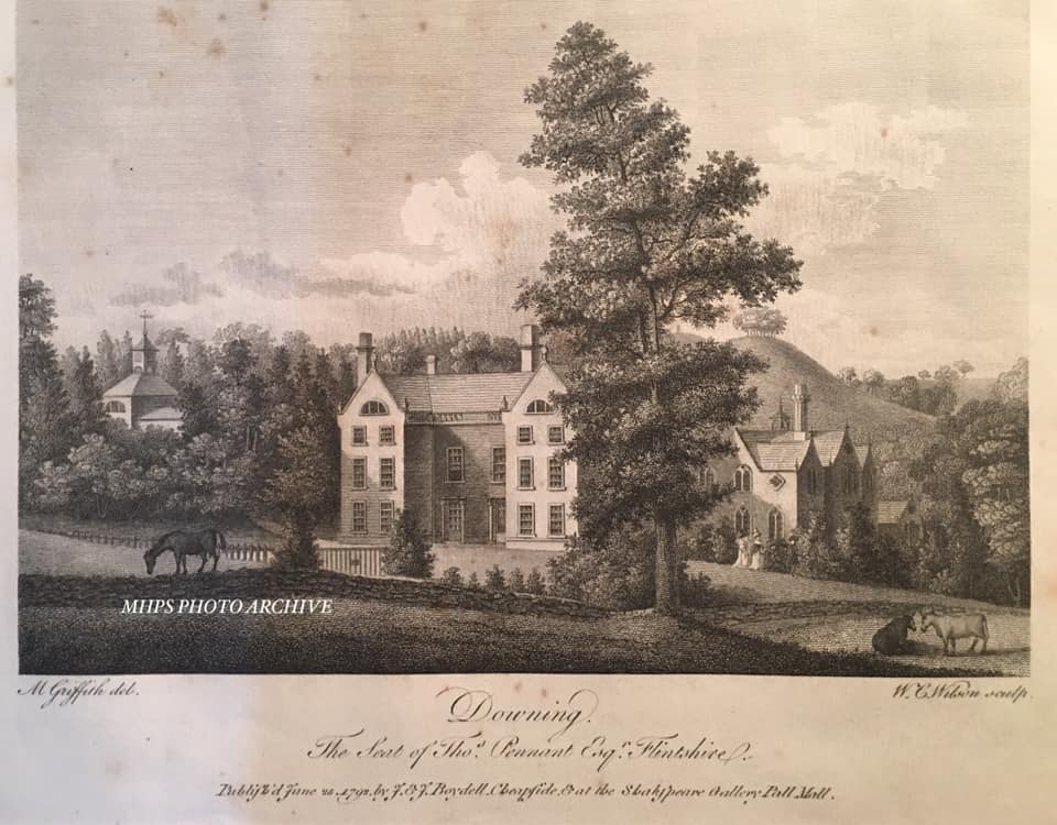
Downing Hall

Downing Hall was built in 1627 by the Pennant family near Whitford, Flintshire. It was later the home of Thomas Pennant, the naturalist, traveller and...

St Winefride's Well

St Winefride's Well (Welsh: Ffynnon Wenffrewi) is a holy well and national shrine located in the Welsh town of Holywell in Flintshire. The patron saint...

St Winefride's Halt railway station

St Winefride's Halt railway station was a station in Holywell, Flintshire, Wales. The station was opened on 1 July 1912 and closed on 6 September 1954...

St Winefride's Church, Holywell

St Winefride's Church (also known as St Winifred's Church or St Winefred's Church) is a Roman Catholic Parish church in Holywell, Flintshire. It was founded...

Holywell Rural District

Holywell was a rural district in the administrative county of Flintshire, Wales, from 1894 to 1974. The district was created by the Local Government Act...

Nearby Amenities

Located within 500m of 53.283102,-3.252861
Power: pole
Lat/Long: 53.2870443/-3.2549329
Power: pole
Lat/Long: 53.2867118/-3.2536743
Power: pole
Lat/Long: 53.2864107/-3.2524804
Power: pole
Lat/Long: 53.2858909/-3.2506306
Power: pole
Lat/Long: 53.2854444/-3.2490203
Power: pole
Lat/Long: 53.2849768/-3.247279
Power: pole
Lat/Long: 53.2840564/-3.2456333
Direction: 105
Generator Method: photovoltaic
Generator Output Electricity: yes
Generator Solar Modules: 12
Generator Source: solar
Generator Type: solar_photovoltaic_panel
Location: roof
Power: generator
Lat/Long: 53.2813326/-3.2580043
Direction: 105
Generator Method: photovoltaic
Generator Output Electricity: yes
Generator Solar Modules: 12
Generator Source: solar
Generator Type: solar_photovoltaic_panel
Location: roof
Power: generator
Lat/Long: 53.2812824/-3.2580526
Direction: 95
Generator Method: photovoltaic
Generator Output Electricity: yes
Generator Solar Modules: 12
Generator Source: solar
Generator Type: solar_photovoltaic_panel
Location: roof
Power: generator
Lat/Long: 53.2813659/-3.2583738
Direction: 95
Generator Method: photovoltaic
Generator Output Electricity: yes
Generator Solar Modules: 12
Generator Source: solar
Generator Type: solar_photovoltaic_panel
Location: roof
Power: generator
Lat/Long: 53.2814404/-3.2583846
Direction: 190
Generator Method: photovoltaic
Generator Output Electricity: yes
Generator Solar Modules: 12
Generator Source: solar
Generator Type: solar_photovoltaic_panel
Location: roof
Power: generator
Lat/Long: 53.2814448/-3.2582123
Direction: 190
Generator Method: photovoltaic
Generator Output Electricity: yes
Generator Solar Modules: 12
Generator Source: solar
Generator Type: solar_photovoltaic_panel
Location: roof
Power: generator
Lat/Long: 53.2814484/-3.2580942
Direction: S
Generator Method: photovoltaic
Generator Output Electricity: yes
Generator Solar Modules: 12
Generator Source: solar
Generator Type: solar_photovoltaic_panel
Location: roof
Power: generator
Lat/Long: 53.282306/-3.2563025
Direction: S
Generator Method: photovoltaic
Generator Output Electricity: yes
Generator Solar Modules: 5
Generator Source: solar
Generator Type: solar_photovoltaic_panel
Location: roof
Power: generator
Lat/Long: 53.2823068/-3.2564386
Direction: 170
Generator Method: photovoltaic
Generator Output Electricity: yes
Generator Solar Modules: 16
Generator Source: solar
Generator Type: solar_photovoltaic_panel
Location: roof
Power: generator
Lat/Long: 53.2823533/-3.2557553
Direction: 190
Generator Method: photovoltaic
Generator Output Electricity: yes
Generator Solar Modules: 16
Generator Source: solar
Generator Type: solar_photovoltaic_panel
Location: roof
Power: generator
Lat/Long: 53.2805492/-3.2541118
Direction: 195
Generator Method: photovoltaic
Generator Output Electricity: yes
Generator Solar Modules: 12
Generator Source: solar
Generator Type: solar_photovoltaic_panel
Location: roof
Power: generator
Lat/Long: 53.2806526/-3.2486052
Direction: ESE
Generator Method: photovoltaic
Generator Output Electricity: yes
Generator Solar Modules: 12
Generator Source: solar
Generator Type: solar_photovoltaic_panel
Location: roof
Power: generator
Lat/Long: 53.2813895/-3.2484389
Direction: 185
Generator Method: photovoltaic
Generator Output Electricity: yes
Generator Solar Modules: 17
Generator Source: solar
Generator Type: solar_photovoltaic_panel
Location: roof
Power: generator
Lat/Long: 53.282393/-3.2496412
Direction: SSW
Generator Method: photovoltaic
Generator Output Electricity: yes
Generator Solar Modules: 3
Generator Source: solar
Generator Type: solar_photovoltaic_panel
Location: roof
Power: generator
Lat/Long: 53.2813937/-3.2485306
Direction: WNW
Generator Method: photovoltaic
Generator Output Electricity: yes
Generator Solar Modules: 3
Generator Source: solar
Generator Type: solar_photovoltaic_panel
Location: roof
Power: generator
Lat/Long: 53.2814321/-3.2484535
Direction: 190
Generator Method: photovoltaic
Generator Output Electricity: yes
Generator Solar Modules: 11
Generator Source: solar
Generator Type: solar_photovoltaic_panel
Location: roof
Power: generator
Lat/Long: 53.2800634/-3.2538079
Direction: 215
Generator Method: photovoltaic
Generator Output Electricity: yes
Generator Solar Modules: 14
Generator Source: solar
Generator Type: solar_photovoltaic_panel
Location: roof
Power: generator
Lat/Long: 53.280053/-3.2570386
Direction: 185
Generator Method: photovoltaic
Generator Output Electricity: yes
Generator Solar Modules: 3
Generator Source: solar
Generator Type: solar_photovoltaic_panel
Location: roof
Power: generator
Lat/Long: 53.2824132/-3.2497571
Historic: ruins
Lat/Long: 53.2865321/-3.2500312
The data included in this document is from www.openstreetmap.org. The data is made available under ODbL.

Have you been to Golch?

Leave your review of Golch below (or comments, questions and feedback).