Goginan

Settlement in Cardiganshire

Wales

Goginan

A tractor on the track Forestry work continues in the hills of Coed Ty-llwyd. The tractor was being used to haul out removed timber.
A tractor on the track Credit: John Lucas

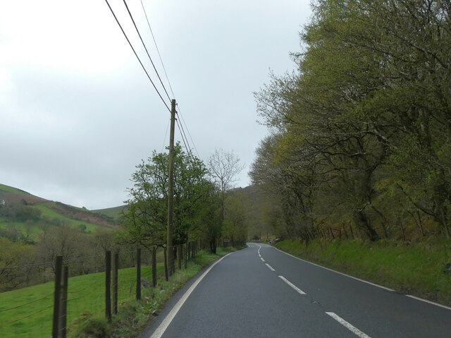
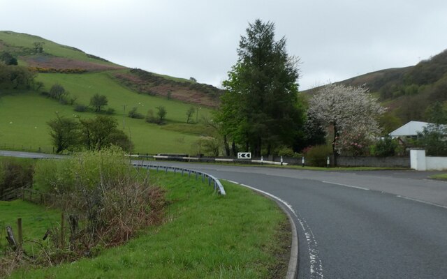
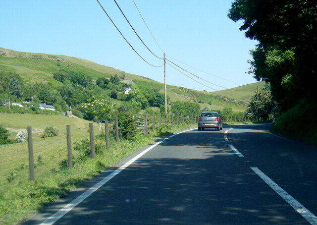
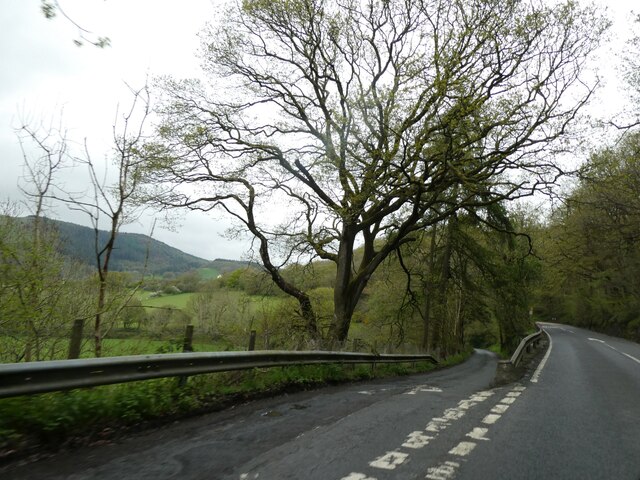
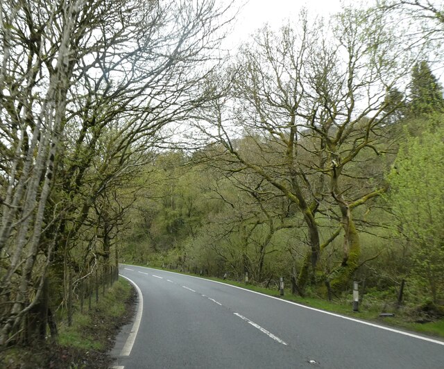
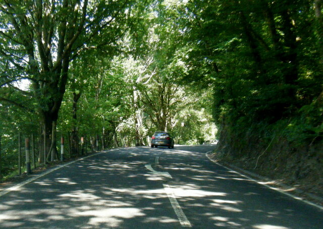
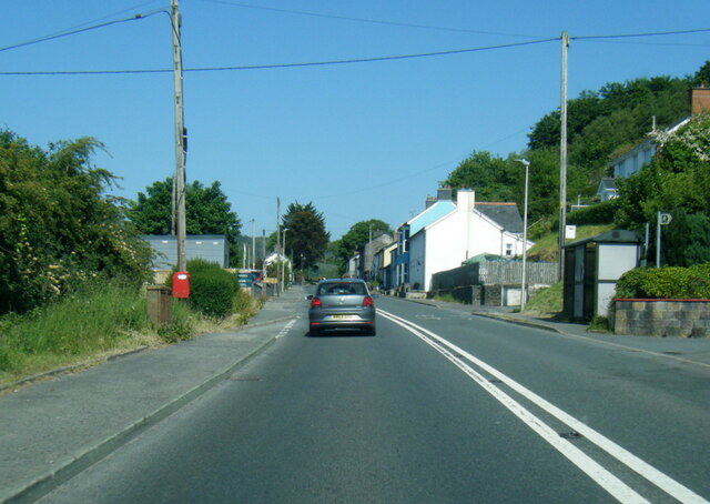
Goginan is a small village located in the county of Cardiganshire, Wales. Situated in the picturesque countryside, it is nestled in the foothills of the Cambrian Mountains, offering breathtaking views and a tranquil atmosphere. The village is approximately 10 miles east of Aberystwyth and is easily accessible by road.

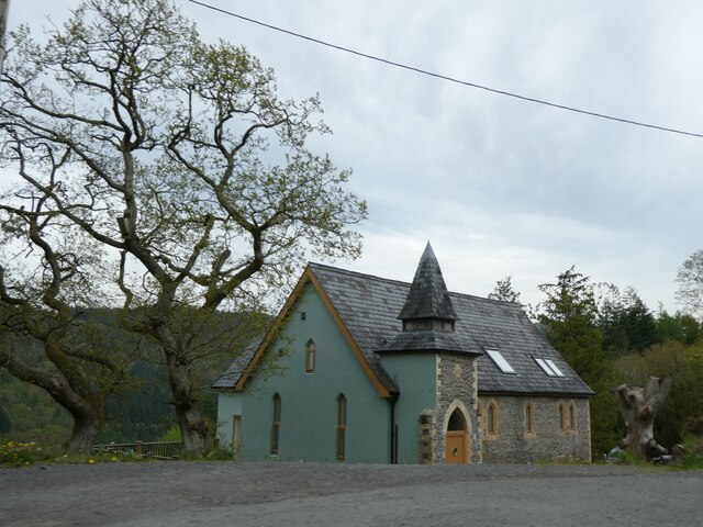
Goginan has a rich history dating back centuries. The name itself is derived from the Welsh words "gog" meaning cuckoo and "inin" meaning stream, reflecting the village's natural surroundings. Historically, the area was known for its lead and zinc mining industry, which played a significant role in the village's development during the 19th century. Today, remnants of the mining heritage can still be seen with old mine shafts and structures dotting the landscape.

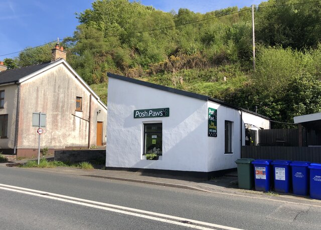
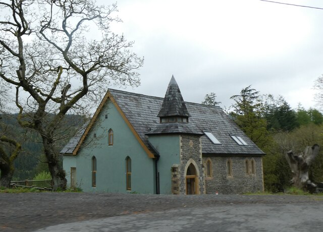
Despite its small size, Goginan is a close-knit community with a friendly and welcoming atmosphere. The village is home to a vibrant local pub, which serves as a social hub for residents and visitors alike. Additionally, there is a small primary school, providing education for the local children.

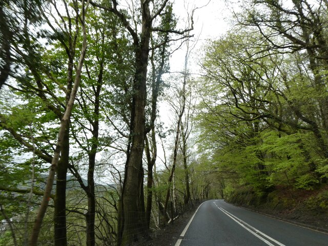
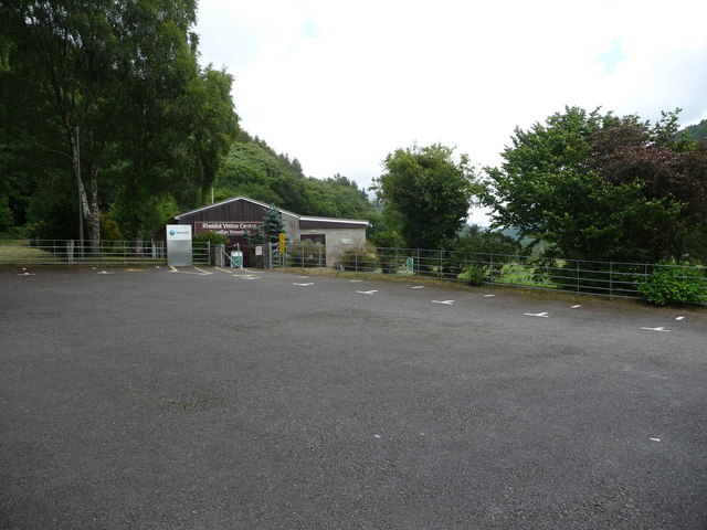
For those who enjoy outdoor activities, Goginan offers ample opportunities for exploration and adventure. The surrounding countryside is ideal for hiking, biking, and birdwatching, with various trails and paths to explore. The nearby Nant-yr-Arian Forest Visitor Centre is a popular destination for nature enthusiasts, offering walking trails and stunning views of the surrounding landscapes.

In conclusion, Goginan is a charming village in Cardiganshire, Wales, known for its natural beauty, mining history, and welcoming community. Whether you seek tranquility, outdoor adventure, or a glimpse into the past, Goginan is a delightful destination to explore.

If you have any feedback on the listing, please let us know in the comments section below.

Goginan Images

Images are sourced within 2km of 52.413295/-3.928398 or Grid Reference SN6881. Thanks to Geograph Open Source API. All images are credited.
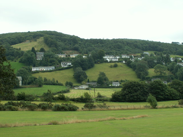
A tractor on the track Forestry work continues in the hills of Coed Ty-llwyd. The tractor was being used to haul out removed timber.
A tractor on the track
Forestry work continues in the hills of Coed Ty-llwyd. The tractor was being used to haul out removed timber.
A44 skirting the valley above Nant Brwyno The A44 is a major road in the United Kingdom that runs for 155 miles from Oxford in southern England to Aberystwyth in west Wales.
<span class="nowrap"><a title="http://www.sabre-roads.org.uk/wiki/index.php?title=A44" rel="nofollow ugc noopener" href="http://www.sabre-roads.org.uk/wiki/index.php?title=A44">Link</a><img style="margin-left:2px;" alt="External link" title="External link - shift click to open in new window" src="https://s1.geograph.org.uk/img/external.png" width="10" height="10"/></span>  SABRE
<span class="nowrap"><a title="https://en.wikipedia.org/wiki/A44_road" rel="nofollow ugc noopener" href="https://en.wikipedia.org/wiki/A44_road">Link</a><img style="margin-left:2px;" alt="External link" title="External link - shift click to open in new window" src="https://s1.geograph.org.uk/img/external.png" width="10" height="10"/></span>  Wikipedia
A44 skirting the valley above Nant Brwyno
The A44 is a major road in the United Kingdom that runs for 155 miles from Oxford in southern England to Aberystwyth in west Wales. LinkExternal link SABRE LinkExternal link Wikipedia
A44 bend for Cwmbrwyno Bridge To avoid steep slopes, the A44 follows a contour round the valley and will double back after the curve
A44 bend for Cwmbrwyno Bridge
To avoid steep slopes, the A44 follows a contour round the valley and will double back after the curve
A44 west of Cwmbrwyno
Posh Paws Dog grooming venture at Goginan
Posh Paws
Dog grooming venture at Goginan
Allt Ty-cam [hill] With Neuadd Parc Farm visible, bottom left. Viewed from Aberffrwd.
Allt Ty-cam [hill]
With Neuadd Parc Farm visible, bottom left. Viewed from Aberffrwd.
A44 in woodland west of Goginan The A44 is a major road in the United Kingdom that runs for 155 miles from Oxford in southern England to Aberystwyth in west Wales.
<span class="nowrap"><a title="http://www.sabre-roads.org.uk/wiki/index.php?title=A44" rel="nofollow ugc noopener" href="http://www.sabre-roads.org.uk/wiki/index.php?title=A44">Link</a><img style="margin-left:2px;" alt="External link" title="External link - shift click to open in new window" src="https://s1.geograph.org.uk/img/external.png" width="10" height="10"/></span>  SABRE
<span class="nowrap"><a title="https://en.wikipedia.org/wiki/A44_road" rel="nofollow ugc noopener" href="https://en.wikipedia.org/wiki/A44_road">Link</a><img style="margin-left:2px;" alt="External link" title="External link - shift click to open in new window" src="https://s1.geograph.org.uk/img/external.png" width="10" height="10"/></span>  Wikipedia
A44 in woodland west of Goginan
The A44 is a major road in the United Kingdom that runs for 155 miles from Oxford in southern England to Aberystwyth in west Wales. LinkExternal link SABRE LinkExternal link Wikipedia
This way to Penbryn and the valley; side road from A44 The A44 is a major road in the United Kingdom that runs for 155 miles from Oxford in southern England to Aberystwyth in west Wales.
<span class="nowrap"><a title="http://www.sabre-roads.org.uk/wiki/index.php?title=A44" rel="nofollow ugc noopener" href="http://www.sabre-roads.org.uk/wiki/index.php?title=A44">Link</a><img style="margin-left:2px;" alt="External link" title="External link - shift click to open in new window" src="https://s1.geograph.org.uk/img/external.png" width="10" height="10"/></span>  SABRE
<span class="nowrap"><a title="https://en.wikipedia.org/wiki/A44_road" rel="nofollow ugc noopener" href="https://en.wikipedia.org/wiki/A44_road">Link</a><img style="margin-left:2px;" alt="External link" title="External link - shift click to open in new window" src="https://s1.geograph.org.uk/img/external.png" width="10" height="10"/></span>  Wikipedia
This way to Penbryn and the valley; side road from A44
The A44 is a major road in the United Kingdom that runs for 155 miles from Oxford in southern England to Aberystwyth in west Wales. LinkExternal link SABRE LinkExternal link Wikipedia
Goginan's abandoned church by A44
Side road from A44 to Blaendyffryn The A44 is a major road in the United Kingdom that runs for 155 miles from Oxford in southern England to Aberystwyth in west Wales.
<span class="nowrap"><a title="http://www.sabre-roads.org.uk/wiki/index.php?title=A44" rel="nofollow ugc noopener" href="http://www.sabre-roads.org.uk/wiki/index.php?title=A44">Link</a><img style="margin-left:2px;" alt="External link" title="External link - shift click to open in new window" src="https://s1.geograph.org.uk/img/external.png" width="10" height="10"/></span>  SABRE
<span class="nowrap"><a title="https://en.wikipedia.org/wiki/A44_road" rel="nofollow ugc noopener" href="https://en.wikipedia.org/wiki/A44_road">Link</a><img style="margin-left:2px;" alt="External link" title="External link - shift click to open in new window" src="https://s1.geograph.org.uk/img/external.png" width="10" height="10"/></span>  Wikipedia
Side road from A44 to Blaendyffryn
The A44 is a major road in the United Kingdom that runs for 155 miles from Oxford in southern England to Aberystwyth in west Wales. LinkExternal link SABRE LinkExternal link Wikipedia
A44 in Blaendyffryn Woods The A44 is a major road in the United Kingdom that runs for 155 miles from Oxford in southern England to Aberystwyth in west Wales.
<span class="nowrap"><a title="http://www.sabre-roads.org.uk/wiki/index.php?title=A44" rel="nofollow ugc noopener" href="http://www.sabre-roads.org.uk/wiki/index.php?title=A44">Link</a><img style="margin-left:2px;" alt="External link" title="External link - shift click to open in new window" src="https://s1.geograph.org.uk/img/external.png" width="10" height="10"/></span>  SABRE
<span class="nowrap"><a title="https://en.wikipedia.org/wiki/A44_road" rel="nofollow ugc noopener" href="https://en.wikipedia.org/wiki/A44_road">Link</a><img style="margin-left:2px;" alt="External link" title="External link - shift click to open in new window" src="https://s1.geograph.org.uk/img/external.png" width="10" height="10"/></span>  Wikipedia
A44 in Blaendyffryn Woods
The A44 is a major road in the United Kingdom that runs for 155 miles from Oxford in southern England to Aberystwyth in west Wales. LinkExternal link SABRE LinkExternal link Wikipedia
A44 south of Penbryn Farm
A44 in Goginan
A44 in Goginan
Goginan chapel
Goginan chapel
The Statkraft Rheidol Visitor Centre in Cwm Rheidol Statkraft is the company that operates the dam and powerstation here. The visitor centre is for the many visitors that come here car touring or walking or to ride the nearby railway and provides history and info on the area and the industry here.
The Statkraft Rheidol Visitor Centre in Cwm Rheidol
Statkraft is the company that operates the dam and powerstation here. The visitor centre is for the many visitors that come here car touring or walking or to ride the nearby railway and provides history and info on the area and the industry here.
Weir on the Afon Rheidol below Cwm Rheidol Reservoir Styled to look naturalistic, this weir looks very photogenic.
Weir on the Afon Rheidol below Cwm Rheidol Reservoir
Styled to look naturalistic, this weir looks very photogenic.
Weir and dam on the Afon Rheidol at Cwm Rheidol Reservoir All still very redolent of its 1960's heyday. Very nicely styled though, an uninformed visitor would hardly notice that it's all part of a man-made reservoir with powerstation etc.
Weir and dam on the Afon Rheidol at Cwm Rheidol Reservoir
All still very redolent of its 1960's heyday. Very nicely styled though, an uninformed visitor would hardly notice that it's all part of a man-made reservoir with powerstation etc.
Hafodau Cottage Situated high above Cwm Rheidol, though the trees restrict the view into the valley.
Hafodau Cottage
Situated high above Cwm Rheidol, though the trees restrict the view into the valley.
Show me another place!

Goginan is located at Grid Ref: SN6881 (Lat: 52.413295, Lng: -3.928398)

Unitary Authority: Ceredigion

Police Authority: Dyfed Powys

What 3 Words

///estimated.quicker.aquatics. Near Bow Street, Ceredigion

Related Wikis

Dollwen

Dollwen is a hamlet in the community of Melindwr, Ceredigion, Wales, which is 72.1 miles (116 km) from Cardiff and 173.6 miles (279.4 km) from London...

Goginan

Goginan is a small village in Ceredigion, about 7 miles outside Aberystwyth on the A44 between Ponterwyd and Capel Bangor. The Afon Melindwr runs through...

Melindwr

Melindwr is a community in the county of Ceredigion, Wales, to the east of Aberystwyth and is 71.6 miles (115.1 km) from Cardiff and 173.8 miles (279.7...

Cwmerfyn

Cwmerfyn (historically Cwm-erfin or Cwmerfin) is a hamlet in the community of Trefeurig, Ceredigion, Wales, nine miles (14 km) by road east of Aberystwyth...

Related Videos

Wigwam Holidays Aberystwyth | Glamping in Wales

Wigwam® Holidays Aberystwyth is tucked away on a quiet hillside meadow, on a working family farm. The site has uninterrupted ...

Our Welsh Adventures

On holiday in Wales. Out and about.

STAFFORDSHIRE BULL TERRIER VISIT ONE OF THE KITE SANCTUARY

OURWAYS tv WALIKING /SWIMMING/DOG/PET /NATURE /LOVER.

Nearby Amenities

Located within 500m of 52.413295,-3.928398
Post Box
Ref: SY23 161
Lat/Long: 52.4120307/-3.9298827
Goginan
Is In: Ceredigion, Wales, UK
Place: village
Source: NPE
Wikidata: Q15427716
Lat/Long: 52.4127709/-3.9294372
Building: yes
Lat/Long: 52.4141215/-3.9272447
Barrier: stile
Foot: yes
Stile: stepover
Lat/Long: 52.4168851/-3.9305513
Barrier: stile
Stile: stepover
Lat/Long: 52.4163071/-3.9311362
Power: pole
Lat/Long: 52.4158995/-3.9228192
Power: pole
Lat/Long: 52.4158897/-3.9241469
Power: pole
Lat/Long: 52.4156639/-3.9254075
Power: pole
Lat/Long: 52.4154234/-3.9268076
Power: pole
Lat/Long: 52.415111/-3.928425
Power: pole
Lat/Long: 52.4152958/-3.9300424
Power: pole
Lat/Long: 52.4154513/-3.9312682
Power: pole
Lat/Long: 52.4156001/-3.9325449
Barrier: stile
Foot: yes
Stile: stepover
Lat/Long: 52.4118488/-3.9326764
Barrier: stile
Foot: yes
Stile: stepover
Lat/Long: 52.4112778/-3.9348635
Power: pole
Lat/Long: 52.4152108/-3.9269096
Power: pole
Lat/Long: 52.4155461/-3.9240986
Power: pole
Lat/Long: 52.4152533/-3.9225107
Defibrillator
Access: yes
Emergency: defibrillator
Indoor: no
Lat/Long: 52.4122765/-3.929172
Direction: 185
Generator Method: photovoltaic
Generator Output Electricity: yes
Generator Solar Modules: 6
Generator Source: solar
Generator Type: solar_photovoltaic_panel
Location: roof
Power: generator
Lat/Long: 52.410251/-3.9234053
Direction: 185
Generator Method: photovoltaic
Generator Output Electricity: yes
Generator Solar Modules: 12
Generator Source: solar
Generator Type: solar_photovoltaic_panel
Location: roof
Power: generator
Lat/Long: 52.4102478/-3.9233208
Direction: 85
Generator Method: photovoltaic
Generator Output Electricity: yes
Generator Solar Modules: 8
Generator Source: solar
Generator Type: solar_photovoltaic_panel
Location: roof
Power: generator
Lat/Long: 52.4172982/-3.9301121
Direction: 265
Generator Method: photovoltaic
Generator Output Electricity: yes
Generator Solar Modules: 8
Generator Source: solar
Generator Type: solar_photovoltaic_panel
Location: roof
Power: generator
Lat/Long: 52.4172966/-3.9301819
Direction: 170
Generator Method: photovoltaic
Generator Output Electricity: yes
Generator Solar Modules: 18
Generator Source: solar
Generator Type: solar_photovoltaic_panel
Location: roof
Power: generator
Lat/Long: 52.4121007/-3.9317751
Direction: 145
Generator Method: photovoltaic
Generator Output Electricity: yes
Generator Solar Modules: 8
Generator Source: solar
Generator Type: solar_photovoltaic_panel
Location: roof
Power: generator
Lat/Long: 52.4127682/-3.9309973
The data included in this document is from www.openstreetmap.org. The data is made available under ODbL.

Have you been to Goginan?

Leave your review of Goginan below (or comments, questions and feedback).