Blae Loch

Lake, Pool, Pond, Freshwater Marsh in Ayrshire

Scotland

Blae Loch

Woodland, Caldwell The woods between the road and glasshouses.
Woodland, Caldwell Credit: Richard Webb

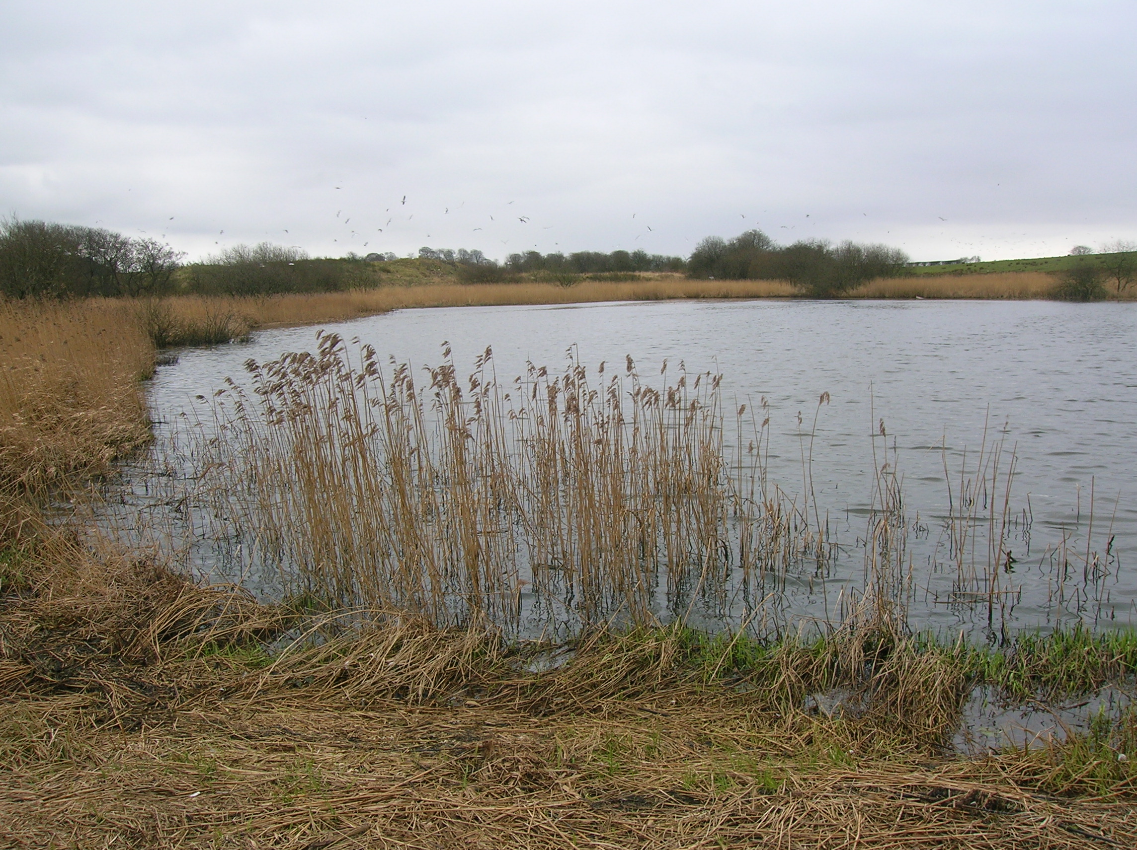
Blae Loch is a freshwater loch located in Ayrshire, Scotland. It is situated in a picturesque and serene environment, surrounded by lush greenery and rolling hills. The loch, also known as a lake, covers a surface area of approximately 10 hectares.

The water in Blae Loch is crystal clear and supports a diverse ecosystem of aquatic plants and animals. The loch is home to a variety of freshwater fish species, including brown trout, pike, and perch. These fish thrive in the nutrient-rich waters of the loch, which provide them with ample food sources.

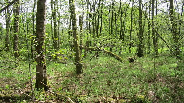
Surrounding the loch is a freshwater marsh, characterized by its waterlogged and marshy terrain. This marshland is a haven for numerous species of wetland plants, such as reeds and rushes, which provide habitat and food for a range of bird species.

Blae Loch offers a tranquil and peaceful setting for visitors to enjoy various recreational activities. Fishing enthusiasts are drawn to the loch's abundant fish population and often spend hours casting their lines from the shore or from small boats. Nature lovers appreciate the diverse birdlife that can be observed in and around the loch, making it a popular spot for birdwatching.

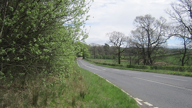
The loch is accessible via a footpath that winds its way around the water's edge, providing visitors with scenic views and opportunities for walks and picnics. Blae Loch is a natural gem in Ayrshire, offering an escape from the hustle and bustle of everyday life and a chance to immerse oneself in the beauty of nature.

If you have any feedback on the listing, please let us know in the comments section below.

Blae Loch Images

Images are sourced within 2km of 55.746394/-4.5558031 or Grid Reference NS3953. Thanks to Geograph Open Source API. All images are credited.

Woodland, Caldwell The woods between the road and glasshouses.
Woodland, Caldwell
The woods between the road and glasshouses.
Ayrshire - Renfrewshire march The B777 runs beside the boundary and the woods of Caldwell.
Ayrshire - Renfrewshire march
The B777 runs beside the boundary and the woods of Caldwell.
Ayrshire - Renfrewshire march Roadsigns at the southern end of the B775 where it meets the B777. Ayrshire seems to be one of those places which thinks of itself as a mere gateway to something better.  You can also get to Arran from Argyll.

There was no Ayrshire Council at this time.
Ayrshire - Renfrewshire march
Roadsigns at the southern end of the B775 where it meets the B777. Ayrshire seems to be one of those places which thinks of itself as a mere gateway to something better. You can also get to Arran from Argyll. There was no Ayrshire Council at this time.
Edge of William Covert Looking into Renfrewshire at a field surrounded by woodland.  A winter view: <a href="https://www.geograph.org.uk/photo/1150170">NS4153 : William  Covert</a>
Edge of William Covert
Looking into Renfrewshire at a field surrounded by woodland. A winter view: NS4153 : William Covert
Woodland, Caldwell A field surrounded by woodland near Lugton. The field is marked as William Covert and is shown on 1890s mapping as woodland.
Woodland, Caldwell
A field surrounded by woodland near Lugton. The field is marked as William Covert and is shown on 1890s mapping as woodland.
The Canny Man Bar and restaurant, Lugton.  Previously The Paraffin Lamp: see <a href="https://www.geograph.org.uk/photo/30292">NS4153 : Paraffin Lamp, Lugton</a>
The Canny Man
Bar and restaurant, Lugton. Previously The Paraffin Lamp: see NS4153 : Paraffin Lamp, Lugton
Industry, Lugton Looking across the Kilmarnock to Glasgow railway line towards the Lockton Lime Works.
Industry, Lugton
Looking across the Kilmarnock to Glasgow railway line towards the Lockton Lime Works.
Railway bridge, Lugton The A735 passes under the Glasgow to Kilmarnock railway.
Railway bridge, Lugton
The A735 passes under the Glasgow to Kilmarnock railway.
Former railway bridge, Lugton The Lanarkshire and Ayrshire Railway crossed the road here, one of two rival lines that passed through Lugton. The duplication was removed in 1964 when this railway closed.

The line connected Glasgow and Ardrossan.
Former railway bridge, Lugton
The Lanarkshire and Ayrshire Railway crossed the road here, one of two rival lines that passed through Lugton. The duplication was removed in 1964 when this railway closed. The line connected Glasgow and Ardrossan.
The Canny Man Another great place to eat.
The Canny Man
Another great place to eat.
A736 Lochlibo Road heading north
A736 entering Lugton village
Whitelee wind farm from the air Many of the 215 turbines at the distant wind farm can be seen in this photo. Lugton is visible in the foreground.
Whitelee wind farm from the air
Many of the 215 turbines at the distant wind farm can be seen in this photo. Lugton is visible in the foreground.
Woodland, Shutterflat Moor A young conifer plantation above Cuffhill Reservoir.
Woodland, Shutterflat Moor
A young conifer plantation above Cuffhill Reservoir.
Shutterflat Moor Much of the moor has been planted with conifers, some rough grazing survives here.
Shutterflat Moor
Much of the moor has been planted with conifers, some rough grazing survives here.
Young woodland, Shutterflat Moor A small area of woodland beside a minor road.
Young woodland, Shutterflat Moor
A small area of woodland beside a minor road.
Drainage, Coldstream Drainage work and high deer fencing suggest that this land is either planted with young trees, or is about to be.
Drainage, Coldstream
Drainage work and high deer fencing suggest that this land is either planted with young trees, or is about to be.
Field, Gilles Hill Dampish pasture.
Field, Gilles Hill
Dampish pasture.
Show me another place!

Blae Loch is located at Grid Ref: NS3953 (Lat: 55.746394, Lng: -4.5558031)

Unitary Authority: North Ayrshire

Police Authority: Ayrshire

What 3 Words

///occupations.future.lines. Near Dunlop, East Ayrshire

Nearby Locations

Blae Loch

Related Wikis

Blae Loch (Beith)

The Blae Loch is a small freshwater loch situated in a hollow in a low-lying area beneath Blaelochhead Hill in the Parish of Beith, North Ayrshire, Scotland...

Hessilhead hamlet

Hessilhead hamlet or Haselet is a small settlement or clachan in North Ayrshire, Scotland. It is situated to the east of the town of Beith and stands on...

Coldstream Mill

Coldstream Mill, near Beith in North Ayrshire, Scotland, was an early 19th century meal mill powered by the Dusk Water and Whitestone Burn that was enlarged...

Hessilhead Loch

Hessilhead Loch or Hazelhead Loch was situated in a low-lying area near the old Castle of Hessilhead in the Parish of Beith, North Ayrshire, Scotland....

Hessilhead

Hessilhead is in Beith, North Ayrshire, Scotland. Hessilhead used to be called Hazlehead or Hasslehead. The lands were part of the Lordship of Giffen,...

Lugton

Lugton is a small village or hamlet in East Ayrshire, Scotland with a population of 80 people. The A736 road runs through on its way from Glasgow, 15 miles...

Lugton railway station

Lugton railway station was a railway station serving the hamlet of Lugton, East Ayrshire, Scotland. The station was originally part of the Glasgow, Barrhead...

Lugton High railway station

Lugton High railway station was a railway station serving the hamlet of Lugton, East Ayrshire, Scotland as part of the Lanarkshire and Ayrshire Railway...

Nearby Amenities

Located within 500m of 55.746394,-4.5558031
Place: farm
Lat/Long: 55.746843/-4.5597569
Power: pole
Lat/Long: 55.7463288/-4.5629407
Power: pole
Lat/Long: 55.7468949/-4.5620893
Power: pole
Lat/Long: 55.7473624/-4.5614445
Power: pole
Lat/Long: 55.7478322/-4.5607746
Power: pole
Lat/Long: 55.7484406/-4.5598897
Power: pole
Lat/Long: 55.7488294/-4.5593242
Power: pole
Lat/Long: 55.74954/-4.5585594
Power: pole
Lat/Long: 55.7501883/-4.5578123
Power: pole
Lat/Long: 55.7507661/-4.5571612
Power: pole
Lat/Long: 55.7472132/-4.5603468
Power: pole
Lat/Long: 55.7482139/-4.5588735
Power: pole
Lat/Long: 55.7479579/-4.5577382
Power: pole
Lat/Long: 55.7477265/-4.5566823
Power: pole
Lat/Long: 55.7473589/-4.5550566
Power: pole
Lat/Long: 55.7468021/-4.5529489
Power: pole
Lat/Long: 55.7465355/-4.5519326
Power: pole
Lat/Long: 55.74627/-4.5509059
Power: pole
Lat/Long: 55.7459364/-4.5496371
Power: pole
Lat/Long: 55.7456111/-4.5484017
Power: pole
Lat/Long: 55.7474023/-4.554848
Power: pole
Lat/Long: 55.747999/-4.5542887
Power: pole
Lat/Long: 55.7485111/-4.5537983
Power: pole
Lat/Long: 55.7490514/-4.5532974
The data included in this document is from www.openstreetmap.org. The data is made available under ODbL.

Have you been to Blae Loch?

Leave your review of Blae Loch below (or comments, questions and feedback).