Loch Arklet

Lake, Pool, Pond, Freshwater Marsh in Stirlingshire

Scotland

Loch Arklet

Glen Arklet - Minor road to Inversnaid Looking westward towards Loch Arklet.
Glen Arklet - Minor road to Inversnaid Credit: Peter Wood

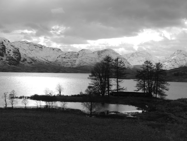
Loch Arklet is a freshwater loch located in Stirlingshire, Scotland. It is situated within the Loch Lomond and The Trossachs National Park, approximately 22 miles northwest of the town of Stirling. The loch covers an area of around 2.5 square kilometers and is nestled amidst picturesque hills and forests.

The loch is fed by several small streams and rivers, including the Arklet Water, which flows into the eastern end of the loch. It is surrounded by diverse vegetation, including patches of woodland and heather moorland, adding to its natural beauty. The surrounding area is also home to a variety of wildlife, including otters, red deer, and a wide range of bird species.

Loch Arklet is a popular spot for outdoor activities such as fishing and boating. Anglers are attracted to the loch's abundance of brown trout, which thrive in its clear and unpolluted waters. The calm and serene environment also makes it a great place for canoeing and kayaking.

The loch's shoreline is largely undeveloped, with only a few scattered houses and farmsteads. This contributes to the Loch Arklet's unspoiled and tranquil atmosphere. Visitors can enjoy scenic walks around the loch, taking in the breathtaking views of the surrounding landscape. There are also several designated picnic areas, providing a perfect spot to relax and enjoy the natural surroundings.

Overall, Loch Arklet offers a peaceful retreat in the heart of Scotland's stunning countryside, where visitors can immerse themselves in nature and enjoy a range of outdoor pursuits.

If you have any feedback on the listing, please let us know in the comments section below.
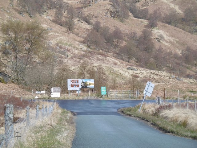
Loch Arklet Images

Images are sourced within 2km of 56.247166/-4.6195982 or Grid Reference NN3709. Thanks to Geograph Open Source API. All images are credited.

Glen Arklet - Minor road to Inversnaid Looking westward towards Loch Arklet.
Glen Arklet - Minor road to Inversnaid
Looking westward towards Loch Arklet.
Glen Arklet - Minor road near Corriearklet Looking south-westward.
Glen Arklet - Minor road near Corriearklet
Looking south-westward.
Glen Arklet - Minor road beside Loch heading towards Inversnaid Looking westward.
Glen Arklet - Minor road beside Loch heading towards Inversnaid
Looking westward.
Loch Arklet from the B829 Approaching the road junction for Inversnaidor Stronachlachar.
Loch Arklet from the B829
Approaching the road junction for Inversnaidor Stronachlachar.
Trees by the aqueduct intake on Loch Arklet
Loch Arklet The aqueduct inlet at the east end.
Loch Arklet
The aqueduct inlet at the east end.
Looking into Stirlingshire Assorted signs at the end of the B829.  An unusual occurrence of looking north from Perthshire into Stirlingshire (all governed by Stirling Council now).
Looking into Stirlingshire
Assorted signs at the end of the B829. An unusual occurrence of looking north from Perthshire into Stirlingshire (all governed by Stirling Council now).
Slopes of Beinn Uamha That is some very rough going in there.
Slopes of Beinn Uamha
That is some very rough going in there.
South shore of Loch Arklet The ground here is very tough underfoot. The classic Arrochar Alps view is lost in cloud at the tail end of some rain.
South shore of Loch Arklet
The ground here is very tough underfoot. The classic Arrochar Alps view is lost in cloud at the tail end of some rain.
Loch Arklet On A March Late Afternoon Shot in monochrome, the beauty of this particular corner of Stirlingshire is self-evident.  The structure within the trees in the foreground is the aqueduct intake to transfer water to Loch Katrine.
Loch Arklet On A March Late Afternoon
Shot in monochrome, the beauty of this particular corner of Stirlingshire is self-evident. The structure within the trees in the foreground is the aqueduct intake to transfer water to Loch Katrine.
T-junction at the end of the B829 The B829 becomes a minor road at this point, left leading to Inversnaid (Loch Lomond) and right leading to Stronachlachar (Loch Katrine). Both roads are dead-ends.
T-junction at the end of the B829
The B829 becomes a minor road at this point, left leading to Inversnaid (Loch Lomond) and right leading to Stronachlachar (Loch Katrine). Both roads are dead-ends.
Loch Arklet Loch Arklet is a small reservoir in a beautiful location between the much more famous Loch Lomond and Loch Katrine. The mountains of the 'Arrochar Alps' can be seen in the distance.
Loch Arklet
Loch Arklet is a small reservoir in a beautiful location between the much more famous Loch Lomond and Loch Katrine. The mountains of the 'Arrochar Alps' can be seen in the distance.
Loch Arklet. Wild Highlands scene.
Loch Arklet.
Wild Highlands scene.
The old military road The military road was built so that soldiers could move quickly during the time of troubles in the 1700's. It is only about a metre wide but was so well laid that it is still a good walkers' path and the modern road runs very close to it between Inversnaid and Trossachs Pier.
The old military road
The military road was built so that soldiers could move quickly during the time of troubles in the 1700's. It is only about a metre wide but was so well laid that it is still a good walkers' path and the modern road runs very close to it between Inversnaid and Trossachs Pier.
Loch Arklet A dark afternoon beside the reservoir. The loch was much enlarged by a dam to provide drinking water for Glasgow.
Loch Arklet
A dark afternoon beside the reservoir. The loch was much enlarged by a dam to provide drinking water for Glasgow.
Road beside Loch Arklet The road out of Inversnaid approaching Corriearklet.
Road beside Loch Arklet
The road out of Inversnaid approaching Corriearklet.
Road to Inversnaid The skyline is dominated by A' Chrois, Beinn Ime and Ben Vane on the far side of Loch Lomond.
Road to Inversnaid
The skyline is dominated by A' Chrois, Beinn Ime and Ben Vane on the far side of Loch Lomond.
Beside Loch Arklet The original natural loch occupied this end of the glen, now the eastern part of the reservoir.
Beside Loch Arklet
The original natural loch occupied this end of the glen, now the eastern part of the reservoir.
Show me another place!

Loch Arklet is located at Grid Ref: NN3709 (Lat: 56.247166, Lng: -4.6195982)

Unitary Authority: Stirling

Police Authority: Forth Valley

What 3 Words

///riots.warbler.expel. Near Tyndrum, Stirling

Nearby Locations

Loch Arklet

Related Wikis

Loch Arklet

Loch Arklet is a freshwater loch and reservoir in the Trossachs area of the Scottish Highlands. It is within the historic county and registration county...

Loch Lomond and The Trossachs National Park

Loch Lomond and The Trossachs National Park (Scottish Gaelic: Pàirc Nàiseanta Loch Laomainn is nan Tròisichean) is a national park in Scotland centred...

Inversnaid

Inversnaid (Scottish Gaelic: Inbhir Snàthaid) is a small rural community on the east bank of Loch Lomond in Scotland, near the north end of the loch....

Inversnaid Falls

Inversnaid Falls is a waterfall of Scotland. == See also == Waterfalls of Scotland == References == Media related to Inversnaid Falls at Wikimedia Commons

Nearby Amenities

Located within 500m of 56.247166,-4.6195982
Power: pole
Lat/Long: 56.2515402/-4.618398
Power: pole
Lat/Long: 56.2512973/-4.6170844
Power: pole
Lat/Long: 56.2510742/-4.6158063
Power: pole
Lat/Long: 56.2510301/-4.6226589
The data included in this document is from www.openstreetmap.org. The data is made available under ODbL.

Have you been to Loch Arklet?

Leave your review of Loch Arklet below (or comments, questions and feedback).