Auld Wife's Stank
Lake, Pool, Pond, Freshwater Marsh in Kirkcudbrightshire
Scotland
Auld Wife's Stank

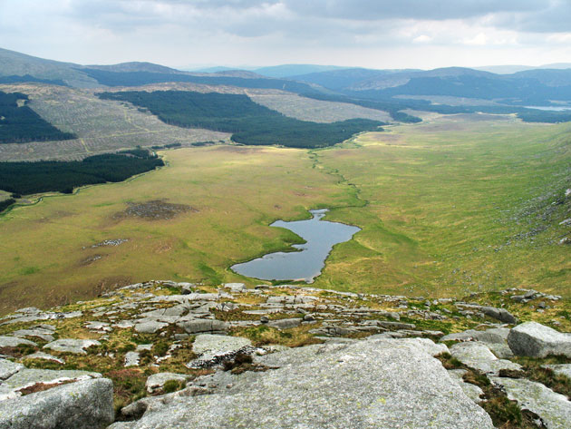
Auld Wife's Stank is a small freshwater marsh located in Kirkcudbrightshire, Scotland. It is classified as a lake but is often referred to as a pool or pond due to its size and shallowness. The stank spans approximately 2 hectares and is surrounded by lush green vegetation, creating a picturesque landscape.
The water in Auld Wife's Stank is sourced from natural springs and rainfall, resulting in a clear and unpolluted environment. The stank is known for its calm and tranquil atmosphere, making it a popular spot for nature enthusiasts and photographers seeking to capture the beauty of the surroundings. The area surrounding the stank is rich in biodiversity, providing a habitat for a variety of plant and animal species.
The vegetation in and around Auld Wife's Stank consists of reeds, rushes, and water lilies, which thrive in the marshy conditions. These plants provide shelter and food for a diverse range of bird species, including ducks, swans, and herons. Fish such as perch and roach can also be found in the stank, attracting anglers who enjoy fishing in its peaceful waters.
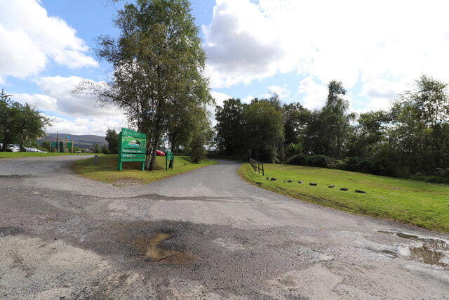
Visitors to Auld Wife's Stank can explore the area by following the well-maintained footpaths that wind through the marsh. The stank also has several viewing points and benches, allowing visitors to sit and appreciate the natural beauty that surrounds them. The site is easily accessible and offers a serene escape from the hustle and bustle of daily life.
Overall, Auld Wife's Stank in Kirkcudbrightshire is a charming freshwater marsh that offers a peaceful retreat for nature lovers, providing an opportunity to observe and connect with the natural world.
If you have any feedback on the listing, please let us know in the comments section below.
Auld Wife's Stank Images
Images are sourced within 2km of 55.065505/-4.5464576 or Grid Reference NX3777. Thanks to Geograph Open Source API. All images are credited.


Auld Wife's Stank is located at Grid Ref: NX3777 (Lat: 55.065505, Lng: -4.5464576)
Unitary Authority: Dumfries and Galloway
Police Authority: Dumfries and Galloway
What 3 Words
///across.intervals.rezoning. Near Newton Stewart, Dumfries & Galloway
Nearby Locations
Related Wikis

Glentrool
Glentrool is a collection of mountain biking routes through the heart of Galloway in southwest Scotland. The mountain bike routes are part of the 7Stanes...

Glen Trool
Glen Trool (Scottish Gaelic: Gleann an t-Sruthail) is a glen in the Southern Uplands, Galloway, Scotland. It contains Loch Trool which is fed by several...

Bargrennan
Bargrennan (Scottish Gaelic: Bar Grianain, meaning height of the summer house or sunny spot) is a village in Dumfries and Galloway, in the south west of...

Loch Trool
Loch Trool is a narrow, freshwater loch in Galloway, in the Southern Uplands in south-west Scotland. It lies in an elevated position in Glen Trool in the...
Battle of Glen Trool
The Battle of Glen Trool was a minor engagement in the First War of Scottish Independence, fought in April 1307. Glen Trool is a narrow glen in the Southern...
Silver Flowe-Merrick Kells
Situated in south-west Scotland, the Silver Flowe-Merrick Kells biosphere reserve is composed of two separate sites. Silver Flowe is a unique bog formation...

Lamachan Hill
Lamachan Hill is a hill in the Minnigaff Hills, a sub-range of the Galloway Hills range, part of the Southern Uplands of Scotland. It is the highest hill...

Cairnderry chambered cairn
Cairnderry chambered cairn is a chambered cairn in Dumfries and Galloway. It is a Bargrennan cairn, a type of Neolithic or early Bronze Age monument only...
Nearby Amenities
Located within 500m of 55.065505,-4.5464576Have you been to Auld Wife's Stank?
Leave your review of Auld Wife's Stank below (or comments, questions and feedback).