Mill Leat

Lake, Pool, Pond, Freshwater Marsh in Ayrshire

Scotland

Mill Leat

Sand Dunes: Seafield At the southern end of Ayr Promenade
Sand Dunes: Seafield Credit: Jim Smillie

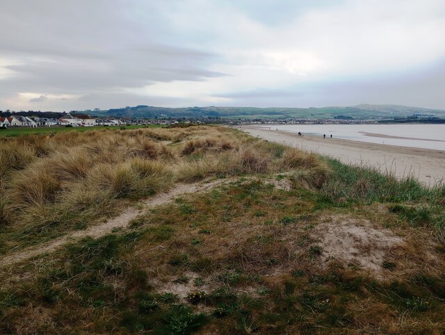
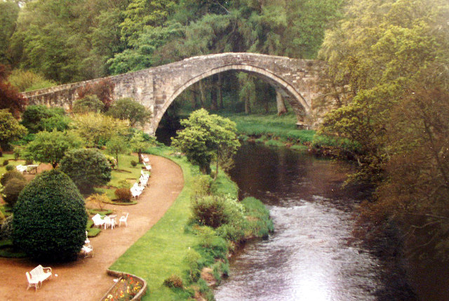
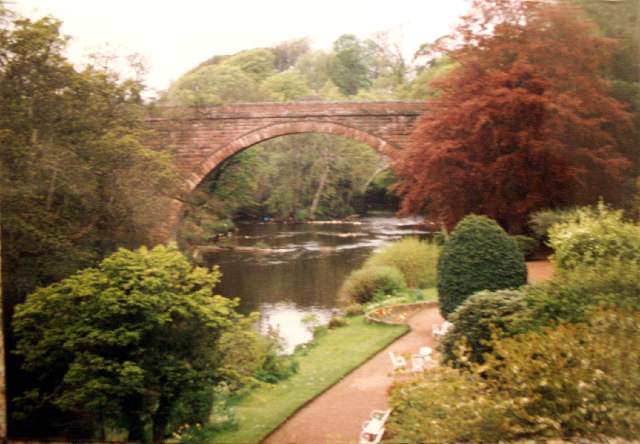
Mill Leat is a picturesque freshwater marsh located in Ayrshire, Scotland. Covering an area of approximately 10 acres, it is a haven for various species of plants and animals. The site is often referred to as a lake, pool, pond, or freshwater marsh due to its unique characteristics.

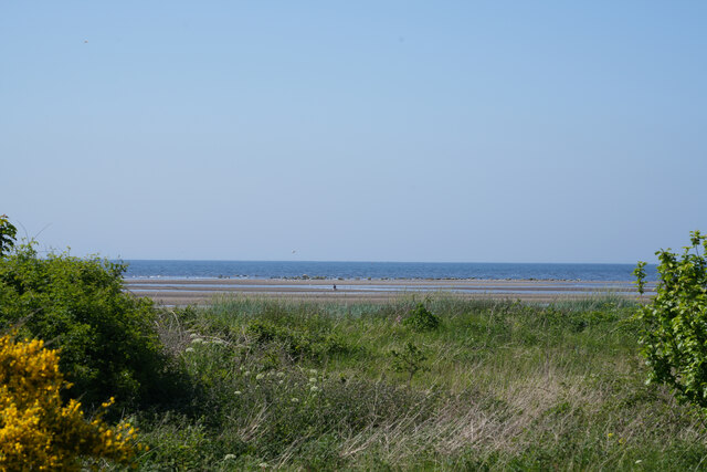
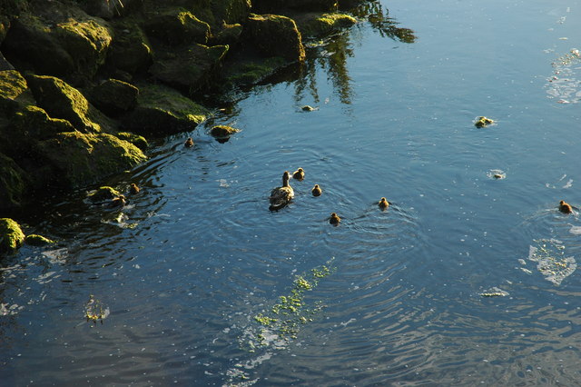
Surrounded by lush greenery and bordered by reeds, Mill Leat is fed by a small stream that originates from nearby hills. The water in the marsh is still and calm, creating a tranquil atmosphere. The marshland is mainly composed of shallow water, making it an ideal habitat for aquatic plants such as water lilies, reeds, and sedges. These plants provide shelter and food for a wide range of animal species.

Bird enthusiasts will be delighted to find a diverse array of avian species at Mill Leat. Ducks, swans, and geese are commonly spotted gliding across the water's surface, while herons can be seen stalking their prey along the marshy edges. The marshland also attracts a variety of insects, including dragonflies and butterflies, which flit among the vegetation.

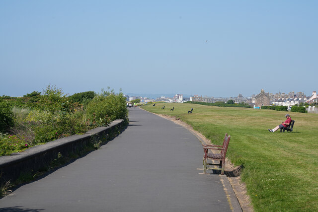
Mill Leat is not only a haven for wildlife but also a popular destination for nature lovers. Visitors can enjoy leisurely walks along the marsh's perimeter, immersing themselves in the serene surroundings. The calm waters offer opportunities for fishing, and the presence of benches and picnic areas make it an ideal spot for a peaceful afternoon outing.

In summary, Mill Leat in Ayrshire is a picturesque freshwater marsh that offers a diverse range of plants and animals. Its tranquil atmosphere, beautiful scenery, and recreational opportunities make it a must-visit destination for nature enthusiasts.

If you have any feedback on the listing, please let us know in the comments section below.

Mill Leat Images

Images are sourced within 2km of 55.432849/-4.6482404 or Grid Reference NS3218. Thanks to Geograph Open Source API. All images are credited.

Sand Dunes: Seafield At the southern end of Ayr Promenade
Sand Dunes: Seafield
At the southern end of Ayr Promenade
The path along the seafront On a hot afternoon the walk along the seafront was very pleasant.
The path along the seafront
On a hot afternoon the walk along the seafront was very pleasant.
The tide is out The sea is quite a way from the path as it is about low tide.
The tide is out
The sea is quite a way from the path as it is about low tide.
Robert Burns' Birthplace Poet Robert Burns was born in this cottage, typical for its time, on 25 January 1759
Robert Burns' Birthplace
Poet Robert Burns was born in this cottage, typical for its time, on 25 January 1759
The Auld Brig O' Doon Taken from the other Brig O' Doon <a title="https://www.geograph.org.uk/photo/44160" href="https://www.geograph.org.uk/photo/44160">Link</a>. Gardens belong to the Brig O' Doon House Hotel (Costley & Costley Hotels) <span class="nowrap"><a title="http://www.costley-hotels.co.uk" rel="nofollow ugc noopener" href="http://www.costley-hotels.co.uk">Link</a><img style="margin-left:2px;" alt="External link" title="External link - shift click to open in new window" src="https://s1.geograph.org.uk/img/external.png" width="10" height="10"/></span>

"Brigadoon", Lerner and Loewe's classic Broadway fantasy Scottish musical, was probably based on this famous Scottish landmark in Alloway. 
<span class="nowrap"><a title="http://www.durham.net/~neilmac/brigdoon.htm" rel="nofollow ugc noopener" href="http://www.durham.net/~neilmac/brigdoon.htm">Link</a><img style="margin-left:2px;" alt="External link" title="External link - shift click to open in new window" src="https://s1.geograph.org.uk/img/external.png" width="10" height="10"/></span>
The Auld Brig O' Doon
Taken from the other Brig O' Doon Link. Gardens belong to the Brig O' Doon House Hotel (Costley & Costley Hotels) LinkExternal link "Brigadoon", Lerner and Loewe's classic Broadway fantasy Scottish musical, was probably based on this famous Scottish landmark in Alloway. LinkExternal link
Brig O' Doon The new Brig O' Doon. Alloway.  Taken from the Auld Brig O' Doon <a title="https://www.geograph.org.uk/photo/44158" href="https://www.geograph.org.uk/photo/44158">Link</a>. Robert Burns Country.
Brig O' Doon
The new Brig O' Doon. Alloway. Taken from the Auld Brig O' Doon Link. Robert Burns Country.
River Doon Millennium Bridge, Ayr This striking foot- and cycle- bridge is the lowest crossing point of the River Doon (only just above the beach), and was completed in 2001. It links the main Ayr seafront with the Greenan Shore to the south. It lies on the National Cycle Network. <span class="nowrap"><a title="http://www.lunemillenniumbridge.info/Dailly.html" rel="nofollow ugc noopener" href="http://www.lunemillenniumbridge.info/Dailly.html">Link</a><img style="margin-left:2px;" alt="External link" title="External link - shift click to open in new window" src="https://s1.geograph.org.uk/img/external.png" width="10" height="10"/></span>
River Doon Millennium Bridge, Ayr
This striking foot- and cycle- bridge is the lowest crossing point of the River Doon (only just above the beach), and was completed in 2001. It links the main Ayr seafront with the Greenan Shore to the south. It lies on the National Cycle Network. LinkExternal link
Burns Cottage Doorway. Detail of Rabbie Burns' Cottage in Alloway. The roof of this "auld clay biggin'" is thatched, the door and window are picked out in contrasting paint, and the window has a wooden shutter. Burns died in Dumfries.
Burns Cottage Doorway.
Detail of Rabbie Burns' Cottage in Alloway. The roof of this "auld clay biggin'" is thatched, the door and window are picked out in contrasting paint, and the window has a wooden shutter. Burns died in Dumfries.
The Auld Kirk, Alloway. This ruined kirkyard is near Burns Cottage. It is the place where Tam saw Cutty Sark and her coven dancing in Burns' poem, "Tam o'Shanter".
The Auld Kirk, Alloway.
This ruined kirkyard is near Burns Cottage. It is the place where Tam saw Cutty Sark and her coven dancing in Burns' poem, "Tam o'Shanter".
Burns Monument, Alloway. The monument stands between the old and new Alloway Brigs.
Burns Monument, Alloway.
The monument stands between the old and new Alloway Brigs.
Sunset from the Castle We cycled up there from Ayr.
Sunset from the Castle
We cycled up there from Ayr.
Duck family on the water near the sands We were on the little stone bridge. There had been quite an escapade with the ducklings having lost their mother - seems she found them OK. The water merges with salt water in about 10 yards.
Duck family on the water near the sands
We were on the little stone bridge. There had been quite an escapade with the ducklings having lost their mother - seems she found them OK. The water merges with salt water in about 10 yards.
Greenan castle A view looking southwest from the beach towards the remains of Greenan castle on an imposing clifftop site. The radio aerial masts on Brown Carrick Hill can be seen in the distance at right.
Greenan castle
A view looking southwest from the beach towards the remains of Greenan castle on an imposing clifftop site. The radio aerial masts on Brown Carrick Hill can be seen in the distance at right.
Auld Brig o' Doon The old bridge is immortalised in Robert Burns' best-know work, 'Tam o'Shanter'.
Auld Brig o' Doon
The old bridge is immortalised in Robert Burns' best-know work, 'Tam o'Shanter'.
Caravans at Craig Tara holiday park, nr. Ayr Most of the old chalets on this former Butlins site have now gone, replaced by caravans forming the current "Haven" site. Some buildings have been retained - that visible in the left middle distance is the old dining hall still in use as a restaurant facility.
Caravans at Craig Tara holiday park, nr. Ayr
Most of the old chalets on this former Butlins site have now gone, replaced by caravans forming the current "Haven" site. Some buildings have been retained - that visible in the left middle distance is the old dining hall still in use as a restaurant facility.
Out of town shopping Small out of town shopping centre at Hollow Park, Maybole Road, Ayr.
Out of town shopping
Small out of town shopping centre at Hollow Park, Maybole Road, Ayr.
Longhill Avenue Roundabout The junction of Longhill Avenue, Ayr and the A719 to Dunure, showing the bus leaving for Craig Tara Holiday Park (formerly Butlin's)
Longhill Avenue Roundabout
The junction of Longhill Avenue, Ayr and the A719 to Dunure, showing the bus leaving for Craig Tara Holiday Park (formerly Butlin's)
Welcome to Ayr Entering Ayr on the A719 coast road from Dunure, where much new building has taken place recently.
Welcome to Ayr
Entering Ayr on the A719 coast road from Dunure, where much new building has taken place recently.
Show me another place!

Mill Leat is located at Grid Ref: NS3218 (Lat: 55.432849, Lng: -4.6482404)

Unitary Authority: South Ayrshire

Police Authority: Ayrshire

What 3 Words

///sling.towns.press. Near Ayr, South Ayrshire

Related Wikis

Doonfoot

Doonfoot is a suburb in the south-west of Ayr, South Ayrshire. == History == The area known as Doonfoot was incorporated as part of the town of Ayr when...

Cambusdoon

Cambusdoon was a cricket ground in Ayr, Scotland. The ground was used by Ayr Cricket Club until the club moved from the ground in 1997 to the purpose...

River Doon

The River Doon (Scottish Gaelic: Abhainn Dhùin, pronounced [avɪɲˈɣuːɲ]) is a river in Ayrshire, Scotland. Its course is generally north-westerly, passing...

Alloway

Alloway (Scottish Gaelic: Allmhaigh, pronounced [ˈal̪ˠavaj]) is a village in South Ayrshire, Scotland, located on the River Doon. It is best known as the...
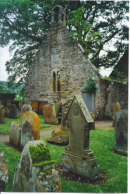
Alloway Auld Kirk

The Alloway Auld Kirk, which dates back to the 16th Century, is a ruin in Alloway, South Ayrshire, Scotland, celebrated as the scene of the witches' dance...

Cambusdoon New Ground

Cambusdoon New Ground is a cricket ground located in Ayr, Scotland. It is the home of Ayr Cricket Club and hosted three One Day Internationals (ODI) in...
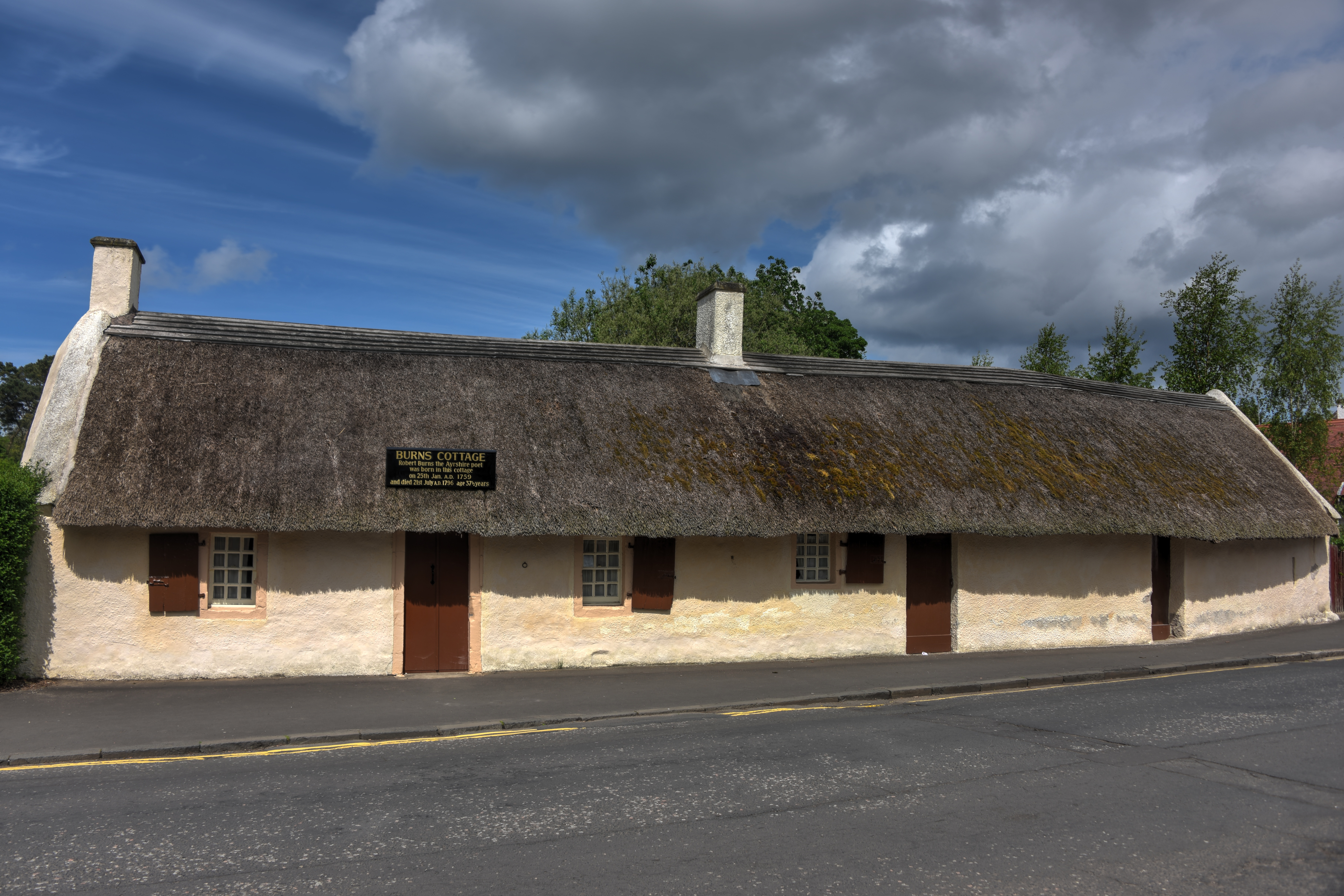
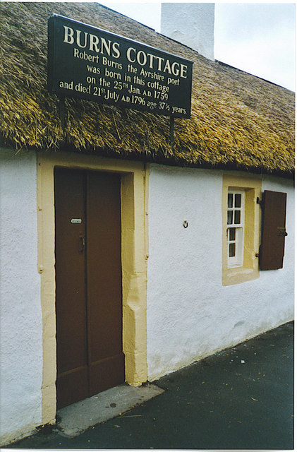
Burns Cottage

Burns Cottage, the first home of Robert Burns is located in Alloway, South Ayrshire, Scotland. It was built by his father, William Burness in 1757. Burns...

Alloway railway station

Alloway railway station was a railway station serving the village of Alloway, South Ayrshire, Scotland. The station was part of the Maidens and Dunure...

Related Videos

Holiday to Butlins (Ayr Scotland) (1990) 4K

Remastered in 4K and ajusted so it's not as long, The first video I ever made with a JVC VHS-C Camcorder 33 years ago, (Can't ...

A Walk through Ayr Town Centre

A binaural recording in 4k of a walk through Ayr Town Centre on the afternoon of Tuesday 1 November 2022. Binaural means that ...

Craig Tara Holiday Park, Scotland | Day 2&3 -Mountain Climbing & The Beach. ABreakFromHealthtCooking

Hi everyone, Thanks for stopping by. Today, we are not cooking, rather on a break in Scotland, just sharing some experiences.

An Ambient Walk around Ayr - Station to Beach and High Street

This one starts as the train pulls into Ayr Station. Then I walk past Burns Statue Square and down Dalblair Road to the High Street, ...

Nearby Amenities

Located within 500m of 55.432849,-4.6482404
Nursing Home
redford
Lat/Long: 55.4359457/-4.6489207
Bus Stop
Bench: no
Shelter: no
Lat/Long: 55.4358082/-4.6488431
Bus Stop
Bench: no
Shelter: no
Lat/Long: 55.4330245/-4.6532398
Bus Stop
Bench: no
Shelter: no
Lat/Long: 55.4330633/-4.6529573
Bus Stop
Naptan AtcoCode: 619012
Naptan NaptanCode: 29723925
Shelter: yes
Lat/Long: 55.4369529/-4.6465566
Mini Roundabout
Lat/Long: 55.4369737/-4.6463045
Barrier: bollard
Bicycle: yes
Bollard: removable
Foot: yes
Lat/Long: 55.4319959/-4.6433185
Post Box
Ref: KA7 97
Lat/Long: 55.4308042/-4.6531937
Barrier: bollard
Bicycle: yes
Foot: yes
Horse: yes
Lat/Long: 55.4357891/-4.648285
Doonfoot
Place: suburb
Wikidata: Q5297168
Wikipedia: en:Doonfoot
Lat/Long: 55.4358459/-4.6531682
Generator Method: photovoltaic
Generator Output Electricity: yes
Generator Source: solar
Generator Type: solar_photovoltaic_panel
Power: generator
Lat/Long: 55.4347681/-4.6442498
Generator Method: photovoltaic
Generator Output Electricity: yes
Generator Source: solar
Generator Type: solar_photovoltaic_panel
Power: generator
Lat/Long: 55.4356356/-4.6440556
The data included in this document is from www.openstreetmap.org. The data is made available under ODbL.

Have you been to Mill Leat?

Leave your review of Mill Leat below (or comments, questions and feedback).